-
Bylot Island
Encyclopedia Arctica 13: Canada, Geography and General
001 | Vol_XIII-0727
Canada, Geography
(P.D.Baird)
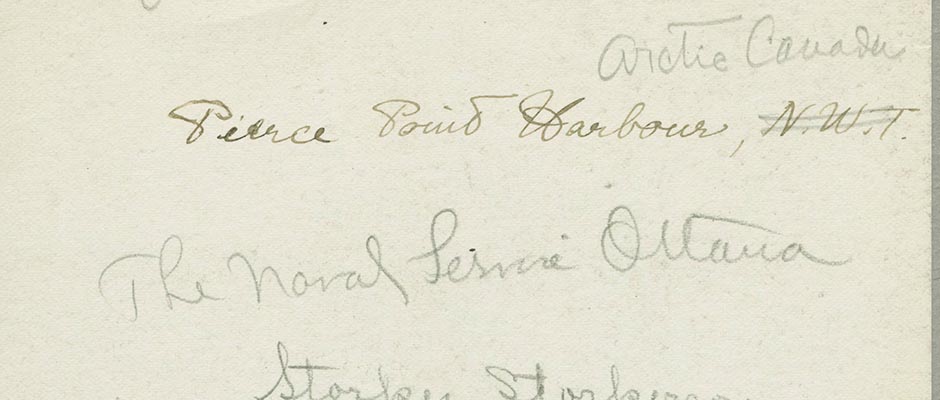
BYLOT ISLAND (Eskimo, Kagiookta )
Bylot Island, named for Robert Bylot, mate to Hudson and Master of the
Discovery which had William Baffin as pilot in their great voyage in 1616, is a
large mountainous island to the northeast of Baffin Island. Its area is about
4000 square miles, and it is separated from the Baffin coast by Pond Inlet,
Eclipse Sound, and Navy Board Inlet, a fine navigable waterway.Between 1616, when it was sighted by Bylot and Baffin, and 1818 Bylot
Island remained unseen by white men. In the latter year Sir John Ross landed at
Possession Bay on September 1st after his notorious retreat from the 'closed'
Lancaster Sound. Lt. Parry, Mr. Skene and Mr. J. C. Ross were in the landing
party who erected a flagstaff and claimed the land for George III. Four days
later, after naming two other capes on the east coast, Ross discovered Ponds Bay
which he also thought to be a closed bay.Parry revisited Possession Bay in 1819 and Sir John Ross himself landed
at his cairn in 1833 after having been picked up by the whaler Isabella at the
northwest corner of the Island at the conclusion of the four year Victory expedi–
tion . Parry's voyage opened the 'North water' to the whalers and from 1820 on–
wards this became one of the greatest northern whaling grounds. The area along
the shore ice off Pond Inlet was the goal of the racing whalers for half a century.
But descriptive accounts from the whaling captains are scanty with the exception
of a [ ?] good account given by Capt. A. H. Markham on a whaling cruise with the
'Arctic'" in 1873, and the Franklin search expeditions have given us more infor–
mation. Assisting this search the whalers Truelove and Advice landed stores at a
cache at Cape Hay. McClintock visited the natives at Button Point and Kaparoktalik
in 1858 during his famous voyage in the yacht Fox.In 1903 a permanent whaling and trading station was established across
Pond Inlet (near Mt. Herodier), the beginning of steady trade which has lasted
till today. In 1914 both Captain Munn and Captain Bernier established trade posts,
the former near Button Point which is the southeast corner of the island closest
to the best whaling and sealing grounds. This station persisted till 1923, Munn
himself spending two winters, but in the latter year he was bought out by the
Hudson's Bay Company who had built in 1921 at the present Pond Inlet site on
Baffin Island. One of Munn's buildings is still used by Eskimo hunters at Button
Point for the spring sealing.Meanwhile other visitors had reached Bylot Island. A. P. Low had
sailed around the island in the Neptune in 1903 and given a rather inaccurate ac–
count of its features. Captain Bernier landed at Canada Point in 1906 and took
possession of the island in the name of Canada. Messrs. Reader and J. Le Bel,
who wintered with Bernier at Albert Harbour in 1912-1913, spent 6 weeks trapping
with natives on the Island, and T. Matthiassen of the 5th Thule E [ ?] pedition
visited points on the southeast coast in 1923.After the establishment of the Hudson's Bay Company, the R. C. M. P.
(1922) and two missions at Pond Inlet, the southern coast of the island was
frequently visited both winter and summer and shacks were erected in several
places for hunting and trapping.In 1939 P. D. Baird spent most of the summer on the island and made a
crossing by dog team in June from the southwest to the middle east coast via an
ice col about 5000 feet above sea level. Later visitors have included the U. S.
Naval Task Force which anchored in Tay Bay in 1946.
002 | Vol_XIII-0728
Description
The island is approximately square though the east coast slopes to the
northwest more than 1947 maps indicate. It is a jumble of rough peaks partly
submerged by ice, but there is no continuous level ice cap. The peaks reach to
about 6300 feet, the highest appearing to be just west of the central point of
the island, and seem to form a wide curved ridge running from northwest to south–
east along the longest axis of the island about 100 miles from Button Point to
the northwest cape.Lowland is scarce, the only extensive areas being the southwest corner
and southern part of the west coast, the c [ e ?] ntral northern coast and other insigni–
ficant areas at the mouth of deep valleys up which the valley glaciers have re–
treated. These glaciers form numerous broad, gently sloping roads to the interior
highlands, the largest Bartle Frere glacier, extending from the ice-shed behind
Mt. Thule to the northern lowland, about 35 miles.The coast immediately facing Pond Inlet post is most precipitous. Four
large glaciers and several smaller ones break through a steep gullied mountain
wall, from west to east these are named Aktinek, Sermilik, Kaparoktalik and
Narsarsuk. In plain view from the village are the peaks between these, Mt. Thule
some 11 miles inland, 5800 feet, Castle Gables, 4600 feet, and an unnamed peak,
4875 feet. Kaparoktalik, described by McClintock, pushes its terminal moraine in–
to the inlet, and at Sermilik ice reaches the sea terminating in a cliff 200 feet
high with occasional discharge of icebergs. From Sermilik westwards a low fore–
land begins, widening around the southwest of the island and vanishing again
south of Canada Point. Aktinek glacier ends nearly five miles from the sea.Mt. Thule, though the highest peak in the spectacular range visible
from Ponds village, is by no means the highest in the island. Several peaks to
the north of it exceed 6000 feet. One of these 6200 feet, stands at the junction
of Aktinek, Sermilik and the largest northflowing glacier (named Bartle Frere by
Capt. Markham) and was climbed by Baird in 1939 1 . From here peaks even higher
were seen to the northwest.Though the main mountain mass consists of Pre-Cambrian gneiss and
granite the southwestern lowland is formed of more recent rocks, sandstones,
shales and thin seams of coal apparently of Tertiary age reaching to 2000 feet in
attitude. In addition many glacial deposits with drumlin-like features have al–
tered the surface which is cut by several recent consequent streams. Considerable
aeolian erosion of the sandstones appears due to powerful easterly winds in this
region in summer which give rise to minor sandstorms. The sea is shoal for some
distance off this southwest shore.North of Canada Point there are more sediments, approximately horizon–
tally bedded, rising to table topped and also more rounded mountains. The age of
these is uncertain.Shortly before the junction of Navy Board Inlet and Lancaster Sound
there is the fine deep harbour called Tay Bay often used by whalers especially
Capt. W. F. Milne of the 'Eclipse'. This has a glacier filled valley at its head.
003 | Vol_XIII-0729
The northwest corner of the island is high, and steep slopes and glaciers
again reach the sea just east of Cape Hay where there is a well know loomery.
But thereafter the central portion of the north coast is lowland again with a
huge piedmont glacier, formed by the joining of a northeastward flowing glacier
with the Bartle Frere ice stream flowing from the height of land near Mt. Thule,
forming the inland side of this lowland. Cape Liverpool is a low point of this
lowland.This lowland comes to an end west of Cape Fanshawe a prominent rocky
headland, and from there on south the east coast consists of broken mountains with
several large glacier filled valleys often forming breaks through the highland.
Possession Bay with at least four miles of wide well vegetated ice-free valley
floor is one of these and two other major openings are situated at latitudes
73°22′ and 72°55′ where four or five miles of low valley extend beyond the
glacier fronts. The latter valley is just north of Cape Graham Moore (called in
Eskimo Agpa after the looms which nest there) and it in turn is six miles north
of the Button Point settlement.Button Point is a spit connected by a narrow neck to a narrow area of
foreland consisting of Quaternary deposits lying on a shelf of gneiss. Mt. St.
Hans rises steeply behind this foreland to about 1000 feet, the level of the 100
plateau summit in this corner of the island. The foreland extends only a few
miles further up the inlet and then the south facing mountains fall off so steep–
ly that overland passage is impracticable.Except where the sandstorms have broken up the vegetative cover in the
southwest the usual northern tundra flora is well developed on the ice-free low–
lands and saxifraga oppositifolia and papaver radicatum were found at 3000 feet
in the interior. Birds abound in summer including lesser snow and occasional
blue geese, and the little brown crane (at its northward limit) observed both in
1858 and 1939. Snow buntings were observed at 5500 feet by Baird as early as 4th
June 1939.Although the right whales no longer give the sea an appearance of
boiling as McClintock described it in 1858, the"North water" off Button Point is
still rich in marine life. Seals are very numerous in spring on the landfast ice
and this area is one of the most favourable in the Canadian Arctic for the rare
narwhal. Narwhal and seals are often chased inshore by the voracious killer
whales.A few caribou still inhabit the valleys of the island, but for many
years the natives who spent the spring at Button Point have traveled inland on
Baffin Island for salmon fishing and caribou hunting, crossing before the ice on
the inlet breaks out which usually occurs during the last week in July (21st in
1939, 28th in 1858).
Bibliography
Arctic Pilot, Vol. III. H. M. Stationery Office, London, 1931.
Bernier, J. E. Report on the Dominion Government Expedition to the Arctic Islands
on board the CGS Arctic 1906-07. Ottawa, 1910.Fisher, A. A Journal of a Voyage of Discovery to the Arctic Regions, 1819-20.
London, 1821.
004 | Vol_XIII-0730
Freuchen, P and Matthiassen, T. Contributions to the Physical Geography of the
region North of Hudson Bay. Geog. Review, 1925.Low, A. P. The Cruise of the Neptune . Ottawa, 1906.
Markham, A. H. A Whaling Cruise to Baffin Bay. London, 1874.
McClintock, F. L. Voyage of the Fox in Arctic Seas. London, 1859.
Matthiassen, T. Contributions to the Geography of Baffin Land 100 . Copenhagen, 1933.
Munn, H. T. 1. Prairie Trails and Arctic Byways London, 1932.
2. Tales of the Eskimo London undated.Parry, W. E. Journal of a voyage for the discovery of a North West Passage.
London, 1821.Polar Record, Vol. 3, No. 19, p. 226. Cambridge 1940.
Ross, John. A voyage of discovery for the purpose of exploring Baffin Bay.
London, 1819.Sutherland, P. C. Journal of a voyage in Baffin Bay and Barrow Strait. London, 1852.
Tremblay, Alfred. Cruise of the Minnie Maud . Quebec, 1921.
P.D.Baird
005 | Vol_XIII-0731
[Figure]