-
Krasnoyarsk Krai
Encyclopedia Arctica 10: Soviet North, Geography and General
Unpaginated | Vol_X-0199
Form for receipt of article "Krasnoyarsk Krai"
001 | Vol_X-0200
4,700 words 5,000 Mandel Sept
[ ?] KRASNOYARSK KRAI (Territory) of the U.S.S.R., 928,000 square miles in
area, with a population of 1,940,000 in 1939 , constitutes the basin of the Yenisei River (qv) emptying into the
Kara Sea (qv) of the Arctic Ocean, and also includes the Severnaia
Zemlia Archipelago (qv) in the Arctic. Excluding these islands , [ ?] it extends from the
northernmost mainland point on the face of the globe, Cape Cheliuskin, (qv)
[ ?] 77°41′N. of the Taimyr Peninsula (qv) south to 51°15′, where it bor–
ders the Tuva Autonomous Oblast. Severnaia Zemlia, however, extends the
latitude of the Territory north ward to 81°16′. Approximately half of the
Territory lies north of the Arctic Circle, and includes such well-known
Arctic developments as the lumber-export city of Igarka (qv), the
mining settlements of Nordvik (qv) and Norilsk (qv) , and the Arctic ports of Dickson,
(qv). and Dudinka (qv). Except for Igarka, they all lie within the northernmost subdivision
of the Territory ,- the Taimyr ( National Okrug , - whose native inhabitants
are chiefly Dolgan and Nenets, with some Yurak, Nganasan and Yakut. How–
ever, this Okrug is the most thinly populated portion of the Eurasian
Arctic, and the majority of the its population are Russians in the four
[ ?] towns and settlements listed above. [ ?]
South of the Taimyr National Okrug, but also largely north of the
Arctic Circle, is the Evenki National Okrug (qv), which parallels the
Yenisei River to the east, but does not quite approach it. This is be–
cause, from Igarka south, the majority of the populati on along the
river, rural as well as urban, is Russian.43% of the Krasnoyarsk Krai is covered by tundra or mixed tundra and forest, while Aalmost the entire Territory is Arctic or sub-Arctic in two three respects.
First, the average annual temperature is below freezing except along
and south of the Trans-Siberian Railroad, which is at about 56°N.
Secondly, the entire north and east of the Territory is [ ?] under–
lain by permafrost. Only the narrow strip from the Yenisei River west
to the boundary of the Territory, from 66° southward, and the narrower
strip east of the river to the beginning of the East Central Siberian Plateau,
are free of permafrost. In the east, permafrost extends southward to
002 | Vol_X-0201
Kranoyarsk
the very border of the Territory, which there lies at 52°-53° N. In
other words, the permafrost line takes an unusual direction in this
portion of the U.S.S.R., running north-south instead of east-west.
This is also the dividing line between Russian and native rural popula–
tion, the Russians not having settled en masse as yet in the rugged
eastern plateau country, whose rugged physical [ ?] structure
and soil conditions [ ?] make agriculture
more difficult and less profitable. The third identifications of the Territory as
Arctic is that it lies, almost entirely, north of rail. [ ?] With one third as large as the U.S., it has 400
miles of track.On the east, Krasnoyarsk Territory is bounded by the Yakut A.S.S.
Republic (q.v.) along the northern half of that border, and [ ?]
by Irkutsk Oblast along the southern half. On the west, running from
north to south, it is bounded by Tiumen Oblast (qv), Tomsk Oblast,
Kemerovo Oblast (the Kuzbass heavy industrial region) and Altai Terri–
tory.In addition to the Arctic Taimyr and Evenki National Okrugs,
Krasnoyarsk Territory includes the non-Arctic, mountainous Khakass
Autonomous Oblast in the extreme south. [ ?] The territory between, inhabited
mainly by Russians, is chiefly sub-Arctic.
[ ?]Physical and Geographical Description . The southwestern [ ?] corner
of Krasnoyarsk Territory is occupi t ed by spurs of the Sailiugem Range,
from which the [ ?] Western Saian Mts. extend
northeastward. They merge with the Eastern Saians in the Kansk
White Mts. The eastern slopes of the Kuznetsk Ala-Tau Mts. penetrate
the Territory from the direction of Kemerovo Oblast. The area east–
ward from them to the Yenisei River is occupied by the steppes and
forest-steppes of non-Arctic Khakassia, intersected by Batenev Ridge
and other low ranges., and interrupted by low mounds in the steppes.
The area between the Angara and Podkammenaia Tunguska Rivers, right
tributaries of the Yenisei, is occuped by the mountainous Yenisei
Ridge. [ ?]
Unpaginated | Vol_X-0202
24036 3861 ﹍ 24036 144216 192288 72108 ﹍ 92802996
003 | Vol_X-0203
Krasnoyarsk
The Central Siberian Plateau, between the Yenisei and Lena (qv)
Rivers, is also intersected by [ ?] low mountain chains. The Terri–
tory in general slopes from South to North. Individual peaks in the
Western Saian rise to 6,600 ft., but in the plateau lands of the Upper,
Podkammennaia and Lower Tunguska Rivers the average heights are between
1,000 and 1,600 ft., while the settlements between the Saians and the
Angara River, usually lying in river valleys, are at altitudes of 325
to 1,000 ft., Lowlands are also encountered along the left (west) bank
of the Yenisei and along the Arctic coast.[ ?] Geologically, Krasnoyarsk Territory is composed,
for the most part of archaic Paleozoic, [ ?] strata, and
only the [ ?] portions lying within the West Siberian and
North Siberian lowlands and on the southern boundary of the Central
Siberian Plateau are overlain by Jurassic, Tertiary and Quaternary
rocks. strata In the course of a succession of geological periods, these
deposits were subjected to a variety of tectonic disturbances, which
[ ?] resulted in the formation of a number of folded regions
of radial movement with breaks in their continuity, filled by magmatic
[ ?] extrusions reaching to the surface. These dislocations facilitated
vigorous formation of ores in the contact zones. On the other hand,
the depressions occupied by bodies of water witnessed the depositing
of various salts and organic - vegetable - deposits, leading to the
formation of true and brown coals.The climate of the Territory is continental. The average winter
temperature ranges from −0.4°F. in the south to −29.2°F. in the north,
with [ ?] temperatures a dozen degrees lower in both cases not
at all uncommon. The summer averages range from 64.4°F. to 68°F. in
the southern, agricultural areas. [ ?] In the northern tundra the range
of averages is between 50°F. and 57.2°F., but on Dickson Island, im–
mediately off the coast, it is only 39°F. to 41°F. It has already been
004 | Vol_X-0204
Krasnoyarsk
mentioned that from the city of Krasnoyarsk south, the average annual
temperature is about [ ?] 33.8°F. Everywhere else it is below freezing,
reaching 7°F. to 3°F. in the Far North. The greatest precipitation is
encountered in the mountains, where it reaches 38 inches. In the forest
zone it is 16 to 20 inches, and in the southern forest steppe, 8 to
12 inches. The heaviest precipitation is during the summer. In the winte
winter, the snow attains a considerable depth, 24 to 32 inches, only
in the forest zone, in some portions of the tundra and in the mountains.
In the forest steppe, however, it reaches only 8 to 16 inches.The Yenisei River serves to this day as the chief transit artery
in the Territory, spatially speaking, [ ?] for there are only 400
miles of railroad track within its borders. However, they carry far
more traffic than does the waterway system. But it is the Yenisei
and its tributaries which give the territory geographic and economic
unity. There is no north-south highway or railroad. The Yenisei has
therefore retained its [ ?] 350-year-old role as the [ ?] link
between the [ ?] thinly-populated Far North and the economically more
advanced south of the territory, served by the Trans-Siberian Railroad.
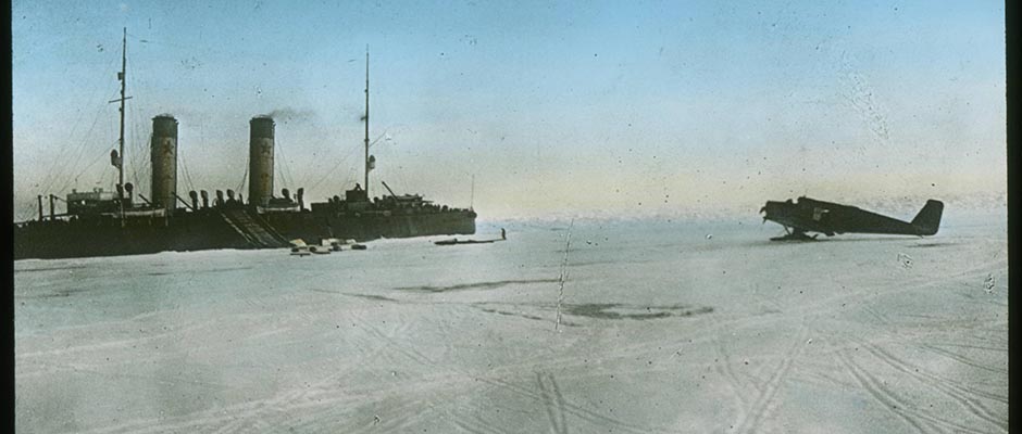
The Northern Sea Route on the one hand, and aerial transport on the
other, are secondary to the riverway as a means of effecting that
north-south connection, although the Arctic waterway has established
a link with other parts of the country hitherto virtually lacking.The Yenisei exercises a modifying climatic influence upon the
northern portion of the Territory by carrying a large mass of warm
water from the south. This reflects itself in annual temperatures and,
therefore, in the absence of permafrost along its [ ?] shores. Rising
in the Tuva National Oblast, the river is navigable virtually the
entire length of the Territory, from Dedushkin Rapids to the Kara
Sea, a distance of some 2,000 miles. Its eastern tributaries, the Kan and the
great Upper (Angara), Podkammenaia and [ ?] Lower Tunguskas, are far
005 | Vol_X-0205
Krasnoyarsk
larger than the western: Kas, Sym, Elogui and Turukhan. The navigable
upper reaches of the Chulym, a tributary of the Ob, give the southern
agricultural regions of Krasnoyarsk Territory access to that other
great river system of the north. The Taimyr Peninsula has its own
river systems in the [ ?] Piasina and Taimyr, which [ ?]
empty into the Kara Sea, and the Khatanga, whosemouth is in the
Laptev [ ?] Sea. There are numerous lakes both in the north and south.
Several of those in the south - Shira, Shunet, Altai andBei, are
salt. The lakes of the tundra, of which Piasino and Taimyr are the
largest, give indications of glacial origin. Many of them are con–
nected by natural waterways and connected to the great rivers of the
area.Soils and Vegetation . The slopes of the Kutznetsk Alatau, the
Saian Mts. and the Yenisei Ridge are covered with coniferous trees,
chiefly cedar and Siberian larch. On the west side of the river,
in the forest zone, [ ?] fir trees occupy the flatlands, while
pines grow in sandy spots and at the bases of the hills. Birch and
asp are also to be found. South of 66° [ ?] , the irregular border with the forest-tundra, the plateau occupying the eastern portion
of the territory is also a solid mass of conif d ers, Siberian [ ?]
larch and pine, with cedar, fir and spruce encountered less frequently.
on the southern border of the plateau, between the taiga and the mount–
ains farther south, there are extensive islands of steppe and forest–
steppe with fertile black soils. The taiga itself has weak podzol
soils, as well as marsh and alluvial types.Fauna . Hoofed, predatory and fur-bearing animals are abundant
in the taiga and the mountains. The chief animals sought by hunters
and trappers are the polar fox and reindeer in the tundra, and the
squirrel, ermine, sable, wolverine, fox, rabbit, bear and elk. There
is a wide variety of birds, chiefly migratory types which nest along
[ ?] in summer along the Yenisei, its [ ?] tributaries and
the numerous lakes and marshes of the tundra and forest-tundra
006 | Vol_X-0206
Krasnoyarsk
The forests and the forested portions of the mixed forest-steppe are
rich in wildfowl: partridge, grouse, nutcrackers and the like. The
Yenisei is rich, particularly in its lower [ ?] reaches, in fish of high
marketability: sturgeon, sterlet, and others. The lakes and small rivers
have pike, carp, perch, ruff, etc. Neither the fish nor the wildfowl
resources have been evenly remotely tapped to their capacity.[ ?] Tundra, forest and grassy steppe are the chief forms of landscape
encountered in the Territory. Tundra extends southward to 69°25′ N.
along the Yenisei, and occupies 26% of the Territory, [ ?] i.e., it
covers an area of 266,500 sq. mi. The next zone south is that of mixed
forest and tundra, occupying 17% of the Territory, or 162,600 sq. mi.
South of that comes an enormous unbroken stretch of virgin coniferous
forest, or taiga, extending southward to approximately the 57th parallel,
with tongues reaching below that in some areas. This covers 42% of
the surface of the Territory, or 415,700 sq. mi. Below that is the
area of mixed forest and prairie, or steppe, constituting only islands
in the unbroken forest, of which there are four, the Achinsk, Krasnoyarsk,
Berozovo and Kansk. A glance at the map will indicate that these are
also the names of the most important cities in the Territory. That is
to say, Russians settled in the type of area most familiar to them
as Europeans and best suited to their economy. Although forest-steppe
embraces only 3.6% of the Territory, some 35,880 sq. mi. in all,
it includes rich cultivated lands.Steppe proper occupies the lower portions of the Yenisei-Chulym
and Minusinsk bowls, but constitutes only 1.6% of the area of the
Territory, or 16,138 sq. mi. Finally, there is a sixth geographical
area, the mountain zone, found chiefly in the southern and central
portions of the Territory, and consisting of the Yenisei Ridge, the
Eastern and Western Saians, and the Kuznetsk Alatau. This constitutes
10% of the area of the Territory, 92,800 sq. mi.
007 | Vol_X-0207
Krasnoyarsk
Mineral Resources . Gold in reef and alluvial form has been mined and
washed on a large scale for many years in the Yenisei Ridge, the headwaters of the Abakan
River on the eastern slopes of the Kuznetsk Alatau, and in the Western
Saians. Deposits of iron on the Abakan, at Irdzhinskoe and in the Minu–
sinsk steppe, deposits of brown hematite and of sphero-siderite between
Krasnoyarsk and Kansk have also been known for a long time. Copper ores
are located in the Minusinsk basin, at Mainskaia, Yuliia, Ulen and else–
where. Amorphous graphite is found on the Arctic Circle along the river
Kureika (scene of Stalin's exile for the last four years prior to the
Revolution), while nickel, platinum, gold and copper are mined in the
mountains of Norilsk (q.v.). Iceland spar and graphite are found along
the Lower Tunguska. Coal is located at various places in the Territory:
at there are the [ ?] Black Mountain and Izykh mines in the Minusinsk [?] depress–
sion; large brown-coal deposits at Kansk along the Trans-Siberian; the
Chulym-Yenisei area northwest of Krasnoyarsk; and the enormous Tungus
Basin, 400,000 sq. mi. in area, embracing almost the entire North of the
Territory except the Taimyr Peninsula - which has its own coal - and
separate deposits of which have been found along the Yenisei, the Lower
Tunguska and the Angara.Rock salt and oil have been discovered in the high Arctic at the
mouth of the Khatanga River (qv), which empties into the Laptev Sea (qv).
Table salt and sulphates are found in the salt lakes of the extreme South.
Polymetallics ores, bauxites, asbestos, kaolin and building stone of vari–
ous types are also found within the Territory.Population . (qv Yenisei) When the first Russian musketeers and cannoneers made
their appearance in this area, they encountered no large state on within
its bounds capable of offering them serious resistance. The region was
populated by small tribes, whose very names are today known only to hist–
orians - the Arin, Kott, Kalmazh, etc. The Russians reached the Yenisei
overland (i.e., via rivers and portages) from their Arctic outpost of
008 | Vol_X-0208
Krasnoyarsk
Mangazeia (qv) on the Taz Gulf - a branch of the Gulf of the Ob - to the
northwest. This eastward progress along the extreme North of Asia resulted
from no ingrained Russian love of the Arctic, but from the consideration
that Mongol and Chinese [ ?] empires to the South presented a force too
powerful for Russia to enter into collision with so far from its center [ ?]
of reinforcement and supply at Moscow.The first settlement on the Yenisei was a wintering station built in
1607 at the junction of the Turukhanka River, just south of the Arctic Circle. First called New Mangazeia,
it later was renamed Turukhansk. Shortly afterward, moving eastward from
the Ob River, Russians reached the mouth of the Kacha and the Angara (Upper
Tunguska). In 1618, therefore, the y founded Fort Yeniseisk at 58° (now the northern–
most site of large-soale agriculture, in Krasnoyarsk Territory) as distinct from Arctic gardening
and stock-raising for anti-scorbutic and diet-variation purposes). In 1628,
having advanced upstream, they founded Fort Krutinskii, later Krasnoyarsk.
South of this point, as they emerged from the forests into natural grass–
lands where cattle-raising and agriculture were easier, the Russians made
slower progress with their conquest, for the steppes supported fairly numer–
ous native peoples capable of offering strong resistance to the tiny forces
with which Russia took Siberia. This is the historical reason underlying
the fact that the Soviet border is, to this day, a relatively short distance
[ ?] south of Krasnoyarsk.The entire expanse of the Krasnoyarsk Territory of today was in Russian
hands by the first quarter of the 18th century, i.e., a century after their
first appearance there. The Russian population along the Yenisei at that
time numbered [ ?] seven or eight thousand. At the outset the Territory was
populated chiefly by the military stationed there for the purpose of sub–
jecting the natives and extracting the yasak - tribute in furs. There were
also some serf peasants, sent there to grow food for the military. The fur–
ther growth of population was from three sources, mainly: exiles, soldiers
sent here as punishment for infractions of regulations, and peasant serfs
009 | Vol_X-0209
Krasnoyarsk
of the Crown itself. A fourth source consisted of runaway serfs of land–
owners. The building of the Trans-Siberian railroad at the end of the
19th century, [ ?] subsequent to the abolition of serfdom, was followed
by large-scale settlement along the railroad, the chief source being
peasants [ ?] for whom freedom had meant deprivation of land as well
as liberation from a master. In other cases it had meant land redemption
payments beyond the means of the freed serf to pay. To quiet unrest,
particularly after the unsuccessful Revolution of 1905, and to populate
this empty territory, the Tsarist government brought 200,000 settlers to
Krasnoyarsk Territory in the 23 years from 1895 to 1917.The Territory may be divided into three zones of population and economic
development. The southernmost, [ ?] zone, non-Arctic in these
respects, extends up to the Angara River. 133,000 sq. mi. in area –
embracing, that is, one-seventh of the Territory - it has 94% of the
population, and embraces virtually all the agriculture and most of the
industry. Population density is 12 per square mile. The next, or sub-Arctic zone, consisting of the virgin forest
north of the Angara, embraces an area of not quite 80,000 sq. mi., and
had a population of 54,000 in 1933, when the density was 0.6 per sq. mi.
The Arctic area, including the Taimyr and Evenkii National Okrugs (qv)
and the Turukhansk region, totals 618,000 sq. mi., or two-thirds of the
Territory, and had a population of 45,000 in 1933, or 0.07 per sq. mi.,
or, in other words, seven in [ ?] a square measuring ten
miles on each of its sides. Since then, the further expansion of Igarka (qv)
and the founding of Norilsk (qv) and expansion of Dudinka (qv), have resulted
at least in doubling and, more likely, in trebling, the population of
the Arctic area. A similar ratio of increase has undoubtedly been brought
about in the sub-Arctic zone through increased lumbering, for that was
the purpose of founding and enlarging Igarka.The native peoples include Kett and Selkup along the Yenisei north
of Yeniseisk, and Nentsy, Yuraks, Nganasan, Dolgan and Yakuts, all in
010 | Vol_X-0210
Krasnoyarsk
very small numbers, on the Taimyr Peninsula. The Evenki dwell in an im–
mense area along the right tributaries of the Yenisei, and [ ?]
the Khakass live in the non-Arctic mountains of the south, although their way of life, includ–
ing use of the reindeer, is closely [ ?] related to that of the Arctic
peoples.Total population of the Territory is approximately four times as high
as at the census of 1897, and three times as high as at the time of the
Revolution, in 1917. [ ?] The growth of the chief city has been as follows:[ ?] 1897 1926 1939 1944 % Increase. 1926-1939 Krasnoyarsk 26,600 72,261 189,999 300,000 162.9%
In 1936, the other non-Arctic cities had the following populations:
Kansk - 30,000; Minusinsk - 25,000; Achinsk - 23,000; Yeniseisk - 18,000;
Abakan - 17,000. In the Arctic, Igarka, newly-founded, had 25,000 on the
eve of World War II; Norilsk had some 30,000 in its mining camps and
refinery, and there were 3,000 at its port of Dudinka.The Tsars used Krasnoyarsk Territory, and particularly outlying
villages in the Arctic and sub-Arctic along the Yenisei, as the site
place of exile for its most dangerous political opponents. Its worst
hard-labor camps were also situated there. Lenin was exiled to Shushenskoe
in the extreme south from 1897 to 1900; Stalin to Kureika on the Arctic
Circle from 1913 to 1917 (he is a native of the sub-tropical Caucasus)
and Jacob Sverdlov, the first President of the Soviet Republic, to Kureika
and Selivanikha in the same years.Economic Geography . It has already been pointed out that the vast maj–
ority of the population of the Territory was born or came there after
the Revolution which brought the present regime to power. Moreover, the
one railroad had h penetrated the region only a generation earlier. It
is not surprising, therefore, that the economy of the area was at an
extremely low level when the Tsarist government was overthrown. The
native population had been pushed northward into the taiga and tundra.
011 | Vol_X-0211
Krasnoyarsk
Ruthlessly exploited by Russian merchants and oppressed by the official–
dom, [ ?] the natives were in the process of dying out. Except for gold
mining, industry was hardly in existence at all. The Territory was, how–
ever, one of the chief sources of gold and furs, i.e., commodities enabl–
ing Russia to purchase abroad. The productivity of agriculture was low,
and its techniques very backward. The building of the railroad did away
with the isolation of at least the southern part of the Territory, and
led to the shipping of wood, grain and livestock products out of the
area, but as yet in negligible quantity. Despite the considerable influx
of settlers after the building of the railroad, and [ ?] a notable increase
in acreage under the plough[?], there remained a considerable amount of
arable land immediately adjacent to the railroad, as well as in the
North, which had not been brought into cultivation, or other use. More–
over, as the Trans-Siberian railroad was the artery along which the
Civil War and Intervention proceeded in the years 1918-20, the most
developed portions of the Territory suffered most grievously. Bridges
were destroyed, warehouses burnt, etc. However, from the mid-' twenties,
with the beginnings of industrialization, and the early 'thirties, with
the collectivization and mechanization of agriculture, the economy of
the Territory advanced with extreme rapidity, as indicated by the fact
that the largest industrial city, Krasnoyarsk, almost trebled in size in
the 13 years 1926-39.Particularly noteworthy were the measures taken to master the Far
North and to place the Arctic tribes on the road to economic and cultural
progress. Their areas of habitation were delimited and established as
governmental units with some degree of autonomy and special measures
of assistance from the central government. Igarka was founded, on the
basis of assured navigation of the Kara Sea under icebreaker convoy.
The mining of coal and graphite on the Lower Tunguska (Nogin mines, 64° N.)
was begun. Schools and hospitals were founded at the various "Cultural
012 | Vol_X-0212
Krasnoyarsk
Bases" established for the native nationalities (Oron and Tura at 64°, etc.).
Expeditions of exploration and survey narrowed the white spots progressively,
and numerous polar stations were founded. In latitude, they extended from
80° (on Sovernaia Zemlia, where there were three) to 64°. Mainland stations
in 1936 included 10 on the Arctic coast proper and offshore islands (13
[ ?] including Severnaia Zemlia) and 12 more inland.The gold-mining industry remains the most important in the Territory.
Lumbering is next, its products largely being exported to the outside
world. Trapping, graphite and mica mining are also of national importance.
Industry and Power . The industrialization of the Soviet East, beginning
in the 1930s, and centered at the Kuznetsk Basin, adjoining Krasnoyarsk
Territory to the west, naturally affected this area as well. In addition
to the thorough reconstruction and expansion of old industrial enterprises,
considerable numbers of new ones were built, including sawmill and wood–
working enterprises, gold and coal mines, a large boot factory, etc. Later
heavy machinery plants were built, chief among them a major enterprise at
Krasnoyarsk building gold-dredges and railway cars. A paper mill was also
established.The [ ?] gold-mining industry was founded in the 1840s, and
within a decade [ ?] this region was the source of 90% of all the gold
originating in Russia. Careless exploitation led to the rapid exhaustion
of the rich resources and to a considerable fall in output during the
second half of the century. Under the Soviets considerable effort has
been put into the rehabilitation of the gold industry in the Territory.
In 1928-37, new mines were opened along the Saral River in the Khakass
Autonomous Oblast in the south. Their equipment is the most modern. In
all, more than 20 gold dredges were in operation in the taiga along the
Yenisei in 1936. Good roads have been built to link the goldfields with
the Yenisei and Angara. The result has been an increase in output. How–
over, with the discovery and exploitation of greater fields in the Far
013 | Vol_X-0213
Krasnoyarsk
Eastern Arctic and sub-Arctic (Kolyma and Aldan Rivers, qv), the relative
importance of Krasnoyarsk gold has declined, only 20% of the Soviet output
now coming from this Territory. The industry is centered in three districts:
the [ ?] Khakass Autonomous Oblast, and Minusinsk and North-Yenisei counties.
Systematic prospecting has revealed the presence of larger resources than
formerly suspected.The lumber industry has undergone particularly rapid development.
Major [ ?] sawmill and processing enterprises have gone up at Igarka,
Yeniseisk, Krasnoyarsk and Kansk. The number of sawmill frames rose from 16
in 1917 to 49 in 1935, when almost four million cubic meters of lumber were
cut in the Territory, of which one-quarter was for firewood and the rest
for other uses. In that year 862,000 cubic meters of [ ?] lumber was sawn in the
mills, the rest being shipped out unsawn. At that time particular emphasis
was being placed upon increasing the felling of larch as a substitute for
deciduous woods in aviation, the building of railway cars and certain other
fields. In a single year, the felling of that typically sub-Arctic species
rose from 70,000 cubic meters (1934) to 170,000 (1935).Shipbuilding for the Yenisei is an important industry at Krasnoyarsk.
Prior to 1937 there was only a small yard with a single way, capable of
launching 10 motorboats per year. But [ ?] , just prior to World War
II, a yard was built with a capacity of 200 wooden and 25 steel power-driven
vessels, and 200 rowboats per year. During the same years, a paper-mill was
erected with a capacity of 28,600 tons of newsprint, 35,900 tons of book
and writing paper, and 3,500 tons of cardboard. More recently, a plant for
the production of wood [ ?] alcohol by hydrolysis was erected. It uses
[ ?] sawmill waste.The coal industry had an output of 535,000 tons in 1935, of which 4/5
came from the Black Mt. diggings in the Minusinsk area. The Zaozernyi
lignite mine in the Kansk area went into operation only in that year, when
90,000 tons were dug. Small quantities of coal are also dug at the Badalyk
014 | Vol_X-0214
Krasnoyarsk
workings near Krasnoyarsk. In the Arctic, the digging of coal near Norilsk
for the Northern Sea Route was begun just prior to World War II.Mica is dug in Rybinsk county. There are two mines and three enterprises
for preliminary processing. 330,000 tons of raw mica were dug in 1934, and
650,000 in 1935. There is a manganese mine near Achinsk. 64,000 tons were
dug in 1934, and 132,000 the following year. The surveyed resources [ ?] were then estimated
at 800,000 tons. Barite is mined in Khakassia for the paint industry.As late as 1935, the metal manufacturing industry consisted chiefly of
re[?]pair and maintenance works. There was a locomotive repair shop in Krasno–
yarsk and a plant making equipment for the lumber industry. However, just
prior to World War II a [ ?] major heavy machinery works was erected,
[ ?] capable of building 10,000 railway cars
per year, as well as gold dredges and large river vessels. During the war
major enterprises were [ ?] permanently moved to Krasnoyarsk from the
areas threatened by German invasion. One of them, a locomotive works,
had 775,000 sq. ft. of floor space in 1945 in 15 shops. Likewise, a plant
making harvester combines was moved to Krasnoyarsk.The presence of wood and graphite led to the building, also on the eve
of the war, of a large [ ?] pencil factory with a capacity of 420,000,000
pencils per year - in excess of a million a day.The main enterprises in the food industry consist of milling and dis–
tilling, and meat-packing.William Mandel