-
Glaciology
Encyclopedia Arctica Volume 1: Geology and Allied Subjects
Former Glaciation of the Arctic Region
Unpaginated | Vol_I-0616
EA-I. (Richard Foster Flint)
FORMER GLACIATION OF THE ARCTIC REGION
CONTENTS
Page Introduction: Existing Glaciation 1 Former Glaciation: Historical Resume 3 Erosional Effects of Glaciers 5 Glacial Deposits 10 Repeated Glaciation 13 Extent and Thickness of Former Glaciers in North America 14 Extent, Thickness, and History of Former Glaciers in
Northern Eurasia18 Sea Ice During the Glacial Ages 21 Glacial Lakes 22 Perennially Frozen Ground 23 Crustal Warping 26 Fluctuation of Sea Level 28 Chronology 29 Effects of Glaciation on Life 30 Causes of the Climatic Fluctuations 33 Conclusion 34 Bibliography 35
Unpaginated | Vol_I-0617
EA-I. (Richard Foster Flint)
Former Glaciation of the Arctic Region
This manuscript was accompanied by one Northern Hemisphere map
(2 colors). Because of the high price of reproducing such maps, only
a few submitted will be used in Volume I. The selection of the number
of these maps will be determined by the publisher, and the choice of
those used should be made in conjunction with a representative of the
publisher. All maps are, therefore, being held at the Stefansson Library
until a selection can be made.
001 | Vol_I-0618
EA-I. (Richard Foster Flint)
FORMER GLACIATION OF THE ARCTIC REGION
INTRODUCTION: EXISTING GLACIERS
During the last million years or more — the time embrace s d by what ✓
geologists call the Pleistocene epoch — the earth has been affected by
repeated fluctuations of climate. These fluctuations have left a strong
impress on the terrain, the soil, the level of the sea, and the character
and distribution of plants and animals, including man. Over large areas
of the temperate regions, the most conspicuous result of the climatic changes
was the growth and spread of glaciers both large and small. Glacier growth
took place during several glacial ages; during intervening interglacial
ages the ice melted and perhaps largely disappeared. Altogether, at one
time or another, more than 30 per cent of the earth’s land area was covered
with glacier ice.In the warmer climates of the present time, glaciers are so reduced in
area that they cover little more than 10 per cent of the lands. They have
melted away from the temperate regions except on mountains high enough to
reach above the existing regional snow line. In high latitudes, also, the
glaciers have abandoned most lowland areas, but they persist on many mountains
and plateaus. In regions having moist maritime climate, some of the glaciers
exist at comparatively low altitudes because in both the north and south polar
002 | Vol_I-0619
EA-I. Flint: Former Glaciation
regions the regional snow line descends markedly toward sea level. The
persistence of glaciers in the arctic region is largely the result of
relatively low mean temperatures coupled with the abundant snowfall assoc–
ciated with maritime climates. The low temperatures may be, at least in
part, the result of the presence of the ice itself. It has been suggested
that, if the existing glaciers in the arctic region could be done away with,
many of them would not be reconstituted under existing climatic conditions (2) .The present-day glaciers of the Arctic are described in a separate
article (see “Glaciers in the Arctic”). However, a general statement about
them is necessary here as a basis for understanding the glaciers that formerly
covered much of the arctic region. The glaciers of today fall into three
general classes: valley glaciers, piedmont glaciers, and ice sheets. The
last mentioned are broad blanket-like glaciers through which little or none
of the underlying rocky surface projects. The Greenland Ice Sheet, 637,000
square miles in area, is by far the largest in the Northern Hemisphere. Much
smaller ice sheets exist on Ellesmere, Devon, Bylot, and Baffin Islands, as
well as in Svalbard, Franz Josef Land, Novaya Zeml y a, and Severnaya Zemlya. ✓
Valley glaciers are generally much smaller than ice sheets. They are tongue–
like in shape because they conform to the valleys they occupy. Piedmont
glaciers are the bulblike, expanded terminal parts of valley glaciers that
spread out on relatively flat surfaces at the bases of highlands. They are
less common than valley glaciers because the topographic conditions that
control them are somewhat specialized.It is noteworthy that the glaciers now existing in the arctic region
lie on relatively high land and in regions of maritime or submaritime climate.
This is true, for example, of the glaciers on the Eurasian Islands in the
003 | Vol_I-0620
EA-I. Flint: Former Glaciation
Arctic Sea. But the same relationship is more strikingly illustrated by
the glaciers of the arctic North America. (6, p.58B). These glaciers are ✓
concentrated in the northeastern arctic islands and in the cordilleran
region, and are absent from the intervening central region. The north–
eastern and western regions, where the glaciers are concentrated, are high
and relatively maritime. The intervening, glacier-free region is low and
continental. These facts are important to an understanding of the former
glaciers, the distribution of which was strikingly analogous to the present
distribution of land ice.FORMER GLACIATION: HISTORICAL RESUME
Although much of the glacier ice that formerly overspread the lands
originated in the arctic region, it spread extensively into lower latitudes.
Therefore, it is not possible to describe the former glaciations of the Arctic
independently of that of other parts of the Northern Hemisphere. Hence this
discussion treats the glaciations as a whole, but emphasizes the glacial
features of the arctic region.The fact of extensive former glaciations was recognized before the middle
of the nineteenth century, first in Europe and later in North America, on a
basis of evidence in middle latitudes. Scratches on exposed surfaces of
bedrock and transported boulders of northern origin soon made it clear that
the glacial invasions had come from the north. At first the ice was ascribed
to a vaguely polar origin; not until geologists had begun to explor e far northern ✓
regions did it gradually become clear that the glaciers had not originated at
or near the Pole, which, indeed, lies near the center of an extensive sea and
is hardly a likely source of land ice. Instead, it was perceived that the
004 | Vol_I-0621
EA-I. Flint: Former Glaciation
largest glaciers had spread outward from lands that fringed the Arctic Sea
and the waters of the North Atlantic and North Pacific oceans. This meant
that the northern parts of the spreading ice had flowed toward the Pole
while the southern parts were flowing away from the Pole. Although this
realization was surprising to many at the time, modern meteorologic studies
have made it abundantly clear why the glaciers originated where they did.
For relatively high lands and a source of moisture are now understood to be
essential to the creation of large glaciers. It was precisely in those
highlands which were in a position to receive snowfall, that the former
glaciers formed and grew.For many years Dawson (7) , a vigorous student of the glaciations of
Canada, held the view that, whereas eastern and central Canada had been
covered by an ice sheet, the Canadian Great Plains at the same time had
been the site of a vast sea dotted with floating icebergs. He had observed
that boulders, originating in the bedrocks immediately west of Hudson Bay
at altitudes of less than 1,000 feet, now occur abundantly on the Great Plains
at various altitudes up to more than 5,000 feet. With the rudimentary under–
standing of the mechanics of flow of an ice sheet that existed then, we need
not wonder that Dawson failed to see how a glacier could transport a boulder
4,000 feet uphill, nor that he fell back, in consequence, on the concept of
floating ice that had been popular in Europe before the importance of glaciers
had become evident.Since 1890, knowledge of the glaciation of the arctic region has grown
through the researches of many geologists in several countries. The region
is so vast that, although mu st ch has been accomplished, hardly more than a ✓
beginning has been made at a detailed understanding of the complex relations
that actually exist. A part of the concept of arctic glaciations now held by
005 | Vol_I-0622
EA-I. Flint: Former Glaciation
geologists is necessarily based, not on the scanty evidence from the arctic
region itself, but on analogy with the conditions inferred from evidence
in temperate latitudes, where many more fa z c ts are available. ✓EROSIONAL EFFECTS OF GLACIERS
The effects of glacial erosion vary from one district to another. The
variation depends primarily on three factors. The r s e are ( 1 ) topography, ✓
( 2 ) character of the rock material present, and ( 3 ) the form and rate of flow
of the glaciers.Of these three factors, topography is probably the most important. Pro–
found erosional effects of former glaciers is are evident only in Mmountains and plateaus ✓ ✓
that had already been deeply trenched by pre-existing stream valleys before the
advent of glaciers. Such valleys, especially those with steep gradients,
afforded channels for the rapid discharge of ice from its highland sources.
Valley glaciers flowed swiftly down these valleys, deepened and widened them,
and converted them into ample troughs, some of which are now partly submerged
beneath the sea to form fjords. Spectacular glaciated valleys of this kind
are common in the majority of the arctic highlands. Conspicuous among them
are the mountains of Alaska, the islands of the eastern Canadian Arctic and
Greenland, the mountains of northern Scandinavia, and the highlands of Svalbard
and Novaya Zemlya. In these highlands, valley glaciers deepened the pre-existing
valleys by amounts varying up to more than 2,000 feet.In contra x s t, the lower lands with slight relief offered no such well- ✓
defined channels with steep gradients. In consequence, probably the glacier
ice flowed less rapidly, and certainly its flow was less concentrated, than in
the highlands. Erosion was far less effective, for it is measurable in tens
006 | Vol_I-0623
EA-I. Flint: Former Glaciation
of feet rather than in hundreds or in thousands. The slight depth of erosion
is recorded both by the preservation of preglacial topographic features and
by the preservation of atmospherically decomposed parts of the bedrock —
essentially subsoil — that are believed to have been very close to the
surface before glaciations.The character of the bedrock also plays a significant part in glacial
erosion, influencing both the volume of the material eroded, and the sizes
of the individual pieces.The bedrocks exposed in the arctic region include three principal areas
of very old (pre-Cambrian) igneous and metamorphic rocks that are generally
harder and more resistant to the processes of erosion than are the larger
areas of younger, mostly sedimentary rocks that surround them. In regions
that have not be d e n glaciated these hard, resistant rocks are generally covered ✓
with a mantle of soil and other loose material derived from long-continued
superficial weathering of these rocks themselves. In the glaciated regions,
on the other hand, the areas of pre-Cambrian rocks stand out distinctly
because the action of the glaciers has removed their soil cover and has cut
into the fresh bedrock beneath it. The hard rock, laid widely bare by glacial
erosion, contrasts strongly with the surrounding weaker rocks, some areas of
which have acquired a thin covering or loose mantle through weathering since
the disappearance of the glaciers. The three principal areas of bar hard
rocks are the Hudson Bay region, the Finland Gulf of Bothnia region, and
the region of extreme northwestern Siberia. Most of the remaining arctic
land areas are underlai d n by weaker rocks. ✓As explained in a later section, the action of moving glacier ice upon
weak rocks is chiefly to break off pieces and grind them up into a mass of
007 | Vol_I-0624
EA-I. Flint: Former Glaciation
fine particles, which is then spread over the ground. In contrast, ice
moving over resistant rock such as granite breaks out large pieces, whose
diameters are controlled by the widely spaced joints and fissures in the
bedrock. These strong boulders resist grinding up in the glacial mill, and,
although many are deposited locally, others are carried long distances — up
to many hundreds of miles — before they are laid down. Hence, strong-rock
areas are likely to have a thin, patchy cover of relatively coarse glacial
deposits, whereas weak-rock areas are more likely to have thicker and more
continuous covers of finer-grained deposits. This contrast is exemplified
by the difference between the regions respectively east and west of Great
Bear and Great Slave lakes in northwestern Canada.The form and rate of flow of the former glaciers also played a part in
the erosion they performed. Glaciers whose thickness was measured in thousands
of feet, and which occupied areas of abundant snowfall, flowed more swiftly
and eroded the ground more effectively than did glaciers in dry, cold area s .
These differences are evident in temperate latitudes and doubtless existed
also in the Arctic.In the highlands as well as on the lower lands the chief process of
glacial erosion was a quarrying or plucking action that lifted out blocks
of the bedrock along joints, fractures, and stratification planes. A
secondary process was a grinding or abrasive action that scratched, grooved,
smoothed, or polished the subglacial surface.The development of scratches and small grooves (striations) on strong,
hard rocks such as granite is much more clearly evident than on soft, weak
rocks such as shale. Accordingly, the distribution of such features is not
a true indication of the distribution or intensity of former glaciations.
008 | Vol_I-0625
EA-I. Flint: Former Glaciation
Thus, striations, which are abundant in the hard rocks east of Great Slave
and Great Bear lakes, are rare in the weak-rock country west and w s outh of ✓
them, although there is abundant evidence of other kinds that the latter
territory, as well as the former, was glaciated.It is well understood that most of the striations now visible were
made underneath the outer margins of the glaciers during their shrinkage,
that, followed concentrically, they represent successively later events,
and that earlier-made striations were erased by movements that made the later
markings. Hence the striations in any district are an indication, not of the
direction of flow of a glacier while it spread over the district, but of the
flow at its margin while it was shrinking away. The earlier, spreading phase
is more reliably recorded by the giant grooves described hereafter.In territory, such as much of northern Canada, that has been temporarily
submerged beneath the sea or beneath large lakes since the time of glaciations,
exposed rock surfaces were scratched by stones carried on the undersides of
masses of floating ice. These scratches are likely to be less continuous
and less nearly parallel with each other than are striations of true glacial
origin, and on this basis are distinguished from them.In general, smoothing and grooving affected flat surfaces and inclined
surfaces opposed to the direction of flow of the glacier ice. Quarrying, on
the other hand, was more likely to take place on steep slopes facing the
direction toward which the ice was flowing. As a result of this difference,
the glacier ice produced, in some districts, a strong accentuation of asymmetric
features of the landscape, so that minor hills and protuberances of bedrock
are gently sloping and smooth in one direction, while exhibiting roughness
and even cliffs in the opposite direction.
009 | Vol_I-0626
EA-I. Flint: Former Glaciation
Although bedrock surfaces smoothed and polished by glacier ice are common
in many regions, they have been widely destroyed in some areas through the
wedging and splitting effect of moisture freezing just below the surface of
the rock. Hence, the fact that such features are not observed in some dis–
tricts does not prove that that district has not been glaciated.In some regions grooves cut or molded by the glaciers on the floors
over which they flowed are of giant size. Successions of straight, parallel
grooves as much as 100 feet deep, 300 feet wide, and one to several miles
long, in weak bedrock, occur in the Mackenzie River basin west of Great
Bear Lake in northwestern Canada (23) , and in the Petsamo district in Finnish
Lapland (26, p.453). Somewhat similar grooves, many of them even larger,
occur in masses of clayey material deposited by the glaciers themselves in
northern British Columbia (1) .One of the striking effects of glacial erosion along sea coasts is the
presence of fjords. These are stream valleys that were converted by glaciers
into deep, steep-sided troughs and were later partly submerged beneath sea
water. They characterize most of the high mountainous and plateau-like
coasts that fringe the northern seas. Thus fjords are common in Labrador,
Greenland, the islands of the eastern Canadian archipelago, Pacific Alaska,
Norway, the Eurasian arctic islands, and parts of eastern Siberia. Their
great depths, reaching as much as 4,000 feet from rim to submerged floor,
reflect the rapid erosion by the valley glaciers that occupied them, made
possible by steep gradients and confining valley walls that prevented the
ice from spreading laterally.
010 | Vol_I-0627
EA-I. Flint: Former Glaciation
GLACIAL DEPOSITS
The glaciers left, in the districts they covered, deposits of distinctive
character and with a wide variety of surface form. A common type of deposit
is till — nonstratified mixture of rock fragments of all sizes, ranging
from clay particles up to large boulders. Many of the larger fragments
exhibit flat faces with scratches upon them, which were made by abrasion
against the ground while the fragments were in transport, frozen into the
base of the glacier ice. The till ranges from a few inches up to 100, and,
rarely, even 500 feet in thickness, which is greatest in districts underlain
by weak rocks that yield readily to glacial erosion. In such districts till
is not only thick but continuous; whereas in hard-rock districts it is likely
to be thin and patchy, with wide areas in which no till at all is visible.
This close relation of till to bedrock is reflected also in the composition
of the till, which approximates that of the bedrocks in the vicinity. From
these facts it is inferred that the average distance of transport of rock
fragments by glaciers is not great. The far-traveled erratic boulders and
stones mentioned earlier, although conspicuous because foreign to the local–
ities where they now lie, actually constitute a very small proportion of the
rock matter transported by glaciers.In some places the till has been built up, at former positions of glacier
margins, into elongated ridges that may reach many miles in length and 100 feet
or more in height. Such ridges are known as end moraine d s ; they are useful ✓
records of positions held by glacier margins for periods of many years. Such
features are widely known, and have been mapped in detail, in the southern
sectors of the glaciated regions of both North America and Europe. However,
little is known of their distribution in far northern North America, Europe,
011 | Vol_I-0628
EA-I. Flint: Former Glaciation
and Siberia, partly because of lack of exploration and party because the
dense subarctic forest makes identification and tracing very difficult.
Isolated localities at which e b n d nirsubes moraines g h ave been reported are shown on ✓
the Glacial Map of North America (11) ; if complete information on the dis–
tribution of these ridges in the North were available, a large amount of
additional inference could be drawn concerning the later history of the
glaciers in that region.Less widespread than the till, but yet conspicuous, is stratified
drift. This consists of sediments, ranging from boulders down through
cobbles, pebbles, sand, and silt to clay, that have been released from
glacier ice by melting, carried by water, sorted and deposited in stratified
beds. Stratified drift is subdivided into two principal types, according
to the conditions of its deposition.The first of these types is ice-contact stratified drift, so called
because it accumulates in actual contact with the melting ice. Laid down
in flowing water or in temporarily ponded water, upon the ice, against an
ice wall, or in an opening within the ice, such deposits are disturbed
and deformed when the supporting ice walls or floors melt away. In con–
sequence, their surface form is likely to exhibit knolls, hummocks, and
closed depressions. These forms occur both isolated and in groups, and,
although commonly only a few tens of feet in height, they stand, in
exceptional instances, several hundred feet (29, p. 51-53) above their
surroundings.A group of forms built of ice-contact stratified drift, distinctive
because of their great length, are the eskers. These are ridges, usually
012 | Vol_I-0629
EA-I. Flint: Former Glaciation
narrow and commonly somewhat sinuous in ground-plan pattern, consisting
of stream-deposited sand and gravel, most of which are believed to have
accumulated in tunnels at the base of the glacier ice during its final
melting away. The trends of the eskers when compared with the trends of
grooves and other features made by the flowing ice show that these long
ridges were built essentially along radii of the glaciers, or, in other
words, about a s t right angles to the outer margins of the glacial masses. ✓
The heights of individual eskers range up to 200 feet, and the lengths of
some of them exceed 100 miles. They occur in many parts of the arctic
region, notably on the northern mainland of Canada both east and west of
Hudson Bay, on Victoria Island, and in northern Fennoscandia. They are
present also in northern British Columbia. Little information on eskers
in Siberia is available, though it is probable that they are present in
glaciated districts where the rocks are such as to yield debris of sand
and pebble size. Eskers are not common in areas of shales and other rocks
that break down into smaller-size fragments.The eskers in northern Canada tend to lie in at least two great radial
groups, suggesting that during the late stages of melting, when the eskers
were being built, one ice sheet centered in the Hudson Bay region and another,
possible in part coalescent with it, covered the highlands of eastern Quebec
and Labrador. In many parts of these regions, eskers constitute the most
conspicuous feature of the landscape.The second type of stratified drift, termed outwash , is the result of ✓
deposition by meltwater streams flowing outward away from the margin of a
glacier. Lacking the features described as peculiar to ice-contact strati–
fied drift, outwash possesses the characters common to all deposits made by
013 | Vol_I-0630
EA-I. Flint: Former Glaciation
streams fully loaded with gravel and sand. It is confined to valleys and
broad plains, and is notable in quantity only in those districts which
sloped outward, away from the ice, during the melting of the glaciers.
Thus outwash is not generally abundant along valleys in the country between
Hudson Bay and the Rocky Mountains, because much of that country sloped
toward the ice rather than away from it. The close relation of outwash to
valleys is clearly shown in a glacial map of Lapland, embracing parts of
northern Norway, Sweden, Finland, and Russia, by Tanner . (28, pl. 1).REPEATED GLACIATION
In various parts of the glaciated regions, particularly the southern
sectors, where study has been intensive, there is abundant evidence that
the glaciers formed and reached a wide extent during at least four episodes,
each of the order of 100,000 years in length. The evidence indicates
further that during the intervening times, each of the order of 200,000 to
300,000 years in length, glaciers were no more extensive than they are now,
and the climate was no cooler than it is at present. Thus far, evidence of
this kind within the arctic and subarctic regions is poor and scanty. The
nature of the evidence is indicated in the occurrences mentioned below.In North America, for example, at many localities in the region south
and west of James Bay, peat containing a coniferous-forest flora lies between
thick layers of glacial deposits . (17, p. 131). At two localities within the ✓
same region fossil-bearing marine clay is overlai d n by glacial deposits. In ✓
the Carmacks district, Yukon Territory , (3, p. 47) , and in central Alaska ,
(5, p. 8), two sheets of glacial deposits are present, the older deposit
decomposed and the younger one fresh. Analogous relations occur in the South
014 | Vol_I-0631
EA-I. Flint: Former Glaciation
Nahanni River region . (21, p. 27-28). In the Y i u kon Basin, in central Alaska, ✓
interval of thaw intervening between two periods when the ground was frozen .
(25). Father east, in East Greenland, several lines of evidence suggest
that glaciations has occurred repeatedly . (8, p. 153-56). The scanty evidence
from the vast arctic region is the result, in considerable measure, of lack
of study and even of exploration. Future research will undoubtedly add much
to the few bits of information that constitute our present knowledge.In Eurasia information is even more scanty. On the Bothnian coast of
Sweden, near latitude 65°30′ N., are lake sediments containing plants and
insects that record a nonglacial climate, overlain by glacial deposits. On
the Kola Peninsula and also near the mouth of the Pechora River are fossil–
bearing marine deposits overlain by sediments of glacial origin. In western
Siberia, sediments containing a fossil flora and fauna indicative of a mild
climate are said to occur between sediments of glacial origin. In several
localities in arctic Siberia, evidence of two glaciations has been reported,
and in the Verkhoiansk Mountains three glaciations are said to have been
identified.EXTENT AND THICKNESS OF FORMER GLACIERS IN NORTH AMERICA
The extent of former glaciations in northern North America, according to
data available up to 1943, is shown in greater detail on the Glacial Map of
North America (11) to which the reader is referred. Glaciers covered nearly
all of this vast region, to an extent of approximately 7 million square miles .
(9, p. 434). The principal land areas not glaciated are in central and
western Alaska and the extreme northern part of Greenland. Failure of glacier
015 | Vol_I-0632
EA-I. Flint: Former Glaciation
ice to cover these areas is attributed to deficient precipitation, which
failed to balance the loss of glacier ice by evaporation. It is possible
also that areas in the northernmost Canadian Arctic Islands were not glaciated
for a similar reason. The region is little known and the exact limit of glacia–
tion there has not yet been fixed . (29, p. 57-59).As already stated, North America was glaciated more than once. But,
although it is probable that the earlier glaciers had much the same distri–
bution as the later ones, the description that follows is based on the latest
glaciations, to which nearly all the evidence in the arctic region pertains.Comparison of rock types in the glacial deposits with the bedrock areas
from which they apparently came, coupled with other evidence, indicates that
the glaciers had two principal sources: the highlands of the eastern arctic
region (including Greenland) and the cordilleran mountains of western North
America. Glaciers from these two sources met and coalesced not far east of
the eastern base of the Rocky Mountains.The cordilleran ice formed from a snowfall precipitated on the high ✓
Coast Ranges, from the Aleutians southward through Alaska and British Columbia
into the United States, and derived from warm, moist maritime air masses from
off the Pacific. To a much smaller extent, glaciers accumulated from the
same source in the Rocky Mountains farther east and north. Valley glaciers,
n h igh in the mountains, formed first. By downward and outward flow, and by ✓
coalescence at the bases of the mountains, these combined into piedmont
glaciers. With continued snowfall the latter thickened and spread until they
submerged the vast territory between the Coast Ranges and the Rockies and
buried many of the mountain tops themselves, forming an ice sheet. In this
coalescence the Coast Range ice played the major role, the Rocky Mountains
016 | Vol_I-0633
EA-I. Flint: Former Glaciation
glaciers contributing lesser amounts of ice to the ice sheet. From this
great confluent reservoir, 1,800 miles long d a nd in places 6,000 feet or ✓
more in thickness, outlet glaciers flowed westward through major valleys
transecting the Coast Ranges, into the Pacific. There they may have
coalesced into a floating shelf similar to the Ross Shelf Ice off the Ross
Sea sector of the Antarctic Continent, and certainly discharged icebergs
into deep water. The maximum area of this cordilleran ice is believed to
have approached one million square miles.The Alaska Range, the Alaska Peninsula, and the higher parts of the
Aleutian chain supported glaciers that were virtually continuous with the
cordilleran ice just described. The glaciers were large and thick, for
they lay on very high ground under a maritime climate. Farther north,
however, because of the much drier continental climate, only the highest
mountains bear the marks of glaciations, and their former glaciers appear
to have been relatively thin. Among these separate glaciated areas were
the Brooks Range, the Kuskokwim Mountains, and the higher mountain groups
on the Seward Peninsula and in the Yukon Basin.Although several of the higher Aleutian islands are known to have been
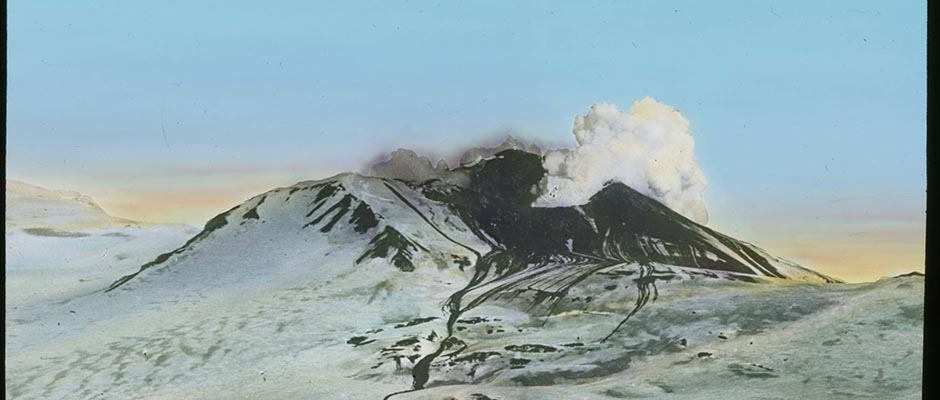
glaciated, the record of glaciations is somewhat obscured by recent volcanic - ✓
activity. Not only has volcanism probably covered some glaciated areas, but
also some islands may have been too low to have formed glaciers even as
recently as the latest glacial age, having reached their present altitudes
since that time.The ice in eastern North America is believed to have formed in much the
same manner as the cordilleran ice , (10), through snowfall precipitated upon
the highlands of eastern Quebec and Labrador, Baffin, Ellesmere, Devon and
017 | Vol_I-0634
EA-I. Flint: Former Glaciation
other islands, and Greenland. The sources of moisture are believed to have
been relatively warm moist Gulf and Atlantic air masses. Valley glaciers
in these highlands are thought to have coalesced into piedmont glaciers
west of the belt of mountains. These, by inducing further precipitation of
snowfall upon themselves, are believed to have thickened and spread, reaching
the condition of a single coalescent ice sheet, and largely burying the
mountains in which they originated. The Greenland Ice Sheet (with an area
of 935,000 square miles when at its maximum) may have been confluent with
the ice on the lands to the west, across Baffin Bay and Davis Strait. How–
ever, the ice reaching the sea along the coasts of East Greenland, Labrador,
Newfoundland, the Maritime Provinces of Canada, and New England probably
formed a floating shelf or shelves, discharged icebergs, and was prevented
by deep water from spreading farther eastward.The western side of the main ice sheet, however, was encouraged to spread
westward by continued snowfall brought to it from the south and west. This
was the chief glacier mass in North America, and, following Dawson (7, p. 162)
is known as the Laurentide Ice Sheet. It became coalescent with the cor c d illeran ✓
ice along a 1,500-mile front, reached northward to the Arctic Sea, and southward
nearly to the mouth of the Ohio River. Its total area was about five million
square miles. The thickness of the Laurentide Ice Sheet is believed to have
been 5,000 to 10,000 feet in its well-nourished southeastern part, 1,000 feet
in its southwestern part, 1,500 feet in the northern Mackenzie Valley region,
and perhaps 2,000 feet in its northern part, fronting the Arctic Sea.As long as the accumulating ice formed valley glaciers and piedmont glaciers,
the mountain ranges and other chief highlands continued to be the centers from
which the ice flowed outward. But when the ice-sheet phase was reached, the
017a | Vol_I-0635
EA-I. Flint: Former Glaciation
ice induced snowfall independently of mountain ranges. Thus in the cordilleran
region, in British Columbia at least, the center of outflow shifted from the
Coast Ranges eastward to the lower mountains farther inland, as the glacier
ice in that region was built up to the level of the mountain tops. In the
Laurentide Ice Sheet the orientation of striations and other indications
suggest that radial outflow occurred from shifting centers situated well to
the west of the east-coast mountains. During the waning of the ice sheet,
a major center seems to have persisted in the Hudson Bay region, and striations
suggest the persistence of other centers in the central part of the Ungava
Peninsula, Labrador, Newfoundland, southern Baffin Island, northern Baffin
Island, Melville Peninsula, Melville Island, and Victoria Island, as well as
in several highland districts south of the St. Lawrence River. If independent
glacial centers did exist in the more northerly situations enumerated, probably
the y antedated by only a short time the dominance of the icecaps existing today ✓
on Baffin, Bylot, Devon, and Ellesmere Islands and Greenland, which can hardly
be other than persistent, though reduced, centers of the same kind.The Laurenfide Ice Sheet reached its greatest westward extent near the
eastern base of the Rocky Mountains, along a front extending from latitude 49°
northward for more than 1,500 miles to the mouth of the Mackenzie River. This
is recorded by the western limit, within the glacial deposits, of rock types
derived from the Hudson Bay region. North of latitude 62° the glacier crossed
the Mackenzie River and reached the Canyon Ranges and Mackenzie Mountains west
of it. Although very little information is available, it is probable that the
margin of the ice crossed the present shore line of the Arctic Sea a short
distance west of the mouth of the Mackenzie.
018 | Vol_I-0636
EA-I. Flint: Former Glaciation
Throughout most or all of its vast western edge, the Laurentide Ice
Sheet was confluent with cordilleran ice in the form either of outlet
glaciers of the Cor c d illeran Ice Sheet or of ice flowing eastward from inde–
pendent mountain centers. This coalescence is shown by interbedding of
glacial deposits derived from the east and from the west, respectively, as
well as by other features.EXTENT, THICKNESS, AND HISTORY OF FORMER GLACIERS IN NORTHERN EURASIA
The glaciers of northern Eurasia were counterparts, in many respects,
of those in northern North America, and the glaciations of the two continents
are believed to have been essentially contemporaneous. The principal ice
bodies were the Scandinavian Ice Sheet and the Siberian Ice Sheet. These
two large masses, when at their maxima, were confluent. On the mainland
east and south of these major ice sheets were large groups of glaciers on
the Central Siberian Plateau, the Altai Mountains, the Baikal highlands,
and various high mountain masses in northeastern Sibeeria. In addition,
separate icecaps or glacier systems existed on the British Isl ands es , the ✓
Faeroes, Iceland, Jan Mayen Island, Svalbard, Franz Jose ph f Land, the New ✓
Siberian Islands, and Wrangel Island.All these glaciers, like those in North America, either were situated
on highlands or originated in mountains from which they later expanded by
migration. The Scandinavian Ice Sheet had a maximum area of about 2,150,000
square miles, while the area of the Siberian Ice Sheet was about 1,620,000
square miles. The other glaciers mentioned above (generally speaking, those
that lay north of latitude 50°) had an estimated combined area of about
975,000 square miles. Adding the figures for all the former Eurasian glaciers
019 | Vol_I-0637
EA-I. Flint: Former Glaciation
north of about latitude 50°, we get a total of 4,750,000 square miles.
This area is considerably less than the 7,000,000-square mile area of
former continuous glaciers in North America, despite the fact that Eurasia
is the large st r continent, chiefly because larger quantities of warm moist ✓
air could reach the North American region than could reach the Eurasian,
to nourish the growing glaciers.The Scandinavian Ice Sheet originated in the snow precipitated
abundantly on the Scandinavian mountains by Atlantic air masses. The
glaciers were prevented from extending westward by the presence, immediately
off the Norwegian coast, of deep water on which developed a floating shelf
of ice that doubtless discharged large numbers of bergs. East of the moun–
tains, however, the glaciers expanded and coalesced to form the ice sheet,
which attained a thickness of about 10,000 feet over the Bothnian lowlands.
This great mass spread northward and eastward, thinning in those directions,
and reaching, on the average, to 50° E. longitude. There it became coalescent
with the Siberian ice. To the southwest it extended across the floor of the
shallow North Sea and at times merged with the glaciers that had formed on
the British Isl ands es . ✓The Siberian Ice Sheet originated in a group of highlands consisting of
the Ural Mountains, Novaya Zemlya, and the Putorana, Byrranga, and Severnaya
Zemlya highlands, and formed a coalescent mass of ice that never succeeded
in burying entirely the highland summits. According to the evidence it left
upon the flanks of the Urals, it was 2,300 feet thick in that region. Its
relative thinness is explained by its relatively unfavorable position with
respect to the receipt of snowfall from maritime air masses. Indeed, as the
Scandinavian Ice Sheet expanded toward the Urals the Siberian ice was thereby
020 | Vol_I-0638
EA-I. Flint: Former Glaciation
deprived of a part of its snowfall from western sources, and it began to
wane. This is shown by the relations of glacial deposits derived from
eastern and western sources, respectively, near the White Sea coast. Toward
the north this ice mass extended outward through an unknown distance over
what are now the shallow floors of the Arctic and Barents seas.In northeastern Siberia, high ranges such as the Verkhoiansk, Cherski,
Kongin, Gydan, Aniui, and Anadyr nourished glaciers that are believed to
have coalesced, at their maximum, into a complex system of valley, piedmont,
and icecap glaciers 1,800 miles in length, and not unlike the cordilleran
system in western North America, although measurably thinner. In addition,
the Koriak Mountains on the Bering Sea coast, the mountains on the Kamchatka
Peninsula, and other ranges farther south, harbored independent glacier systems.The glaciated island areas mentioned earlier were covered principally by
ice sheets. Glacier ice on the Faeroes reached an altitude of at least 1,600
feet and covered all but the mountain tops. About nine-tenths of the area of
Iceland was similarly covered with ice that is believed to have averaged more
than 2,000 feet in thickness.Jan Mayen Island, 300 miles northeast of Iceland, has a volcanic cone
reaching to 7,680 feet above sea level. This cone supports glaciers at present,
but the record of former glaciations is obscured by recent volcanic activity.
However, if Jan Mayen had sufficient altitude when Iceland was glaciated, it
is probable that it, too, was glaciated.From the evidence on record it is highly probable that the various islands
of the Svalbard archipelago, as well as Bear Island, 150 miles to the south,
were fully glaciated; indeed, nearly 90 per cent of their combined area is
still glacier-covered. Possibly the Bear Island ice was confluent with the
Svalbard ice at the time of maximum glacial extent.
021 | Vol_I-0639
EA-I. Flint: Former Glaciation
Both the Franz Jose ph f Land archipelago, and the two isolated islands ✓
(White and Victoria) that lie between it and the Svalbard group, are today
almost completely covered with glaciers of the thin icecap type. Since
it is generally true that areas now ice-covered were more extensively
covered during the former glacial ages, it is believed that a confluent
ice sheet probably covered Franz Jose ph f Land at the times when Svalbard ✓
was so covered. Both areas receive maritime precipitation from the southwest.The New Siberian Islands are inferred to have been the center of a
relatively small, thin ice sheet that spread to the mainland coast, as indi–
cated by geologic evidence on this coast. It is probable that the De Long
Islands, northeast of the New Siberian group, were glaciated, and Wrangel
Island, likewise, was completely blanketed by an ice sheet.SEA ICE DURING THE GLACIAL AGES
The Arctic Sea today is extensively covered with floating ice, which,
as recently as the late nineteenth century, was even more extensive. There
seems to be little basis for doubt that, when the great ice sheets occupied
northern lands, the Arctic Sea was completely covered with ice. Moreover,
that ice probably was substantially thicker than it is today.The southern limit of continuous sea ice, when at its maximum, probably
stretched across the North Atlantic in a great are from Newfoundland past
southern Greenland and Iceland to Ireland. Its position can only be
conjectured. However, core sampling of the North Atlantic sea floor has
revealed abundant stones and grit occurring in layers interbedded with
fine-grained warm-water sediments. The stones and grit are attributed to
deposition by melting sea ice as it floated southward during one or more
glacial ages . (4) .
022 | Vol_I-0640
EA-I. Flint: Former Glaciation
As discussed in a later section, the level of the sea, during the
glaciations, stood as much as 300 feet lower than its present level. In
consequence, the Bering Sea must have been separated from the Arctic Sea
by an isthmus several hundred miles in width. South of this isthmus, in
the shrunken Bering Sea, there may have been little floating ice other
than bergs broken off from the small number of glaciers that may have reached
tidewater along the northern shores of some of the Aleutian Islands.The parts of Baffin Bay, Davis Strait, and the Labrador Sea that were
not occupied by glacier ice either aground or as floating shelves probably
had a continuously frozen surface.GLACIAL LAKES
The gradual shrinkage of the great glaciers was accompanied in many
regions by the temporary impounding of meltwater between ground sloping toward
the ice, and the ice itself. As these temporary basins filled to overflowing,
spillways were formed and streams, often large, poured away from the newly
created lakes. Gradual melting of the glaciers progressively uncovered newer
and lower outlets; this resulted in repeated sudden changes in configuration
of the lakes. With final disappearance of the ice, many lakes were completely
drained away; others, however, occupied basins so deep that they have persisted
down to the present time.Among the larger lakes of this kind in North America are the glacial
Great Lakes (far more extensive than the existing lakes), and Lake Agassiz,
an enormous water body of which Lake Winnipeg is a present-day survivor.
Farther northwest, abandoned shore lines and lake sediments surrounding the
existing Reindeer, Wollaston, Cree, Athabaska, Lesser Slave, Great Slave,
023 | Vol_I-0641
EA-I. Flint: Former Glaciation
and Great Bear Lakes testify to the presence of former glacial ancestors.
Farther east in North America the only large water body thus recorded is
Lake Barlow-Ojibway, whose floor sediments of silt and clay occupy a belt
500 miles long south of James Bay. Many small glacial lakes were formed,
but the large ones are confined chiefly to the southern and western sectors,
where the margin of the Laurentide Ice Sheet retreated down very long, very
gentle slopes.In Eurasia a similar lake of large size, the Baltic Ice Lake, occupied
the Baltic region, southern Finland, and adjacent parts of Russia. Other,
smaller lakes formed in northern European Russia. In general, however, the
relation of the directions of deglaciation to the slopes of the land were
less favorable for the creation of large glacial lakes in Eurasia than in
North America.In addition to the usual cliffs, beaches, bars, and other shore features,
some of the smaller glacial lakes are fringed, in favorable sectors, with
stony ridges up to several feet in height, made by the shoreward shove of
ice floes impelled by winds and currents.PERENNIALLY FROZEN GROUND
The solid rock of the earth’s crust is covered with a discontinuous
mantle of loose rock material of various kinds, whose thickness ranges from
a very thin veneer up to many hundreds of feet. In some places the mantle
is the product of the disruption, by weathering, of the bedrock immediately
beneath. In others it is a deposit brought in by streams, waves and currents,
glaciers, or the wind. In districts having a mean annual temperature of less
than 0° C. the mantle freezes and remains frozen perennially, thawing only
024 | Vol_I-0642
EA-I. Flint: Former Glaciation
to very shallow depths during the summer season. Such perennially frozen
ground (also termed permafrost) may extend vertically throughout the full
thickness of the mantle and even include part of the underlying bedrock.
Laterally, in the Northern Hemisphere, it forms a circumpolar belt of
irregular width extending south to about latitude 62° in Alaska and to
52-55° in the region of Hudson Bay and Labrador. In Eurasia its southern
limit trends southward from the White Sea coast to less than 50° N. in
cold southeastern Siberia. (See articles on Permafrost.)Three aspects of perennially frozen ground are related to the problems
of arctic glaciation: ( 1 ) the relation of the distribution of frozen ground
to the glaciated regions, ( 2 ) the stratigraphy of the frozen ground, and
( 3 ) the geomorphic effects of frozen ground. Each of these aspects will
be briefly considered.It has been held that areas of frozen ground are complementary to the
formerly glaciated areas. This view is based largely on the deduction that
ground protected beneath a covering of glacier ice would not freeze. However,
a comparison of the distribution of the two phenomena (cf. 18, fig. 1) yields
little evidence of a complementary relationship. There is a growing belief
among authorities on frozen ground that its areal distribution has changed
materially since the maximum of the latest glaciation and now represents,
to a large degree, a response to present-day climatic conditions.In places where the frozen zone is both thick and artificially exposed
to view, its stratigraphy yields valuable data on its history. In the Yukon
Basin in central Alaska are thick accumulations of silt deposited under a
milder climate but now perennially frozen. Mining operations have exposed
features in the silt that indicate a former interval of deep thaw, accompanied
025 | Vol_I-0643
EA-I. Flint: Former Glaciation
by extensive erosion . (25). This interval, which clearly occurred between
two times when a deep frozen condition prevailed, undoubtedly records a
less rigorous climate. Unfortunately, the time of thaw has not been fixed;
so this climatic fluctuation has not yet been dated. The central Alaskan
occurrence, however, indicates that frozen ground may be a source of important
information upon the glacial ages.The geomorphic effects of frozen ground are the result of surface
activities during summer thaw. The frozen substratum inhibits the normal
downward percolation of the subsurface water created by thawing of the ground.
As a result the superficial zone becomes saturated and flows down slope, or,
on flat areas, sorts the stones from the finer materials and pushes them
into characteristic geometric patterns. Thus are formed the often-described
solifluction features, soil polygons, stone stripes, and the like. The
significance of such features to the problems of glaciation is that their
occurrence in areas of nonfrozen ground is proof of former frozen conditions,
and therefore records former colder climates, presumably those associated ✓
with the latest glacial maximum. In both North America and Eurasia this
assemblage of features occurs throughout an irregular belt extending beyond
the limits of the latest glaciation.In very high latitudes, the geomorphic effects of frozen ground are
clearly postglacial, and therefore reflect present-day low mean temperatures.
Similar phenomena in middle latitudes are generally “fossils,” constructed
at an earlier time when temperatures were lower, and now inactive.
026 | Vol_I-0644
EA-I. Flint: Former Glaciation
CRUSTAL WARPING
Emergence of coastal parts of the arctic region from beneath the sea is
widely evident in the presence of fossil-bearing marine sediments, as well
as wave-out cliffs, beaches, bars, and the like, at altitudes as great as
several hundred feet above sea level. The distribution of such features in
North America is shown on the Glacial Map of North America (11) and therefore
need not be described in detail. The marine deposits generally overlie those
of glacial origin; hence it is inferred that the date of emergence is mainly
postglacial. However, in the Far North the altitudes of individual features
are not yet known in sufficient detail to permit a definite inference as to
the cause of emergence. Recourse to the much better-known altitude data
from middle latitudes, however, shows that the upper limit of marine features
decreases radially outward from the Hudson Bay region as a broad center, and
passes below present sea level near the limit of the glaciated region (see
map, 9. Fig. 81, in ref. 9 ). This implies that domelike upwarping has occurred
✓
within the area formerly covered by the Laurentide Ice Sheet, and that the
center of the dome coincides in a general way with the geographical center
of the former ice sheet. Similarly, along the Pacific Coast, evidence of
postglacial emergence is widely present, and altitudes of marine features
seem to bear a general relationship to the inferred thickness of the former
glaciers. On the Bering Sea coast, for example, where glaciers were thin or
absent, there is little or no evidence of emergence dating from this same time.A similar relationship exists in Fennoscandia, where the facts are known
in greater detail than in North America. The emerged marine features reach
their greatest altitudes in the region of the Gulf of Bothnia, where the
geologic evidence suggests that the Scandinavian Ice Sheet was thickest.
027 | Vol_I-0645
EA-I. Flint: Former Glaciation
Emerged marine features have been identified in Iceland, Greenland,
Spit z s bergen, Novaya, Zemlya, and the New Siberian Islands. They are reported ✓
along the arctic coast of Eurasia within the area of the former Scandinavian
and Siberian ice sheets but not east of the latter.These facts of distribution indicate a close connection between the
former glaciers and warping of the crust. It is widely believed that these
extraordinary masses of ice constituted extra loads upon the crust, which
was depressed beneath these loads by amounts equal to something like one-third
the thickness of the over-lying ice. As the glaciers melted, the crust
slowly recovered its preglacial position, but with a considerable lag in time,
during which the sea submerged many areas formerly ice-covered, and left
shore features and floor deposits to be later warped up above sea level.Measurements in northern Europe and eastern North America (15) show
that upwarping is still in progress. Scattered observations in northern
North America (29, p. 69-71) indicate that emergence there is likewise still
in progress, though detailed measurements are not available to indicate
whether warping is involved, or to what extent any contemporary warping is
the result of the melting away of glacial loads upon the earth’s crust.Not until such detailed systematic measurements have been undertaken
can an adequate idea of the postglacial warping of the arctic region be formed.
From the fact of present-day emergence, however, it is clear that the next
few centuries should witness substantial changes in the configuration of
arctic coasts from this cause alone. Calculations based on certain assumptions
as to the nature of the warping have led to the prediction that the movement
still to be expected will convert virtually all Hudson Bay into dry land and
will turn the Gulf of Bothnia into a minor lake.
028 | Vol_I-0646
EA-I. Flint: Former Glaciation
FLUCTUATION OF SEA LEVEL
Although the preceding discussion brings out a close relationship between
emergence and crustal warping, it can not be inferred that the presence of
emerged marine features is wholly the result of crustal warping. Again, lack
of much evidence from the f F ar n N orth compels us to seek evidence in the much ✓
better-known middle latitudes.It has long been understood that the tremendous quantities of water
substance locked up on the lands during the glacial ages in the form of
glacier ice were derived ultimately from the sea. It has been realized
further that the abstraction of this water (by evaporation) lowered the
sea level by amounts that have been variously estimated but that may be
conservatively placed at 300 feet below the present level. Correspondingly,
during the interglacial ages when there is reason to believe that complete or ✓
nearly complete deglaciation of the polar regions occurred, it is thought
that the sea level stood some 100 feet above its present position. Evidence ✓
of sea levels both higher and lower than the present level, and apparently
unrelated to crustal warping, occurs in many nonglaciated regions and
rarely in the glaciated regions. Thus, on the nonglaciated arctic coast
of Alaska, fossil-bearing marine deposits no older than the earliest glacia–
tion occur far above present sea level . (24, p. 238-241). On the northeast
coast of the Kola Peninsula, facing the Barents Sea, there are reported
marine sediments containing a fossil fauna that records a warmer climate
than that which now affects that region . (13, p. 448). Finally, on the
coastal plain of southwestern Kamchatka, facing the Sea of Okhotsk, two
marine strand lines are reported, with respective altitudes of 30 feet and
100 feet above present sea level . (9, p. 443).
029 | Vol_I-0647
EA-I. Flint: Former Glaciation
These scattered occurrences make it seem likely that the arctic region
contains a good deal of information on sea level fluctuation dependent on
the building and melting of glaciers. In those parts of the Arctic that
were formerly covered by thick glaciers the changes in shore lines that
occurred during the glacial ages must have been extremely complex. During
the growth of the glaciers, the sea level would have subsided, but local
sagging of the earth’s crust under the weight of the ice would, in some
districts, have been even greater in amount. Conversely, during deglacia–
tion, the rise of the crust as the ice melted away would have been greater
than the contemporaneous rise of sea level in some district, and less in
others. Only systematic, detailed, and long-continued observations and
measurements will reveal what actually happened.CHRONOLOGY
No discussion of arctic glaciation would be complete without mention
of the actual dates of the glacial events. Little or no evidence of actual
dates has yet been obtained from the Far North, and, despite extensive
effort in research, the evidence from middle latitudes does not yield definite
figures. (For a discussion of the available information up to 1946 see 9,
p. 379-406.) The best dates available are based only on controlled estimates.
They indicate, in addition to the figures cited in an earlier part of the
present discussion, that the latest glaciation may have had its inception
about 100,000 years ago and may have reached its maximum extent about 60,000
years ago, and finally that the deglaciation of most of the eastern half
of glaciaged North America may have been accomplished during the last 25,000
years. These figures are only estimates, and are subject to adjustment as
better data become available.
030 | Vol_I-0648
EA-I. Flint: Former Glaciation
EFFECTS OF GLACIATION ON LIFE
The record of fossil plants and animals in the deposits made during
the glacial and interglacial ages indicates that the chief effect of the
repeatedly changing climates was to cause large-scale changes of range.
Both plants and animals, adapted to definite habitats, moved equatorward
or poleward as the climatic belts were slowly shifted. These movements
of groups of organisms were not migrations in the strict sense. They were
gradual changes of range, wherein no one individual moved far, the majority
of individuals probably not moving at all beyond the radius of movement
normal to their kind.In the Northern Hemisphere two directions of changes are evident in
the fossil record: a shift of organisms toward the equator, during the glacial
ages, and a shift toward the poles during interglacial times. The evidence
is fragmentary, but it distinctly shows these trends.As most of northern North America and much of northern Eurasi s a were ✓
obliterated beneath glacier ice at the maxima of the glacial ages, large
areas were removed from the list of habitable places. In far no r thern North ✓
America, only interior and western Alaska and adjacent areas in Yukon Territory
escaped inundation. Here many arctic plants survived the glaciation, as well,
no doubt, as some animals; but the climatic conditions can hardly have been
hospitable. During such times boreal plants and animals found their way far
to the south, both in North America and in Eurasia, though the lesser extent
of glaciers in Asia compelled less drastic changes of range.More remarkable is the occurrence, as fossils in alluvium in central
Alaska, of a richer mammal fauna than inhabits the region today. This fauna
includes a big bear ( Arctodus ), the dire wolf, a lion ( Panthera atrox ), two
031 | Vol_I-0649
EA-I. Flint: Former Glaciation
genera of ground sloths, a cameloid, two genera of musk oxen, a horse
a woolly mammoth, and mastodon. All the foregoing mammals are extinct,
but many kinds still living occur as fossils in the same deposit, including
peccary, reindeer, moose, bighorn sheep, Saiga antelope, Rocky Mountain
goat, and musk ox. Although the character of this assemblage does not
prove that it dates from an interglacial time, it seems likely that this
was so.That both woolly mammoth and mastodon followed the shrinking Laurentide
Ice Sheet into the Hudson Bay region is shown by fossil finds. In Eurasi s a , ✓
likewise, not only the woolly mammoth but also the woolly rhinoceros and
its distant relative Elasmotherium , reoccupied the areas vacated by the
melting ice sheetsVery few new species of animals seem to have developed through adaptive
evolution resulting from the appearance of glacial climates; the woolly
mammoth and the woolly rhinoceros may have evolved in this way, though their
specific relationships are still uncertain. Among marine invertebrates,
likewise, the record seems to be one of repeated migrations rather than one
of marked evolutionary changes.As for the land plants, their present distribution throughout the northern
part of the Northern Hemisphere indicates that they have reached their present
positions in postglacial time through dispersal from refuges in northwestern
North America and northeastern Asia. This evidence fits well the evidence of
glaciation itself, for the refuges were situated in the only extensive far
northern areas not covered by glacier ice. It is believed that in preglacial
time northern plants had a more or less uniform distribution throughout a
circumpolar belt. The development of glaciers repeatedly split up this
032 | Vol_I-0650
EA-I. Flint: Former Glaciation
preglacial arrangement. Only recently have the plants repopulated the
glaciated areas for the latest time, but they have not yet succeeded in
reestablishing their former circumpolar distribution.Apparently among the plants, as among the animals, there is little
evidence of evolution during the time embraced by the several glaciations . (16).It has been urged that the present-day distribution of certain arctic–
alpine plants on and near the summits of arctic highlands and their absence
from their lower slopes indicate that such highlands projected above the
glaciers and constituted local refuges upon which these plants survived the
latest glaciation. However, geologic evidence of glaciation in a number of
such summit areas is plan; aside from this it seems probable that the plants
in question migrated to their present sites during deglaciation, and that
they have since been eliminated from the slopes and bases of the highlands
through gradual warming of the climate.The present distribution of circumpolar plants (16) and animals (22)
finds adequate explanation in the present distribution of land and sea, with
one exception: a land bridge across Bering Strait, connecting North America
with Eurasia, must have existed at times, in order to provide a path for
the interchange of plants, for the migration of a few North American mammals
to Eurasia, and for the introduction of a spectacular assemblage of Asiatic
mammals into North America. Barely 50 miles wide and very shallow, Bering
Strait could have been converted into an isthmus through a change of level
amounting to only 150 feet — either a fall of sea level or a local upwarping
of the crust. When we recall that glacier-building is believed to have lowered
the sea surface by as much as 300 feet, we experience little difficulty in
visualizing a broad isthmus, perhaps several hundred miles in width, connecting
033 | Vol_I-0651
EA-I. Flint: Former Glaciation
the two continents during each of the glacial ages. Glaciers were not
abundant on the adjacent highlands, and, although the climate at those times
must have been cold, the fossil record shows that only those migrants which
could survive a rigorous climate succeeded in making the journey . (22, p. 651).The results of modern research, therefore, do away with the necessity
of a transatlantic land bridge such as has been invoked by some writers on
this subject, and, indeed, with the necessity for any conspicuous change in
the configuration of the arctic lands, other than those mentioned, during the
glacial and interglacial ages.CAUSES OF THE CLIMATIC FLUCTUATIONS
The causes of the glacial and interglacial climatic fluctuations, although
a fascinating subject of inquiry, do not fall specifically within the scope of
the present discussion. The status of research and speculation in this field
has been summarized recently (9, p. 501-520) and need only be mentioned here.
The hypothesis that seems best to meet the facts known at present appeals to
two events. The first was a worldwide uplift of the lands shortly before the
earliest glaciation — an uplift in which arctic lands took an important part.
This uplift is a fact of historical geology. The second event is a pure
assumption. It is assumed that radiation is emitted by the sun (and received
by the earth) at a rate that is variable rather than constant. To this
assumed variation are ascribed the fluctuations of the earth’s climates. To
the presence of high lands is ascribed the fact that responses to these
fluctuations consisted of the growth of glaciers.It is noteworthy that throughout fifty million years, or more, of pre–
glacial time, arctic lands were comparatively low, and the fossil record of
034 | Vol_I-0652
EA-I. Flint: Former Glaciation
T t hose times implies, not glaciation, but widespread cool-temperate climates. —
The glacial ages constituted a very unusual group of events throughout the
world, but nowhere were they accompanied by changes as profound as in the
circumpolar regions.CONCLUSION
Further changes are taking place within the arctic region at present.
Within the last hundred years glaciers have shrunk at a rapid rate, sea ice
in the Arctic Sea has been notably reduced in both area and thickness, the
area of perennially frozen ground has been diminishing, and in places the
subarctic forest has been creeping forward at the expense of the tundra.
All these changes are apparently consequent upon a worldwide increase in
mean annual temperatures — an increase of which there is reliable evidence
in the results of direct meteorologic observations. In other words, the
repeated and extraordinary changes that have characterized the last million
years are still in progress. The trend in the immediate future can not be
predicted because no past rhythm or periodicity in the climatic swings has
been detected. Therefore we have no reliable basis for extrapolation into
the future.However, what is abundantly clear is the need for ever-increasing
scientific exploration of the arctic region. The great era of primary
exploration has drawn nearly to a close, but the field for intensive scien–
tific investigation of these little-known regions has only just been laid
open. This constitutes a splendid challenge to future workers.Richard Foster Flint
035 | Vol_I-0653
EA-I. Flint: Former Glaciation
BIBLIOGRAPHY
1. Armstrong, J.E., and Tipper, H.W. “Glaciation in north central British
Columbia,” Amer.J.Sci . vol.246, pp.283-310, 1948.2. Bonacina, L.C.W. “Climatic change and the retreat of glaciers,” Roy. Met.
Soc., Quart.J . vol.73, pp.85-95, 1947.3. Bostock, H.S. Carmacks District, Yukon . Ottawa, 1936. Can.Geol.Surv.,
Mem . 189.4. Bradley, W.H., and others. Geology and Biology of North Atlantic Deep-Sea
Cores between Newfoundland and Ireland . Washington, D.C., G.P.O.,
1942. U.S.Geol.Surv., Prof.Pap . 196.5. Capps, S.R. “Glaciation in Alaska,” U.S.Geol.Surv., Prof.Pap . 170. Wash.,
D.C., G.P.O., 1931, pp.1-8.6. Dawson, G.M. “Notes to accompany a geological map of the northern portion of
the Dominion of Canada,” Can.Geol.Surv., Ann.Rep . Ottawa, 1886, vol.2,
pp.1R-62R.7. ✓ ----. “On the glaciati i o n of the northern part of the Cordillera,” Amer.Geol .
vol.6, pp.153-62, 1890.8. ✓ Flint, F.R. “Glacial geology and d g eomorphology (of parts of East Greenland),”
Amer.Geogr.Soc., Spec.Publ . no.30. N.Y., 1948, pp.90-210.9. ✓ ----. Glacial Geology and the Pleistoce [?] n e Epoch . N.Y., Wiley, 1947.
10. ----. “Growth of the North American ice sheet during the Wisconsin age,”
Geol.Soc.Amer., Bull . vol.54, pp.325-62, 1943.11. ----, and others. Glacial Map of North America . N.Y., 1945. Geol.Soc.Amer.,
Spec.Pap . 60. Pt.1: Map; Pt.2: Bibliography and Explanatory Notes.12. ----, and Dorsey, H.G., Jr. “Glaciation of Siberia,” Geol.Soc.Amer., Bull .
vol.56, pp.89-106, 1945.13. ✓ Gerasimov, I.P., and Markov, K.K. Lednikovye Period na Ter t r itorii USSR .
(The Glacial Period in the Territory of USSR.) Akad.Nauk, Inst.Geogr.,
Trudy vol.33, 1939. (Russian with English summary.)14. Grønlie, O.T. Contributions to the Quaternary Geology of Novaya Zemlya .
Kristiania, Brøgger, 1924. Norwegian Expedition to Novaya Zemlya, 1921.
Report of the Scientific Results . N n o.21.
036 | Vol_I-0654
EA-I. Flint: Former Glaciation
15. ✓ Gutenberg, Beno. “Changes in sea level, postglacial uplift, and mobilit y of
the earth’s interior,” Geol.Soc.Amer., Bull . vol.52, pp.721-72, 1941.16. ✓ Hult e é n, Eric. Outline of the History of Arctic and Boreal Biota during
the Quaternary Period . Stockholm, Bokförlags Aktiebolaget Thule, 1937.17. McLearn, F.H. “The Mesozoic and Pleistocene deposits of the Lower Missinaibi,
Opazatika, and Mattagami Rivers, Ontario,” Can.Geol.Surv., Summ.Rep .
Ottawa, 1926, pt.C, pp.16-47.18. Muller, S.W. Permafrost or Permanently Frozen Ground and Related Engineering
Problems . Ann Arbor, Mich., Edwards, 1947.19. Nordenskjöld, Otto, and Mecking, Ludwig. The Geography of the Polar Regions .
N.Y., 1928. Amer.Geogr.Soc., Spec.Publ . 8.20. Obruchev, V.A. Geologiia Sibiri . (Geology of Siberia.) Moscow, Leningrad,
✓ Akademiia Nauk, 1935-38. 2 3 vol.21. Raup, H.M. “The botany of southwestern Mackenzie,” Sargentia no.6, pp.1-275,
1947.22. ✓ Simpson, G.G. “Holar a c tic mammalian faunas and continental relationships
during the Cenozoic,” Geol.Soc.Amer., Bull . vol.58, pp.613-88, 1947.23. Smith, H.T.U. “Giant glacial grooves in northwest Canada,” Amer.J.Sci .
vol.246, pp.503-14, 1948.24. Smith, P.S., and Mertie, Jr., H.B. Geology and Mineral Resources of North-
western Alaska . Wash.,D.C., G.P.O., 1930. U.S.Geol.Surv., Bull . 815.25. Taber, Stephen. “Perennially frozen ground in Alaska; its origin and
history,” [ ?] Geol.Soc.Amer., Bull . vol.54,
pp.1433-1548, 1943.26. Tanner, Vaino. “Die Oberflächengestaltung Finnlands,” Bidrag till Kännedom
✓ of [on?] Finlands Natur och Folk vol.86, 1938.27. ----. Outlines of the Geography, Life and Customs of Newfoundland-Labrador
(the Eastern Part of the Labrador Peninsula) . Helsinki, Tilgman, 1944.
Acta Geogr ., Helsingf. 8, no.128. ----. Studier öfver Kvartärsystemet i Fennoskandias nordliga delar. Part III:
✓ Om landisense rörelser och afamältning i Finska Lappland och angränsande
trakter . Helsingfors, 1915. Finland. Bulletin Geologinen Tutkimuslaitos . Bull .
✓ Helsingf. 38. (Swedish with French summary.)29. Washburn, A.L. Reconnaissance Geology of Portions of Victoria Island and
Adjacent Regions, Arctic Canada . N.Y., 1947. Geol.Soc.Amer., Mem . 22.Richard Foster Flint
Glaciers in the Arctic
Unpaginated | Vol_I-0655
EA-I. (Robert F P . Sharp)
GLACIERS IN THE ARCTIC
CONTENTS
Page Introduction 1 Classification of Glaciers 1 Distribution, Area, and Volume 5 Present Regime 7 Greenland 8 Iceland 16 Jan Mayen 21 Svalbard 23 Novaya Zemlya 29 Franz Josef Land 31 Severnaya Zemlya 32 Other Siberian Islands 33 Scandinavia 34 Urals 41 Siberia 42 Canada 42-b Alaska and Adjoining Parts of Canada 45 Ellesmere Island 55 Baffin and Bylot Islands 58 Other Canadian Arctic Islands 61 Bibliography 63
Unpaginated | Vol_I-0656
EA-I. Sharp: Glaciers in the Arctic
PHOTOGRAPHIC ILLUSTRATIONS
With the manuscript of this article, the author submitted one
photograph for possible was as an illustration. Because of the high
cost of reproducing them as halftones in the printed volume, only a small
proportion of the photographs submitted by contributors to Volume I,
Encyclopedia Arctica , can be used, at most one or two with each paper;
in some cases none. The number and selection must be determined later
by the publisher and editors of Encyclopedia Arctica . Meantime all
photographs are being held at The Stefansson Library.
001 | Vol_I-0657
EA-I. (Robert F P . Sharp)
GLACIERS IN THE ARCTIC
INTRODUCTION
Arctic and subarctic glaciers constitute prominent features of the
landscape, exert considerable influence on meteorological conditions, and
have economic significance. Their size, nature, distribution, and behavior
are treated briefly.Any armchair compilation must necessarily be based on the writings and
observations of others. Practically every statement written herein has
been made before; nothing is original. Although references to the litera–
ture are sprinkled liberally through the text, it is not possible to ac–
knowledge every word and thought. This debt to the works and writings of
others is fully appreciated. Unfortunately, the short time available for
compilation and limited library facilities precluded reference to all of
the literature on arctic glaciers.CLASSIFICATIONS OF GLACIERS
Glacier classifications are nearly as numerous as glaciologists. Each
classification benefits from its predecessors, so attention is directed to the
latest. A morphological arrangement has the greatest use for this article,
and Ahlmann’s classification is one of the most comprehensive . (6) . —
002 | Vol_I-0658
EA-I. Sharp: Glaciers
Morphological Classification of Glaciers
A. Glaciers extending in a continuous, sheet, the ice moving outward in all
directions.1. Continental Glaciers or Inland Ices : covering very large areas (e.g.,
Greenland and the Antarctic).2. Glacier Caps or Icecaps : covering smaller areas than Continental Gla–
ciers (e.g., Vatnajökull in Iceland, Jostedalsbreen and most other
large Norwegian glaciers; this group includes what by other authors
are called Plateau Glaciers, Island Ices, Highland Ices, Icecaps).3. Highland Glaciers : covering the highest or central portions of a moun–
tain district, from which ice streams issue through the valleys (e.g.,
in the interior of Spitsbergen, particularly New Friesland).B. Glaciers confined to a more or less marked path, which directs its main
movement. This group includes both independent glaciers and outlets
of ice from glaciers of group A.1. Valley Glaciers (of alpine type): occupy only the deeper portions of
the principal valleys and obtain their supply from the heads of the
valley system (e.g., the alpine glaciers).2. Transection Glaciers : the whole valley system is more or less filled
by ice, which overflows the passes between the valleys (e.g., the
Yakutat Glacier in Alaska, most of the glaciers in the interior of
Spitsbergen, and in the Alps during the last glacial period; called
Eisstromnetz by Drygalski and by O Nordenskjöld, the Spitsbergen
type; include both the Reticular and Dendritic Glaciers of Tyrrell).3. Circus (Cirque) Glaciers : localized to separate niches on a mountain
side, or to the uppermost part of a valley (e.g., large numbers of
small glaciers in the Alps and other mountain ranges, as well as in
Norway; called cwm glaciers by Hobbs and others).4. Wall-sided Glaciers : covering the side of a valley or some part of it
which is not furrowed by any marked niche or ravine. (In Spitsbergen
these are called Stufenvereisung by Drygalski and Flankenvereisung by
Philipp.)5. Glacier Tongues Afloat : an ice stream more or less afloat at the shore of
the ice-covered land.
003 | Vol_I-0659
EA-I. Sharp: Glaciers
C. Glacier ice spreading in large or small cakelike sheets over the level
ground at the foot of high-glaciated regions.1. Piedmont Glaciers : formed by a fusion of the lower parts of two or
more independent glaciers of types B1, B2, or B4 (e.g., the Mala–
spina Glacier in Alaska; this group also includes Priestley’s Confluent
Ice).2. Foot Glaciers : from the lower and more extended portions of glaciers
of types B1, B2, and B4.3. Shelf Ice : connected to a glaciated inland, but receiving most of its
supply from snow accumulating on it and recrystallized into a firn–
like mass. It either floats on the sea or covers coastal shallows,
in the latter case largely resting on the bottom (e.g., the Ross
Barrier).
004 | Vol_I-0660
EA-I. Sharp: Glaciers
Refinements and further subdivision of these classes are possible
but not necessary here. Matthes’ (72) intermontane glacier, an ice mass
occupying a spacious trough between separate mountain ranges or mountain
groups, might be added, for they are well represented in Alaska.Glaciers may also be distinguished on a dynamical basis as active,
inactive, or dead (12, p. 63), or on the basis of their mode of flowage
as pressure-controlled or gravity-controlled (30, pp. 365-73; 72, pp.
150-53). A geophysical classification (12, p. 66) can be made on internal
temperature, meltwater behavior, and firn condition. Temperate glaciers are at
the pressure-melting temperature throughout except in winter when a thin
surficial layer is chilled below 0°C. The temperature in polar glaciers
is negative even in summer down to a considerable but unspecified depth.
In high-polar glaciers no meltwater forms even in summer, but in subpolar
glaciers surface melting and percolation of some meltwater do occur.
005 | Vol_I-0661
EA-I. Sharp: Glaciers
DISTRIBUTION, AREA, AND VOLUME
The greatest ice mass outside the Antarctic is the justly famed
Greenland Ice Sheet. Neighboring islands of the Canadian Arctic west of
Greenland also have sizable ice masses. East of Greenland are such well–
known glacier-bearing islands as Iceland, Jan Mayen, Svalbard, Novaya
Zemlya, and the lesser known Franz Josef land and Severnaya Zemlya archi–
pelagos. Of these island groups, Franz Josef Land is the most completely
covered by ice. Of the continental areas treated, southern Alaska and
adjacent parts of Canada are by far the most heavily covered. Scandinavian
glaciers, although the largest in Europe, are relatively small by compare–
son, and scattered glaciers in the Urals, Siberia, and the interior and
eastern parts of Canada are much smaller still.The ma [?] j or glacier-bearing areas of the Arctic and Subarctic center
primarily around the North Atlantic and secondarily in southern Alaska and
Canada near the Gulf of Alaska. In both areas the sea is relatively free
of floe ice for part or all the year. In the North Atlantic, glaciers
border the great re-entrant eaten into the arctic ice pack by the Gulf
Stream. Although topography is an obvious factor in glacier development,
equally important is an abundant supply of moisture derived primarily from
an open sea and carried to the ice-bearing areas along favorable storm
paths. The present glaciers in the Arctic clearly show a close relation
to sources of moisture, storm paths, and suitable topography.
006 | Vol_I-0662
EA-I. Sharp: Glaciers
The following compilation of arctic and subarctic ice-covered
areas is derived principally from Hess (54, p. 121), Thorarinsson (108,
p. 136), and Flint (42, p. 39). It is supplemented locally by plani–
metric measurements made on latest issues of U.S. Air Force World Acronau–
tical Charts based mostly on recent air photography. Throughout this
article these planimetric measurements are marked with asterisks.Aerial Distribution of Arctic and Some subarctic Glaciers
Region Area in square miles Greenland Inland Ice Sheet 637,000 Independent ice bodies 63,000 Total 700,000 Iceland 4,655 Jan Mayen 45* Svalbard Northeast Land 4,340 Other islands, chiefly
West Spitsbergen18,060 Total 22,400 Franz Josef Land 6,560 Novaya Zemlya 5,800 Severnaya Zemlya 6,400* Canadian Arctic Archipelago Ellesmere Island 31,400* Axol Heiberg Island 3,740* Devon Island 6,250* Bylot Island 2,000* Baffin Island 12,000* Other small islands 200 Total 55,590* Scandinavia 2,400 Continental North America 30,890 Grand Total 834,740
007 | Vol_I-0663
EA-I. Sharp: Glaciers
This 834,740 square miles constitutes approximately 14.3 per cent
by area of the present ice cover on our planet. Thicknesses of ice have
been determined at only a few places, and even these determinations are
fraught with uncertainties. If we follow Daly (28, p. 12) and assume an
average thickness of 3,280 feet for the Greenland Ice Sheet and an
average of 985 feet for all other ice bodies, the total volume of the
ice tabulated above is approximately 432,750 cubic miles. In light of
modern estimates of thickness, this is probably too great.PRESENT REGIME
With minor exceptions, glaciers in arctic and subarctic regions
are receding at an ever-increasing rate (108). In areas bordering the
North Atlantic, the present accelerated recession is the modern phase
of a general retreat which started in some areas as much as 200 years
ago and in others 50 to 60 years ago (12, p. 74). About the same
history is recorded around the Gulf of Alaska, although some Alaskan
glaciers are now at their most advanced positions in centuries.The present rapid recession is ascribed largely to the so-called
“recent climatic improvement,” which has produced a rise in winter, spring,
and autumn temperatures in at least the North Atlantic area (11, p. 24).
Climatic amelioration is also indicated by the decrease in average thick–
ness of the arctic ice peak from 144 inches to 86 inches between 1893-95 and
1937-40 (11, p. 23). The length of the navigation season to Svalbard has
also increased; birds and fish are now found farther north than formerly;
and frozen ground is deteriorating in many areas.
008 | Vol_I-0664
EA-I. Sharp: Glaciers
This climatic improvement is thought to be the result of increased
northward circulation of warm air brought about by changes in atmospheric
pressure gradients. The low-pressure area of the North Atlantic, and
perhaps also of the North Pacific, has moved farther north to give rise
to these conditions. A rise in temperature rather than a change in pre–
cipitation appears to be the major result, and temperature is the factor
most strongly affecting glacier behavior (6, p. 190).GREENLAND
The greatest ice mass of the Northern Hemisphere is the Greenland
Ice Sheet. Since the first crossing by Nansen in 1888, it has become our
best explored and most studied continental sheet. Greenland is also richly
endowed with a wide variety of additional glacier types including indepen–
dent icecaps, highland glaciers, the greatest outlet glaciers of the
Arctic, valley and cirque glaciers, wall-sided glaciers, expanded foot
glaciers, tidal glaciers, floating glaciers, and even in places an ice
foot. Of all the glacier types listed in Ahlmann’s morphological classi–
fication (6, pp. 192-93), it at one time appeared that only piedmont
and transaction glaciers might be lacking in Greenland. However, at
least one piedmont has now been reported (43, p. 134), and transaction
glaciers ar e also described from high mountainous areas on the east
coast (31, p. 184).
009 | Vol_I-0665
EA-I. Sharp: Glaciers
Many figures have been given for the area of the Greenland Ice
Sheet, but the 637,000 square miles determined from planimetric measure–
ments by L o ö we (71, p. 317) is probably the best. An ice mass of this
size covers about 76 per cent of the land. The total ice cover on Green–
land, including independent glaciers and ice on islands, is estimated at
— 700 0 ,000 to 715,000 square miles by Matthes (72, p. 159) and 733,000 square
miles by Hess (54, p. 12). This amount of ice would cover close to
85 per cent of the land (72, p. 159). The length of the sheet is about
1,570 miles, and the maximum width is close to 600 miles. The greatest
elevation on the sheet may still be a moot question. Latest maps show
an elevation of 10,325 feet at 69° 49′ N., 37° 52′ W. The British Trans–
Greenland Expedition (67, pp. 402,406) reported 10,400 feet (uncorrected)
on the ice sheet 20 miles north of Mount Forel, and stated that the high
center attains 10,500 feet. Flint (42, p. 40) speculates that the highest
point may exceed 11,000 feet. The mean height is said to be about 6,900
feet (71, p. 317). The highest point in Greenland, so far as known, is
a rocky peak of 12,139 feet in the Watkins Mountains at 68° 54′ N., 29°
49′ W. (27, p. 202).The W a e gener expedition made seismic soundings through the ice at
various points up to 250 miles inland from the west coast (97, p. 335).
Thicknesses ranging from 150 to 6,000 feet, and possibly more, were
supposedly indicated by this work. However, the reliability of these
results has been seriously questioned (31, p. 29; 30, pp. 383-86; 8,
p. 157), and the conclusion that Greenland is like a gigantic saucer filled
with ice is not highly regarded in many quarters. However, the seismic
soundings do appear to indicate that terrain beneath the ice has a considera–
ble relief with steep slopes.
010 | Vol_I-0666
EA-I. Sharp: Glaciers
The crestal ridge of the ice sheet is much nearer the east side
and consists of three independent summits. The longest and highest summit
in the east-central region rises above 10,000 feet, and the two smaller
summits farther sou g t h attain more than 9,000 feet (42, p. 38, Fig. 9).
The origin of this crestal ridge has been long debated. One view main–
tains that it marks the location of the thickest ice (111, p. 154). If
this were true, the ridge would be a relic feature, for the area of maxi–
mum accumulation is now much farther west (54, p. 115; 97, p. 335). The opposite
view, vigorously defended recently by Demorest (30, pp. 378-86), holds
that the crest reflects a high upland in the underlying bedrock topo–
graphy. Reliable determinations of ice thickness would, of course, re–
solve this problem. Another major topographic feature of the Greenland
Ice Sheet is a broad depression extending east-west across it at about
69°N. (63, pp. 47, 55). This depression terminates at both ends in
some of the greatest and most active outlet glaciers of Greenland.
011 | Vol_I-0667
EA-I. Sharp: Glaciers
The surface of the ice sheet slopes gently away from the central
ridge at 5 to 50 feet per mile. Near the edges the slope steepens appre–
ciably, and a more varied relief develops. On the west side, heads of
great outlet glaciers are marked by depressed or drawn-down areas termed
“basins of exudation” by Peary. These extend at least 85 miles inland
from the edge of the sheet, and crevasses indicating flowage into the
basins are found 125 to 185 miles inland. Basins of exudation are rare
along the east coast, but depressions at the head of the great Kangerd–
lugssuak Glacier (69° N.) and at the head of Waltershausen Glacier in the
Franz Josef Fjord region may be of this nature. In general, the ice along
the east coast piles up behind the high coastal mountains and spills over
through high passes (111, pp. 149-150; 67, p. 407). However, even here
there are great hollows 500-1,000 feet deep, steep-sided, flat-floored,
5 to 10 miles across, and separated by rounded ice ridges and summits
67, p. 400). These are thought to reflect the underlying bedrock to–
pography. On both edges where the ice thins, nunataks stick through.In addition to marginal steepening, the ice sheet exhibits a series
of terrace-like steps, five with 50- to 100-meter separation on the west
side, and four on the east (54, p. 112). These have been interpreted
as reflecting the configuration of the bedrock floor (55, p. 129; 73,
p. 252), and as the product of large-scale sliding and slumping
(30, p. 394).
012 | Vol_I-0668
EA-I. Sharp: Glaciers
The inland ice reaches the sea at Melville Bay on a 240-mile front
and in two places along the northeast coast between 78° and 80°N. for a
total of 130 miles. Humboldt Glacier emptying into Kane Basin is usually
described as a gigantic outlet glacier with a front of 60 to 70 miles, but
it might almost as well be interpreted as a part of the inland ice which
reaches the sea directly.Greenland provides the finest display of outlet glaciers to be
seen in the Arctic. Some are truly huge; Petermann Glacier draining to
Hall Basin is 15 miles wide and at least 60 miles long. Waltershausen
Glacier draining to Franz Josef Fjord is about 10 miles wide at maximum
and fully 75 miles long. Teichert (105) mentions other lengthy Green–
land outlet glaciers. Most of these are tidal, and many are afloat.
Outlet glaciers centering in the Disko-Umanak-Upernivik area of the west
coast and the Scoresby Sound region on the east coast are among the
greatest berg-producing glaciers in the world. Berg production is truly
tremendous, and from some glaciers occurs as great cataclysms about every
fortnight which give off as much as 18,000 million cubic feet of ice and
choke the f i j ords. Total annual output of bergs in West Greenland is es–
timated at 7 to 10 cubic nautical miles (42, p. 45). The major berg–
producing glaciers are also those with consistently high velocities, for ’ —
which the description “running glaciers” is appropriate. Velocities up
to 124 feet in 24 hours have been recorded on Upernivik Glacier (22, pp.
244-45), one of the most active on the west coast. Maximum movements of
60 feet per day are more usual (70, p. 267; 22, p. 247). This compares
with movements of fractions of an inch per day on the inland ice (55, p.
135). Great daily variations in rates of flow are also recorded on
Greenland glaciers (100, p. 45).
013 | Vol_I-0669
EA-I. Sharp: Glaciers
The largest areas of land not covered by inland ice are at the
north, in Peary Land (62), on the west coast between 66° and 68°N. where
the sheet lies as much as 100 miles inland (80, p. 313), and along the
east coast south from 78°N. where the ice sheet is a maximum of 80 to . —
180 miles inland (18 , ) p. 159. Within areas not covered by inland ice —
are highland glaciers, independent icecaps like Sukkertoppen, outlet
glaciers, transection glaciers, and cirque and valley glaciers numbered
in the hundreds. Some of the outlying caps may not be remnants of the
Pleistocene ice sheet but features reborn after the great shrinkage of
the postglacial warm-dry period (72, p. 208). In support of this possi–
bility, Demorest (29, pp. 54-55) reports névé fields on Nugssuak Penin–
sula that are probably postglacial.Among the minor features associated with Greenland glaciers are
abundant dust wells and dust basins, and the Chinese Wall aspect of
steep to overhanging ice faces (23, p. 565). This condition has been
attributed to differential ablation related to the low angle of the
sun and to the large amount of debris in the lower ice layers (23, p.
566; 18, pp. 180, 197). In other instances it is ascribed to differ–
ential overriding by the upper ice layers (84, pp. 115-16). Most
writers, including those cited above, recognize both methods as
possible. The thrust, sheared, and fractured condition of ice in the
basal layers of many Greenland glaciers (23, pp. 676-77; 18, pp. 180-
82) is thought to be due in part to low temperature of the ice . (70, —
p. 268; 84, p. 124).
014 | Vol_I-0670
EA-I. Sharp: Glaciers
On a geophysical basis, the ice bodies or Greenland are classified
as polar and subpolar. Thermal observations in the firn at Eismitte
(97, pp. 339, 341) and subsequent calculations (54, p. 113; 116, p. 171)
indicate that the central part of the Greenland Ice Sheet is polar, but
air temperatures are not low enough to prevent basal melting by the heat
flux of the earth. The Fröya and other low-level glaciers in north–
eastern Greenland are subpolar (11, p. 21). Thermal studies of Sukker–
toppen Icecap (100, 1940, p. 47) would seem to indicate that it is almost —
temperate.Matthes (72, p. 156) offers the interesting speculation that ice now
appearing at the edge of the Greenland Ice Sheet may be 10,000 years old.
Wager (111, pp. 154-55) suggests that the Greenland Ice Sheet may have
first developed as far back as the Miocene.The inland ice seems to be about in a state of balance (71, pp. 317-
29; 30, p. 398). Koch (64, p. 105) observes that the ice sheet in north–
ern Greenland has varied little, and Reid (90, p. 474) reports a descript–
tion of the inland ice prepared in A.D. 1200 , which would apply rather —
well to modern conditions. It also appears from the present rise of sea
level that the inland ice is not melting as rapidly as other smaller
bodies in the Northern Hemisphere (12, p. 75).
015 | Vol_I-0671
EA-I. Sharp: Glaciers
The situation with regard to the margins of the icecap, some outlet
glaciers, and the independent ice bodies is wholly different. Considerable
shrinkage of the ice in Greenland probably occurred during the postglacial
warm-dry period (9, p.198; 72, p.208), and moraines now a short distance
beyond present glacier snouts are thought to represent the greatest Hochstands
of the postglacial period. These probably occurred sometime between the
middle eighteenth and the middle nineteenth centuries (9, pp.199-202).
Flint (43, pp.139-140, 147, 159) records evidence in northeastern Greenland
indicating two glacier advances separated by a considerable deglaciation,
with the youngest readvance possibly having occurred during the nineteenth
century. Advances of other Greenland glaciers in about 1850 and 1890 are
recorded (108, p. 146; 72, p. 194), but since 1890 recession seems to have
rules. Fröya Glacier, on Clavering Island, was 22 per cent larger by area
and 60 per cent larger by volume during its Hochstand than now (9, p. 203).
Upernivik Glacier receded an average of 3,000 feet and a maximum of 5,000 feet
between 1887 and 1931. Jakobshavn Glacier receded 6 to 8 miles between 1851
and 1902, with interruptions by short-lived advances (22, pp. 249-54).
Glaciers in the Umanak area have undergone recession for 40 years (69).
During the 68 years between 1869 and 1937, Pasterze Glacier in northeastern
Greenland probably receded 3.85 miles (43, p. 125). Another glacier in this
area disappeared completely during this interval. Considerable recession
has also been recorded in other parts of eastern Greenland (18, pp. 159-60,183;
47, p.40; 76, p. 388).
016 | Vol_I-0672
EA-I. Sharp: Glaciers
Thorarinsson (108, p. 147) states that glaciers of Greenland,
apart from the ice sheet, have experienced recession and thinning for
some decades and with minor interruptions this has been going on since
the middle or latter half of the nineteenth century. However, northwest
in the Cape York (76°N.) district many glaciers advanced until 1920 and
since then have receded (64, p. 107). In North Greenland the
edge of the ice sheet showed no appreciable change in 100 years, and in
this region in the 1920's were 15 advancing, 8 stationary, and 9 receding
glaciers. Even though recession is the rule, erratic advances of glaciers
continue to be recorded; Taterat Glacier of West Greenland, for instance,
showed a lateral expansion of 100 feet in one month during the summer of
1938 (100, p. 51).Detailed studies of radiation and the meteorological factors in–
fluencing glacier wastage have been made in both East (10) and West
Greenland (34; 100). The amount of convective heat and the relatively
minor role of radiation (8.2 per cent of total heat) supplied to Fröya
Glacier in August is surprising (33, p. 39). Ablation also proved to
be greater during cloudy weather in this area.ICELAND
Iceland is strictly a subarctic area, but consideration of its
glaciers here is justified by the scope of Encyclopedia Arctica Encyclopedia Arctica and by —
the special interest attached to these ice bodies.
017 | Vol_I-0673
EA-I. Sharp: Glaciers
One-eighth of Iceland is glacier-covered (42, p. 52). The total area
of ice on Iceland and Jan Mayen is 4,700 square miles (54, p. 121), of
which about 45* square miles is on Jan Mayen. Iceland is pre-eminently
a land of icecaps, of which the largest , Vatnajökull, covers 3,050 square
miles (54, p. 99). This is more than the combined area of all other
glaciers on the island. The other principal caps are Hofsjökull (502 square
miles), Langjökull (464 square miles), Myrdalsjökull (386 square miles), and
Drangajökull (60 to 70 square miles) (35, p. 121). Many smaller caps lie
periferal to the major caps; Langjökull has at least 4 satellites, and
Myrdalsjökull and Vafnajökull have 2 or 3 apiece. Snaefellsjökull is a
small isolated cap of 10* square miles in far western Iceland near Cape
Öndver t d (Öndverdarnes).Ice tongues and outlet glaciers project from the larger caps. Vatnajökull
alone having some 18, but none reaches the sea. The largest and most active
outlets are on the southeast flank of Vatnajökull. Cirque and valley glaciers
are rare in Iceland, except in the north between Skaga and Eyja fjords where
the rough mountainous terrain harbors a number of small caps, and valley and
cirque glaciers. Icelandic glaciers are relatively thin, the largest having
an estimated thickness of not more than 750 feet (42, p. 52). This permits
the underlying topography to exert considerable influence on the relief and
shape of the icecaps. Elevations on Vatnajökull range from 6,952 feet almost
down to sea level. High points of other icecaps are between 3,035 and 5,581
feet, but none extends as low as Vatnajökull.
018 | Vol_I-0674
EA-I. Sharp: Glaciers
A phenomenon of particular interest associated with the Icelandic
glaciers is the periodic eruption of subglacial volcanos. Principal
centers of eruption are the Grimsvötn area in western Vatnajökull, and
the Katla area in south-southeastern Myrdalsjökull. In recent times
eruptions have occurred in Grimsvötn at intervals of about 10 years, the
latest in 1922 and 1934. The Katla area has erupted twice every century
since 1580, the latest in 1918 (110). Nielsen (81, p. 11) recognizes —
several eruptional phases from studies of the Grimsvötn activity in
March and April of 1934. The first phase appears to be the formation of
a great subglacial lake through extensive melting by volcanic heat. Melt–
ing may go on independently of actual volcanic outbursts (110, p. 66).
When this subglacial lake exceeds a certain level or reaches the edge
of the icecap, a great flood or jökulhlaup rushes forth, carrying huge
quantities of water, debris, and ice out over the sandy outwash areas
or sandurs periferal to the ice. The second phase occurs when the erup–
tion breaks through the icecap and ejects a huge column of ash and steam
- high into the air. When the eruption subsides, a steaming crater lake —
remains, but in a year or two it is covered over by ice and snow. The
outbursts of meltwater sometimes create great collapse craters or “ice–
caldera,” a spectacular example of which was photographed from the air
in the fall of 1945 (110, p. 64). This caldera, 2,600 feet in diameter
and 260 feet deep, had a striking series of concentric boundary fractures.
Ash, erupted from Grimsvötn in 1934, served as a valuable marker bed in
studies of nourishment and wastage on Vatnajö [?] Vatnajökull (14, p. 39). —
019 | Vol_I-0675
EA-I. Sharp: Glaciers
The moist maritime environment of Iceland gives its glaciers, par–
ticularly those in the south, an extremely high rate of metabolism,
featuring large accumulation and great ablation (5, pp. 171-88). Outlet
glaciers such as Hoffellsjökull are extremely active even though
they are receding and have a strong negative regime.Studies of Hoffellsjökull and Heinabergsjökull, outlets from the
southeast margin of Vatnajökull, indicate that meteorological factors are
more important than radiation as a cause of ablation in this area in a
ratio of 60 to 40 (13, p. 228). It also appears that these glaciers are
more susceptible to variations of temperature than to changes of precipi–
tation (6, pp. 188-205). Great differences in ablation and accumulation
over a 3-year period (1936-38) are recorded on Hoffellsjökull, but the
net sum is a deficiency of about 3.3 billion cubic feet of water.
Hoffellsjökull also has a relatively rapid rate of flow, the maximum
recorded being 2,070 feet a year (107, p. 202).
020 | Vol_I-0676
EA-I. Sharp: Glaciers
Fluctuations of Icelandic glaciers during historical time are relatively
well documented. From the time of colonization, about A.D. 900, to at least
the fourteenth century, glaciers in Iceland were less extensive than after
1700 (108 p. 144). An advance, started in the early 1700’s, attained its
climax about 1750. This was followed by alternate periods of stagnation or
recessin, and advance (35, p. 134; 109, pp. 49-50). Two principal Hochstands
can be distinguished, one in 1750-60 and one in 1840-50. Three lesser Hoch–
stands are also recognized in the 1710’s, in the 1810’s, and about 1890,
and further tendencies toward advance are distinguished about 1870, 1910,
and at the beginning of the 1920’s and the 1930’s. Not all glaciers reached
their most advanced position during the same climax. Some were most extended
in 1750, some in 1850, and still others in 1890 (106, p. 194). These maxima
are the greatest attained within historical time and possibly within the entire
period subsequent to the great recession of the postglacial dry-warm period
(4, pp. 198-200).
021 | Vol_I-0677
EA-I. Sharp: Glaciers
The recession that set in about 1890 has, with minor interruptions, gradually
become accentuated until the 1930’s when it became almost catastrophic for many
glaciers. Hoffellsjökull is estimated to have lost at least one-third of its
volume by shrinkage alone in 45 years between 1890 and 1935 (106, p. 189).
Recessions of glacier snouts of 3,000 to 10,000 feet between 1890 and 1936
are reported (72, p. 193). However, as in many parts of the world, this re–
cession has been punctuated by local aberrant advances of individual glaciers.
o O utlet glaciers from Drangajökull have long been famous in this respect. The —
G g lacier of Kaldalon advanced 635 feet in 1935-40, that of Reykjar Fjord ad–
vanced 2,460 feet in 1933-36, and that of Leiru Fjord 3,240 feet in 1938-42
(36, p. 250). At Skeidararjökull conditions are abnormal owing to frequent vol–
canic activities. Between 1904 and 1932 this ice front fluctuated con–
siderably but showed an over - all advance. In 1929, it advanced suddenly,
breaking newly erected telephone poles. Short-lived advances have also been
reported for ice tongues of Vatnajökull (119, p. 228), and differential be–
havior of ice fronts on the west rim of Hofsjökull and the southeast rim of
Langjökull have been recorded (86, p. 49).JAN MAYEN
The glaciological significance of Jan Mayen far outweighs its small size.
Its location (71° N., 8° 30′ W.) 375 miles north-northeast of Iceland makes
Jan Mayen a significant reference point in the vast Norwegian Sea.
022 | Vol_I-0678
EA-I. Sharp: Glaciers
Glaciers on Jan Mayen are limited to a high volcanic peak, Mount Beerenberg
(7,680 feet), at the northeast end of the island. Fifteen tongues protrude from
the mantle of ice and snow covering the upper parts of this cone (59, p p. 168-78), and
the total ice-covered area is about 45* square miles. Some of the tongues, par–
ticularly those on the northeast, lie in valleys or shallow depressions, but
others rest unconfined on the slopes of the cone as wall-sided glaciers (58, p.128).
Kjerul k f , Svend Foyn, and Weyprecht glaciers, all draining the northeast slope,
are tidal. Other glaciers, such as Wille, Grieg, and Friele, extend almost to
sea level but apparently do not discharge bergs. Glaciers on the northeast slope
are the most active, and of these Weyprecht, draining the inner crater of
Beerenberg, is the largest and most active.Jan Mayen, like Iceland, appears to be an area of high glacier metabolism
with high rates of accumulation and ablation (58, pp. 128-30). From 5,000 feet
upward, rime appears to be an important form of nourishment, as might be antici–
pated from the maritime environment.All glaciers except Svend Foyn and Kjerulf have morained abandoned by recent
recession, and most glaciers appeared to be retreating in 1938. This recession
probably took place from an advanced position attained during the Hochstand of
the middle eighteenth century (108, p. 148), and two phases are distinguished.
The earliest phase was a slow retreat which occurred prior to 1882-83 and left
a massive outer moraine in front of Kerokhoff and other glaciers (59, p.180).
The second phase is represented by a twofold set of terminal and laferal
moraines, probably indicating some readvance (43, p. 106), at the snouts of
South, Fotherby, and other glaciers. The whole of this later recession occurred
after 1882-83 and probably followed the Hochstand of the middle or latter half
of the nineteenth century (108, p. 148). Fresh moraines of this recession still
have cores of ice (7 2 , p. 194). South Glacier receded 2,340 feet between 1882
and 1938, and its surface was lowered 160 to 200 feet by ablation between
1883 and 1937 (43, p. 107).
023 | Vol_I-0679
EA-I. Sharp: Glaciers
SVALBARD
The islands of Svalbard have an extensive covering of ice, long a
favored subject of glaciological studies and relatively well known through
numerous explorations. Ice covers about 22,000 square miles (54, p. 109)
or 80 to 85 per cent of the land.The largest island, West Spitsbergen, has three principal areas of high–
land ice, one in Torell Land in the south, one in the northwest, and the most
extensive in New Friesland to the northeast. The last mass is cited as a type
specimen highland glacier (6, p. 192). The configuration and surface expres’- —
sion of major highland glaciers in West Spitsbergen are influenced by the roll–
ing relief of the dissected plateaus upon which they rest at elevations be–
tween 2,000 and 3,000 feet. Peaks of 4,000-5,000 feet rise above the high–
land glaciers, particularly along the west coast. Periferal to the major ice
masses are numerous small independent icecaps and valley glaciers. Outlet
glaciers flow as much as 28 miles outward from the inland ice through deep
valleys, and many ultimately reach the sea. Others spread out on lowlands as
expanded foot glaciers or merge with their neighbors to form piedmont sheets.
Two exceptionally fine piedmont glaciers are reported from the Prince Charles
Foreland, just west of West Spitsbergen (6, p. 199), and Svalbard provides the
finest examples of these glaciers outsides of Alaska, the type area.The west coast of West Spitsbergen, particularly the northern part, has
a s strong alpine aspect with sharp peaks and ridges and deep glacier-filled —
valleys. This is the area of “spitzen Berge” (54, p. 108). Independent valley
and cirque glaciers are abundant in this and other mountainous area. In
some districts, the heavy ice cover leads to development of transaction
glaciers, which rival those of Alaska.
024 | Vol_I-0680
EA-I. Sharp: Glaciers
Northeast Land, the second largest island, has been the site of
considerable glaciological study, and its relatively simple ice bodies
are among the best known in the Arctic. This is primarily an area of
thin icecaps and highland glaciers resting on dissected plateaus. Three
major ice bodies are distinguished and named , : West Ice, East Ice, and —
South Ice. East Ice is much the largest and is separated from West Ice
by an ice-free valley joining the heads of Rijps and Wahlenberg bays.
South Ice is separated from East Ice by a ling, ice-filled depression,
but each mass has a separate crestal dome (1, p. 164). A mong the —
smaller separate caps, Glittne, Vega, Forsius, Backa, De Geer, and
Ahlmann ices are commonly mentioned (50, p. 6). The larger inland
ices all have outlet glaciers, many reaching the sea. Laponia
Peninsula harbors a number of small cirque glaciers (50, p. 14), and
in places along the coast is a well-developed ice foot (1, p. 164). —West Ice covers 1,080 square miles and has a gently undulating sur–
face with a succession of domes and hollows and some nunataks (49, p.
202). It attains 2,000 to 2,100 feet elevation in its highest part.
The ice is thin, and the influence of underlying bedrock topography is
so apparent that Glen (49, pp. 207-208) considers West Ice a typical
highland glacier dis t integrating into what may later become a number —
of small separate domes. The center thickness of West Ice is estimated at
not more than 400 feet (50, p. 8). In many places the ice is probably —
only 5 65 to 250 feet thick, and even in valleys the thickness probably —
does not exceed 1,000 feet (51, pp. 67-69). The inland ice ends on
land in many places with a feather edge (94, p. 455; 1, p. 165).
025 | Vol_I-0681
EA-I. Sharp: Glaciers
Lady Franklin Glacier, draining westward, is the largest outlet from
West Ice, Sabine and Rijps glaciers are notable outlets to the north and
a number of glaciers pour over th e south rim of the plateau into Wahlen–
berg Bay. In summer, melting on West Ice produces a succession of stages,
ranging from a slushy firn mantle to a complex of superglacial ponds and
streams on bare ice (51, pp. 139-40).East Ice, the largest mass on Northeast Land, covers 2,150 square
miles (1, p. 168) . and flows in all directions from a nearly level —
central part at 2,000 to 2,400 feet elevation (50, p. 10). Its surface
relief is more subdued than that of West Ice, and it appears to be more
truly an icecap then a h gi ig hland glacier. It meets the sea in an ice —
cliff up to 165 feet high (50, pp. 10-11) and fully 80 miles long, in–
terrupted only briefly at Isis Point (1, p. 168). This , the Dickson
Ice Cliff, is said to be the largest feature of its kind outside Ant–
arctica. Eton Glacier, draining west into Wahlenberg Bay, and Dove
Glacier, draining northward, are two of the largest outlets of East
Ice. Eton Glacier creates a large depression or draw-down similar
to the exudation besins of the Greenland Ice Sheet. The central part
of East Ice has an estimated thickness of 325 to 825 feet (50, p. 11).
The great “canals” described by Nordenskiöld (55, p. 115), cutting
across the southern part of East Ice, are now interpreted as large crevasses
(94, p. 463; 1, pp. 169-70).South Ice covers 910 square miles with a central dome at 2,000 to
2,300 feet elevation, and it appears to be true icecap. Six outlet
glaciers project from South Ice over the steep edge of the plateau north
tow e ard Wahlenberg Bay, but only four reach tidewater. On the south, the —
icecap itself reaches the sea and composes part of the 80-mile Dickson
Ice Cliff.
026 | Vol_I-0682
EA-I. Sharp: Glaciers
Vega Ice is a small plateau cap of 80* square miles, separated from
South Ice by Erica Valley. It discharges northward through Palander
Glacier into Palander Bay and southward by Rosenthal Glacier to Ulve Bay.
Glittne, the largest of the small independent caps, covers 85* square
miles, lies just west of Vega Ice, and discharges outlet glaciers north–
ward into Palander Bay. The remaining independent caps are all smaller,
and, insofar as known, none discharges to tidewater.Other glacier-bearing inlands of Svalbard are Barents and Edge,
southeast of West Spitsbergen. Both have interior icecaps of 600 to
1,200 square miles, which reach the sea directly and through outlet
glaciers. Prince Charles foreland, west of West Spitsbergen, has two
highland ice masses from which glaciers flow eastward to the sea or spread
out on coastal lowlands as piedmont sheets. Great Island off the north–
east corner of Northeast Land has an icecap rising in a flat dome on the
higher, southern part of the island (1, p. 171). This ice reaches the sea
in a cliff along its southern margin. Much the greater part of White Island,
farther east, is covered by a domed icecap. Victoria Island, about mid–
way between Svalbard and Franz Josef Land, has only a narrow strip of
ice-free land along its north shore (1, p. 1 8 7 ). In the King Charles Land —
group, southeast of Northeast Land, small icecaps are shown on maps of
Sven and King Islands. Other Svalbard islands may be ice-bearing, but
specific information on this point has not been found.
027 | Vol_I-0683
EA-I. Sharp: Glaciers
The ice masses on Northeast Land have been classified on a geo–
physical basis as subarctic (subpolar) ( 1, p. 291; 51, p. 145), although —
the large amount of meltwater and the isothermal condition of the firn
during summer (79, pp. 225-27; 51, pp. 71-143) on West Ice suggest
that it, at least, is not too far removed from a temperate condition.
Thermal conditions in the firn of Isachsen Plateau on West Spitsbergen
(101, pp. 53-88) indicate a similar condition for the highland glaciers
of that island. The Fourteenth of July Glacier in West Spitsbergen is
temperate throughout (3, p. 169), and this condition probably attains
in other valley and outlet glaciers in Svalbard.Dynamically, the larger ice masses of Svalbard, and particularly
of Northeast Land, are inactive or stagnant (1, p. 180). The conditions
on Northeast Land are those of recession, passiveness, and stagnation.
The small independent icecaps are said to be mostly stagnant and wasting
away in situ (1, p. 166; 49, p. 298). Parts of West Ice are also ab–
solutely stagnant (49, p. 204).Outlet glaciers and some valley glaciers are the only ice bodies
showing much activity, and even these do not display exceptional veloci–
ties. Maximum movement recorded on Fourteenth of July Glacier is 6.5
inches per day (12, p. 57). Nordenskiöld Glacier moved 1.9 feet per
day in August 1921 (95, p. 436), and King Fjord Goacier has attain–
ed a peak rate of 6.5 feet per day (87).
028 | Vol_I-0684
EA-I. Sharp: Glaciers
Throughout Svalbard, glaciers are experiencing a recession from
their stage of maximum advance during the first half of middle of the
nineteenth century (108, p. 145). In West Spitsbergen, most glaciers
terminating in fjords appear to have attained this maximum position
about 50 years earlier than those terminating on land (1, p. 186).
Moraines left by the Hochstand of 1890 are reported at the snout of
Fourteenth of July Glacier (3 3 , p. 206.) Recession has been more —
pronounced since about 1920, and almost catastrophic in some instances
since about 1930. As usual, recession has not been uniform from place
to place or from time to time, and it has not proceeded without inter–
ruption (1, pp. 180-85; 1935b 3 , p. 204). Lady Franklin Glacier, for ex–
ample, receded about 1.75 miles from 1899 to 1936, but part of its
front experienced a notable advance between 1931 and 1938.Studies of thermal conditions in the firn of Isachsen Plateau,
West Spitsbergen, showed that early summer temperatures in the firn were
markedly different from place to place and that changes were likewise
highly erratic (101). The winter’s cold front penetrated to a depth
of 10 meters, but by the end of July the firn was isothermal at 0°C.
Most warming of the firn is produced by freezing of downward percola–
ting meltwater, which adds to the thickness of ice bands in the firn.
029 | Vol_I-0685
EA-I. Sharp: Glaciers
Through analyses of ablation (2, pp. 43-52) and its controlling
factors were made by the Norwegian-Swedish Spitsbergen expedition of
1934 (102). Unfortunately, space does not permit a detailed accounting
of all results from this work. It was shown that between June 26 and
August 15, 1934, on Isachsen Plateau, 56 per cent of the total ablation
was due to radiation and 44 per cent to meteorological factors such as
conduction, convection, and condensation. Only 3.5 per cent of the
ablation was by evaporation. For the entire Fourteenth of July Glacier,
ablation proved to be 45 per cent by radiation and 55 per cent by
meteorological factors.NOVAYA ZEMLYA
Novaya Zemlya is bisected transversely by Matochkin Shar. The south–
ern island, low and featureless in its south part, rises northward to
heights of 2,8000 feet. The high northwestern part harbors a few small
glaciers, the only ice on the southern island.North of Matachkin Shar, more rugged country rises to 3,500 feet and
contains a number of alpine glaciers. North of 74°N. the ice cover be–
comes heavier and takes on the characteristics of a highland glacier
(73, p. 157). Outlet glaciers from this inland ice reach tidewater on
both coasts. One of the greatest outlets, 35 miles in length, empties
into Glazova Bay on the west coast.
030 | Vol_I-0686
EA-I. Sharp: Glaciers
North of 75°N., the inland ice becomes a cap lying on a dissected
plateau at elevations between 2,000 and 3,000 feet. Several crossings
of this can have been made and its surface is described as only slightly
undulating (56, p. 374). Here, much the larger part of the land is
covered, and large, broad outlet glaciers extend to the sea on both
sides. Some of these glaciers end in spectacular ice cliffs, 130 to
165 feet high and 8 to 9 miles long. However, at the northern end of
the island the cap is separated from the sea by a strip of land several
miles wide (32, p. 74). In the northwest, outlet glaciers descend
steeply to the sea from rugged country of nearly 3,500 feet elevation.The total area of ice and Novaya Zemlya is 5,800 square miles, cover–
ing approximately one-sixth the land (54, p. 121). This ice is thought
to be thin, averaging less than 800 feet and not exceeding 1,400 feet
(42, p. 59).Evidences of glacier recession are widespread as ice fronts lie a
mile or more behind old and moraines (73, p. 158; 65, p. 131). Accord–
ing to Thorarinsson (108, p. 145), the present glaciers are receding,
thinning, stationary, and, in some inst r a nces, dead. However, a report —
of the International Committee on Glaciers in 1896 (89, p. 379) noted
that glaciers of Novaya Zemlya were increasing. Perhaps, they were
then nearing their maxima of the 1890 Hochstand . Lavrova (65, p. 131)
has data indicating that Novaya Zemlyan glaciers experienced intense
melting and reduction within postglacial time prior to advances of
recent centuries.
031 | Vol_I-0687
EA-I. Sharp: Glaciers
FRANZ JOSEF LAND
Franz Josef Land consists of at least 75 separate islands nearly all
of which have extensive, and in at least 12 instances complete, covers of
ice (32, pp. 66-67). Most islands have only a few capes or a narrow
coastal strip free of ice, although some of the smallest islands are
shown on recent maps as wholly devoid of ice. Ice is said to cover 87
per cent of Hooker and 93 per cent of Leigh Smith, two of the larger
islands (54, p. 109). The largest single icecap with 1,150* square miles
is on George Land, the next with 775* square miles occupies Wilczek Land,
and the third with 663* square miles lies on Graham Bell Island. For
the most part Franz Josep Land island have elevations a few hundred to
2,000 feet above sea level. Wilczek Land has the highest point (2,411
feet) and seemingly the most rugged topography.The glaciers are pre-eminently icecaps with only a few outlet ice
streams, but every cap appears to reach the sea directly. The total area
of ice is 6,560 square miles (54, p. 121), and if the total area of land
is the 7,000 square miles cited by Flint (42, p. 58) or the 7,720 square
miles given by Mecking (73, p. 151), the land is 85 to 93 per cent
covered. This is said to be the most polar-appearing area outside of
Greenland (73, p. 153). Thickness of the ice probably does not exceed
500 to 600 feet (42, p. 59), and motion within the glaciers is slow
(55, p. 106). Movement of Jury Glacier has been measured at 5 to 7
inches per day (54, p. 109). The glaciers of Franz Josef Land are
stationary (108, p. 145), or receding (72, p. 194).
032 | Vol_I-0688
EA-I. Sharp: Glaciers
SEVERNAYA ZEMLYA (NORTH LAND)
Komsomolets, Pioneer, October Revolution, and Bolshevik, the four
principal islands composing this archipelago, all have extensive icecaps,
but no ice is shown or reported on smaller islands. The ice masses appear
to be true caps lying on low, broad, somewhat dissected plateaus at ele–
vations up to 2,300 feet. Local relief is not great and outlet glaciers
are sparse, the west coast of Bolshevik Island id di splaying the best —
examples. Caps on October Revolution and to a smaller extent on
Komsomolets Island reach the sea directly along broad fronts. At some
places the land is so low that glacier ice is distinguished from the
arctic pack with difficulty (32, p. 70). The caps are thought to be
no more than 600 to 800 feet thick ( Flint, 1947 42 , p. 60). —About 6,400* square miles of ice covers 42 per cent of the land
(42, p. 59) with the following distribution: on Komsomolets Island a
large cap of 2,310* square miles and a small cap of 158* square miles,
total 2,468* square miles; on Pioneer Island a single small cap of 150*
square miles; on October Revolution Island four rather large caps of
740* square miles (southwest), 628* square miles (east), 625* square
miles (south ), and 650* square miles (north), total 2,643* square miles; —
on Bolshevik Island a western icecap of 785* square miles and an east–
ern cap of 348* square miles, total 1,133* square miles. October Revolu–
tion Island has the greatest area of ice, but the central cap of
Komsomolets Island is by far the largest single ice body.
033 | Vol_I-0689
EA-I. Sharp: Glaciers
The percentage ice coverage on the three largest islands is 21
per cent on Bolshevik, 45 per cent on October Revolution, and 65 per
cent on Komsomolets. This increase in total ice coverage from southeast
to northwest is attributed more to proximity of the northwestern island s to —
the open ocean of the North A tlantic than to topography or latitude —
(44, p. 92). Decrease in degree of glacial coverage from west to
east in the Siberian Arctic is due chiefly to a decreasing supply
of moisture. The glaciers of Severnaya Zemlya were receding, stagnant,
or dead in 1930-32 (108, p. 145; 31, p. 179).OTHER SIBERIAN ISLANDS
The New Siberian Islands are generally considered to be free of glaciers
(73, pp. 177-81; 44, p. 92). The fossil stone ice mentioned by Drygalski
and Machatschek (31, p. 179) is probably ground ice. Lack of glaciers is
partly a product of low elevation but more the result of isolation from
a suitable source of moisture (44, p. 93).The small islands of Semenovski and Vasilevski lie east of the New
Siberian group in the Laptev Sea at 74° 17′ N., 133° 30′ E. In 1823,
both were covered by ice, but by 1936, the ice on Semenovski had shrunk
to one-eighth its former size and had entirely disappeared from
Vasilevski. (108, p. 146).Bennett Island, east-northeast of the New Siberian group at 76° 40'
N., 149 N., 149° E. has an icecap on its 1,000-foot-high basalt plateau from which —
several small glaciers descend to the coast (31, p. 179; 42, p. 60).
034 | Vol_I-0690
EA-I. Sharp: Glaciers
Farther east, islands of the De Long group are said to have caps of
ice from some of which small tongues project almost to the shore (73, p.
181; 31, p. 179). Still farther east, Wrangell Island is said to carry
ice (31, p. 179), but this is contradicted by maps and by other state–
ments (44, p. 92).Nothing is known concerning glacier regimes on these various islands,
but the shrinkage of ice masses on Semenovski and Vasilevski Islands
suggests that they have all diminished considerably in the past few
decades.SCANDINAVIA
Scandinavian glaciers are the largest of the European Continent.
They cover about 2,416 square miles (42, p. 60), some 310 square miles
of which are in Sweden. The principal ice bodies are flat to dome–
shaped caps resting on broad plateaus. The largest, Jostedalsbrae,
occupies a broad Miocene peneplain remnant (99, p. 20). These are
type e m x amples of Nordenskjöld’s (82, p. 25) plateau glaciers. Outlet —
glaciers and tongues project to lower levels from the principal caps,
but none reaches tidewater. Most glacier fields also contain inde–
pendent valley and cirque glaciers.
035 | Vol_I-0691
EA-I. Sharp: Glaciers
The ice of Scandinavia shows a preference for high areas and coastal
environments. The two most heavily covered areas are in the southern,
highest part of Scandinavia, and in the northern highlands. The southern–
most ice mass appears to be Folgefonna Icecap of 108 square miles (31, p. 154)
on an upland at 5,423 feet maximum elevation south of Hardanger Fjord
(60° N., 6° 20′ E.). Two large outlet glaciers flow from this cap. About
60 miles farther northeast, inland from the head of Hardanger Fjord, are
smaller caps including Hardanger Icecap of about 52 square miles at 6,109
feet maximum elevation (60° 35′ N., 7° 25′ E.). Small icecaps dot the upland
north to Sogne Fjord, and farther north, at 61° 40′ N., 7° E., is the great
Jostedal glacier field including Jostedalsbrae, the largest icecap in
Scandinavia. This cap covers 365 square miles and has 25 outlet glaciers
and tongues extending to lower elevations from its maximum height of 5,653 feet.
Tungbergdalsbrae, the largest outlet, is 8.7 miles long by 0.6 to 1.25 miles
wide and extends down to 1,335 feet elevation. Numerous smaller satelletic
icecaps and independent glaciers, some with elevations of 7,000 feet, cluster
around Jostedalsbrae and raise the total ice-covered area to at least 646
square miles and possibly 785 square miles. To the west on the coast at
about the same latitude is the [?] alfot Cap of 48 square miles, and 40 miles
to the east are the cirque and valley glaciers of the famed Jotunheim district,
including the highest peak of Scandinavia, 8,097 feet.
036 | Vol_I-0692
EA-I. Sharp: Glaciers
Between 62° and 65° N. is a great stretch of ice-free land, and at
65° 20′ N., 13° 45′ E. are small icecaps and cirque and valley glaciers
at about 5,500 feet in the Børge Mountains. The much larger glacier
field at Okstinder (66° N., 14° 10′ E.) covers 29 square miles with
three separate caps, several outlet glaciers, and many independent
valley, cirque, and hanging glaciers * ( 31, p. 156). Farther north is the —
Svartisen glacier field (66° 40′ N., 14° E.), at maximum elevation
5,246 feet, the most extensive ice-bearing area of northern Scandina–
via. Several large outlet glaciers flow from the two major icecaps
of this field, and one outlet, Engabrae, extends almost to sea level.
Many small satellitic caps and independent glaciers augment the total
ice coverage reported as 175 square miles (31, p. 156) to 385 square
miles (54, p. 98). Rough planimetric measurements indicate that the
smaller figure is probably more nearly correct.
037 | Vol_I-0693
EA-I. Sharp: Glaciers
Along the Norwe i gian-Swedish border, between 67° and 67° 30′ N., are —
several icecaps such as Sulitelma, Blamandsisen, and other smaller caps
and independent glaciers at 5,000 to 6,000 feet elevation. Some of
these extend into Sweden or lie largely in that country. About 40
miles farther east in Sweden at this latitude are the Partef and Sarekt
Mountains, both bearing small alpine glaciers at elevations between
6,700 and 7,000 feet. Glaciers of the Sarekt Mountains, numbering more
than 200, have long been subjects of glaciological study (54, p. 98).
Glimajalos Glacier of about 9 square miles is the largest; Mikka Glacier
is about 3 miles long. Farther north on Kebnekaise Mountain (7,005
feet), at 67° 54′ N., 18° 30′ E., is a cluster of small alpine glaciers
including Stor Glacier, 2.2 miles long by 2,600 feet wide (53). The
northernmost glaciers of Sweden appear to be small alpine glaciers on
Mount Marmat (6,565 feet) and on the high ridge to the north, south of
Torne-Träsk, at 68° 8′ to 68° 12′ N. Among these is the well-known
Kårsa Glacier west of Abisko (12, p. 4).West —
038 | Vol_I-0694
EA-I. Sharp: Glaciers
Westward in Norway at about the same latitude are several small icecaps,
notably on Storsl i lins Mountain (5,722 feet) and neighboring peaks at 5,000 —
to 6,000 feet. This region is also dotted with many small alpine glaciers.
At the head of Ofot Fjord is the Frostisen Massif with 12 square miles of
ice, including steep ice tongues and a reconstructed glacier. Islands of
the Lofoten group at this same latitude are said to have many small cirque
glaciers (31, p. 156). Northward, the Norwegian mainland is sprinkled with
small icecaps and alpine glaciers. Two of the larger caps are those on
Jaegge Mountain (6,286 feet), at 69° 28′ N., 19° 50′ E., and Oksfjord Glacier
on a plateau at 3,871 feet close to the coast, 70° 10′ N., 220 E. This glacier
is said to have an area of about 73 square miles (54, p. 98), which would make
it easily one of the largest icecaps in northern Scandinavia. Measurements
on the latest maps indicate an area of not more than 15 square miles, so per–
haps the earlier figure is in error. The northernmost Scandinavian glaciers
appear to be two icecaps, at 5,218 feet and 3,527 feet, covering a combined
area of 15 to 20 miles on the island of Seiland at 70° 25′ N., 23° 5-15′ E.The available data indicate that Scandinavian glaciers are not especially
active or fa [?] t-flowing. Maximum average movements of 3.15 inches per day on
Styggedal and of 2.84 inches per day on Kåarsa glaciers have been recorded
(12, p. 57). These are both small glaciers; some of the large outlet
glaciers from Jostedalsbrae undoubtedly have higher velocities.
039 | Vol_I-0695
EA-I. Sharp: Glaciers
Study of fluctuations in Scandinavian glaciers has established a
pattern for investigating and evaluating glacier behavior in North
Atlantic regions (12, pp. 67-68). It was here that the so-called
“climatic improvement” and its deteriorating effects on glaciers was
first analyzed in detail. It should also be noted that the Scandina–
vian area was the first to give birth to the idea that small alpine
glaciers have been regenerated following the postglacial warm-dry
period. This concept was put forth as early as 1896 by Hamberg as
a result of his studies in the Kvikkjokk district of Sweden (72,
p. 207).
040 | Vol_I-0696
EA-I. Sharp: Glaciers
Principal oscillations of Norwegian glaciers have been summarized by
Thorarinsson (108, p. 139). Following a minimal stand about 1700 (37), a
strong advance occurred in the first half of the eighteenth century and
reached its maximum about 1750. This Hochstand has generally not been
reached by subsequent advances which took place in the 1810’s, in the
period from the late 1830’s to 1850, and about 1890. This is well illus–
trated by end moraines near the snout of Styggedal Glacier where an inner,
unvegetated series was formed at the end of the eighteenth or beginning
of the nineteenth century (11, p. 11).
040a | Vol_I-0697
EA-I. Sharp: Glaciers
Some Swedish glaciers advanced slightly or were stationary in 1897
(90, p. 473), but before and since that time seem to have had a history
paralleling that in Norway (11, p. 69). Detailed study of outlets from
Jostedal s brae shows that the recession and shrinkage which set in subsequent —
to 1890 have been interrupted by advances in 1905-1906 and 1924 (11, p. 12).
The periodic variations of these glaciers match the meteorological record
(37; 38). The late history of other Norwegian glaciers is a slight advance
in 1901-1902, with subsequent slow recession increasing to about 1912, and
with stagnation developing in some instances about 1906-1907. Oscillations
occurred between 1912 and 1932 but with recession maintaining the upper hand.
Since 1932, recession and shrinkage have been accelerated, and if continued will
prove catastrophic for Norwegian glaciers (7, p. 122). Exposure of old arrows
buried in firn fields suggests that the present melting exceeds any since
Roman times (108, p. 139). Modern deterioration is emphasized by rapid
recession of glacier snouts from 100 to more than 2,000 feet per year (38).
Styggedal Glacier on the Horung Massif, in Jotunheim, lost 189.2 million
cubic feet of ice between 1919 and 1935 (7, p. 111). It is concluded that
this recent deterioration is due largely to a rise in temperature causing
an increase in ablation primarily by lengthening the ablation season.
041 | Vol_I-0698
EA-I. Sharp: Glaciers
URALS
Prior to 1929, the Ural Mountains were assumed to be ice-free, but
in that year small cirque glaciers were discovered in protected spots on
the eastern and northeastern slopes of Sablia Mountains, in which the
highest point is Sablia Peak (5,407 feet) at 64° 50′ N. (15, p. 57).
About a dozen additional small cirque glaciers have since been discov–
ered in this region (16), and latest reports give the total number as
15 (31, p. 179). These are located principally on slopes of the
Sablia Mountains between 64° and 65° N., and on Narodnaia Peak (6,184
feet), 31 miles to the northeast, the highest point in the Urals.
Hofmann Glacier on Sablia Peak with a length of 0.6 mile is one of
the largest. It has a typical banded internal structure and consists
of ice at least 220 years old (15, pp. 58-61). The snout at 2,300
feet elevation had, in 1929, an abandoned moraine 25 to 35 feet high
and 50 to 60 feet beyond the ice front. Wind drifting and favorable
northeast exposure are considered important factors in the formation
and preservation of these glaciers.
042 | Vol_I-0699
EA-I. Sharp: Glaciers
SIBERIA
The glaciers of continental Siberia have been described as small in
number and size in spite of the cold climate and many highlands. Recent
Russian explorations and reports indicate that Siberian glaciers are in c d eed
small but more numerous than thought heretofore. The known glaciers, all
of alpine variety, are restricted to the following highlands at the approxi–
mate altitudes noted (44, p. 92): Saian Mountains (52° N., 95° E.) at
10,000 feet; Verkhoianek Mountains (62° N., 142° E.) at 7,000 to 8,000
feet; several localities in the Cherski i Mountains at 8,500 feet and possibly
lower; Koriak Mountains (62° N., 173° E.) at 2,700 to 4,000 feet; Anadyr
Mountains (62° N., 177° E.) at 3,000 feet in the eastern and 4,000 feet in
the south-central part; and the high volcanic peaks of Kamchatka Peninsula
(56° N., 160° E.).Explorations in the 1940’s along headwaters of Indigirka River in
the Cherski i and Verkhoiansk ranges have revealed many new glaciers (87b).
Approximately 46 valley and hanging glaciers plus 36 minor firn fields are
reported on Buordskh Mountain Ridge (65° N., 146° E.), a part of the Cherski i
range rising to 9,515 feet and lying each of Moma River. The total area
covered by glaciers, omitting firn fields, is about 30 square miles (87a).
Farther west in the Cherski i Range, Mount Chon, 10,215 feet, the highest
peak in the northeastern Siberia and known for some time to be glacier–
bearing, is now reported to harbor considerable group of small glaciers
(87b).
042a | Vol_I-0700
EA-I. Sharp: Glaciers
Explorations and mapping of the newly discovered Suantar Khaiata
Mountain Ridge (62° N., 142° E.), a southern spur of the Verkhoiansk Range
rising to 9,000 feet, have located at least 114 small cirque and valley
glaciers (17b; 87a). The largest of these is a valley glacier, 6 miles long,
2.5 miles wide, and estimated to be 500 to 650 feet thick, at the head of
Kongor and Setania rivers. The total area of ice here is said to be about
36 square miles, although one publication reports more than 250 glaciers
and an ice-covered area in excess of 200 square miles (5 5 1 a; 87a). The —
highest peak in Siberia, Kliuchevsk a i a i at 15,912 feet on Kamchatka Peninsula,
is a good example of an intermittently active volcano with glacier-clad slopes
(31, p. 170).It seems likely that further explorations will add substantially to
the number of known Siberian glaciers and to the ice-covered area which may
now be conservatively estimated at perhaps 200 square miles. Siberian
glaciers appear to be remnants of more extensive alpine glaciers and all are
said to be shrinking and disappearing (87b). The relatively small size of
these glaciers and their geographical limitation of highland areas are
attributed largely to the great distance from suitable sources of moisture
(44, p. 93).
042b | Vol_I-0701
EA-I. Sharp: Glaciers
CANADA
The areas treated here are the mountains of northeastern Labrador
and the ranges of the Canadian cor c d illera north of latitude 60°. The —
well-known glaciers of the Canadian Rockies and the smaller ice masses
of the central plateau and mountain area (19, pp. 43-45) west of the
Rockies and south of 60° N. are not considered. Extensive ice bodies in
the Coast Mountains and the St. Elias Range are described in conjunction
with Alaskan glaciers. Like Siberia, most of the continental Canada has —
only a few small glaciers, even though much of it is cold and many parts
are relatively high. Lack of sufficient moisture is again a principal
reason.
043 | Vol_I-0702
EA-I. Sharp: Glaciers
The Torngat and Kaumajet Mountains of northeastern Labrador with
peaks in excess of 5,000 feet (Cirque Peak, 5,500 feet) contain the only
glaciers of continental eastern North America. These “glacierettes”
lie in deep cirques on northern, eastern, or northeastern slopes. The
best known is Bryant Glacier on the northern slope of Mount Tetragona
(4,511 feet, 59° 18′ N., 63° 54′ W.) first described in detail by E. S. Bry–
ant (45, pp. 34-35). Other glacierettes are reported on Mount Razor–
back, the Four Peaks (4,140 to 4,416 feet), and other Torngat peaks
to the south and east (85, p. 212). The ice body on Razorback descends
to 1,200 feet and is one-third to one-half mile long (45, p. 47). A
small perennial ice mass on the northeast side of Brave Mountain (4, 200 —
200 to 4,400 feet) in the Kaumajet Mountains (57° 45′ N.) is cited —
as probably the southernmost glacier in eastern North America. If
current maps are correct, the Kaumajet Mountains lie on Cod Island,
so this glacier is not continental.Bryant Glacier receded 250 to 300 feet between 1908 and 1931. In
that year it was judged to be in a state of recession and only one step
removed from stagnation (83, pp. 205-206). The accelerated west–
age of recent times has probably caused further deterioration of these
glaciers and perhaps the destruction of some.The principal glacier-bearing areas of the Canadian cordillera,
as limited above, are the Selwyn and Mackenzie mountain ranges. The
rugged Logan Mountains composing the southern part of the Selwyns con–
tain numerous small alpine glaciers and ice fields in an area centering
around Brintnell Lake and Mount Sir James MacBrien (9,049 feet, 62° 10′ N., —
N., 127° 45′ W.). Some of the ice fields are more than 3 miles long
(19, pp. 53-58).
044 | Vol_I-0703
EA-I. Sharp: Glaciers
Keele (60, p. 46) early described a small glacier in the Itsi Range
on Upper Ross River in the central Selwyn Mountains. The Wernecke Moun–
tains composing the northern part of the Selwyns contain a few small
glaciers and ice fields among peaks 6,000 to 7 . , 500 feet high at 64° —
40′ N., 135° W. (19, p. 58).The Backbone Ranges of the Mackenzie Mountains constitute the
higher more rugged part of this chain between 62° and 65° N. The rela–
tively dry northeast flank is devoid of glaciers, but the moister south–
west slope has a number of small slpine glaciers (19, p. 28). Late
maps also show a valley glacier in the westernmost part of the Mackenzie
Mountains (65° 17′ N., 140° W.) near the Alaska border.Nothing is known con v c erning the current state of health of these —
Canadian cordilleran glaciers, but it is likely they have receded in
recent years.
045 | Vol_I-0704
EA-I. Sharp: Glaciers
ALASKA AND ADJOINING PARTS OF CANADA
The glaciers of this region have been glowingly described as among
the largest outside of polar regions (48, p. 9; 103, p. 1). Although
this may be an overly enthusiastic description, it is true that southern
Alaska and contiguous parts of Canada bordering the Gulf of Alaska
provide an exceptionally fine display of valley, transaction, inter–
montane, and piedmont glaciers. One should note that the most heavily
glaciated parts of this area are neither are northernmost nor the high–
est. Rather, those areas which combine a modestly high elevation with
copious supplies of moisture contain the greatest glaciers. This in–
cludes the Coast Mountains as far south as 56° 30′ N., the St. Elias
Mountains, the Chugach Range, and the Kenai Mountains. The snow line —
rises rapidly inland so that interior ranges such as the Wrangell,
Talkeetna, Aleutian, and the Alaska, although in many instances higher
in altitude and latitude than coastal ranges, have less extensive
covers of ice.
046 | Vol_I-0705
EA-I. Sharp: Glaciers
The area of most intense glacier development centers around the
high peaks of the St. Elias Mountains and the Fairweather Range, which
rise abruptly 10,000 to 15,000 feet above the Pacific e and culminate in —
Mount Logan at 19,850 feet. It is here that great storms sweeping in
from the Gulf of Alaska leave their heaviest snows. This area contains
long valley glaciers such as the Hubbard, 80 to 90 miles, great inter–
montane glaciers such as the Seward and Brady (72, p. 152), many tran–
section glaciers, and type examples of piedmont sheets in the Bering
and Malaspina glaciers (93, p. 176). This is also a region per excel–
lence for tidal glaciers. The ice coverage tapers off southward in
the Coast Mountains where cirque and valley glaciers are the rule,
although even here some ice streams are fed from highland ices, like
that north of Juneau, and many extend to tidewater as far south as 57° N. —
N. Westward, the Chugach Mountains and other high areas around Prince
William Sound have extensive glacier coverage. In parts of the Kenai
Mountains, the ice practically attains the state of highland glaciers.
047 | Vol_I-0706
EA-I. Sharp: Glaciers
The Aleutian Range, although bordering Cook Inlet on the west, is
relatively distant from major sources of moisture, and its environment
is more continental. Its glaciers, although wholly creditable in the
higher parts between Iliamna Volcano and Mount Gerdine, are more restrict–
ed. Alpine glaciers and small icecaps are the principal types. Talkeetna
Mountains (62° N., 149° W.) are distinctly continental and contain rela–
tively small cirque and valley glaciers. Wrangell Mountains have one of
the most compact glacier systems in Alaska. This is partly due to a
topography that permits development of an extensive cover of upland ice.
A lofty elevation, in excess of 16,000 feet, and somewhat lower coastal
mountains to the south and southwest are also significant factors. The
Alaska Range fails to produce glaciers in keeping with its pre-eminent
elevation on the North American Continent (Mount McKinley, 20,300 feet).
Glaciers are clustered chiefly around Mount McKinley in the western,
Mount Hayes in the central, and Mount Kimball in the eastern parts of
this range. Cirque and relatively long valley glaciers are the common
types.
048 | Vol_I-0707
EA-I. Sharp: Glaciers
Glaciers are scattered among high peaks along the Alaska Peninsula with
Veniaminof Volcano (8,400 feee) having the greatest cover of ice in the form of
a small cap with outlet tongues. High peaks of the Aleutian Islands are also
ice-bearing. Most Aleutian glaciers are on the three large eastern islands of
Unimak, Unalaska, and Umnak. Mount Shishaldin on Unimak, at 9,372 feet, the
highest peak in the Aleutians, has a permanent mantle of ice and snow, but it
may not be glacier-bearing in the strictest sense, for the ice may have slumped
rather than flowed. However, Isanotski Peak just to the east has a number of
small glaciers, and Roundtop nearby is also glacier-bearing. Pogromni, a smok–
ing volcanic cone, at the west end of Unimak has at least two large valley
glaciers. Unalaska Island, although not as lofty as its neighbors, has an
extremely rugged terrain favorable to the protection and growth of cirque and
valley glaciers, and it has the heaviest ice cover in the Aleutian chain.High peaks at the west end of Umnak Island, including Recheschnoi Volcano
(6,920 feet) and Mount Vsevidof, have small glaciers on their north sides. In
1945, volcanic eruptions and a lava g f low caused melting of a glacier on Okmok
Volcano at the east end of Umnak (92, p.514). Westward in the Aleutians, glaciers
are fewer as the peaks are generally lower. Korovin Volcano o n Atka, at about
174° 10 ′ W., is said to have glaciers (103, p.18), and five glacie r s are reported
(94a, pp.59-65) on Great Sitkin Island (52° 5′ N., 176° 8′ W.). Tanaga Volcano
(6,975 feet) on Tanaga Island (51° 55′ N., 178° W.) is certainly high enough to
bear glaciers, but no specific reports on the nature of its ice mantle have been
found.Gareloi Island (5,334 feet) with two ice streams is the westernmost
(178° 54′ W.) Aleutian island yet reported to be glacier-bearing (23a, p.98).
049 | Vol_I-0708
EA-I. Sharp: Glaciers
In the interior of Alaska, small glaciers persist in the central
part of the Tikchik Mountains north of Bristol Bay (60° N., 159° 30′ W.)
among peaks of 5,000 feet elevation (75, p. 14). Glaciers are also
reported on Mount Oratia (5,400 feet) in the Kilbuck Mountains a bit
farther north, and on the Seward Peninsula (103, p. 19).The Brooks Range of northern Alaska is a massive range rising to
elevations above 9,000 feet, but containing only a few small glaciers be–
cause of a deficiency in moisture. At its west end, small cirque glaciers
are reported in the Beird end Endicott Mountains at the heads of the Noatak
and Koyukuk rivers (96, p. 32). The principal glacier-bearing area in
the Brooks Range is farther east on the north slope of the Romanzof
Mountains. Here, one valley glacier attains a length of 10 miles,
dozens are up to 3 miles long, and there are scores of cliff and cirque glaciers —
(66, p. 156). These ice bodies cluster around Mounts Chamberlin (9,131
feet) and Michelson (9,239 feet), and in the high country at the head
of the Canning, Sadlerochit, Hulahula, Okpilak, Jago, and Aichillik
rivers. The largest in Okpilak Glacier at the head of the west fork
of Okpilak River with an area of about 10 square miles and a thickness
of at least 200 feet. Mount Chamberlin and Mount Salisbury may also
have small icecaps.In total, Alaska and adjacent parts of Canada contain thousands
of glaciers. Those of Alaska cover an estimated 20,000 square miles or
slightly more than 3 per cent of the Territory(21, p. 1). The con–
tiguous parts of Canada contain at least another 5,000 square miles
of ice, so it is readily apparent that the major part of the 30,890
square miles of ice on the North American continent lies in this area.
050 | Vol_I-0709
EA-I. Sharp: Glaciers
The coastal glaciers of southern and southeastern Alaska are re–
latively easy of access and have been extensively studied, particularly
in Glacier, Lituya, and Yakutat bays, Prince William Sound, and lower
Copper River. Fortunately, early explorations by Bering, Cook, Vancouver,
La Perouse, and others left records, which permit relatively accurate re–
counting of glacier behaviors for the past 15 9 0 to 200 years. This is —
also a region in which extensive shrinkage and recession during the post–
glacial warm-dry period were early recognized (48, p. 103), and later
more firmly established (26, pp. 18,21). Glaciers in Prince William
Sound, Glacier Bay, and other parts of southern Alaska (48, p. 103;
117, pp. 888,891; 40, p. 78; 25, pp. 38-39) are uncovering by their
present recession the stumps and remains of forests, which grew far
up the valleys when ice masses were much reduced during the warm-dry
period (24, pp. 88-93). Readvances, probably within the last 4,000
years (72, p. 210-11), brought these glaciers to their maximum posi–
tions within postglacial time.
051 | Vol_I-0710
EA-I. Sharp: Glaciers
The climax of advance has been attained at various places at
different times. It seems to have culminated in Glacier Bay about 150
to 200 years ago (25, p. 47), as recession of only 3 to 6 miles had
occurred at the time of Vancouver’s visit in 1794. In parts of Prince
William Sound and on the western slopes of the Fairweather Range, the
glaciers are now at their most advanced position in centuries or have
but recently receded from such maxima (39, p. 371; 40, pp. 69, 72;
26, pp. 4, 17). Other glaciers have culminated their advances at in–
termediate times. La Perouse Glacier was at its maximum in 1899
(48, p. 103), having advanced since La Perouse’s visit in 1786 (61,
p. 526; 74, p. 122). The glaciers of Port Wells attained their peak
about 50 to 100 years ago. The coastal glaciers of Alaska appear to
have attained their postglacial Hochstands at various times within the
last 200 years. In view of this irregularity, one may be permitted
to wonder how successful attempts will be in Alaska to distinguish
the Hochstands of 1850 and 1890 so widely recognized in other parts
of the world.
052 | Vol_I-0711
EA-I. Sharp: Glaciers
Even at present, behaviors of individual Alaskan glaciers are no–
toriously out of phase. Since attaining their maximum postglacial posi–
tions, many Alaskan glaciers have been in r e a pid retreat. One of the —
most noteworthy recessions is the 60-mile retreat of Muir Glacier in
Glacier Bay since 1794 (72, pp. 198-99). Field (41, p. 369) calculates
that the ice-covered area draining to Muir Inlet has been reduced about
35 per cent, or 175 square miles, during the last two-thirds of a
century. The Muir Glacier of the 1890’s has been disme n m bered into —
12 separate glaciers by this recession. Shrinkage and recession of
equal proportions have undoubtedly occurred in other parts of Alaska,
and great shrinkage of interior Alaskan-Canadian glaciers is recorded
by H. B. Washburn (113, pp. 220-22).The earliest detailed study of Alaskan coastal glaciers (48,
p. 104) recognized and emphasized that closely associated glaciers
display markedly dissimilar behaviors. In the century between 1794
and 1894, a glacier in Glacier Bay receded 45 miles while another
only 20 miles away advanced 5 miles. In Lituya Bay, two glaciers
advanced an average of 3 miles in 108 years while a third glacier
lying geographically between them receded (74, p. 123). This dis–
cordant behavior continues today at many places along the coast (40;
26, p. 41). One of the most consist a e ntly advancing glaciers in Taku
(58° 26′ N., 134° 3′ W.), the snout of which moved forward 7,600
feet between 1909 and 1931 (117, p. 892), and continues to advance.
Its neighboring glaciers, some of which drain from the same snow
fields, are receding.
053 | Vol_I-0712
EA-I. Sharp: Glaciers
One of the most erratic behaviors recorded in recent times is that
of Black Rapids Glacier, draining from the southeast slope of Mount
Hayes in the Alaska Range (63° 32′ N., 145° 55′ W). This glacier had
been receding consistently for 2 or 3 decades when suddenly, in late
September or early October 1936, it started a vigorous advance (52,
p. 778). By early March 1937, it had reached about its point of maximum
advance, the front having moved forward approximately 4 miles (78,
p. 152) at an average rate of 115 feet per day. The daily rate between
December 3, 1936, and March 7, 1937, approached 200 feet and perhaps
at times attained 250 feet. By September 1937, movement had ceased,
and the glacier has since receded.These erratic behaviors are attributed largely to climatic varia–
tions, local meteorological conditions, relations between snow line and
maximum snowfall (40, p. 81), orographic factors (25, p. 61; 48, p. 109),
reservoir lag (104, p. 137), the threshold resistance of glaciers (78,
pp. 155-56), and various combinations of any or all of the above
(88, pp. 278-82).
054 | Vol_I-0713
EA-I. Sharp: Glaciers
At times it appears that earthquakes may also cause glaciers to
behave erratically. The earthquake at Yukutat Bay, in 1899, was one of the
most severe of modern times. Prior to 1899 and up to 1906, the glaciers
of Yakutat Bay and vicinity had been stagnant or receding. Starting in
1906 and continuing to 1913, many glaciers in this area experienced a
rapid, short-lived rejuvenation and advance. Fortunately, this occurred
at a time when a comprehensive study of Alaskan coastal glaciers was
being made, so the details are relatively well known (103, pp. 168-97).
Some glaciers advanced as much as 4,000 feet in a few months, and one
moved forward 10,000 feet in less than a year. The advances in
different glaciers occurred at different times, being later in direct
proportion to the length of the glacier. The rejuvenation is attributed
to great quantities of snow avalanched down onto the nourishment areas
by the earthquake. This supposedly caused a wave of accelerated flowage
to move down the glacier in the interior viscous ice eventually producing
an advance of the snout. Erratic advances of A laskan glaciers at
other times and places may have been caused by other earthquakes (103,
p. 193), but none is as well documented as the Yakutat Bay occurrence.
However, it seem likely that most irregular glacier behaviors find
their cause in climatic variations as complicated and influenced by
the host of other factors listed above.
055 | Vol_I-0714
EA-I. Sharp: Glaciers
ELLESMERE ISLAND
Ellesmere, the second largest and most northerly of the Canadian —
Arctic Islands, is also probably the highest and most rugged. Peaks in
the northern part reach at least 10,000 feet (57, p. 425), and Flint
(42, p. 54) cities a speculative 13,000 feet. The eastern part of
Ellesmere is much higher and more rugged than the gently sloping,
slightly dissected, low plateaus in the west. The island is 540
miles long by 250 miles wide at maximu m , and contains about 80,000
square miles. Its glaciers are the most extensive of the Canadian
islands with a total of 31,400* square miles of ice covering 39 per
cent of the land.Ellesmere Island is divided into four principal sections by long
opposing fjords indenting the east and west coasts. From north to south
these sections have been named Grant Land, Grinnell Land, Ellesmere
Land, and North Lincoln Land, respectively (57, p. 387). More
recently “Sverdrup Land” has been proposed as a name for North
Lincoln Land (17, p. 36). All four sections have independent
caps of ice, but some caps in the south are so thin that the in–
fluence of underlying topography is clearly evident, and they are
perhaps better classified as highland glaciers (17, pp. 43-44).
Much of the low western parts of Grinnell and Ellesmere lands are —
ice-free.
056 | Vol_I-0715
EA-I. Sharp: Glaciers
Grant Land has a major icecap covering the highlands of the
United States Range and contiguous mountains from which long outlet
glaciers extend to the sea, mostly on the northwest. A number of much
smaller periferal caps lie to the west-northwest. The major cap attains
at least 9,000 feet elevation at Mount Oxford and covers about 9,500*
square miles. The total ice coverage on Grant Land is approximately
10,200* square miles.The icecap on Grinnell Land is second largest, 9,175* square miles,
and it covers a larger percentage of the land than on any other section
of the island. Much of this cap lies at 2,000 to 3,000 feet, and the
highest point is about 5,000 feet. A few long outlet glaciers extend
northwest into arms of Greely Fjord, and many more reach tidewater in
Kane Basin to the east and southeast. Smaller periferal caps lie to
the west between Ca n ñ on and Bay fjords. The country north of Princess —
Marie Bay is distinctly alpine, and the ice has much the nature of a
highland glacier with numerous outlets. The total ice cover on Grinnell
Land is 9,500* square miles.Ellesmere Land has a single, relatively simple icecap with many
outlets reaching tidewater on the north, east, and south, but not to the
west. This ice mass attains a maximum elevation of 6,550 feet and
covers a total of 7,860* square miles. In places along the east coast
the topography is high and rugged with a strong alpine aspect.
057 | Vol_I-0716
EA-I. Sharp: Glaciers
North Lincoln, or Sverdrup Land, has two major icecaps or highland
glaciers, and several smaller caps. The largest cap, 2,200* square miles,
is at the eastern end and has numerous outlet glaciers (17, pp. 43-44).
Small icecaps occupy highlands on both sides of Starnes Fjord a bit farther
west. The second largest cap, 1,235* square miles, centers north of Heim
Peninsula at about 76° 55′ N., 85° W., and sends several outlet glaciers
south to tidewater. Farther west in Sverdrup Land are much smaller caps
on the upland between Muskox and Goose fjords, 100* square miles, and on
Simmons Peninsula west of Goose Fjord, 40* square miles. The total area
of ice in Sverdrup Land is 3,835* square miles.In addition to these icecaps, highland glaciers, and outlets, there
are independent valley and cirque glaciers in the more alpine areas of the
east coast, particularly southeastern Grinnell Land. Outlet glaciers and
valley glaciers which fail to reach the sea form expanded foot glaciers, and
some unite as peidmont sheets in the Smith Bay area (73, p. 231; 17, p.44).
Cascading glaciers also tumble down over steep cliffs at edges of ice-capped
plateaus. Some outlet glaciers form spectacular cliffs in the sea (114,
pp. 136c-137c). Much of the low western parts of Grinnell and Ellesmore
lands is ice-free.Little glaciological work has been done on Ellesmere Island, and
practically nothing is known of past behavior or present regime of the
glaciers. Those in Sverdrup Land are said to be stationary, or in slight
recession (17, p. 44). The larger of two glaciers at Craig Harbour retreated
6 feet between 1936 and 1938. It ’ s snout is less than a quarter of a mile —
from an old moraine, and end moraines are found some distance from the
snouts of expanded foot glaciers in other parts of Sverdrup Land. These
moraines were probably formed in one of the “ Hochstands” between 1750 and —
1890, recognized in other regions.
058 | Vol_I-0717
EA-I. Sharp: Glaciers
According to the International Committee on Glaciers (91, p. 220),
the glaciers of Grinnell Land appear to have attained a maximum shortly
before 1883. As usual, at least one glacier is out of step with the
general recession of the present. In 1935, Sven Hedin Glacier, at Woodward
Bay in southeastern Grinnell Land, appeared to be advancing (57, p. 412).BAFFIN AND BYLOT ISLANDS
Baffin is the largest island in the Canadian Arctic Archipelago and,
next to Ellesmere Island, the highest and most rugged. Bylot Island is
so closely related geographically that it is logically included for treat–
ment here. The highest part of Baffin Island is the Penny Highland on
Cumberland Peninsula where elevations up to 10,000 feet have been estimated
(115, p. 88c), but are shown on late maps as 8,200 to 8,500 feet. Much of
eastern Baffin Island attains elevations of 4,000 to 5,000 feet, but the
western part is low and flat. In the northwest and north-central sections,
plateaus predominate. Bylot Island is a high plateau with Mount Thule on
its south coast rising to 6,600 feet. Bylot Island is about 40 per cent
covered by a plateau icecap of 2,000* square miles. Large outlet glaciers
extend down steep valleys and through spectacular ice falls to the sea
(46, p. 554), particularly on the south along Pond Inlet. They increase
the ice coverage on Bylot to a total of perhaps 43 to 45 per cent.Baffin Island has at least 30 small separate icecaps, some of which
in the south, at least, are better described as highland glaciers. Its
total ice coverage is about 12,000* square miles. This includes 11,572
square miles as determined by planimeter measurements and an estimated
400+ square miles of valley and transection glaciers in southern Cumberland
Peninsula. The icecap of Byl e o t Island is not included. —
059 | Vol_I-0718
EA-I. Sharp: Glaciers
In the north, a long narrow icecap covers 290* square miles on
Brodeur Peninsula, and the high, northern part of Borden Peninsula has
two small caps totaling 1,000* square miles. An elongate icecap of 540*
square miles lies on the highland south of Fond Inlet (46, p. 554), and
sends outlet glaciers through steep valleys to the sea. Between Cape
Bowen and Cap d e Adair in northeastern Baffin Island is high rugged alpine —
country with probably a dozen small caps or highland ices and many valley
and cirque glaciers (118, pp. 310-11). Most of this ice lies close to
the east coast at 2,500 to 3,500 feet elevation. Corrie glaciers on peaks
of 4,000 to 5,000 feet are also reported. The largest icecap on Baffin
Island lies about 50 miles inland from the east coast between Capes Hunter
and Eglinton. This cap, 85 miles long and 30 miles wide, lies on a high
plateau at 4,000 to 5,000 feet and covers approximately 2,440* square miles.
Closer to the coast between Gibbs and Dexterity fjords and including the
Bruce Mountains is an icecap of 1,125* square miles, and a smaller, nearly
circular icecap of 930* square miles lies south of McBeth Fjord at 4,000
to 5,000 feet elevation. This region contains other small caps south of
River Clyde, on Henry Kater Peninsula, inland from the head of Home Bay
and elsewhere. These have an accumulated area of 315* square miles.
Another icecap of 1,050* square miles is located on a 5,000-foot plateau
near the center of the island at 68° N. Farther southeast is the Penny
Highland Cap attaining maximum elevation of 8,200 to 8,500 feet and
covering about 1,800* square miles. Many outlet glaciers from this cap
reach the sea at heads of long fjords.
060 | Vol_I-0719
EA-I. Sharp: Glaciers
South of Penny Highland on Cumberland Peninsula is rugged alpine
country with peaks of 3,000 to 5,000 feet. On many maps this area is
shown as free of ice despite early reports of valley glaciers, small
icecaps, and “glacier-infested terrain” (115, p. 90c; 77, pp. 45-46 . ; 69 ( ) . —
The latest maps based on air photographs show this region to be truly
infested with small icecaps, valley glaciers, and a complex of trans–
section glaciers rivaling those of West Spitzbergen and Alaska. Many of
the valley glaciers reach tidewater. Late maps also show a “snow field”
(probably an icecap) of 118* square miles near the east coast of Hall
Peninsula, 10 to 15 miles inland from Popham Bay, and other small caps
or snow fields appear farther south. The southernmost glaciers are close
to the southwest shore of Frobisher Bay (120, p. 2; 20, pp. 4-5). Here
the Grinnell Icecap at maximum elevation of 3,000 feet covers 150* square
miles, and the Southeast Icecap at 2,800 feet elevation covers 112* square
miles. Outlet glaciers from the Grinnell Cap reach tidewater.Nothing is known concerning the present state of health of these
glaciers or their immediate past history. There is no reason to believe
that it would differ markedly from the recent history of glaciers in
other arctic areas.
061 | Vol_I-0720
EA-I. Sharp: Glaciers
OTHER CANADIAN ARCTIC ISLANDS
Among the remaining glacier-bearing islands of the Canadian Arctic,
Devon, midway between Ellesmere and Baffin, has considerable ice (68, p. 236)
Eastern Devon Island has an icecap of 5,650* square miles on a 3,000-foot
plateau. The margin of this cap is strongly digitated and frayed, and a
number of small periferal caps lie to the south and southwest. Many large
outlet glaciers descend steep slopes from the central plateau to the sea.
Southwest of the main cap and its fringing satel l ites is a small independent —
cap of 70* square miles on the upland west of Maxwell Bay. In northern
Devon Island, three caps totaling 300* square miles occupy Colin A rher Archer —
Peninsula. Latest maps show at least one outlet glacier extending to the
sea on the north side from the eastern cap. Total ice cover is 6,250*
square miles.North Kent Island, between north Devon and the southwest tip of
Ellesmere, bears a small icecap of 68* square miles with an outlet to
tidewater on the west.About 15 miles northeast of Devon Island across Lady Ann Strait is
Coburg Island with two small caps and a number of outlet glaciers to the
sea, on the northeast and southwest coasts especially. Coburg may also
have some independent valley glaciers. This island with 85 to 90* square
miles of ice and a total land area of 140* square miles is 60 to 65 per
cent covered.
062 | Vol_I-0721
Ea-I. Sharp: Glaciers
Axel Heiberg Island has long been known to bear glaciers, but most
maps have heretofore shown only a dozen small valley or outlet glaciers
in the southernmost part. Latest World Aeronautical Charts (April 1948)
of the U.S. Air Force, presumably based on air photographs, show an
extensive ice cover on Axel Heiberg. An icecap about 145 miles long
covers 2,770* square miles in the central part of the island with a smaller,
kidney-shaped cap of 810* square miles in the southernmost part. These are
supplemented by many smaller fringing caps and by large outlet glaciers,
at least four of which reach tidewater from the central cap. The total
area of ice on Axel Heiberg is 3,737* square miles. The highest part of
the central cap may reach 8,000 feet, and the southern cap attains 5,000
to 5,400 feet elevation.Meighen Island, west of Axel Heiberg, has long been thought to have
a small icecap (98, pp. 518-19). This has been confirmed by recent aerial
observation (112, p. 44), but the size and nature of this cap have not
been reported. Small glaciers on Somerset Island are also recorded
(68, p. 124-25), but the glaciers reported from other Canadian arctic
islands are probably only perennial snowbanks (112, p. 44). Lack of glaciers
on most islands in the central and western part of the Arctic Archipelago
is attributed to low elevation and low precipitation (73, p. 221).
063 | Vol_I-0722
EA-I. Sharp: Glaciers
BIBLIOGRAPHY
1. Ahlmann, H.W. “Scientific results of the Swedish-Norwegian arctic expedition
in the summer of 1931,” Geografiska Ann ., Stockh. vol.15, pp.161-216,
261-95, 1933.2. ----. “Scientific results of the Norwegian-Swedish Spitsbergen expedition in
1934,” Ibid . vol.17, pp.22-52, 1935.3. ----. “The Fourteenth of July Glacier,” Ibid . vol.17, pp.167-218, 1935.
4. ✓ ----. “Oscillations of the other outlet glaciers from W V atnajökull,” Ibid .
vol.19, pp.195-200, 1937.5. ----. “The regime of Hoffellsjökull,” Ibid . vol.21, pp.171-88, 1939.
6. ----. “The relative influence of precipitation and temperature on glacier
regime,” Ibid . vol.22, pp.188-205, 1940.7. ----. “The Styggedal Glacier in Jotunheim, Norway,” Ibid . vol.22, pp.95-130,
1940.8. ----. “The main morphological features of north-east Greenland,” Ibid . vol.23,
pp.148-82, 1941.9. ----. “Glacial conditions in north-east Greenland in general and on Clavering
Island in particular,” Ibid . vol.23, pp.183-209, 1941.10. ----. “Accumulation and ablation on the Fröya Glacier; its regime in 1938-
39 and 1939-40,” Ibid . vol.24, pp.1-22, 1942.11. ----. “Researches on snow and ice, 1918-40,” Geogr.J . vol.107, pp.11-25, 1946.
12. ----. Glaciological Research on the North Atlantic Coasts . London, Royal
Geographical Society, 1948. Research Series no.1.13. ----, and Thorarinsson, Sigurdur. “The ablation,” Geografiska Ann ., Stockh.
vol.20, pp.171-233, 1938.14. ----, ----. “The accumulation,” Ibid . vol.21, pp.39-66, 1939.
✓ 515. Aleschkow, A.N. “Ein rezenter Gletscher im nördlichen Ural,” Zeitschrift für
Gletscherk vol.18, pp.57-62, 1930.16. ----. “The glaciers of the northern Urals,” Scottish Geogr.Mag . vol.49,
pp.359-62, 1933.17. Bentham, Robert. “Structure and glaciers of southern Ellesmere Island,”
Geogr.J. vol.97, pp.36-45, 1941.17a. Berman, L.L. “O sovremennom oledenenii severo-vostoka Azii v sviazi s Prob–
lemoi drevnego oledenenia.” (Contemporary glaciation in the upper
reaches of the Indigirka River.) Voprosy Geografii , Moscow, no.4,
p.33, 1947.
064 | Vol_I-0723
EA-I. Sharp: Glaciers
17b. ----. “Zagadka belykh Gor.” (The mystery of the White Mountains.) Vokrug
Sveta , Moscow, no.4, p.45, April, 1947.18. Bretz, J.H. “Physiographic studies in East Greenland,” Amer.Geogr.Soc. Spec.
Publ. 18. N.Y., 1935, pp.159-245.19. Bostock, H.S. Physiography of the Canadian Cordillera with Special Reference
to the Area North of the Fifty-Fifth Parallel . Ottawa, 1948.
✓ Ca n .Geol.Suv. Mem . 247.20. Buerger, M.J. “Spectacular Frobisher Bay,” Canad.Geogr.J . vol.17, pp.1-18, 1938.
21. Capps, S.R. Glaciation in Alaska . Wash.,D.C., 1931. U.S.Geol.Surv. Prof.Pap .
170-A.22. Carlson, W.S. “Movement of some Greenland glaciers,” Geol.Soc.Amer. Bull .
vol.50, pp.239-56, 1939.23. Chamberlin, T.C. “Glacial studies in Greenland,” J.Geol . vol.3, pp.61-69,
198-216, 469-80, 565-82, 668-81, 833-43, 1895.23a. Coats, R.R. “Reconnaissance geology of some western Aleutian islands,”
U.S.Geol.Surv. Alaskan Volcano Investigations, Report no.2. Wash.,D.C.,
G.P.O., 1947, pt.7, pp.97-105.24. Cooper, W.S. “A third expedition to Glacier Bay, Alaska,” Ecology , vol.12,
pp.61-95, 1931.25. ----. “The problem of Glacier Bay, Alaska; a study of glacier variations,”
Geogr.Rev . vol.27, pp.37-62, 1937.26. ----. “Vegetation of the Prince William Sound region, A a l aska, with a brief
✓ excurs l ion into post-Pleistocene climatic history,” Ecological Monogr .
vol.12, no.1, pp.1-22, 1942.27. Courtauld, Augustine. “A journey in Rasmussen Land,” Geogr.J . vol.88,
pp.193-208, 1936.28. Daly, R.A. The Changing World of the Ice Age . New Haven, Conn., Yale Univ.
Press, 1934.29. Demorest, Max. “Glaciation of the upper Nugssuak Peninsula, West Greenland,”
Zeitschrift für Gletscherk . vol.25, pp.36-56, 1937.30. ----. “Ice sheets,” Geol.Soc.Amer. Bull . vol.54, pp.363-400, 1943.
31. Drygalski, Erich v., and Machatschek, Fritz. “Gletscherkunde,” Enzyklopädie
der Erdkunde . Leipzig, Deutiche, 1942, pp.1-261.32. Ellsworth, Lincoln, and Smith, E.H. “Report of the preliminary results of the
Aeroarctic Expedition with ‘Graf Zeppelin,’ 1931,” Geogr.Rev . vol.22,
pp.61-82, 1932.33. Eriksson, B.E. “Meteorological records and the ablation on the Fröya glacier
in relation to radiation and meteorological conditions,” Geografiska
Ann ., Stockh. vol.24, pp.23-50, 1942.
065 | Vol_I-0724
EA-I. Sharp: Glaciers
34. Etienne, Erich. “Expeditionsbericht der Grönland--Expedition der Univer–
sität Oxford 1938,” Leipzig. Univ. Geophys. Inst. Veröff. Ser .2, vol.
13. (Reviewed by H.W. Ahlmann, Geografiska Ann ., Stockh. vol.22,
pp.243-46, 1940.)35. ✓ ✓ Eyth o ó rsson, J o ó n. “On the variations of glaciers in Iceland,” Ibid. vol.17,
pp.121-36, 1935.36. ----. “Variations of glaciers in Iceland, 1930-47,” J.Glaciol . vol.1,
pp.250-52, 1949.37. Faegri, Knut. “Über die Längenvariation einige Gletscher des Jostedalsbrae
und die dadurch bedingten Planzensukzessionen,” Bergens Mus. Årbok
✓ 1933, Natur.Rekke , Nr.7, pp.1-255. (Abst. in Geol [?] ogisches Zentralblatt
vol.59, p.257, 1937.)38. ✓ ----. “Forandringer ved norske breer 1933-1934,” Bergens Mus. Årbok N o r .11,
pp.1-8, 1934. (Abst. in Geologisches Zentralblatt vol.55, pp.246,
1935)39. Field, W.O. “The glaciers of the northern part of Prince William Sound,
Alaska,” Geogr.Rev . vol.22, pp.361-88, 1932.40. ----. “Observations on Alaskan coastal glaciers in 1935,” Ibid . vol.27,
pp.63-81, 1937.41. ----. “Glacier recession in Muir Inlet, Glacier Bay, Alaska,” Ibid . vol.37,
pp.369-99, 1947.42. Flint, R.F. Glacial Geology and the Pleistocene Epoch . N.Y., Wiley, 1947.
43. ----. “Glacial geology and geomorphology (of parts of Northeast Greenland),”
Amer.Geogr.Soc. Spec.Publ . 30. N.Y., 1948, pp.91-210.44. ----, and Dorsey, H.G. “Glaciation of Siberia,” Geol.Soc.Amer. Bull . vol.56,
pp.89-106, 1945.45. Forbes, Alexander. “Surveying in northern Labrador,” Geogr.Rev . vol.22,
pp.30-60, 1932.46. Freuchen, Peter, and Mathiassen, Therkel. “Contributions to the physical
geography of the region north of Hudson Bay,” Ibid . vol.15,
pp.XXX 549-62, 1925.47. Gabel-Jørgensen. “Dr. Knud Rasmussen’s contribution to the exploration of the
south-east coast of Greenland, 1931-35,” Geogr.J . vol.86, pp.32-49,
1935.48. Gilbert, G.K. Glaciers and Glaciation . Wash.,D.C., 1910. Smithsonian
Institution. Harriman Alaska Series , vol.III. ( Publication 1992)
066 | Vol_I-0725
EA-I. Sharp: Glaciers
49. Glen, A.R. “The Oxford University arctic expedition, North East Land,
1935- [ ?] 36,” Geogr.J . vol.90, pp.192-222, 289-310, 1937.50. ----. “The glaciology of North East Land,” Geografiska Ann ., Stockh. vol.21,
pp.1-38, 1939.51. ----. “A sub-arctic glacier cap: the West Ice of North East Land,” Geogr.J .
✓ vol.98, pp.65-76, 1 9 35-146, 1941.51a. Grigoriev, A.A. “Die Fo n r tschritte des Sowjetischen Physischen Geographie in
den letzten 30 Jahren,” Petermanns Mitt . Jahrg.92, H.1, p.19, 1948.52. Hance, J.H. “The recent advance of Black Rapids Glacier, Alaska,” J.Geol .
vol.45, pp.775-83, 1937.53. ✓ Herrmann, Ernst. “Gletscherstudien im Kebnekaise-- B G ebiet (Schwed-Lappland),”
Zeitschrift für Gletscherk . vol.19, pp.263-84, 1931.54. ✓ Hess, H. “ S D as Eis der Erde,” Handbuch der Geophysik , vol.7, pp.1-121, 1933.
55. Hobbs, W.H. Characteristics of Existing Glaciers . N.Y., Macmillan, 1911.
56. Holtedahl, Olaf. “A crossing of Novaya Zemlya,” Geogr.J . vol.59, pp.370-75,
1922.57. ✓ Humphreys, Noel, C S hackleton, Edward, and Moore, A.W. “Oxford University
Ellesmere Land expedition,” [?] Ibid . vol.37, pp.385-441, 1936.58. ✓ Jennings, J.N. “ C T he glaciers of Jan Mayen,” Ibid . vol.94, pp.128-31, 1939.
59. ----. “Glacier retreat in Jan Mayen,” J.Glaciol . vol.1, pp.167-81, 1948.
60. ✓ Keele, Joseph. A F R econnaissance Across the Mackenzie Mountains on the Pelly,
Ross, and Gravel Rivers. Yukon and North West Territories . Ottawa,
1910. Can. Geol. Surv. ( Publ .) 1097.61. Klotz, O.J. “Notes on glaciers of south-eastern Alaska and adjoining territory,”
Geogr.J. vol.14, pp.523-34, 1899.62. Koch, Lauge. “Preliminary report on the results of the Danish bicentenary
expedition to north Greenland,” Ibid . vol.62, pp.103-17, 1923.63. ----. “Some new features in the physiography and geology of Greenland,”
J.Geol . vol.31, pp.42-65, 1923.64. ----. “Ice cap and sea ice in north Greenland,” Geogr.Rev . vol.16, pp.98-107,
1926.65. Lavrova, Maria. “Notes on the valley glaciers of the Rusanov Valley and
Krestovaya Fiord in Novaya Zemlya,” Akad.Nauk Geol. Inst. Trudy vol.1,
pp.95-1932. (Russian with English summary)
067 | Vol_I-0726
EA-I. Sharp: Glaciers
66. Leffingwell, E. de K. The Canning River Region, Northern Alaska . Wash.,
D.C., 1919. U.S.Geol.Surv. Prof.Pap . 109.67. Lindsay, Martin. “The British Trans-Greenland expedition, 1934,” Geogr.J.
vol.85, pp.393-408, 1935.68. Low, A.P. Report of the Dominion Government Expedition to Hudson Bay and the
Arctic Islands on Board the D.G.S. Neptune. 1903-1904. Ottawa, 1906.69. ✓ Löwe, Ftiz Fritz . “Einige ‘Gletscherbeobachtungen in Umanagbezirk Westgrönlands
✓ 1932,’” Zeitschrift für Gletscherk . vol.21, pp.358-65, 1934. (Abst.
in Geologisches Zentralblatt vol.54, p.209, 1935.)70. ----. “Central western Greenland; the country and its inhabitants,” Geogr.J.
vol.86, pp.263-75, 1935.71. ----. “Höhenverhältnisse und Massenhaushalt des grönlandischen Inlandeisses,”
Beiträge zur Angew.Geophys. (Gerlands) vol.46, pp.317-330, 1936.72. Matthes, F.E. “Glaciers,” National Research Council. Committee on Physics
of the Earth. Physics of the Earth . N.Y., McGraw-Hill, 1942, vol.9,
chapt.5, pp.149-219.73. Mecking, Ludwig. “The polar regions; a regional geography,” Amer.Geogr.Soc.
Spec.Publ . 8. N.Y., 1928, pp.93-338.74. Mertie, Jr., J.B. “Notes on the geography and geology of Lituya Bay, Alaska,”
U.S.Geol.Surv. Bull . 838-B. Wash., D.C., 1931, pp.117-35.75. ----. The Nushagak District, Alaska . Wash.,D.C., 1938. U.S.Geol.Surv.
Bull . 903.76. Mikkelsen, Ejnar. “The Blosseville Coast of East Greenland,” Geogr.J . vol.81,
pp.385-402, 1933.77. Millward, A.E., ed. Southern Baffin Island . Ottawa, Canada. Dept. of
Interior. Northwest Territories and Yukon Branch, 1930.78. Moffit, F.H. “Black Rapids glacier, Alaska,” U.S.Geol.Surv. Bull . 926-B.
Wash.,D.C., 1942, pp.146-57.79. Moss, R. “Physics of an ice-cap,” Geogr.J . vol.92, pp.211-27, 1938.
80. Mott, Peter. “The Oxford University Greenland expedition, West Greenland,
1936,” Geogr.J . vol.90, pp.313-32, 1937.
068 | Vol_I-0727
EA-I. Sharp: Glaciers
81. Nielsen, Niels. “A volcano under an ice-cap, Vatnajökull, Iceland, 1934-
1936,” Geogr.J . vol.90, pp.6-20, 1937.82. Nordenskjöld, Otto. “Geography of the polar regions,” trans. by Ernest
Antevs. Amer.Geogr.Soc. Spec.Publ . 8. N.Y., 1928, pt.1, pp.1-89.83. Odell, N.E. “The mountains of northern Labrador,” Geogr.J . vol.82,
pp.193-210, 1933.84. ----. The glaciers and morphology of the Franz Josef Fiord region of north–
✓ east F G reenland,” Ibid . vol.90, pp.111 + + 25, 1937.85. ✓ ----. “T j h e glaciers and physiography of northernmost Labrador,” Amer.Geogr.
Soc. Spec.Publ . 22. N.Y., 1938, pp.187-215.86. Oetting, Wolfgang. “Beobachtungen am Rande des Hofsjökull und Langjökull in
Zentralisland,” Zeitschrift für Gletscherk . vol.18, pp.43-51, 1930.87. Pillewizer, Wolf. Die Kartographischen und Gletscherkundlichen Ergebnisse der
Deutschen Spitsbergen-Expedition 1938. Gotha, Perthes, 1939.
Petermanns Mitt.Ergänzungsch . 238. (Reviewed by W.H. Ahlmann,
Geografiska Ann ., Stockh. vol.22, pp.246-47, 1940.)87a. Popov, I.N. “Ploshchad sovremennogo oledenenia na Severo-Vostoke S.S.S.R.”
(The surface of contemporary glaciation in northeastern U.S.S.R.)
✓ Vsesoiuznoe Geogr. obshch. Izvestia vol.80, no.2, p.182, Mar.-Apr. 1948.87b. ✓ ----. “Sovremennye Ledniki v basseine Indigirki.” ( Contemporary glaciers in
✓ ✓ ✓ the Indigirka River basin. ) Priroda , Moscow, no.4, p.41, April, 1947.88. Reid, H.F. “The variations of glaciers,” J.Geol . vol.3, pp.278-88, 1895.
89. ----. “The variations of glaciers,” Ibid . vol.5, pp.378-83, 1897.
90. ----. “The variations of glaciers,” Ibid . vol.6, pp.473-76, 1898.
91. ----. “The variations of glaciers,” Ibid . vol.7, pp.217-25, 1899.
92. Robinson, G.D. “Exploring Aleutian volcanoes,” Nat.Geogr.Mag . vol.94,
pp.509-28, 1948.93. Russell, I.C. “An expedition to Mount St. Elias, Alaska,” Ibid . vol.3, pp.53-204,
1891.94. Sandford, K.S. “The glacial conditions and quarternary history of North-East
Land,” Geogr.J . vol.74, pp.451-70, 543-52, 1929.94a. Simons, F.S., and Mathewson, D.E. “Geology of Great Sitkin Island,” U.S.Geol.
Surv. Alaskan Volcano Investigations, Report no.2. Wash., D.C., G.P.O.,
1947, pt.4, pp.57-69.95. Slater, George. “Observations on the Nordenskiöld and neighboring glaciers
of Spitsbergen, 1921,” J.Geol . vol.33, pp.408-46, 1925.
069 | Vol_I-0728
EA-I. Sharp: Glaciers
96. Smith, P.S. The Noatak-Kobuk Region, A a l aska . Wash.,D.C., 1913. U.S.Geol.
Surv. Bull . 536.97. Sorge, Ernst. “The scientific results of the Wegener expeditions to Greenland,”
Geogr.J . vol.81, pp.333-44, 1933.98. Stefansson, Vilhjalmur. The Friendly Arctic; the Story of Five Years in the
✓ P o lar Regions . N.Y., Macmillan, 1921.99. Strøm, K.M. “The geomorphology of Norway,” Geogr.J . vol.112, pp.12-23, 1949.
100. Sugden, J.C., and Mott, P.G. “Oxford University Greenland expedition, 1938,”
Ibid . vol.95, pp.43-51, 1940.100a. Suslov, S.P. Fizibheskaia Geografia S.S.S.R . (Physical Geography of the
U.S.S.R.) Moscow, Uchpedgiz, 1947.101. Sverdrup, H.U. “The temperature of the firn of Isachsen’s Plateau, and
general conclusions regarding the temperature of the glaciers on West
Spitsbergen,” Geografiska Ann ., Stockh. vol.17, pp.53-88, 1935.102. ----. “The ablation on Isachsen’s Plateau and on the Fourteenth of July
Glacier in relation to radiation and meteorological conditions,” Ibid .
vol.17, pp.145-66, 1935.103. Tarr, R.S., and Martin, Lawrence. Alaskan Glacier Studies . Wash.,D.C.,
National Geographic Society, 1914.104. ----, and Engeln, O.D. von. “Experimental studies of ice with reference to
glacial structure and motion,” Zeitschrift für Gletscherk . vol.9, pp.81-
139, 1915.105. Teichert, C. “Inlandeis und Gletschers Ostgrönlands,” Natur und Volk vol.64,
pp.140-51, 1934. (Abst. in Geologisches Zentralblatt vol.54, pp.111,
1935.)106. Thorarinsson, Sigurdur. “Preliminary account of the oscillations of the
Hoffellsjökull,” Geografiska Ann ., Stockh. vol.19, pp.189-95, 1937.107. ----. “[?]Hoffellsjökull, its movement and drainage,” Ibid . vol.21, pp.189-214, —
1939.108. ----. “Present glacier shrinkage and eustatic changes of sea level,” Ibid .
vol.22, pp.131-59, 1940.109. ----. “Oscillations of the Iceland glaciers in the last 250 years,” Ibid .
vol.25, pp.1-54, 1943.110. ----, and Sigurdsson, Steinthor. “Volcano-Glaciological investigations in
Iceland during the last decade,” Polar Re[?] . vol.5, pp.60-66, 1947.
070 | Vol_I-0729
EA-I. Sharp: Glaciers
111. Wager, L.R. “The form and age of the Greenland ice cap,” Geol.Mag ., Lond.
vol.20, pp.145-56, 1933.112. Washburn, A.L. Reconnaissance Geology of Portions of Victoria Island and
Adjacent Regions, Arctic Canada . N.Y., 1947. Geol.Soc.Amer. Mem . 22.113. Washburn, H.B. “A preliminary report on studies of the mountains and
glaciers of Alaska,” Geogr.J . vol.98, pp.219-27, 1941.114. Weeks, J.L. “The geology of parts of eastern arctic Canada,” Can.Geol.Surv.
Summ.Rep . pt.C, 1925. Ottawa, 1927, pp.136c-41c.115. ----. “Cumberland Sound area, Baffin Island,” Ibid . pt.C, 1927. Ottawa,
1928, pp.83c-95c.116. Wegener, Kurt. “Die Temperature am Boden des grönlandischen Inlandeis,”
Zeitschrift für Gletscherk . vol.12, pp.166-72, 1936.117. Wentworth, C.K., and Ray, L.L. “Studies of certain Alaskan glaciers in
1931,” Geol.Soc.Amer. Bull . vol.47, pp.879-934, 1936.118. Wordie, J.M. “An expedition to Melville Bay and northeast Baffin Land,”
Geogr.J . vol.56, pp.297-313, 1935.119. Wright, John. “The Hagavatn Gorge,” Ibid . vol.86, pp.218-29, 1935.
120. Wynne-Edwards, V.C. Report on the 1937 MacMillan Arctic Expedition . 1937.
Manuscript.Robert F. P. Sharp