-
Geology of Greenland
Encyclopedia Arctica Volume 1: Geology and Allied Subjects
Unpaginated | Vol_I-0405
EA-I. (J. Tuzo Wilson; Arne Noe-Nygaard;
Chr. Poulsen; Alfred Rosenkrantz)
GEOLOGY OF GREENLAND
CONTENTS
Page I. Geological History 1 West Greenland 1 North Greenland 2 East Greenland 4 II. The Pre-Cambrian 9 Older Pre-Cambrian 9 Younger Pre-Cambrian 11 III. Paleozoic Formations 14 North Greenland 14 Cambrian 14 Ordovician 14 Silurian 16 Carboniferous and Permian 17 East Greenland 17 Cambrian 17 Ordovician 18 Silurian 19 Devonian 19 Carboniferous 19 Permian 20 IV. Mesozoic and Cenozoic Formations 22 West Greenland 22 Cretaceous and Tertiary 22 Paleocene 22 Paleocene-Danian 23 Danian 23 Upper Senonian 23 Lower Senonian 23 Coniacian 24 Igneous Rocks 24 North Greenland 24 Triassic 24 Cretaceous or Tertiary 24-a East Greenland 25 Triassic 25 Jurassic 26 Cretaceous 28 Tertiary 30
001 | Vol_I-0406
EA-I. (J. Tuzo Wilson)
GEOLOGY OF GREENLAND
I. GEOLOGICAL HISTORY
The greater part of Greenland is entirely covered by a great ice sheet
which in places extends to within 300 kilometers of the sea coast and in
many places reaches it in the form of great glaciers.Only v V ery little is known of the bedrock geology beneath this ice. A ✓
few seismic measurements in the western and central part of the sheet have
suggested that the ice is thick, and it has accordingly been supposed by
some that the interior surface is basin-shaped. On the other hand, explorers
farther south and east have suggested that irregularities of the surface of
the icecap reflect the presence of rock at no great depth. If both sets of
observations are correct, it would follow that the interior has at least
some mountains and valleys but nothing more definite can be said. The nature
of the bedrock below the ice sheet can only be speculated upon, as knowledge of
it is based solely on observations pertaining to erratic boulders. ✓WEST GREENLAND
Of the rock exposed around the margins, those on the southern and
western coasts that face the Atlantic Ocean and Davis Strait are largely of
Archean types. These pre-Cambrian rocks have been included in the Canadian
Shield by Suess, but any definite correlation with the rest of the shield is
002 | Vol_I-0407
EA-I. Wilson: Geology of Greenland
prevented by our ignorance of the nature and direction of folding of the
Archean rocks which underlie Baffin Island. A detailed description of the
pre-Cambrian is given in Section II.The only younger bedrock formations in West Greenland are the flat-lying
Cretaceous and Tertiary sedimentary and volcanic rocks occurring on theamong others on
✓ vicinity of Disko Island and N u û gssuaq Peninsula. These comprise conglomerates, —
sandstones, and shales of both terrestrial and marine facies not less than
✓ 1 2 ,000 meters thick, which range from uppermost Lower Cretaceous to E Paleocene or
✓ younger. Tuffs occur interbedded with the youngest Cretaceous and Paleocene beds, and
there was large-scale volcanic activity of post-Lower Paleocene age. Tuffs
and pillow lavas are succeeded by plateau basalts with known thickness of
several kilometers, which are cut by a variety of minor intrusions. Further
details are given in Section IV.These beds enable several different periods of faulting in that region
to be dated. Unconformities and conglomerates in the earlier sedimentary beds
show that epeirogenic movements took place at intervals in Cretaceous and
Paleocene time. Block faulting occurred in Danian time and on a much larger
scale immediately before the formation of the basalt complex. A further
period of block faulting, tilting, and folding, which may be of late Tertiary
age , disturbed the basalts. —NORTH GREENLAND
Unlike South and West Greenland the northern and eastern coasts are each
bordered by mountain ranges which consist largely of younger sedimentary rocks,
folded and intruded in some place d s by igneous rocks.
003 | Vol_I-0408
EA-I. Wilson: Geology of Greenland
The North Greenland mountains extend from Peary Land, in extreme north–
east Greenland, where they reach heights of about 2,000 meters, to north–
western Greenland, where they have maximum elevations of 1,300 meters.
There they are divided by huge fjords into the peninsulas of Wulff, Nyeboe , and
✓ Hall , and Washington Lands. Only narrow straits separate them from Ellesmere
Island in northern Canada, where there are high mountains, quite probably
parts of the same range.On the basis of scanty field observations, Schuchert suggested that in
late pre-Cambrian time a trough was formed, which he named the Franklinian
geosynclines, trending northeast across the northwestern arctic islands and
✓ northern Greenland. He believe[d?] that its sediments were derived from an
active rising land mass, which at that time lay to the north. Teichert, on
the other hand, suggests that the sediments came from the south, in which
case they may have been deposited on a marginal shelf.These rocks are now schists, slate, sandstones, and limestones, which
have been intensely folded with axes striking northeast and southwest in a
zone that extends from Peary Land to Hall Land. To the southeast, in
Inglefield Land, these rocks pass into thinner, flat-lying formations.
Successively older beds crop out until the Archean rocks of the shield are
exposed.Late pre-Cambrian, Cambrian, Ordovician, and Silurian rocks have been
identified with a total thickness of about 3,600 meters as measured in various
sections.The folding of these rocks and mountain building took place in post–
Silurian time, tentatively correlated with the Caledonian disturbance; but
this is not certain because overlying, younger Paleozoic rocks are unknown
in northwest Greenland.
004 | Vol_I-0409
EA-I. Wilson: Geology of Greenland
The Carboniferous, Permian, Triassic, Cretaceous, and Tertiary rocks of
Peary Land and of Ellesmere Land have very recently been studie s d by J. Troelsen. ✓
Mesozoic fossils have been found only at one place in Northwest Greenland , ✓
near Thule.A detailed description of Paleozoic sections is given in Section III of
this article.EAST GREENLAND
The southern part of a range of high mountains along the east coast of
Greenland has been carved from metamorphic and igneous rocks, but the
northern part of these same mountains coincides with a wide belt of folded
sedimentary rocks. Unlike the North Greenland mountains, this range is some–
what accessible by sea and has been extensively explored.From Cape Farewell in the south (latitude 60° N.) to Kangerdlugs s uaq ✓
(68° N.), the narrow coastal fringe, where it is not covered by ice, is
chiefly composed of igneous and metamorphic rocks which are considered to
belong to the same petrographic provinces as the Canadian Shield. Small
patches of Cretaceous sediments occur at several places. The whole coast is
high, ranging from 2,000 to 2,600 meters, as far as Angmagssalik (66° N.)
but reaching 3,800 meters at Mount Forel, a little farther north.Between Kangerdlugs s uaq and Scoresby Sound (70° N.) immense flows of ✓
plateau basalt extend from the coast to nunataks more than 150 kilometers
inland. These reach altitudes of 4,000 meters in the Watkins Mountains,
the highest in Greenland. Inland the flows are flat-lying but near the coast
dip toward the sea at about 10°.
005 | Vol_I-0410
EA-I. Wilson: Geology of Greenland
These extensive outpourings of Tertiary basalts and their counterpart
on the opposite coast of Greenland on Disko Island and N u û gssuaq
Svartenhuk peninsula r s are considered by Koch to mark the division of ✓
Greenland into two blocks. Wherever they are exposed, the southern one
is composed almost exclusively of Archean rocks, whereas the northern is
covered by extensive areas of late pre-Cambrian, Paleozoic, and some Mesozoic
sedimentary strata. This is a convenient, empirical division, yet it must
be remembered that it is impossible to prove any structural connection beneath
the ice.The main basalt flow area terminates at Scoresby Sound, from whence there
strikes in a northerly direction a wide belt of thick, folded Proterozoic,
Paleozoic, and Mesozoic sedimentary rocks bounded on the west either by
igneous and metamorphic rocks or by the Greenland Ice Sheet. One hundred
miles farther north a second belt of older and less well-known sedimentary
rocks, lying west of the metamorphic complex, emerges from under the ice
sheet; thus the three belts, each some tens of meters wide, continue north,
paralleling the coast to the northeastern part of Greenland, where they
apparently strike out under the sea. The mountains that they form do not
join the North Greenland mountains of Peary Land, for the axes of folding
of the two ranges are at right angles and they are separated by the gulf
at the mount of Independence Fjord in the extreme northeast corner of
Greenland. Furthermore, the succession and faunal relationships of the
strata deposited in the two geosynclines are not always identical.The East Greenland mountains formed from these folded belts reach
altitudes of nearly 3,300 meters at intervals as far north as 76° N. latitude,
beyond which they do not exceed 1,600 meters. This whole east coast range is
cut at intervals by many large fjords and by glaciers which cross the range
near its north and south ends to reach the sea.
006 | Vol_I-0411
EA-I. Wilson: Geology of Greenland
These East Greenland belts are believed to have originated in late
pre-Cambrian time as a single wide geosyncline or trough in which was
✓ deposited a great thickness of quartzite grading upward through shales into limestone
and dolomite. Near the coast and inland, these rocks are known, respectively,
as the Eleonore Bay and Peterman formations. They are separated from the
✓ thinner and less disturbed Thule beds of West North Greenland by the inland ice.
✓ The close of the pre-Cambrian was marked in East Greenland by basic intrusions
and extensive glaciations but not by orogenic movements.Above the Eleonore Bay formation and the tillite that overlies it,
Cambrian and Ordovician formations with a maximum total thickness of 2,300
meters are found in a narrow coastal strip along the East Greenland geosyncline.
They were involved in intense Caledonian movements which are considered to
have formed a chain of high mountains extending from Dronning Louise Land to
the vicinity of Scoresby Sound. All available observations favor referring
this to the Taconic phase of the Caledonian orogeny, but Silurian strata
400 meters thick have been found only at one locality and the Lower Devonian
is not represented.A thick and widespread series of clastic rocks of Middle Devonian to
U u pper Permian age follow. Sections totaling more than 8,000 meters have —
been measured, the greater part being of Upper Devonian age. Slight folding
within the Devonian is regarded as posthumous Caledonian deformation. There
was also slight folding and much faulting at the close of Carboniferous time,
representing the Asturian phase of the Hercynian orogeny. Faulting of less
intensity took place during the Permian period.The only igneous rocks of Paleozoic age now recognized in Greenland are
restricted to East Greenland. On Ella Island, Ordovician diabase cuts
007 | Vol_I-0412
EA-I. Wilson: Geology of Greenland
pre-Devonian sedimentary rocks. Devonian extrusive rocks, including
✓ keratophyre, quartz-porphyry, spilite, and tuff, occur in association with
Devonian sandstone in Moskusokse Fjord, Ymer Island, and in the Canning
Land-Wegener Peninsula area. The volcanic rocks of the northern localities
have been referred to the Upper Devonian, but those of the Canning Land-Weagener
Peninsula are only known to be older than Middle Devonian. In the latter
region there are important intrusions of granitic and granodioritic plutonic
rocks, which may be of Caledonian age.The Mesozoic era is represented fairly completely, but only by compara–
✓ tively small overlaps of thin sediments which occur chiefly in the coastal
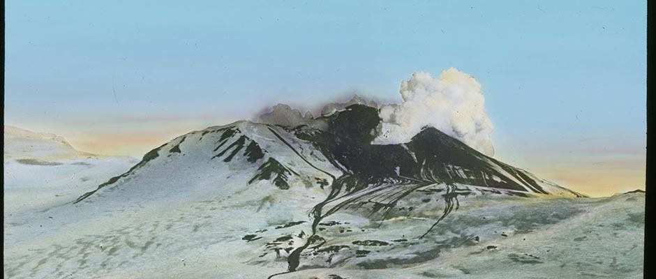
region. A composite section is described in some detail in Section IV.✓ Between Kangerdlugssuaq and Scoresby Sound, an area of at least 75,000 square
✓ kilometers is underlain covered by plateau basalts several kilometers in thickness.
North of Scoresby Sound the plateau basalts proper cover only smaller areas
but large sills and inclined sheets penetrate the Mesozoic sediments over a
large area between Davy Sound and Dove Bay. The rock types that have been
described include olivine trachybasalt, plagioclase basalt, olivine basalt,
and basalt proper. Rhyolites are known to occur at Cape Franklin. Although
sedimentary beds containing either a Tertiary flora or a marine fauna are
interbedded with the lavas at some places, the chronological sequences are
known only in part.Plutonic centers younger than part of the basalts occur along the whole
✓ coast. They consist of gabbros, (e.g., the Skaergaard en intrusive), granite,
and syenite.It will thus be understood that knowledge of the geology of Greenland
is necessarily somewhat fragmentary. Nothing is known of the rocks that
008 | Vol_I-0413
EA-I. Wilson: Geology of Greenland
occupy four-fifths of the country beneath the great interior ice sheet,
and little is known concerning the coasts facing the Arctic Sea. At many
places on the other coasts careful detailed work has been done. Since
these localities form only a narrow strip and since many formations are
known only from isolated occurrences, it is an encouraging achievement to
have discovered as much about the geology of a land so large and difficult
of access.
009 | Vol_I-0414
EA-I. (Arne Noe-Nygaard)
II. THE PRE-CAMBRIAN
Older Pre-Cambrian
Through geological investigations carried on during the last few decades,
remnants of three old mountain chains have been discovered in Greenland. The
first occurs in southwest Greenland, the Ketilids; the second in central
West Greenland, the Nagsugtoqids; and the third in northwest Greenland, the
Agpatids. Presumably the succession is given in order of age, but the
studies have not progressed sufficiently to establish this with certainty.Ketilids . The Ketilidian cycle begins with the formation of a geosyn–
clinal series which can be divided into: ( a ) a lower sedimentary series, the
so-called Sermilik group, and ( b ) an upper, mainly volcanic series, the
so-called Arsuk group. These two series have been folded together, and the
resulting structure has been largely granitized. The result is the Julianehaab
granite and its different varieties. An extensive period of erosion followed,
which denuded the mountain chain down to the migmatites and granites. A
hypsogenous movement seems to have accompanied and succeeded the granitization.
The above analysis of the Ketilids has been based mainly on structural studies
made between 60° and 62° N. latitude by Wegmann.Nagsugtoqids . Farther north in West Greenland between 66° and 69° N.
two old chains of folded mountains have been recognized. They are separated
010 | Vol_I-0415
EA-I. Noe-Nygaard: Geology of Greenland
by a period of dike injection. The older chain, designated the “Kangamiut
complex,” probably belongs to the Ketilids just described; however, a younger
complex, termed the Nagsugtoq u ids by Ramberg, also occurs here. From what is —
known of this younger chain, it may be divided into three main zones according
to degree of regional metamorphism: ( a ) a southern gneiss zone, comprising an
amphibolite and epidote-amphibolite facies, the “Ikertoq complex,” ( b ) a
central zone, comprising a granulite facies, the “Isortoq complex,” and ( c )
a northern zone , also belonging to an amphibolite and epidote-amphibolite facies, —
the “Egedesminde complex.” The analysis of the Nageugtoq u ids is mainly based —
on investigations of mineral facies and thermodynamics.Agpatids . Between approximately 70° and 72° N., Steenstrup divided the
[ ?] pre-Cambrian of the Umanak Fjord district into three sections:
( a ) a southerly section of gneiss with banded amphibolite, marble, and dolomites;
( b ) north of this, a nd presumably overlying it, a phyllite series several thousand —
feet thick; and ( c ) still farther north a section where the phyllite passes into
gneiss and which Steenstrup regards as younger than the phyllite, and conse–
quently also younger than the southern gneiss section. Krüeger later studied
the southernmost of these three complexes, which he renamed the “Agpat forma–
tion.” He considered a conglomerate at Majortarsuatsiak to form the base of
this formation.More recently, Noe-Nygaard has studied the phyllite division. For the time
being, [ ?] it can only be said with certainty that at least one orogenic period
has put its stamp on this region, and that the complex after the folding processes was
not eroded to such depths as were the mountain ranges of the Nagsugtoqu u ids or the —
Ketilids, thus rocks showing evidence of a rather low degree of metamorphism
are abundant and the folds are more flat and open.
011 | Vol_I-0416
EA-I. Noe-Nygaard: Geology of Greenland
Pre-Cambrian gneisses underlie the coastal areas north of Svartenhuk
Peninsula, including the narrow strip of Melville Bay.In East Greenland the whole coast land from Cape Farewell to
Kangerdlugssuaq, north of Angmag a ssalik, consists of folded pre-Cambrian ✓
rocks; according to Wager, the axial strike between Angmagssalik and
Kangerdlugssuaq is WNW.-ESE., but more to the south it varies good deal.
Considerable field work has been carried on in southeast Greenland but only
preliminary reports are as yet available, and co o r relation with known orogenic ✓
movements on the west coast cannot, therefore, be made with certainty. It is
likely, however, that the southern part of the southeast coast was folded
during the Ketilidian orogeny.Younger Pre-Cambrian
In southwest Greenland a new accumulation began on the deeply cut
post-Ketilidian peneplain. This has been called the “cycle of the Gardar
formation,” and it consists of the following main divisions ; : ( a ) the Igaliko ✓
sandstone, associated with a lower volcanic portion of an explosive
character, with a decreasing gaseous content toward ( b ) the porphyry forma–
tion, comprised of an almost purely volcanic formation of great thickness.
These formations were intruded by the “essexite series,” a series of plutonic
rocks consisting of essexite gabbro passing into nordmerkite and arfvedsonite
granite. Beyond the Tunugdliarfik area this series is probably represented
by diabases. These were succeeded by a series of syenitic intrusive rocks,
which are surrounded by a shell of younger granites and “Rapakiwi” rocks.
They form a large number of massifs all over South Greenland. In the
Tunugdliarfik area the whole edifice, the basement rocks (Ketilidian), the
012 | Vol_I-0417
EA-I. Noe-Nygaard: Geology of Greenland
Igaliko sandstone, the porphyry formation, and also the essexite series
were transformed into the alkaline rocks or the nepheline syenites (Naujaites,
Lujav ir ri tes, and Kakortokites) as originally described by N. V. Ussing. The ✓
Gardar cycle was apparently not terminated by a mountain building revolution.A sedimentary “Thule formation” has been traced along the north coast
of Greenland from Thule in the west to the region around Independence Fjord
in the east. Its substratum consists of older pre-Cambrian rocks of which
very little is known. The thickness of the Thule formation is about 200 meters
at its farthest west section, but amounts to at least 1,000 meters in the
east; it begins with coarse conglomerates and red and yellow sandstones. In
the upper part of the sandstone series tillites have recently been found by
J. Troelsen (verbal information); the sandstones are followed by dolomite
and rather coarse shales. Fossils proper have not been found, but Cryptozoon
reefs were discovered. The strata of the Thule formation are cut by numerous
dykes which are probably older than the overlying lower Cambrian sediments.In East Greenland, owing to later Caledonian folding, younger pre-Cambrian
strata are found mainly in two zones. The first is in the Franz Josef Fjord
region, named the Eleonore Bay formation; the other is in and behind the
inner f r amifications of the fjords, the Petermann series. Although now separated, ✓
the two zones are still similar and are supposed to have been part of the same
unit originally.The Ele o nore Bay formation is typically developed between 72° and 74° N. ✓
latitude. Its thickness exceeds that of the Thule Fformation and amounts to ✓
about 4,000-5,000 meters. The basement on which it was deposited is not known.
Its lower part consists of quartzites often containing ripple marks; the
quartzites gradually pass into shales and thin bedded calcareous and dolo–
mitic layers with varying, bright colors; “the multicolored series.”
The uppermost 600-800 meters, less colored, consists of dolomites, limestones,
013 | Vol_I-0418
EA-I. Noe-Nygaard: Geology of Greenland
and dark shales. Cryptozoon reefs are common in some of the dolomite e s, but ✓
no [ ?] fossils have been found in the dark bituminous shales.The Peterman series extends as a discontinuous belt from about 72° N. to
north of 80° N. in the nunatak zone. Considerable parts of these rocks are
at present covered by the icecap. The visible rocks are similar to the
Eleonore Bay formation and consist of quartzites, shales, c d olomites, and ✓
limestones. Neither the thickness nor the details of the succession of
these strata have been established.In East Greenland, old tillites (Cape Oswald formation) have been
recognized on top of the Eleonore Bay formation in the fjord zone for a
distance of 150 kilometers, between the Strindberg Peninsula to the north
and Lyell Land to the south. The thickness of the old morainic sediments
varies from a little over 100 meters to more than 500 meters. At Cape Oswald
on Ella Island, where detailed studies have been made by C. Poulsen, the
tillites are divided into a lower moraine carrying erratics derived mainly ✓
from the limestone-dolomite members of the Eleonore Bay formation, and an
upper moraine containing some granite and gneiss boulders but mainly volcanic
and porphyritic rock types, the geographical source of which is not known.
Between these two glacial horizon o s there are beds of sandstone and sandy shales, ✓
indicating perhaps an interglacial period. The glacial deposits are followed
by very finely stratified sediments, and these may represent a sedimentation
facies comparable to late-glacial or postglacial “varves” of Pleistocene time.
014 | Vol_I-0419
EA-I. (Chr. Poulsen)
III. PALEOZOIC FORMATIONS
NORTH GREENLAND
Cambrian
In northern Greenland the Cambrian is known only from the north coast
of Inglefield Land, the southeastern part of Washington Land, and Peary Land.The sequence of strata is as follows:
Lower Cambrian . ( 1 ) Wulff River formation (thickness 30m.): conglomerates,
glauconitiferous, calcareous sandstones, and limestones with Botsfordia ,
Kutorgina , Salterella , Strenuella , Olenellus , and Wanneria . Pebbles in the
basal conglomerate contain species of an older fauna, Acrothele and Micromitra .
On top of this formation follows: ( 2 ) Cape Kent limestone (thickness 10-20 m.);
oölitic limestone with Olenellus , Dolichometopsis , Kochiella , Inglefieldia ,
and Poulsenia . ( 3 ) Brønlund Fjord dolomite in Peary Land (thickness 156 m.):
with Botafordia? , Obolella , Fordilla , Hyolithes , and Bonnia ; in northeastern
Peary Land the dolomite is replaced by shales. (From a note by J. Troelsen.)Middle Cambrian . Cape Wood formation: ( 1 ) Cape Russell member (thickness
45-85 m.): conglomerates, sandstones, and limestones with Glossopleura ,
Acro s c ephalops , Glyphaspis , Kootenia , Prosymphysurus , Clavaspidella , and ✓
Elrathiella . These strata are overlain by: ( 2 ) Blomsterback limestone
member (thickness 2-5 m.): basal conglomerate and limestone with Blainiopsis .Ordovician
Ordovician strata occupy the greater part of Washington Land and probably
extend through Hall Land, Nyeboe Land, Wulff Land, etc., to southern Peary
Land where Ordovician sediments are exposed. Only the occurrences in Washington
Land, especially those along the south coast, and in Peary Land, have been
studied; the sequence of strata is as follows:Lower Canadian . Cass Fjord formation (thickness about 400 m.): limestone
conglomerates alternating with shaly limestone. Fauna: Macrocystella ,
015 | Vol_I-0420
EA-I. Poulsen: Geology of Greenland.
Lingulepis , Eoorthis , Sinuopea , and Hystricurus . These beds were overlain by:
( 2 ) Cape Clay limestone (thickness 30-50 m.); limestone with intraformational
limestone conglomerates. Fauna: Shizambon , Ophileta , Ozarkispira , Helicotoma ,
cf. Clarkoceras , Hystricurus , and Symphysurina .Upper Canadian . ( 1 ) Poulsen Cliff shale (thickness exceeds 40 m.):
unfossiliferous shale with a few thin layers of limestone conglomerates. The
shale passes gradually into the overlaying: ( 2 ) Nygaard Bay limestone (thickness
about 10 m.): limestone with chert nodules and a few limestone conglomerates.
The only identifiable fossil is a Protocycloceras . ( 3 ) Cape Weber limestone
(thickness about 10 m.): fauna: Petigurus groenlandicus , Bathyurellus teicherti ,
Pseudomera dactylifera , and Bolbocephalus seelyi . This stratum is identical
with the Cape Weber formation of East Greenland. On top of it follows: ( 4 )
Nunatami formation (thickness about 140 m.): ( a ) bifidus horizon: shale with
Didymograptus bifidus ; ( b ) angustifolius horizon; limestone with Phyllograptus
angustifolius , Raphistomina , and Isoteloides ; ( c ) gastropod and ostracod horizon:
limestone with gastropods and species of Pomatotrema , Syntrophia , Goniotelus ,
Bathyurellus , Bolbocephalus , Cybelopsis , Pseudomera , Protop l iomerops , and Isochillina . ✓
( 5 ) Wandel Valley limestone in Peary Land (thickness 350 m.): with Ceratopea .
(From a note by J. Troelsen.)Chazyan? . Cape Webster formation (thickness 290 m.): limestone alternating
with shale and mudstone. Fauna: crinoid stems and a questionable Spyroceres .Trenton-Richmond . ( 1 ) Gonioceras Bay limestone (thickness about 50 m.)
containing among other things Bathostoma magnopora , species of Gonioceras and
Leuorthoceras , and the trilobite Bumastus milleri . ( 2 ) Cape Calhoun limestone
(thickness about 250 m.) with a very rich fauna, containing many American forms
from the Trenton-Richmond series and species of Receptaculites , Streptelasma ,
Columnaria , Plasmopora , Calapaecia , Halysites , Rhynchotrema , Strophomena ,
Rafinesquina , Sowerbyella , Hesperorthis , Platystrophia , Trochonema ,
016 | Vol_I-0421
EA-I. Poulsen: Geology of Greenland
Maclurites , Vaginoceras , Endoceras , Charactoceras , Apsidoceras , Lambeoceras ,
Actinoceras , Huronia , Kochoceras , Isotelus , Homotelus , Vogdesia , Ill s a enus , ✓
Bumastus , Calymene , Ceraurus , Ceraurinus , and Pterygometopus . (3) Børglum
River limestone in Peary Land ; ( thickness about 800 m.): the rich fauna has not ✓
yet been identified but seems to be related to that of the Gonioceras Bay and
Cape Calhoun limesones. (From a note by J. Troelsen.)Silurian
Silurian deposits occupy a narrow zone, which extends northeastward from
southwestern Washington Land along the south coast of Kennedy Channel through
Hall and Warming Land to Peary Land.Middle Clinton . ( 1 ) Cape Schuchert formation (thickness 100-200 m.): basal
conglomerate, bituminous shale, and limestone with Climacograptus scalaris
normalis , Monograptus convolutes , M. leptotheca , M. lobiferus , Rastrites
peregrines socialis , and species of Favosites , Diplotrypa , Lingula , Onniella ,
Leptaena , Sowerbyella , Clorinda , Atrypa , Eospirifer , Harpes , Pseudoproetus ,
Leonaspis , Dicranurus , Bumastus , Illaenus , Scutellum , Cheirurus , Encrinurus ,
Phacops , and Ceratocypris. On top of this formation follows: (2) Offley Island
formation (thickness about 500-800 m.): basal conglomerate and shale, but
mainly limestone with Amplexus, Columnaria , Cystiphyllum , Propora , Proheliolites , ✓ underline
Favosites, Paleofavosites , Nyctopora , Halysites , Clathrodictyon , Stromatopora ,
Platystrophia , Barbarorthis , Fascicostella , Sowerbyella , Leptaens , Schuchertella ,
Streptis , Clorinda , Sieberella , Harpidium , Camarotoecia , Atrypa , Atrypopsis ,
Nalivkinia , Eospirifer , Crispella , Merista , Tryblidium , Salpingostoma ,
Bellerophon , Lophospira , Liospira , Coelocaulus , Platyceras , Strophostylus ,
Cyclonema , Orthoceras , Geisonocerina , Kionoceras , Protokionoceras , Polygrammoceras ,
Phragmoceras , Illaenus , Scutellum , and Cheirurus .
017 | Vol_I-0422
EA-I. Poulsen: Geology of Greenland
Upper Clinton-Lockport-Lower Cayugan . Cape Tyson formation (thickness
about 500m.) conglomerates, shales, and limestones. Fauna: Monograptus
turriculatus , M. Priodon , M. bohemicus , Retiolites geninitzianus , Cyrtograptus
murchisoni , and underscribed graptolites, branchiopods, mollusca, and trilobites.Cayugan? Polaris Bay formation (thickness about 500m.): coarse sandstone ✓ underline
with shaly beds and micaceous laminae. No fossils are known. A boulder
possibly originating from this formation contains a new species of Dicranogmus .In Peary Land the Silurian system is represented by shaly micaceous sand–
stone with undescribed Monograptus spp . (thickness at least 30 m.). (Note by ✓
J. Troelsen.)Carboniferous and Per i mian ✓
Pennsylvanian . Eastern Peary Land (thickness at least 50 m.): impure
limestone with Triticites , corals, and brachiopods. (Note by J. Troelsen.) ✓ underlineLower (?) Permian . Greely Fjord Group (?) Eastern Peary Land (thickness
about 300 m.). Cherty limestone with corals and brachiopods. May be comparable
to the Permian beds of Ellesmere Island. (Note by J. Troelsen.)EAST GREENLAND
Cambrian
Cambrian deposits are found in the Franz Josef Fjord and King Oscar Fjord
regions, where they form a narrow strip of isolated areas extending southward
from Hudson Land through southeastern Strindberg Land, the Cape Weber
Peninsula, western part of Ymer Island, eastern Suess Land, and [ ?] Ella
Island to southeastern Lyell Land.Lower Cambrian . ( 1 ) Bastion formation (thickenss about 200 m.):
quartzite followed by arenaceous, partly glauconitiferous shale with minor
017a | Vol_I-0423
EA-I. Poulsen: Geology of Greenland
beds of sandstone and limestone. Fauna: Lingulepis , Obolella , Botsfordia ,
Hyolithellus , Fordilla , Hyolithes , and Olenellus . ( 2 ) Ella Island formation
(thickness about 50 m.): fine-grained, calcareous, cross-bedded sandstone,
and finely crystalline limestone with intraformational limestone conglomerates.
018 | Vol_I-0424
EA-I. Poulsen: Geology of Greenland
Faune: Psammosphaera , Archaeocyathus , Paterina , Kutorgina , Billingsella? ,
Hyolithellus , Salterella , Stenothecoides , Olenellus , Wanneria , Paedeumia ,
Proliostracus , and Bonnia .Middle and/or Upper Cambrian . ( 1 ) Hyolithes Creek dolomite (thickness
about 200 m.): massive-bedded, somewhat arenaceous, more or less cross - bedded —
dolomite without fossils. ( 2 2 ) Dolomite Point dolomite (thickness about 300 m.): —
thinly bedded, fine-grained dolomite and intraformational dolomite breccias
with stromatolites and nodules and bands of chert.Ordovician
The Ordovician formations occur in the same localities as the Cambrian
ones.Lower Canadian . Cass Fjord formation (thickness about 300 m.):
intraformation limestone conglomerates and limestone alternating with
✓ shales. Faune: Ophiograptus, Clonograptus, Lingulepis, Eoorthis , cf. Macrocystella , cf.
Rhachopea, Sinnopea, Hystriourus , and Symphysurina .Upper Canadian . ( 1 ) Cape Weber formation (thickness about 600 m.):
more or les dolomitic limestone and intraformational limestone breccias.
Fauna: Archaeorthis , Polytoscia , Ectomaria , Gyronema , Helicotoma , Hormotoma ,
Lophospira , Maclurites , Pagodispira , Raphistomina , Roubiduxia , Solenospira ,
Turritoma , Protocycloceras , Proterocameroceras , Bathyurellus , Bathyurina ,
✓ Bolbocephalus , Ceratopeltis , Hystricurus , Petigurus , and Niobe ? ( 2 ) Narwhal Sound
formation (thickness about 600m.): crystalline dolomite s with Eccy l iopterus, ✓
Lophospira , Pagodispira , Trochonema , Trocholitoceras , and Bathyurus? , followed
by more or less dolomitic limestone with Bathyurellus? and Heterochilina .
019 | Vol_I-0425
EA-I. Poulsen: Geology of Greenland
Silurian
Middle Clinton . More than 400 meters of limestone of the Offlay Island
formation, containing among other things Amplexus , Favosites , Halysites , Heliolites , Stromatopora ,
Pentanerideo , and Eogmochilina , occur in Crown Prince Christian Land,
20 kilometers west of Ingolf Fjord.Devonian
Middle Devonian. Old Red Sandstone facies (thickness more than 900 m.).
The Middle Devonian is known with certainty only from the Wegener Peninsula
and Canning Land on the south coast of Davy Sound. ( 1 ) Heterostius strata
(thickness about 50 m.): basal conglomerate and arkose with Heterostius ,
Homostius , and Thursophyton . ( 2 ) Asterolepis strata: ( a ) Sandstone with
Asterolepis , Crossopterygii , and Psilophyton (about 350 m.); ( b ) sandstone — take out underline
with Canningius (more than 500 m.).Upper Devonian . Old Red Sandstone facies (thickness more than 7,000 m.).
The Upper Devonian covers a considerable areas embracing southern and western
Hudson Land, the Gauss Peninsula, southeastern Strindberg Land, eastern half
of Ymor s Island, western part of Geographical Society Island, western part of
Traill Island, and the southeastern part of Ella Island ( 1 ) Basal conglomerate
(locally more than 1,000 m.). The exact stratigraphical position of the basal
conglomerate is uncertain; a Middle Devonian age is conceivable; ( 2 ) Phyllolepie
series (maximum thickness 6,400 m.); ( 3 ) Remigolepis series (100-800 m.);
( 4 ) Arthrodire sandstone (200-500 m.); ( 5 5 ) Upper sandstone complex (60-160 m.). —Carboniferous
Lower Carboniferous (Mississippian) . Continental deposits of Dinantian
age, mainly sandstone of varying thickness and/or shale with minor coal seems,
020 | Vol_I-0426
EA-I. Poulsen: Geology of Greenland
occur in the following localities: A n m drup Land, Holm Land, Loch Fine, Hudson ✓
Land, Gauss Peninsula, Haslum Islands, southwestern Traill Island, and the
south coast of Davy Sound. Flora: Asterocalamites strobiculatus , Telangium
bifidum, Adiantites cf. bellidulus , species of Lepidodendron , and Strigmaria
ficoides.Upper Carboniferous (Pennsylvanian) . ( 1 ) Continental deposits of Namurian
age, mainly sandstone of varying thickness with dark shale and minor coal seems,
occur in southwestern Clavering Island, northern Hudson Land, southwestern
Traill Island, and estern Scoresby Land. Flora: Calamites suckowi , C. haueri ,
species of Lepidodendron and Sigillaria , Stigmaria ficoides , and Cordaites .
( 2 ) Marine deposits, mainly limestone, merl, and shale (thickness about 400 m.),
occur in Amdrup Land and Holm Land. The rick fauna contains Productus longispinus ,
P. simensis , P. punctatus , and Choristites supramosquensis , and (according to
Troelsen) fusulines belonging to Des Moinesian types.Permian
Upper Permian . On top of the upper Carboniferous in A n m drup Land and Holm —
Land 300 meters of limestone follows with a rich fauna containing Productus
(Horridonia) timanicus , P. (Buxtonia) porrectus, and others. The occurrence of
Pseudoschwagerina indicates an early Permian age of these beds (note by J. Troelsen).In the fjord region between about 71°30′ and 74°30′ N. latitude, the Permian —
beds form a 200-meter-thick series of highly varying sediments, which replace
each other in the great many localities to such a degree that a standard section
cannot be given. These facies include: ( 1 ) a basal conglomerate in the area between the mouth —
of Franz Josef Fjord and Gael Hamke Bay, ( 2 ) gypsum, ( 3 ) limestone and dolomite
with typical Zechstein fossils: Productus ( Horridonia) horridus var. Initialis ✓
and var. hoppeianus , Streptorhynchus pelargonatus , Spiriferina cristata var.
multiplicata , Dielasma elongatum , Schizodus truncates , S. obscures ,
S. schlotheimi , Bakevellia antiqua , B. ceratophaga , Pseudomonotis
021 | Vol_I-0427
EA-I. Poulsen: Geology of Greenland
speluncarea , and Libea hausmanni , (4) black shale and Posidonomya sp.,
Permoteuthis groenlandica , Paleonisous freie a s lebeni , and others, ( 5 ) limestone ✓
with Martinia triquetra , Chonetes aff. capitolinus , Medlicottia malmquisti ,
Cyclolobus kulingi , and species of Arctacanthus , Fadenia , Campodus , and
others, ( 6 ) limestone with Productus (Horridonia) timanicus , P. ( Buxtonia) ✓
porrectus , and several others species of Productus associated with species of
Marginifera , Strophalosia , Spirifer , Spiriferella , and Streptorhynchus , and
finally ( 7 ) red, arenaceous strata with an impoverished fauna of Linoproductus ,
Sanguinolites , Bellerophon , and others; the Palaeonthological and stratigraphical ✓
data indicate that this Zechstein series must be fairly complete.(The information concerning the Middle Cambrian Cape Wood Formation, the
Lower Ordovician Poulsen Cliff Shale and Nygaard Bay Limestone, and the
position of the Cape Weber Limestone in the North Greenland series of strata
originates from a manuscript by Dr. J. Troelsen and is published with his
kind permission.)
022 | Vol_I-0428
EA-I. (Aflred Rosenkrantz)
IV. MESOZOIC AND CENOZOIC FORMATIONS
WEST GREENLAND
Cretaceous and Tertiary
Covering the young pre-Cambrian crystalline rocks, a series, at least
800 meters thick, of limnic conglomerates, sandstones, and shales contain–
in v g very rich floras has been found in the Svartenhuk-N u û gssuaq-Disko area. ✓
The oldest is the Kome flora, probably of Albian age. Somewhat younger beds
contain another rich flora, the Atane flora, possible belonging to the
Cenomanian.Other limnic beds, younger than the Kome-Atane series, are found in the
same area, for example, the Paut u û t flora belonging to the Senonian and the
Atanikerdluk flora of possibly Danian age and overlain by plant-bearing
strata just below the basalt formation, belonging to the Paleocene. Further–
more, some inter r b asaltic floras have been discovered, presumably Eocene or ✓
younger.In Svartenhuk and especially on the N u û gssua q k Peninsula, several marine
horizons younger than the Cenomanian-Atane beds have been found, ranging
from the Coniacian to and including the Paleocene. They are more than 1,000
meters thick and have developed as bituminous shales with subordinate sand–
stones and conglomerates. Also fossiliferous, marine basaltic tuffs have been
encountered.Paleocene
Sandstones and conglomerates in bituminous shales passing gradually into
tuffs and pillow lavas of the basalt formation and containing a rich fauna
have been found in the interior of the N u û g s sua q k Peninsula. The fauna
023 | Vol_I-0429
EA-I. Rosenkrantz: Geology of Greenland
comprises a Stegoconcha , a big Cucullaea (Latiarca) , a big Glycimeris , a
big Venericor and many more pelecypods, a big Turritellas of the Mortoni ✓
group, Polynices and other Naticids , Tylostoma , Ficopsis , Fulguroficus ,
Sassia , Pseudoliva aff. prima and fissurata , Sycum , div. Levifusus , Mayeria ,
Clavilithes , Volutocorbis , Ancilla , several Pleurotomids , Gilbertina and
many other gastropods. The age is presumably L l ower Paleocene. —Paleocene-Denian
From N u û gs s ua q k bituminous shales with calcareous concretions and a rich
fauna have been found situated between the true Paleocene and Danian beds.
The fauna consist of a Propeamussium , Nucula , Myrtea , big Dentaliums , —
Naticids , Perisoptera , Fusids , Tudicla , Volunthilites , Pleurotomids , etc. —
Tuff horizons occur in this series.Danian
Below the Perisoptera beds, just mentioned, a series of bituminous shales,
sandstones, and fossiliferous tuffs is found to contain a fairly rich fauns:
div. corals, Tylocidaris , Echinocorys , Hemiaster , Terebratulina striata ,
Solemya , Thyasira conradi , Lucinids , Pleurotomaria , Palaeocypraea aff. spirata ,
and other gastropods, Hercoglossa and Eutrephoceras . No ammonites, belemnites,
or inocerams have been met with.Upper Senonian
About 600 meters below the Danian level, bituminous shales with
Acanthoscaphites roemeri occur at N u ûgssuaq . —Lower Senonia
Bituminous shales with Inoceramus patootensis are found at N u ûgssuaq .
024 | Vol_I-0430
EA-I. Rosenkrantz: Geology of Greenland.
Coniacian
Bituminous shaoes with Scaphites ventricosus stanoni have been found in
the Svartenhuk Peninsula.Igneous Rocks
As mentioned, the oldest basaltic ash layers (tuffs) are found in marine
strata of Danian age and contain Danian fossils; subsequent tuffs are found
in the Danian-Paleocene strata. Surface volcanism on a large scale is post-lower
Paleocene; it began with the deposition of tuffs containing Paleocene fossils
followed by an extrusion of subaquatic breccias (pillow lavas).The subaquatic phase was followed by the plateau basalts proper of several
kilometers thickness known especially from Svartenhuk, N u û gssuaq, and Disko.
The lava succession in Svartenhuk started with picritic types. The olivine
content diminishes upward in the plateau, the last basalts being olivine-free.
On top of the plateau small domes of anorthoclase trachyte are found. In
Ubekendt Island a granophyric intrusion center has been recorded. Two special
groups of basaltic intrusive are met with in N u û gssuaq: an ultrabasic suite
(peridoties) and a system of quartz-gabbroic sills, the latter apparently
connected with large-scale faulting in N u û gssuaq as well as in Svartenhuk.NORTH GREENLAND
Triassic
From the Thule district some fossils, for example, Monotis cf. subscircularis ,
have been brought back suggesting an Upper Triassic (Nori s c ) age. Moreover ✓
Dr. Troelsen has quite recently discovered lower Triassic marine sandstones
and shales in eastern Peary Land. These strata are younger than the Eotriassic
beds of East Greenland and seem to be comparable with the lower Triassic strata of Spitsbergen .
024a | Vol_I-0431
EA-I. Rosenkrantz: Geology of Greenland
Cretaceous or Tertiary
In eastern Peary Land Dr. Troelsen has found shales and coarse sandstone
with petrified wood and leaves of dicotyledones . ✓The above mentioned discoveries of Dr. Troelsen have been published with
his kind permission.
025 | Vol_I-0432
EA-I. Rosenkrantz: Geology of Greenland
EAST GREENLAND
Triassic
Lower Eotriassi oc . Marine strata are known from the fjord region ✓
between Davy Sound and Young Sound, comprising conglomerates, sandstones,
and clays (Table I).Table I.
Triassic Faunal Zones of East Greenland.Substage Zone Beds with: Eotriassic? Anodontophora Andontophora fassaensis —
Myalina kochi —
Anodontophora breviformis —Gyronitan Proptychites Prophychites rosenkrantz i ✓ — Vishnuites Ophiceras dubium —
Vishnuites decipiens —Otoceratan Ophiceras Ophiceras commune and [?] subacuntala —
Metophiceras praecursor
Glyptophiceras serpentinum —Glyptophiceras Glyptophiceras minor —
Glyptophiceras trivial s e ✓ —
Among the ammonites from the lower beds, the genus Otoceras is represented.
Of special interest is the rich and well-preserved fauna of fossil fishes and
stegocephalians found throughout the whole series belonging to the genera
Polyacrodus, Birgeria, Glaucolepis, Australosomus, Bobasatrania, Laugia,
Perleidus, Ospia, Broughia, Helmolepis, Lyrocephalus, Stochiosaurus and Wetlugasaurs .Between the Lower Eotriassic and the Rhaetic, a brackish or limnic series
of sandstones, gypsum, and red marls has been deposited in the southern part of
026 | Vol_I-0433
EA-I. Rosenkrantz: Geology of Greenland
the area, the uppermost part commonly referred to the Keuper. In Jameson
Land, the Keuper marl is unconformably overlain by the Rhaetic, consisting
of limnic sandstones and shales with coals and a rich Lepidopteris flora.Jurassic
Lower Jurassic . In Jameson Land, the Rhaetic Lepidopteris beds are
followed by the L l ower Liassic cola-bearing Thaumatopteris beds also contain–
ing a very rich flora. In the same area the Rhasto-Liassic limnic complex is
overlain by marine L l ower and U u pper Liassic strata (Table II). — —Table II
Lower Jurassic Faunal Zones of East Greenland.Substages Zones Beds with: Aalenian Aalensis Pseudolioceras beyrichi — Yeovillian Striatulum Pseudolioceras compactile — Whitbian Bifrons Pseudolioceras lythense —
Pseudolioceras dumortieri —
Dactylioceras —
Catacoeloceras —Domerian Marine ex parte, no guide fossils Carixian Ibex Beaniceras — Jamesoni Uptonia —
The marine Liassic strata consist of conglomerates, sandstones, and shales.
Especially from the Bifrons and Jamesoni zones, large faunas of pelecypo l ds have ✓
been secured.Skeletal remains of Ichthyosaurus and Plesiosaurus have been found in the —
U u pper Liassic. —
027 | Vol_I-0434
EA-I. Rosenkrantz: Geology of Greenland
Middle Jurassic Middle Jurassic is known from marie sandstones, arenaceous shales, and underline
clays in the area between Scoresby Sound and Koldewey Island. Bajocian,
L l ower Bathonian, and U u pper Callovian are not represented (Table III). — —Table III.
Middle Jurassic Faunal Zones of East Greenland.Substage s Zones Beds with: ✓ Middle Callovian Kepplerites Kosmoceras pauper Helen —
Kepplerites tychonis —
Cadoceras victor Cardioceras —Lower Callovian Arcticoceras Cardioceras pseudishmae —
Arcticoceras kochi —
Lingula Lingula —Upper Bathonian Arctocephalites Natica —
Arctocephalites ornatus —Helen Cr e a nocephalites Cranocephalites pompeckji —
Cranocephalites subbulatus —
P L arge ammonite faunas, including many pelecypods, gastropods, etc., have ✓
been collected in the different horizons.Upper Jurassic is represented by marine conglomerates, sandstones, and
shales and in the north also by limnic coal-bearing beds transitional to the
Middle Jurassic. They occur in the fjord region between Scoresby Sound and
Koldewey Island. The most complete section has been measured in Milne Land
(Scoresby Sound) (Table IV).
028 | Vol_I-0435
EA-I. Rosenkrantz: Geology of Greenland
Table IV.
Upper Jurassic Faunal Zones of East Greenland.Substage s Beds with: ✓ Purbeckian Craspedites Craspedites and Iitanites Titanites ? T ✓ — Portlandian Laugeites groenlandica Laugeites groenlandica —
Crendonites lesliei Crendonites lesliei and div. sp. —
Behemoth groenlandicus Behemoth groenlandicus —
Epipallasiceras praecox Epipallasiceras praecox and div. sp. —Upper Kim m eridgian Pallasiceras jubilans Pallasiceras jubilans and div. sp. —
Pectinatites groenlandicus Pectinatites groenlandicus and div. sp. —Middle Kim m eridgian Subdichotomoceras? —
Subplanites? —
Virgatosphinctoides? Virgatosphinctoides? —Lower Kim m eridgian Hoplocardioceras decipiens Hoplocardioceras decipiens —
Eurionoceras kochi Eurionoceras kochi —
Rasenia borealis Rasenia borealis —
Rasenia orbignyi Rasenia orbignyi —
Rigsteadia sp Rigsteadia sp . —Upper Oxfordian Prionodoceras rosenkrantzi Prionodoceras rosenkrantzi and div. sp. —
Cardioceras Cardioceras aff. zenaidae zenaidae —
From the Heden L l ower Kim m eridgian, a plesiosaurian ( Cryptoclidus ) and a fish — —
( Caturus ) have been collected. Moreover, large quantities of ammonites, —
pelecypods (e.g., Aucellas ) ha s ve been collected from the different levels. ✓ —Cretaceous
Lithologically very similar to the Jurassic, Cretaceous deposits are
known from the Kangerdlugssuaq region in the south, in the fjord region between word missing
Scoresby Sound and Germania Land, and possibly from the Northeast Foreland
at Independence Fjord.
029 | Vol_I-0436
EA-I. Rosenkrantz: Geology of Greenland
Lower Cretaceous is know from the fjord region only (Table V).
Table V.
Lower Cretaceous Faunal Zones of East Greenland.Substage s Beds with: ✓ Albian Upper Hystricoceras? Hystricoceras? , Beudanticeras Beudanticeras , Puzosia Puzosia — Middle Gastroplites div. sp., Inoceramus anglicus —
Hoplites —Lower Euhoplites , Dipoloceras , Dimorphoplites —
Leymeriella div. sp., Arcthoplites —
Beudanticeras . —Aptian Upper Sanmartinoceras groenlandioum ✓ —
Tropaeum arcticum? —Lower Deshayesites div. sp. Ba rremian Missing Hauter i vian Valanginian Upper Lyticoceras — Middle Polyptychidtids , Neocraspedites — Lower Missing Infravalanginian Tollia payeri —
Subcraspedites div. sp. —
Hectoroceras sp . —
030 | Vol_I-0437
EA-I. Rosenkrantz: Geology of Greenland
Upper Cretaceous covers rather small areas in the Kangerdlugssuaq region,
the fjor e d region (Knud’s Head and other localities), and probably at the ✓
Northeast Foreland (Table VI).Table VI.
Upper Cretaceous Faunal Zones of East Greenland.Substage s Beds with: ✓ Helen Se n onian Upper Not known Lower Inoceramus geltingi , Parapachydiscus? Inoceramus geltingi , Parapachydiscus? — Turonian Upper Scaphites Scaphites aff. Lamberti , Prionotropis Lamberti , Prionotropis cf. —
volgari volgari —Lower Not known Cenomania Schloenbachia Schloenbachia div. sp. —
In the Kangerdlugssuaq area, marine Senonian beds containing Actinocamax Actinocamax —
cf. blackmori blackmori and A. A. cf. plenus plenus have been found. —From all Cretaceous levels in East Greenland, apart from the ammonites,
many species of pelecypods, gastropods, etc., have been found. The Valagninian
is rich in Aucellas Aucellas . —Tertiary
The Kangerdlugssuaq sedimentary series comprises beds following the marine
Senonian, and inclosing an early Tertiary or Danian flora.Marine interbasaltic strata are known from Cape Dalton south of Scoresby
Sound, consisting of a Coeloma Coeloma bed overlying a Cyrena gravesi Cyrena gravesi - bed. The age — —
has been estimated to be either L l ower Eocene or Oligocene-Miocene. Other —
presumed marine Tertiary deposits have been reported from Cape Gustav Holm
031 | Vol_I-0438
EA-I. Rosenkrantz: Geology of Greenland
south of Kangerdlugssuaq, Little Pendulum Island, and other northern
localities.Limnic interbasaltic strata containing a fairly rich Paleocene-Eocene
flora have been met with in the northern as well as in the southern basalt
area.J. Tuzo Wilson (Geological History)
Arne Noe-Nygaard (The Pre-Cambrian)
Chr. Poulsen (Paleozoic Formations)
Alfred Rozenkrantz (Mesozoic and
C h enozoic Formations) ✓