-
James M. Wordie
Encyclopedia Arctica 15: Biographies
001 | Vol_XV-0931
EA-Biography
(J. M. Scott)
JAMES M. WORDIE
James (Mann) Wordie, C.B.E.M.A. (1889- ), one of the most experienced
and scholarly of modern polar explorers, has traveled widely both in the Arctic
and the Antarctic. James Wordie was born in Glasgow, the second son of John
and Jane (Mann) Wordie. He was educated at Glasgow Academy and Glasgow and
Cambridge universities. His first experience of the Arctic was a visit to the
Yukon and Yakutat Bay, Alaska, which followed the International Geological
Conference at Toronto in 1913.Wordie was geologist and chief of the scientific staff of Shackleton's
1914-16 Antarctic Expedition. He was a member of the Weddell Sea party and,
after the loss of the Endurance and after living for six months on drifting
pack ice, wintered on Elephant Island. Returning to Europe, he became a lieu–
tenant in the Royal Field Artillery in 1917-18.In 1919, Wordie returned to polar exploration, this time to the Arctic
as geologist and second-in-command of the Scottish Spitsbergen Syndicate expe–
ditions of 1919 and 1920, initiated by Dr. W. S. Bruce. Wordie made geological
surveys in Spitsbergen in the Stor Fjord region and on Prince Charles Foreland,
climbing Mount Monaco in the course of his work. His general results were con–
tained in a paper read to the Royal Geographical Society in which he describes
the complicated tectonic problems on Prince Charles Foreland and the compara–
tively undisturbed history of the Stor Fjord region. The weather of the
002 | Vol_XV-0932
EA-Biog. Scott: J.M. Wordie
former is almost as boisterous as the latter is sedate. Wordie discusses
the glacier types and the widespread glacier retreat, and by contrast the
possibilities of coal mining development on a large scale. His companions
and assistants were recruited from geological students at the Scottish uni–
versities. He has stressed the importance of his experience gained in the
Antarctic before taking up Arctic work, and the very great advantage of
intimate knowledge of both regions.In 1921, Wordie led a small summer expedition of Cambridge men to Jan
Mayen. The plan had been originated by J.L. Chaworth-Musters and was
carried out in conjunction, as far as sea transport was concerned, with
Hagbard Ekerold, who was setting up a Norwegian radio weather station on the
island. The other members of the party were Richmond Brown, W.S. Bristowe,
T.C. Lethbridge and Prof. P. L. Mercanton. The Jan Mayen expedition was the first of the Cambridge Arctic expeditions,
just as Binney's visit to Spitsbergen in the same year was the first of the
Oxford expeditions.The voyage to and from Jan Mayen was made in the 24-ton sealer Polarfront .
Wordie, with Mercanton and Lethbridge, made the first ascent of the extinct
volcano Beerenberg, originally named Mount Hakluyt, the height of which they
corrected, by controlled aneroid readings, to 8,090 ft. (A more recent measure–
ment makes the height 7,450 ft.) Botanical, zoological, glaciological, and
geological work was intensively carried on during the party's stay on the island.
Bristowe made a notable collection of spiders, and Musters found many plant
species new to the island. The geological work was mainly concerned with the
two questions, the age at which the island was first formed and how long since
Beerenberg had ceased to be an active volcano. One may briefly summarize
Wordie's cautious deductions by saying that the island is probably of very
003 | Vol_XV-0933
EA-Biog. Scott: J.M. Wordie
recent geological date, while Seerenberg itself has certainly not erupted
in historical times. The last very minor ash eruption was that seen by
Scoresby near Vogt (Esk) crater in 1818. Apart from the unusually large
amount of driftwood and other jetsam to be found on its coast, Wordie con–
sidered Jan Mayen has no commercial value; its usefulness lies in the site
it offers for a weather station.Wordie had long been attracted to the incompletely known regions of
Northeast Greenland, and to this end the Jan Mayen expedition was a stepping–
stone. His first Greenland attempt was in 1923, when he led a Cambridge
expedition in the Norwegian sealing sloop Heimen , consisting of Lord Cawdor,
H. E. David, Lt. C. C. Duchesne, R.E., T. C. Lethbridge, Lt. R. H. Maclaren,R.E.,
and L. S. Mayne. The idea was to reach Franz Josef Fjord and the coast which
may have been Hudson's Hold with Hope, discovered in 1607, just as Jan Mayen
may have been "Hudson's Tutches." The sea-ice conditions were extremely un–
favorable and thick pack ice barred the coast. The ship was nipped and lifted
bodily on to the ice. She narrowly escaped disaster and a repetition of the
shipwreck of the Endurance in the Antarctic, and the attempt to reach Greenland
that year had to be abandoned.In 1926, however, a second attempt succeeded. Wordie's party con–
sisted of M. A. Barnett, radio, J.H. Bell, camp stores and equipment, C. de
Bunsen and A. Courtauld, cameras and survey, D. McI. Johnson, Eskimo archaeology
and doctor, G. Manley, geodesy and survey, and Lt. P. F. White, R.E., surveyor.The party sailed from Aberdeen on June 30 in the coal-burning sealing
sloop Heimland of 152 tons gross, with Lars Jacobsen of T r omeö (who had com–
manded the smaller Heimen in 1923) as captain, and made contact with the radio
station on Jan Mayen. Then, in foggy weather and after a blind but rapid
passage through very open pack ice, anchor was dropped, still in fog, on the
004 | Vol_XV-0934
EA-Biog. Scott: J.M. Wordie
south side of what proved to be Little Pendulum Island. One of the objects
of the expedition was to repeat Sabine's pendulum experiments made in 1823,
when Clavering in the Griper first discovered this part of the East Greenland
coast. While Manley made pendulum observations on the site where Captain
Sabine had made his gravity experiments one hundred and three years earlier,
the rest of the party sailed through Clavering Strait to Cape Berlin. Various
landings were made for geological and archaeological purposes and Mount
Huhnerberg was climbed. On the summit Courtauld found a record left by
Prof. Copeland of the Germania expedition on the same day and month in 1870.
Manley's longitude observations gave no support to the idea of continental
drift and the claim that Greenland had movedwestward since either Sabine's
time or Copeland's later determinations of longitude.Next, Clavering's survey of Gael Hamke Bay was extended and completed.
His work was found to be of remarkable accuracy, although for some reason the
great, broad Jordanhill Glacier, which Koch has since named the Wordie Glacier,
was shown on his map as open water. Wordie's party penetrated new ground and
discovered Granta Fjord to the west of Clavering Island. Working in separate
parties, the survey was extended to Loch Fyne and Jackson Island. Meanwhile
thorough archaeological examinations were being made and many old Eskimo sites
were found. It will be remembeeed that Clavering was the only man to record
seeing living Exkimos in this region, in fact, anywhere on the east coast
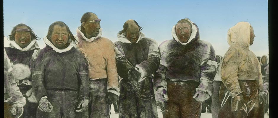
north of Angmagssalik. The winter houses of Clavering's Eskimos were found
by Johnson at Eskimo Bay, on the south side of Clavering Island. From their
observations, wordie and Johnson decided that there must have been an immigra–
tion of these Eskimos by a route round the very north of Greenland, a view
the reverse of that held by Knud Rasmussen.At the beginning of August, the hundred-mile-long stretch of Franz Josef
005 | Vol_XV-0935
EA-Biog. Scott: J.M. Wordie
Fjord was entered for the first time since the original discovery in 1899.
The party were impressed by the warm weather and the strikingly rich vege–
tation. The surveyors climbed peaks at the head of this remarkable fjord,
and sighted but could not reach Petermann Peak in the short time available.
Before leaving Franz Josef Fjord the ship penetrated to the head of the
tributary Musk Ox Fjord, to tie in with the Loch Fyne Survey. The most
important geological discovery was the finding in Andr e é e Land of overthrust–
ing of older rocks and the evidence of Caled onian mountain building on a
very large scale.The ship turned southward from the mouth of Fran s z Josef Fjord and,
working night and day, a plane-table survey of the outer coast was carried
to Davy Sound. A difficult and interesting part of this hiehterto hitherto unsurveyed
and unexplored coast was to reconcile what was seen at close quarters with
the features named on William Scoresby Junior's map, made in 1822 from some
thirtymiles offshore. In every case it was found that Scoresby's capes
represent high mountains standing well back from the coast. The survey was
concluded at Cape Simpson on Davy Sound, where Scoresby had found an abandoned
Eskimo settlement of unusual type. Before returning to Scotland the party
visited the newly established Eskimo colony at Scoresby Sound.Wordie returned to the same area of Northeast Greenland in 1929 with
the object of enlarging the field both of topographical and geological survey
and also, if possible, of climbing Petermann Peak. His ship was again the
Heimland , but with Karl Jacobsen as captain, and his party was as follows:
A. Courtauld and R. C. Wakefield, surveyors; P. de K. Dykes, radio; V. S.
Forbes, geographer; .V. E. Fuchs, M.M. L. Parkinson, and W.F. Whittard,
geologists; and J. F. Varley, medical officer.
Unpaginated | Vol_XV-0936
EA-Biog. Scott: J.M. Wordie
The passage through the pack ice was not made quickly or without
anxious moments, the ship being several times nipped by the pack ice, and
the rudder damaged. But after nearly a month of struggle in ice as heavy
and close as in 1923, Franz Josef Fjord was entered on August 5. Because
of this delay, the land work had to be pressed forward at an even greater
pressure than is usual on summer expeditions.The most spectacular achievement was the climbing of Petermann Peak.
The climbing party consisted of Wordie, Wakefield, Courtauld, Fuchs, Varley,
and Forbes. The main difficulty lay in finding a route from Kjerulf Fjord
to the mountain in the short time available, carrying not only food and camp
gear but also survey equipment. After making a survey of the Cambridge Peaks,
the party marched westward along the watershed south of the Nordenskiöld
Glacier, which flows into the head of Franz Josef Fjord, and down the Ptarmi–
gan Glaciers to lower levels. Then the great Nordenskiöld Glacier was crossed.
The Petermann summit was reached by Wordie, Wakefield, and Forbes on August 15,
nine days after the start of the overland trip. The height, by corrected
aneroid and boiling point readings, was found to be 9,650 ft. The return
journey to the coast was accomplished without incident.The important geological discoveries made during the 1926 expedition
were extended by Whittard and Parkinson while the mountain expedition just
described was in progress. Caledonian folding on [ ?] large scale was found,
and the thrust of the Franz Josef Beds over the underlying Metamorphic Complex
determined. In 1926 a major thrust had been located and examined at Junction
Valley on Andres Land, about 4 miles N.N.W. across Franz Josef Fjord from
Cape Mohn. In 1929 the region south of Franz Josef Fjord was examined down
to Antarctic Harbor in Davy Sound.The In 1929 expedition completed a trio directed to Northeast Greenland;
008 | Vol_XV-0937
EA-Biog. Scott: J. M. Wordie
the first had been turned back by the polar ice current, but the latter two had
both done good work. For his next two expeditions Wordie was now to turn his
attention to Northwest Greenland and the Canadian Arctic.On May 24, 1934, he sailed from Aberdeen in the Heimen , a recently
built oil-driven vessel of 129 tons gross, with Lars Jacobsen again as skipper
and a crew of ten and the following scientific party: P. D. Baird, surveyor
and geologist; C. T. Dalgety and H. P. Hanham, ornithologists; Lt. W. E. Fletcher,
R.N., navigator; Sir John Hanham, botanist; Dr. T. G. Longstaff, medical officer
and zoologist; T. T. Paterson, geologist and archaeologist; H.M.W. Ritchie,
photographer.The first object of the expedition was to cross Melville Bay and to reach
Cape York in June, during the nesting season, and later to cross to Ellesmere
Island. For the first part of the program an unusually early start and speed
were essential. All went well as far as Upernivik, the most northerly settle–
ment in West Greenland which can be reached with certainty early in the season.
Navigation beyond varies considerably from year to year, and in 1934 the ice
broke up late after a long cold winter. The party were held up at Upernivik
for ten days, passing the time in geological and ethnological work; Paterson
made a collection of about 30 string figures. They also climbed Sanderson's
Hope (3,560 ft.), from which it was possible to reconnoiter the extent of the
pack ice ahead.After further delays at Nutarmiut and at the Duck Islands (which were
surveyed), the Heimen reached the entrance to Melville Bay [ ?] on July 7.
But here the party was held up for the remainder of the month by unbroken
winter ice which barred the way northward. This was a month beyond the usual
date of crossing Melville Bay by Dundee whalers in the nineties. Like them,
009 | Vol_XV-0938
EA-Biog. Scott: J. M. Wordie
Wordie had hoped to push his ship across the bay in June.The most spectacular achievement during the long delay was the climb–
ing of the Devil's Thumb by Longstaff and Baird. The ascent of this remark–
able landmark, a 600-foot flake of gneiss projecting, to all appearances,
vertically from a steep 1,200-foot shoulder of the same rock, was technically
described by these two experienced climbers as more than "difficult" and less
than "severe."After failing to cross to Cape York and Ellesmere Island, Wordie decided
early in August, as the main objective could not now be realized, to retreat
to Upernivik and cross south of the "Middle Ice" to Baffin Island. This was
done, and the remainder of the expedition's time was spent in exploring and
charting Eglinton Fjord and Clyde Inlet. From a high peak Baird and Ritchie
discovered a hitherto unknown icecap in central Baffin Island. At the end of
August, after three months of continuous activity, the ship turned for home,
arriving in Aberdeen on September 15.It will be remembered that in the course of the expedition just described
Wordie had been induced to make a radical change of plans, unbroken winter ice
in Melville Bay making a visit to Cape York and Ellesmere Island only possible
so late in the season as to be of little value. The alternative program in
Baffin Island had been valuable enough in itself, but Wordie, who has never
been satisfied with half-success, decided to return to the same area in 1937.
His party was as follows: H.I. Drever, petrologist; E. G. Dymond, physicist;
R.W. Feachem, assistant surveyor; I.M. Hunter, radio; E.D.W. Leaf, assistant
archaeologist; T. C. Lethbridge, archaeologist; T.T. Paterson, geologist;
A. H. Robin, surveyor.He sailed from Leith on June 27 in the Norwegian motor sealing vessel
010 | Vol_XV-0939
EA-Biog. Scott: J. M. Wordie
Isbjorn of 177 tons, with Bergerson as captain. Since on this occasion
there was no intention of crossing Melville Bay to reach Cape York in the
nesting season, an early start was not necessary and advantage could be taken
of the improved late summer sea ice conditions. But, as fate would have it,
this particular year was so remarkably ice-free compared with 1934 that the
geographical part of the program could probably have been carried out much
earlier in the season. Very briefly, the Isbjorn's course was north along
the coast of West Greenland, with stops at Godhavn, N u û gssuak, the Ryder Islands,
and Thule, and then across Smith Sound to Cape Sabine and Bache Peninsula;
then southward by the east coasts of Ellesmere Island and Baffin Island as
far as the newly discovered Cambridge Gulf; then southeastward across Baffin
Bay to Godhavn, and so home.Mapping and charting was carried out at the little-known Cary Islands,
but the most important geographical discoveries were on the Baffin Island
coast around Cambridge Gulf, between latitudes 71° and 72° 30′ N., where a
deep fjord system with 600 miles of new coast line was explored and mapped.
Six fjords up to 60 miles in length cut southwestward through a high mountain
land to lower levels. The fjord walls were up to 3,000 ft. in height, but
above was an old land plateau or peneplain, covered in places by icecaps
which spilled down the fjord walls in numerous cascading and valley glaciers.
The outer fringe of this newly discovered region had been frequented by
Dundee whalers in the latter part of the 19th century, and wrecks and wreckage
were frequently found, as well as traces of occasional recent visits by Eskimos.The geologists made important discoveries at N u û gssuak and Ubekjendt
Island. Interesting work was also done on the Thule Sandstone at the base
of the Cambrian system.The main archaeological investigations were made at Turnstone Beach in
011 | Vol_XV-0940
EA-Biog. Scott: J. M. Wordie
Buchanan Bay, Ellesmere Island. Attempts were being made to locate Eskimo
remains on the route by which they must have originally reached Greenland.
The open year gave exceptional opportunities, and the digging of old sites
yielded rich results. In the course of the digging an unexpected find was
the discovery of Dr. Cook's winter quarters in an abandoned Eskimo hut at
Cape Hardy (Cape Sparbo) in Jones Sound.The most original and interesting scientific work was that concerned
with cosmic ray investigations. To assist this unusual work with balloons,
the Royal Society had made a special grant of £ 800, and the Physics Depart–
ments at both Cambridge and Edinburgh universities had also contributed. The
Geomagnetic Pole (Magnetic Axis Pole) being to the east of Smith Sound, about
two degrees north of Thule, the course of the Isbjorn offered valuable
opportunities.Observations were made by apparatus lifted on balloons to exceptionally
high levels. Two different types of apparatus were used. Carmichael had
designed and constructed one in the Cavendish Laboratory at Cambridge. This
consisted of a light-weight ionization chamber with electroscope and a small
camera which recorded the latter at work, the air pressure and temperature
being also recorded on the slowly revolving film. Recovery of the apparatus
was obviously necessary at the conclusion of the flight. Dymond's apparatus
was a triple-coincidence Geiger counter set with wireless transmission both
of the counts and the barometric pressure. Thus recovery was not essential.
Both types of apparatus were lifted by a pair of balloons and parachutes.
One of the former would collapse at the extreme altitude of the observations,
leaving the remaining balloon to descend slowly with the apparatus and the
steadying parachutes.Six successful flights were made. Two of these proved particularly
012 | Vol_XV-0941
EA-Biog. Scott: J. M. Wordie
valuable, one with the wireless apparatus to a height of over 12 miles in
magnetic latitude 88, and [ ?] the other with the lighter ionization appara–
tus in magnetic latitude 75 to a height of about 18 miles. It was found
rather unexpectedly that cosmic radiation near the Magnetic Axis Pole is not
very much stronger than at lower magnetic latitudes. Some twenty pilot-balloon
flights were also made to heights of between 12 and 20 miles (20 to 30 kms.).Since 1937 Wordie has so far made one further journey to the polar regions,
this time to the Antarctic. In January and February, 1947, under the auspices
of the Colonial Office, he visited the South Orkneys, South Shetlands, and
Graham Land to advise on the program of the Falkland Islands Dependencies Survey.Wordie is one of the outstanding British figures in all matters which
concern both the Arctic and the Antarctic. His experiences have been acknow–
ledged by the Royal Geographical Society's Back Award in 1920, by the Founders'
Gold Medal in 1933; the Bruce Medal of the Royal Society of Edinburgh in 1926,
and the Royal Scottish Geographical Society's Gold Medal in 1944.He is also well read in polar history and a specialist in glaciology
and geology. His post as Senior Tutor and Fellow of St. John's College,
Cambridge, has enabled him to assist and influence many young explorers,
notably Gino Watkins. He has been Honorary Secretary of the Royal Geographical
Society from 1934 to 1948, and is now Foreign Secretary; he has served on the
Mount Everest Committee, on the Discovery Committee of the Colonial Office
since 1923, and is chairman of the Falkland Islands Dependencies Scientific
Committee. He has been chairman of the Scott Polar Research Institute since
1936. He is vice president of the British Glaciological Society and a member
of the Alpine Club. These numerous and varied duties show how extensively
his wide and gently expressed influence is felt in all that concerns the
polar regions.
013 | Vol_XV-0942
EA-Biog. Scott: J. M. Wordie
BIBLIOGRAPHY
J. M. Wordie. "Present-day Conditions in Spitsbergen," Geog.Journ . Vol.58,
N.1, July 1921.----. "Jan Mayen Island," Geog. Journ ., Vol.59, N.3, March 1922.
----. "The Cambridge Expedition to East Greenland in 1926," Geog.Journ .,
Vol.70, N.3, Sept. 1927.----. " [ ?] Cambridge East Greenland Expedition, 1929: Ascent of Petermann
Peak," Geog.Journ ., Vol.75, N.6, June 1930.----. " [ ?] An Expedition to Melville Bay and North-East Baffin Land,"
Geog. Journ ., Vol.86, N.4, Oct. 1935.----. "An Expedition to North West Greenland and the Canadian Arctic in 1937,"
Geog. Journ ., Vol.92, N.5, Nov. 1938.----. "The North West Passage since the last Franklin Expedition," Geog.Journ. ,
No.106, Nov-Dec. 1945.J. M. Scott