-
James Williams Tyrrell
Encyclopedia Arctica 15: Biographies
001 | Vol_XV-0823
EA-Biography
(D. M. LeBourdais)
JAMES WILLIAMS TYRRELL
James Williams Tyrrell (1863-1945), Canadian civil engineer and explorer,
brother of Joseph Burr Tyrrell (q.v.), was born at Weston, Ontario, May 10,
1863, son of William and Elizabeth (Burr) Tyrrell. He was educated at the
Weston Grammar School and the University of Toronto (C.E., 1889). He joined
the Geological Survey of Canada in 1883 as topographer and that year began work
in the Lake of the Woods region, continuing with the Survey until he became a
member of an expedition sent to Hudson Bay and Strait by the Canadian Govern–
ment in 1885. The expedition sailed in the steamer Alert, commanded by Lieut–
enant A. R. Gordon, R.N., to investigate and report upon the feasibility of the
Bay and Strait as a commercial route to Europe.During the summers of 1885 and 1886, James Tyrrell was engaged in hydro–
graphic and topographical surveying, while during the winter of 1885-86, he
remained as observer at Big Island, near the middle of the north shore of Hud–
son Strait. He was later convinced that this was the most advantageous observa–
tion point, because of its geographical position and also because of its alti–
tude of four hundred and fifty feet above sea level. Most of the expedition's
maps and charts were drawn by him.In 1887-88, he served as engineer on construction of the Maine and Inter–
national Railway, now an integral part of the Canadian Pacific Railway's line
between Montreal and Saint John. Following this, he practised his profession
in Hamilton, Ontario, until 1893, when he accompanied his brother on an explor-
002 | Vol_XV-0824
EA-Biography. LeBourdais: James Williams Tyrrell
atory expedition from Lake Athabaska to Hudson Bay through previously unknown
territory. (This journey is described at length under the heading: Joseph Burr
Tyrrell.) James Tyrrell's book, containing an account of that expedition,
Across the Sub-Arctics of Canada (Toronto, 1908), now out of print, is a classic
of northern exploration.In 1900, he conducted an exploratory survey for the Canadian Department
of the Interior of the country lying between Great Slave Lake and Hudson Bay,
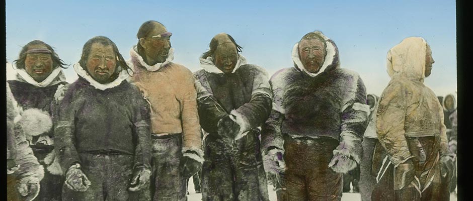
part of which he had covered previously with his brother.With a party consisting of two assistants and five half-white and Indian
canoemen, he reached Great Slave Lake with dog teams on April 1st, expecting to
transport his 6,000-pound outfit — including three Peterborough canoes — from
Fort Resolution, at the western end of the lake, to Old Fort Reliance, 250 miles
northeast of there. Discovering that Indian sleds would carry only 400 pounds
each, and since fifteen such sleds were not available, he built four new ones
to carry 1,500 pounds apiece, and shod them with steel that he had had the fore–
sight to bring with him.Old Fort Reliance was reached on May 8th. "Historically," wrote Tyrrell,
"Fort Reliance is of interest chiefly as having been the headquarters of Sir
George Back and his party during the three years of their exploits when they
were supposed to be searching for traces of Sir James Ross, who shortly after
Back's departure, turned up safely in England."Back, like myself, wrote a book descriptive of his discoveries, and I
have sometimes thought, since reading it, and having gone over portions of his
stamping grounds, that if knighthood was conferred upon him as a result of his
published narrative and maps, that he did certainly earn the distinction as a
writer of fiction rather than as a recorder of facts."
003 | Vol_XV-0825
EA-Biography. LeBourdais: James Williams Tyrrell
Tyrrell quotes, as an example of Back's carelessness or willful distor–
tion, his description of the falls on the Lockheart River which he named in
honor of Sir Edward Parry. Back gives the height of the falls as from 400 to
500 feet, while according to Tyrrell's measurements the total fall from top to
foot of the lower rapid is only 85 feet. Back gives the width as 200 feet,
while Tyrrell's measurement is 30, which might, he says, at higher stages of
water be increased to 50, but no more.From Old Fort Reliance the route lay northeastward across a 20-mile port–
age to Artillery Lake. By June 8th, the entire outfit had been taken across
the portage and was halfway up Artillery Lake when the ice suddenly began to
disintegrate. They thereupon went ashore, where they waited ten days for the
end of the breakup. Then, on June 18th, they set off up the lake in their canoes.
From the bottom of ean eastern arm of Clinton-Colden Lake, a portage was dis–
covered which they followed from lakelet to lakelet until on the 24th they
reached the divide at an elevation of 1,300 feet above sea level.Three days later they had crossed the height of land, again following a
succession of small lakes. On the way they encountered a band of nine musk
oxen, all of which were killed, and two days were spent in drying the meat.Arrived at the Thelon River, they proceeded downstream to its confluence
with the Dubawnt. Below this was familiar ground to Tyrrell. Here the party
divided. Tyrrell's two assistants, with two canoes and three canoemen, set off
on July 16th for Hudson Bay, while Tyrrell himself, with the one remaining canoe
and two men, went back up the Thelon to explore its upper reaches and to see
if they could get through that way to Lake Athabaska.Survey of the upper river continued until August 9th, when Tyrrell came to
the conclusion that it was not possible to find a way to Lake Athabaska in that
004 | Vol_XV-0826
EA-Biography. LeBourdais: James Williams Tyrrell
direction, and decided to explore a second route across the height of land
to Artillery Lake. Dropping downstream 30 miles to the mouth of a small stream
flowing in from the west, he began its ascent on August 13th, but the stream
soon ran out, and Tyrrell then decided to send the two men and the canoe back
to Artillery Lake by the way they had come, while he would walk across, estimat–
ing the distance at 80 miles.Carry9ng a pack of about 50 pounds, he made 13 miles the first day, which
he considered not too bad, but the third day he encountered a large lake, which
he later named for himself, This he tried to go round by the south, but was
soon stopped by a large river that was too deep and too swift to ford. There
was nothing he could do but retrace his steps and try going round the other way.
Three days later he reached the northwest angle of the lake and estimated that,
in five days, he had traveled 65 miles, yet had gained only 16 westward.Hitherto the weather had been favorable, but on the sixth day a cold rain
began, continuing all night. There was no timber, the moss was drenched, and
a fire was out of the question. He lay on a bed of wet moss and shivered through–
out the night. And this was not the only such night. Bad weather continued for
a week, during which he made little progress.At length, on August 28th, he reached his cache on Artillery Lake after a
tramp that he estimated at 180 miles. In relation to this trip his brother, Dr.
J. B. Tyrrell, says of him that he was one of the greatest travelers Canada ever
produced. While not a large man, he was of particularly powerful physique.The Dubawnt River party returned on September 13th, after a successful trip
to the Bay and back. On the way out, Tyrrell and his party were caught by the
freeze-up at Port Chip e wyan, o n Lake Athabaska, and continued their journey, as
they had begun it, by dog team, reaching Edmonton on December 6th.
005 | Vol_XV-0827
EA-Biography. LeBourdais: James Williams Tyrrell
Following this expedition, Tyrrell recommended to the Government that
the territory between the Thelon and Back rivers be set apart as a game pre–
serve, especially to protect the musk ox, and a game sanctuary has since been
established in that region.While continuing the practice of his profession in Hamilton, he conducted
a number of other surveys for the Department of the Interior, but his main work
was for private individuals. In 1905 he explored a railway route from Prince
Albert, Saskatchewan, to Churchill, which he always believed to be the logical
terminus for a railway to Hudson Bay. Although he succeeded in locating a
feasible line, it was destined to be one of the many in Canada that were sur–
veyed but never completed.He had had an exceptional opportunity to become acquainted with Hudson
Bay and Strait, having crossed the former six times and traversed the latter
four times, in addition to the winter he spent at Big Island. His survey of
Churchill Harbor, made in 1905, was the first detailed one ever made.James Tyrrell continued to be an ardent advocate of the Hudson Bay Route.
His conclusion, following his years of experience, was "that the proposition
to open up a route for commerce through Hudson Bay and Strait is, in my opinion,
a wise and perfectly feasible move, both because of the service it will render
in developing the local resources of the country, and because of the additional
transportation facilities it will afford for the products of Western Canada."D. M. LeBourdais