-
Martin Lindsay
Encyclopedia Arctica 15: Biographies
001 | Vol_XV-0470
EA-Biography
(J. M. Scott)
MARTIN LINDSAY
Martin Lindsay, D.S.O., M.P. (1905- ) made an unsupported sledge
journey of over 1,000 miles across the Greenland Ice Cap in 1934. Martin
Lindsay was born in London on August 22, 1905, the only son of Lt. Col. A. B.
Lindsay and Gladys (Hutton) Lindsay. He was educated at Wellington College
and the Royal Military College, Sandhurst, thereafter gaining a commission in
the Royal Scots Fusiliers. In 1929 he made a journey across Central Africa
from west to east. He was a member of the 1930-31 British Air Route Expedi–
tion to Greenland, during which he was a member of the party which established
the Central Ice Cap Weather Station and, with Quintin Riley, formed its first
garrison. With Scott and Riley he made the first (and unsuccessful) attempt
to relieve this station in February and March 1931. Then, with Scott and
Stephenson, he made the 450-mile crossing of the ice cap from the east coast
base near Angmagssalik to Ivigtut on the west coast. It was during this journey,
a rapid and successful summer trip, that Lindsay conceived the idea of his own
much longer journey which was to take place three years later.To explain the purpose of this journey, the British Trans-Greenland Ex–
pedition of 1934, it is necessary to revert to the 350-mile-long stretch of
the East Greenland Coast north of Angmagssalik, which includes Kangerdlugssuak
Fjord. As described under Gino Watkins, Courtauld, and others [?]
[?] this mountainous strip of coast line was first surveyed from the sea
by Amdrup in 1901. In 1931 the B. A. A. R. E. by boat and airplane improved
002 | Vol_XV-0471
EA-Biography. Scott: Martin Lindsay
this survey and Watkins located from the air a very high range of mountains
inland and northward from Kangerdlugssuak. Further surveys of this part of
the area had been made by the Danes (see Courtauld). But the inland or icecap
side of this 350-mile strip was known by actual exploration only at its south–
ern limit near Angmagssalik. There in 1912 de Quervain had seen a high mountain
which he had named Mount Forel. And Stephenson's party of the B. A. A. R. E.
had later surveyed this. But the rest was unknown, and Lindsay's intention
was to travel and to map it.His plan was a bold one. He would not approach the area from the east
coast, which, though naturally much the shorter route, was defended first by
the heavy ice current and then by 50-100 miles of very rough and mountainous
hinterland. Instrad he would approach from the west coast, right across the
icecap. This would add at least 450 miles to the hourney, but would also add
another useful contour to the map of the icecap. Thus Lindsay's course would
form two sides of a triangle, due eastward across the icecap, and then roughly
southward along its edge as far as Mount Forel. (The line of de Quervain's
crossing would, incidentally, complete the triangle.)In addition to the 350 miles which were to be surveyed on the second leg,
there would be a final 200 miles to be covered before the party could reach
the sea in Kangerdlua Fjord, Watkin's old base near Angmagssalik. Thus the
total distance would be 1,000 miles at least. Considerations of expense and
time prevented both the taking of a supporting party and the laying out of
depots on the icecap the summer before. Thus the stores which Lindsay's party
loaded onto their sledges at the start of their icecap journey would have to
supply all their wants — food, fuel, and covering — until they stepped off
the ice at the head of Kangerdlua Fjord.
003 | Vol_XV-0472
EA-Biography. Scott: Martin Lindsay
This plan has been dealt with in some detail because it caused a good
deal of discussion at the time. The Royal Geographical Society felt that,
although they approved of the object, the method proposed was too risky to be
given their official support. Lindsay, however, obtained the patronage of the
Prince of Wales and the support of the Admiralty, War Office, and Air Ministry
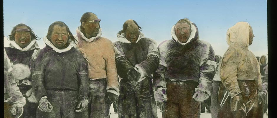
who lent personnel and instruments.The other members of his party were only two in number, Andrew Croft,
who acted as photographer, and Lieutenant A. S. T. Godfrey, R. E., who was in
charge of navigation and survey. Croft, it must be mentioned, made an extremely
valuable, in fact essential, contribution to the success of the expedition. He
went to Jakobshavn in West Greenland in the autumn of 1933 and before Lindsay
and Godfrey arrived next summer he had chosen the place of ascent to the icecap,
put a depot of nearly 2 tons of dog food at the edge of the ice, selected the
best 43 dogs he could find, and himself became an expert driver.In spite of Croft's energetic preparations, the expedition suffered a
severe setback at the very start, owing to events quite beyond their control.
The Gertrud Rask , in which Lindsay and Godfrey traveled from Copenhagen, was
three weeks late and did not reach Jakobshavn until May 21st. As a result, the
spring thaw had started in earnest before the journey could begin. Croft's de–
pot had been made in latitude 60° 45′ N. at the edge of the icecap and 2,000
feet above sea level. There was no more than 1,000 pounds of other stores to
convey to it. But this journey lasted until June 3rd. The ice in the fjords
had become unsafe and the coastal hills were almost bare of snow. Even after
reaching the depot, the party's troubles were far from over. A warm föhn wind
and heavy rain washed all the snow off the lower icecap slopes and created mor–
asses which were often waist-deep. Five dogs were lost down crevasses. Not
004 | Vol_XV-0473
EA-Biography. Scott: Martin Lindsay
until June 18th did the sledges run on frozen snow.Then the luck changed and the party covered 115 miles in five nights,
traveling on hard spring snow. But at over 9,000 feet altitude they found
themselves in soft snow winter conditions. They changed over to day travel
and their speed decreased, a reduction which was still further accentuated by
the increasing boredom of the dogs. Only when it became possible to carry the
three loads on two sledges and to leave one man free to go in front did the
interest of the leading team increase. All in all, however, the 470-mile
crossing was done in very good time, with a daily traveling avergage of over
18 miles. On July 21st the first survey station was set up in latitude 70°
05′ N., in sight of the east coast mountains.The party were now at the northern end of the 350-mile stretch which they
had come to map. Although, with lightened loads, they did not expect this to be
particularly arduous physically, it was in fact to prove so. On the whole the
weather was bad and the snow soft. Also there was the occasional strain of look–
ing ahead for crevasses. Even on lying-up days there were observations to be
made every few hours. But, above all, both men and dogs were tired and stale.
The dogs could no longer be inspired by the sight of a man skiing ahead of them.
This 350 miles was a hard stretch of the journey.Several curious phenomena were noticed in this part of the icecap. There
was a series of depressions as much as 500 or 1,000 feet deep, presumably caused
by the shape of the ground underneath. Here and there, particularly at the head
of the Kangerdlugssuak basin, there were crevasses large enough to swallow a
battleship. And in one perfectly flat stretch of ice there was a great rift of
uknown depth, 20 to 30 feet broad and several miles long.On August 26th the men were able to take sights of Mount Forel. Thus their
005 | Vol_XV-0474
EA-Biography. Scott: Martin Lindsay
map could link up with that made by the B. A. A. R. E. In spite of bad weather
and increasing weariness, they had completed their survey and could now run for
their depot in Kangerdlua Fjord, 200 miles away.This last stretch of the journey was handicapped by exceptiona;ly bad
weather for that season, gales, föhn winds, and mist following close upon each
other. But with the descent to Watkins's old base the 1,200 miles was accomplish–
ed in 103 days, with two and a half days' man food and one day's dog food in
hand. It was a very fine achievement for all concerned, including of course
the magnificent west coast dogs. From Kangerdlua the party went on to Angmags–
salik, where, after waiting a week, they were able to force their way in small
boats through the pack ice to the trawler Jacinth which landed them three weeks
later in Aberdeen.Martin Lindsay has not visited the Arctic since. During the war he served
in Norway in 1940 and in northwest Europe in 1944-45, winning the D.S.O. and
being promoted to the rank of Lt. Colonel. Since the war he has been Conserva–
tive Member of Parliament for Solihull, Birmingham. His awards include the
Roquette Gold Medal of the French Geographical Society, the medal of the Royal
Belgian Geographical Society, the Andr e é Plaque of the Swedish Society for Geo–
graphy and Anthropology, and the Murchison Grant of the Royal Geographical Society.
006 | Vol_XV-0475
EA-Biography. Scott: Martin Lindsay
Publications by Martin Lindsav:
Books :
Those Greenland Days . Blackwood, London, 1932. An account of the
British Arctic Air Route Expedition. The Epic of Captain Scott . Peter Davies, London, 1933. Sledge . Cassell, 1935. An account of the British Trans-Greenland
Expedition. "So Few Got Through." Collins 1946. War Experiences. "Three Got Through." The Falcon Press 1946. Arctic Reminiscences. "The House of Commons." Britain in Pictures 1947. "Shall We Reform the Lords?" The Falcon Press 1948.Magazine Articles :
"The British Trans-Greenland Expedition 1934." Geographical Journal ,
Vol. 85 N. 5, May 1935. Continued and concluded in Vol. 86 N. 3 –
Sept. 1935.J. M. Scott