-
The Uses of Ice
Encyclopedia Arctica 7: Meteorology and Oceanography
The Uses of Ice
Unpaginated | Vol_VII-0627
EA-I. (Vilhjalmur Stefansson)
THE USES OF ICE
CONTENTS
Page Aviation Uses 2 Lake and River Ice 4 Salt Water Ice 13 Coastal Ice 13 Drift Ice 21 Pack Ice 22
Unpaginated | Vol_VII-0628
This copy of “Uses of
Ice” read & marked
by Roberts.
007 | Vol_VII-0629
EA-I. Donnels: Industrial Structures
Storag
Unpaginated | Vol_VII-0630
The entire area outside of the heavy solid line may be called the “Zone
of Approach by Ship”; the area within the “Zone of Man-and-Dog
Travel.” The stippled portion of the latter is the “Zone of Comparative
Inaccessibility.” The distance between the isochronic lines is five days’
dog-sledge travel, or 60 miles. Incidentally the map shows the superiority
of Peary’s position of 1908 over all others on land as a base for a dash
aimed at the point of latitude 90° N. It is also favorably situated for an
attack on “Pole of Inaccessibility,” which is only 200 miles farther away
from Peary’s base than the North Pole.
001 | Vol_VII-0631
EA-I: (Vilhjalmur Stefansson)
THE USES OF ICE
In the history of transportation, water has been of paramount importance.
We have used oceans as highways between continents; within the continents the
lakes and rivers have had a similar role. Even with the supplement of avia–
tion, inland waterways are still of prime importance wherever roads and railways
have not as yet been built. It is, therefore, of consequence in relation to
the Arctic to note on a globe, or on a pole-centered map of the Northern Hemis–
phere, that the Arctic Sea is a mediterranean sea, central with relation to
Eurasia and North America, the great rivers so radiating from it that they
furnish to boats in summer transportation routes to the heart of their conti–
nents. At least four of them have a relation to the Arctic Sea which is like
that of the Mississippi to the Gulf of Mexico. The Mackenzie reaches 2,000
miles south into North America; the Ob, Yenisei, and Lena reach equally far
or farther south into Asia.To Europeans the rivers, lakes , and the ocean have had their chief trans- —
portation use as liquid highways. If they froze at all, they froze so briefly
that wein Third person? have thought in terms of navigation seasons and have left the inland
waterways idle the rest of the year. We have felt similarly about the northern
ocean, as valuable around the edges for boat rather than sleigh transportation.
002 | Vol_VII-0632
EA-I. Stefansson: Uses of Ice
But as our culture moves farther north, and as our thinking looks
farther and farther ahead, it becomes Increasingly hard to reconcile ourselves
[ ?] to using water transport facilities only during summer. In the case of
the great north-flowing rivers, the season of navigation is less than half
the year; with the Mackenzie it is considerably less, for that stream runs
through Great Slave Lake, and big northern lakes hold their ice in spring
several weeks longer than the rivers. Some northern lakes are free of ice
only a third of the year; the time for sea navigation is in places even briefer.Accordingly, It is the more important the farther north we are to consider
how the waters may be used during those parts of the year when they are not
wholly liquid. There are also lands partly or wholly covered by ice, derived
from snow which has not melted. This article, then, considers some of the
uses of ice, under thres heads: L l ake and river ice, sea ice, salt water ice, and inland or snow — —
ice. We have in mind chiefly the lands and seas north of 60° N. latitude,
and chiefly the uses connected with transportation but also those which re–
late to encampment or residence.AVIATION USES
Length of Ice Season . Excepting parts of the south coast of Alaska, the
whole of Iceland, and portions of the Scandinavian p P eninsula, lake ice north
of 60° can be used fox airplane descents landing take-offs for six or more
months a year, and river ice almost as long. In some parts, lake ice is
usable for eight months and even longer.Coastal salt water ice is good for airplane use along few coasts for
more than seven to eight months. The variation ranges from no availability
at all in southern Alaska, around Iceland , and around the northern shores of —
003 | Vol_VII-0633
EA-I. Stefansson Uses of Ice
the Scandinavian peninsula, to a maximum of perhaps ten months around Peary
Land and Northern Land (Severnaya Zemlya).Salt water drift ice, as distinguished from pack ice (for definitions
see Glossary), is never, properly speaking, usable for air fields, although —
it may serve for emergency landings — has, in. fact, been so used on many
occasions.In the pack region of the Arctic Sea, the season for air - base use varies —
between seven or eight months near the outer edge of the pack to nine or ten
months near its center. This refers to landing strips that can be maintained
in first-rate operating condition. Air bases for what type aircraft? can function through, the twelve months
in the central pack, with the qualification that from late June to early
September it will be difficult to maintain good landing conditions.Inland or glacier ice, with exceptions which will be brought out, is
suitable for planes at all times of year. This form of ice has been found
especially useful in summer; during winter it has generally proved more
convenient to land upon river, lake , or coastal sea ice. The unavailability —
of these three ice forms in midsummer is compensated for, in some places,
by the permanent availability of glaciers. For instance, at the most northerly
air base permanently occupied before World War II — Rudolf Island in the
Franz Josef group — planes used sea ice during winter but land ice during
summer.Rarity of Land Ice in Arctic . It is important to keep in mind, with
regard to the Arctic, that land ice is by no means as common or persistent
as we used to believe. Irrespective of latitude, ice which is formed from
snow does not endure from one winter to the next in large sheets, except on
004 | Vol_VII-0634
EA-I. Stefansson: Uses of Ice
mountains or near enough to them so that glaciers can spread from the high to
the low land. Even small sheets are rare in the Arctic, for in only a few
places do snowdrifts persist, then usually in east-west ravines which are so
deep that the sun does not strike, or, in rare cases, along the north slopes
of hills, (The reason that a northward slope often fails to preserve snow,
in the most northerly countries, is that the night sun strikes from the north.)LAKE AND RIVER ICE
Air Stations Dependent on Rivers —
Air Stations Dependent on Rivers . The use of river ice for airplane landings is well known to all who have
been connected with pioneer flying in lands of cold winters; for such fields
have no doubt exceeded in number all others combined, during the pioneer stage.Although better than rivers, lakes have been less used because trading
posts and villages are usually located along rivers. There was the advantage,
too, that (in the days before radio aids) airplanes could find their way along
valleys or by hitting them at some predetermined angle.Among the well-known river landing fields in Canada were those at Fort
Nelson, on the Nelson River, and at Fort Norman and Norman Wells, on the Mac–
kenzie. In Alaska, the ice of the Yukon, Kuskokwim, Colville, Canning, and
other rivers furnished the usual winter landing fields, although lake ice was
used by a few towns. The history was similar in northern Eurasia.Drawbacks of r R iver Ice Fields . In comparison with lake fields, which can —
usually be laid out so that they are wide enough for take-offs in any direction,
a river field has the disadvantage that descents and take-offs are necessarily
005 | Vol_VII-0635
EA-I. Stefansson: Uses of Ice
upstream or downstream. However, this difficulty is mitigated by the circum–
stance that in deep valleys the winds usually blow up or down, not crosswise
of the river bed.Another disadvantage of river fields, in comparison to lakes, is that
where currents are at all strong it is likely that thin ice will form in autumn
and then break, to refreeze with many of the ice blocks standing on edge at
various angles. If this sort of broken ice cannot be avoided, it has to be
leveled with pickaxes or by other methods. Usually this ice is so fragile
that it is not difficult to break with machinery of the bulldozer type, or
to crush with heavy rollers.Except for the difficulties already implied, the problem of keeping a
river ice field level in winter is the same as that of keeping a neighboring
land field in good condition.Lengthening the Season . If nature is allowed to take its course on a
river, there is the special difficulty that after the freeze-up a heavy snow–
fall may come along which puts down an insulating blanket such that the river
current eats the ice away to a point where it becomes unsafely thin, or may
even disappear, leaving no roofing over the water, in certain spots, except
the snow. This trouble can be obviated by, removing, rolling or tramping ? tamping down the snow
after each fall, to change it from a poor to a good conductor.Care in tramping down or rolling the first snowfall permits the use of
the field earlier in autumn. This is only half the advantage; for the gradual
building up of compressed snow, snow concrete (see (Glossary), will lengthen
the use of the field from a week to three weeks in the spring. The advan–
tages come chiefly under two heads, those of the avoidance of both thaw–
water puddles and candle-ice formation.
006 | Vol_VII-0636
EA I. Stefansson: Uses of Ice.
Avoidance of Puddles . If the landing strips are rolled after each snow–
fall you gradually build thorn up higher than the surrounding ice and snow.
Then, when the spring thaws come, the water trickles to where it can gather
in the low places, thus draining off the landing s trips, with resulting —
lessened trouble from slush and standing water.Besides, the thicker the ice the longer it takes to thaw, and the ice
beneath will be much thicker where the snow has been rolled than in other
places alongside where the better Insulation against atmospheric chill, due to
snow fluffiness, will have prevented the ice from thickening as rapidly. This
advantage, however, may prove to be less than that from the prevention of
candling.Candle Ice . One of the differences between fresh and salt water ice is
that when salty ice thaws the process is gradual and works from the outside,
after a manner to which we are accustomed through seeing ice melt in a water
glass. Bat large outdoor formations of fresh water ice, in addition to thawing
in the way we look upon as normal, will disintegrate through a process known.
as candling. This is the formation of ice crystals that are sort of pencil–
shaped and vertical, each of them with a length (at right angles to the surface
of river or lake) equal to the full thickness of the ice. These candles are
separated by films of water so that, when the condition is just right, you
could go out on fresh - water ice which is three or four feet thick and push —
a rod of wood, such as a broom handle, right down through into the water
beneath.Few things are more surprising to the inexperienced than the behavior of
007 | Vol_VII-0637
EA-I. Stefansson: Uses of Ice.
candle ice. For instance, it may happen during the break-up of a river that
chunks of ice as big as pianos will be thrown up on the river bank. If these
are composed of candle ice, then as you walk past them you can give each a
smart blow with a light club and the whole ice boulder will slide apart,
flattening out into a heap composed of Innumerable ice candles. —Even more striking is it to watch a dog that has been thrown into open
water adjoining a field of candle ice, which may be as much as three feet
thick. When the dog swims toward the ice and gets his front paws up on it,
preparatory to climbing out, the candles will give way and he will sort of
swim or scratch his way Into the apparently solid ice, making a canal for
himself of perhaps several feet, or even yards, before he comes to the point
where the ice has enough supporting power to enable him to get on top of it.But snow concrete, formed on a lake or river airfield by the compression
of repeated snowfalls, does not candle. The field then has on its runways
a different sort of ice from that on either side of them. This structural dif–
ference can by itself make a favorable seasonal time difference, in the
lasting of runways in the spring, of anything from a few days to one or two
weeks.It appears that candling (of each ice as will candle) takes place only
under the influence of direct sunlight. River and lake ice seemingly does
not candle so long as it has an unthawed snow cover.Qualifying Statements . It is only in a few places that rivers break up
by direct thawing from sunlight delivered at a given spot; they more usually
break up by relatively warm streams beginning to flow on top of the ice, which
streams derive their water from small tributaries and from rivulets flowing
008 | Vol_VII-0638
EA-I. Stefansson: Uses of Ice
down the banks. It is, therefore, on lakes rather than rivers that the
full effects which we have tried to describe are noted.As we shall bring out later, it is possible so to locate two or more
lake fields in the vicinity of an airport that one shall be receptive to
flying boats when another is in condition to receive wheel or ski planes.
This is scarcely possible on a river. Rivers therefore have longer periods
than lakes during which the ice is not strong enough for land craft and
the water not open enough for sea craft.Naturally it is often possible to have a river airport so located that
a lake suitable for airplane landings descents is near; then the difference in
freezing dates of autumn, and again of thawing dates in spring, can be uti–
lized so as to lengthen the active season of that airport.Air Stations Dependent on Lakes
Air Stations Dependent on Lakes. In most of the Arctic, and in much of the Subarctic, the ground is per–
manently frozen below a certain level. Where the subsoil is frozen there
can be no underground drainage and, without that sort of drainage, there
are bound to be innumerable lakes. In hilly country, where the main determi–
nants are the contours, these lakes will average large but will cover usually
less than 25% of the ground. Where the land is gently rolling or level, the
lakes may cover more than 50% of the surface; but these lakes will average
smaller and more shallow.Alternative Landing Fields for a Single Air Base . In rolling country,
it is usually possible to locate hangers and other structures so that there will
be available in different directions alternative lake landing fields. Many
009 | Vol_VII-0639
EA-I. Stefansson: Uses of Ice.
lakes differ so in freezing and thawing characteristics , that the time gap —
can be closed, nearly or quite, which on rivers intervenes between the
periods of safe ice and safe open water.Deep lakes freeze slowly, shallow ones more rapidly. If a base has
near it both a deep and a shallow lake, then it may be possible to continue
in autumn using the deep one for water gear, perhaps nearly or quite to the
point where the shallow lake becomes safe for land gear. (Naturally, in
order to make the shallow lake usable earlier, the snow will be rolled after
every fall and converted into concrete so as to prevent its acting as a
blanket that [ ?] slows down ice formation.)In the spring, shallow lakes thaw out faster than deep ones. Although
we are being repe t itious, overlapping the river ice section of this paper, —
we go here into some detail as to how the thawing of the ice on the deep
lake can be delayed while the thaw on the shallow lake is being advanced.Protecting the Deep Ice Lake . As explained already in the river dis–
cussion, a main consideration in spring, to prolong the ski and wheel landing
season, is to prevent the ice from candling. On a lake, even though no more —
than two or three strips running in different directions are needed upon which
to descend and take off, it might be advisable to roll the entire field,
therefore , several square miles. This need not be difficult, for very heavy —
rollers are not required to compress snow if the rolling is done immediate l ly —
after each snowfall. Since the rollers are light, they can be very wide,
and the number of back-and-forth trips in covering the whole field will not
be great.If the airfield, then, has several [ ?] square miles of ice, all of them
010 | Vol_VII-0640
EA-I. Stefansson: Uses of Ice.
with an upper layer of snow concret e , then there will be sufficient strength —
so that, even if the untreated ice round about becomes very weak or even —
disintegrates, there still is an ice island from which planes can operate.
Obviously, we do not have in mind here indefinite operation, but merely the
lengthening of the possibility of the use of land gear by a few days.Accelerating the Thaw on the Shallow Lake . To advance the thawing of
an ice airfield, the principle is [ ?] employed that the sun delivers no heat
hut only light that is converted into heat by absorption. This absorption
is least on spotless white snow; it is greatest on a black surface. Several
methods then suggest themselves for speeding up the thaw on a shallow lake,
so as to prepare it for an early reception of water-equipped airplanes.If there is sand anywhere nearby, the easiest thing may be to hitch
a sand sprinkler to the rear of a tractor and sprinkle the lake, or the parts
of it where early melting is wanted. Sand must be lightly spread and Care must be taken to use just the
right amount of sand. Each grain Each grain or pebble must be separated ? must be separated from all others;
for if the deposit is a continuous layer it forms a blanket over the ice,
which, true enough, gets hot with the sun but which has an insulating power
that tends to protect the ice beneath it from thawing.The chief difficulty about using this process is the possibility that
snow will fall just after the field has been sprinkled with sand. A thing
of importance, then, is the accuracy of weather forecasting; there should
be at least a day of sunshine between the sprinkling operation and the next
snowfall. When the snowfall does come, the new snow will have to be sprinkled,
to give the sun a purchase.
011 | Vol_VII-0641
EA-I. Stefansson: Uses of Ice.
Better than sand may be black, dirty oil, like crankcase oil. The plan
would be, then, throughout the winter, to save all the dirty grease possible,
for use in the spring as a blackener, In place of sand.A third way, and perhaps the best, Is to sprinkle lampblack, or some
other dark powder, over the snow from airplanes in the manner used when
dusting an orchard with insecticide, or, Indeed, after the manner of laying
a smoke scree n . —The method just described; ordinarily with sand, has been used by polar
explorers when they have wanted to destroy in the spring the ice which was
Immediately around ships that were wintering, so that each ship could come to
float in a basin of water while the ice round about was still strong. It —
has not been uncommon for ships to float free several weeks before the ice
thawed generally in the bay where they were wintering.One place where melting with dirty oil has been in long use is Lake
Bennett on the Yukon River, downstream from Whitehorse. What they have done
there, in springs, is to trundle beck and forth with their sprinklers until
they have covered a belt about two or three times as wide as a steamer. This
belt thaws out, making [ ?] a canal through the ice. In some years this Lake Bennett canalizing has worked very well, giving
passage to steamers across the lake from one to three weeks ahead of the
general thaw. (In the North, rivers thaw from one to several weeks ahead of
lakes through which they flow ). .) In other years the canal scheme has not worked —
well because the ice on one side o f r the other of the channel became loose from
the shore and floated in, closing the thoroughfare.¶ To prevent this sort of
thing, one would preferably use, for an air base landing field, a lake of
012 | Vol_VII-0642
EA-I. Stefansson: Uses of Ice.
such moderate size that it would be feasible to sprinkle the whole of it
for early melting. Even so, it would not really be necessary to melt away the whole sur–
face. It would be enough to clear one end : for lake ice does not move except —
under the pressure of the wind, which means that, with a south wind, there
is open water in the southern part of the lake; with a north wind, the north
end of the lake would he open. Planes would then descend at whichever end
was ice-free.The Cooperation of Rivers and Lakes . Instead of using two lakes, one
shallow and the other deep, the same result can be attained by using a deep
lake which has a considerable river that enters one side or end, there being
no corresponding stream which enters opposite. n the spring the river pours
warm water upon the lake ice in its vicinity, melting out in one part a space
suitable for pontoon craft and flying boats, while at the far side the ice
remains relatively firm. This arrangement may reduce or even close the spring
transportation gap by having wheeled planes descending on ice far from the river
almost or quite up to the time when watercraft can use the river mouth.Keeping Lake Ice Level . Unless a lake is very large, say ten or more miles
in diameter, ice will form on it smooth and level in the autumn, except per–
haps right near shore. There will be, then, no such problem in leveling it
originally as one may have on a river.If the lake is in a forest, or other sheltered location, there will be
little bother from winds and snowdrifts, so the only problem will be to roll
the field after each snowfall. But many lakes are so windy that snowdrifts
013 | Vol_VII-0643
EA-I. Stefansson: Uses of Ice.
will form. Then the problem of leveling the drifts, and keeping the ice field —
in the right condition, will be the same as on land.Variable Time Element . The freeze-up of rivers and lakes is so dependent
upon a number of things other than the season that a separate timetable is
needed for each section of a river and for each lake. A good library will have
this information available for many rivers and lakes. In the Arctic?Lakes are even more variable than rivers. For instance, there will be a
difference of several weeks between the freeze-up of McTavish Arm, in Great
Bear Lake, and that of small lakes in the immediate neighborhood which are,
nevertheless; big enough for air base purposes.An example of the difference between lakes and rivers is that, where the
Mackenzie River passes through Great Slave Lake, the ice on the lake will
hinder steamboat navigation in some seasons for more than a month after the
river, both north and south of the lake, is free of ice.Speaking roughly, the ice of lakes in northern Greenland, or in the more
northerly Eurasian and Canadian islands, can be used by ski and wheel planes
nine or ten months per year. In the middle Canadian islands the lake ice can
be used seven or eight months. In the northern part of the North American
or Asiatic mainland it can be used six or seven eight months.SALT WATER ICE
Coastal Ice
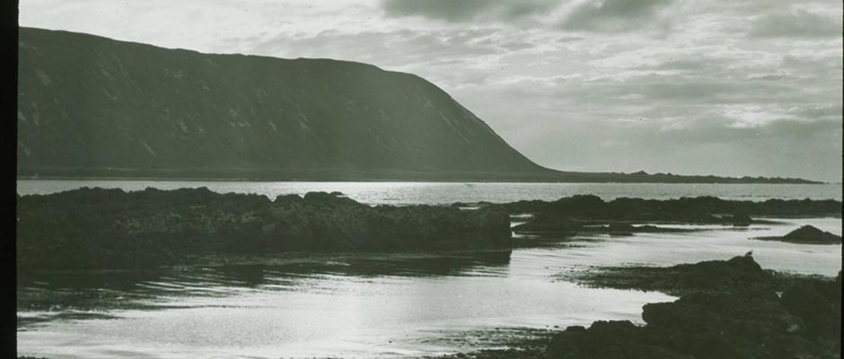
Coastal ice falls into three main subdivisions: I i ce foot, bay and lagoon —
ice, and landfast ice.
014 | Vol_VII-0644
EA-I. Stefansson: Uses of Ice.
Ice Foot . This type, as distinguished from the more general landfast ice,
is found on shores which have considerable [ ?] rise and fall of tide.Most arctic shores have small tides; for instance, the north coast of Alaska
and of northwestern Canada into Coronation Gulf, and the channels which run
eastward from the Gulf , have tides that range between six inches and two —
feet, insufficient to form a proper ice foot. But other coasts have consi–
derable tides. There, in autumn, a certain width of ice will adhere to the
land, freezing to the bottom and refusing to fall and rise with the tide.
This is the ice foot.The ice outside the tide crack, which does rise and fall, will never
be higher than the ice foot; for, if it were, then there would be a flooding
of water inward along the top of the shorefast ice, this water freezing
and adding enough to its thickness for making the surface of the ice foot level
with the highest tide.There are not many places where the ice foot is wide enough so that an air–
field could be laid out which has landing strips at right angles to the shore.
Usually such runways would have to be parallel to the shore. This ice is seldom
very level originally, and so would have to be leveled with pickaxes or mechani–
cal levelers.Bay and Lagoon Ice . Bays and lagoons are usually of such limited size that
large waves do not form, so their ice is normally level; or else it has small
snags of broken ice, like those of rivers which have a strong current, and they
are easily leveled with pickaxes or machinery.Bay ice occurs on practically all coasts in the Arctic. The lagoon variant
of bay ice is found chiefly off low coasts. There are some lagoons to the south-
015 | Vol_VII-0645
EA-I. Stefansson: Uses of Ice.
west of Point Barrow, on Alaska’s northwest shore. To the southeast of Barrow
is first a chain of lagoons which runs toward Cape Simpson, and then another
chain which begins east of the Colville River and extends to Flaxman Island,
with smaller lagoons east toward the international boundary. We discuss these
as typical for many other coasts.Between the sand bars and islands of the chain that fences off the
northern Alaska lagoons are openings deep enough for floe ice to drift in during
summer. Some years there will be a considerable number of these vagrant hum–
mocks scattered through the lagoons, particularly in such places as behind Cross
Island, east of the Colville, where the entrance channels are fai l r ly deep.
It will not be difficult, however, to find areas free from the drifting chunks
(that have been set fast when the bay ice formed) aid which are big enough for
landing fields containing strips laid out in any direction.In selecting a bay or lagoon landing field, one would keep in mind, among
other things, that the location should be ordinarily reachable by drifting sand;
for, as explained, sand grains on ice produce an early break-up in the spring,
shortening the season during which the field can be of use. And, for a similar
reason, a field should not be off the mouth of a river, for the warm water from
it will break up the ice early in the spring.There is, however, the same consideration here as with lake ice, that it
may be desirable to have in mind landing facilities for both wheeled planes and
flying boats. Usually a bay or lagoon field can be so located that, although
not exposed either to drifting sand or to river water , , it will nevertheless be —
only a reasonable distance from another area base which has early melting
due to sand storms or river flow. The base would then have, in spring, on one
016 | Vol_VII-0646
EA-I. Stefansson: Uses of Ice.
side of it ice still strong enough for wheeled planes, while on the other side
there would be water lending facilities.For hay and lagoon operations, as for those oa on an ice foot, hangars and —
other buildings will no doubt be on an adjacent shore. The field must be
far enough from all buildings so that snowdrifts formed in their ice do not
extend out upon the landing strips.Landfast i I ce . Apart from the special variants already discussed, winter —
ice [ ?] in the Arctic which is landfast may vary in breadth, as measured from
the shore, between a few feet and several hundred miles. Among places which
have only a few feet or a few yards of landfast ice, even toward the end of
winter, are promontories like Cape Lisburne in northwestern Alaska, Cape Lyon
in northwestern arctic Canada, Nelson Head, at the south tip of Banks Island,
and various promontories among the Svalbard and Franz Josef Islands. Off the
mouth of the Mackenzie River lie, in winter, from thirty to sixty miles of
landfast ice. The greatest known width of this type is in the New Siberian
Island section of the northeastern Soviet Union, where the landfast ice may
be up to 270 miles in [ ?] width toward the end of winter, as off the mouth of
the Yana River.“Typical” Landfast Ice . A case history of the formation of landfast ice
is more explanatory than a description.With no slush previously in the sea, the first frost of the year may pro–
duce only a few inches or a few feet of very thin ice which adheres to the
shore along one edge, the rest of it, as a floating apron, rising and falling
with any gentle wave motion. For salt water ice is not brittle like glass,
017 | Vol_VII-0647
EA-I. Stefansson: Uses of Ice.
but is more of the consistency of ice cream, and, in that sense, flexible.
More often, however, there is adrift in the sea near shore a mass of sludge
ice, a kind of ice porridge, and a night of calm frost may produce a harden–
ing of this to the width of several feet or yards, and sometimes hundreds of
feet or hundreds of yards. This belt of landfast ice may continue growing
for several nights until an expense of it one or several miles wide fringes
the lend, none of it strong enough for a man to walk upon , but all of it, —
nevertheless, a single sheet.Now in case of an offshore wind, particularly if accompanied by a rise
of water, all this ice — excepting a few inches or feet near shore — will
go adrift and disappear seaward. But if the wind blows from the sea, and
particularly if there are drifting floes offshore, the ice apron will be crushed
up and pressed toward land. We have, then, in case of only a moderate pressure,
the formation of smell ice ridges, from a few inches to a few feet in height
and lying mainly parallel to the shore, but with others at various angles.If this sort of pressure is followed by a calm, there is a cementing to–
gether of the various blocks, which have been pressed upon edge with their
flat sides meeting each other. This makes such a strong fortification of the
shore that, even though stiff gales come later from seaward, and even if these
bring in heavy drift ice, the apron of shore ice will likely become permanent
for the year.What usually takes place in such a case as we are describing is that a
big pressure ridge forms anything from several hundred yards to several miles
from shore, this ridge becoming firmly grounded because of being heaped so
high that its weight presses heavily against the sea bottom. For the time
018 | Vol_VII-0648
EA-I. Stefansson: Uses of Ice.
being at least, this ridge marks the outer edge of the landfast ice.On the outside of the heavy pressure ridge is the shore lead, or whet the
Yankee whalers in northern Alaska used to call the shore flaw (so written, but
pronounced usually as if spelled floe or flow). This flaw is, then, the meet–
ing place of the landfast ice with the moving pack, and may be represented
at different times by an open lead several miles wide, by [ ?] a narrow water–
filled, crack, by grinding ice that is moving past the landfast ridge, or by
ice frozen to the shore ridge and temporarily immobile but ready to go
adrift, particularly with a combined rise of water and increase of wind.Take Flaxman Island as an example: The original flaw may be three or
four miles from shore and this may continue throughout the winter. However,
it can happen, under special circumstances, that heavy pressure will pro–
duce another ridge half a mile, or even a mile, farther out at sea, which
will be so firmly grounded that the ice between the original and the new
flaw may remain immobile all winter.But experience has taught the seal hunters to the north of Alaska that
this second ridge, and second belt of shore ice, cannot be relied upon to
stay put. There was, for instance, the case of the Stefansson party of
1914 when they were about to start sledge travel northward from the coast of
Alaska at Martin Point and were five or six miles from land upon ice that
had formed between the first and second ridges — ice that normally would
have stayed the whole year. In thin case a gale sprang up so violent and
with such a rise of “storm tide” (probably six or seven feet) that the second
pressure ridge floated free of the sea bottom end went adrift, with its
019 | Vol_VII-0649
EA-I. Stefansson: Uses of Ice.
adjacent Ice, carrying the party with it, so that when the gale cleared the next
day they were twenty or thirty miles from land and forty or fifty miles east
of where the camp had been pitched originally.The picture we have tried to draw applies to the formation of land ice
that is going to be five miles wide, as off Flaxman Island, fifty miles wide,
as off the Mackenzie delta, or two hundred miles wide, as off northeastern
Siberia. Of course, the process is more complicated the wider the shelf of
landfast ice.To make a reasonable determination as to whether shore ice is safe
for the building of temporary winter airports, we need more knowledge and
experience than can be reduced to writing in a brief statement, if it be
desired to have the base as far as possible from shore. However, an
observer can tell by mere common sense, even without much experience, that
certain parts near shore are definitely safe.Leveling an Airfield . A landing field on shore ice is, in its pris–
tine stage, usually different from bay or lagoon ice in that a good deal
of it will require leveling with picks or machinery. Leveling an ice field
is simple, compared to leveling a rough field composed of frozen earth.
True, salt ice (unless very young and therefore slushy) is tougher than fresh
ice, and does not splinter so easily; but this difference between fresh and
salt ice is negligible compared with the extreme toughness and unworkability
of frozen muck.The problem of using heavy machinery for leveling fields on sea ice
will be discussed in relation to stations maintained on the pack.
020 | Vol_VII-0650
EA-I. Stefansson: Uses of Ice.
The Time Element . On lagoons and bays, such as those along the north
coast of Alaska, the ice near shore may become firm enough for dog - sledge —
travel in middle or late September. There is, in this respect, a seasonal
variation of perhaps five or six weeks. The very earliest sledging season
begins in this locality around or just before the middle of September, while
a corresponding stage may not be reached in another year until late in October. , —Even for the lightest ski planes, the season will be a bit later than
for dog sledging. There will be few years when heavy wheeled planes can
safely descend land on northern Alaska lagoons before late October. However, the
preparation of the landing strips can begin before the ice is strong enough
for planes to use it. This preparation, as already indicated, is in the main
to roll the field after each snowfall, to produce a snow concrete surfacing.In a very [ ?] early spring, difficulty with the ice on North Alaska
lagoons may start the first or second week of May. Fields properly selected
and tended, as discussed heretofore, may nevertheless be usable into late May.On ice that extends far offshore, autumn use will start a little later
than on coastal lagoons --in practice, at least a month later, because the
risk to men and equipment of working far from land is considerable during the
early part of the season, while near shore the risk is small. Similarly, the
danger that ice may go adrift under a violent gale and a sharp rise of storm
tide also is considerable. The general principle will be, then, that for
both earliness of season and for safety it is better to have the air field —
on a bay or lagoon than to have it on shore ice, unless very near a beach
that has shoal water offshore.But a field located on shore ice immediately outside of a lagoon may, in
021 | Vol_VII-0651
EA-I. Stefansson: Uses of Ice.
some years, be usable later into the spring season than if on lagoon ice, with
a possible maximum difference of two or three weeks. So the leader of an ex–
pedition may think it worth while to level off, outside of the lagoons, a
temporary field for use during two or three extra weeks in the spring.The foregoing is with reference to northern Alaska and northern Canada;
the autumn freeze-up begins, however, somewhat earlier to the east of Cape
Parry, and the spring break-up a little later. On the Siberian shore ice, the
sparing break-up will be a little later than off the Canadian mainland, and
the autumn freeze-up a bit earlier.Proceeding north among the Canadian islands, the autumn freeze-up be- —
comes earlier and the spring break-up later. For a rough comparison with the
eastern north coast of Alaska, the season of usable bay ice will be a month
longer near islands like Banks and Victoria, two months longer on the north
coast of Melville Island, and a bit longer still in islands farther north
than Melville.Drift Ice
Outside the shore flaw is the belt of drift ice which separates the nor–
mally stationery shore ice from the heavy pack. This middle area will contain
in winter somethng less than 20% of all the ice of the northern sea. The floes
and fields which make up the drift are in such rapid motion, and are so rela–
tively fragile, that we do not consider them as po possible air stations of semi–
permanence, even if only a month or two were in mind.But the floes and fields of the drift are nevertheless of aviation sig–
nificance, for many of them have received safe descents by airplanes in dis-
022 | Vol_VII-0652
EA-I. Stefansson: Uses of Ice.
tress. Take-offs have usually proved successful also, when it proved feasible
to remedy the trouble which brought the plane down. We do not follow this up,
however, for we deal here not with the general problem of flight safety in the
Arctic Sea but only with the feasible use of semipermanent airports.Pack Ice
Triple Classification of Sea Ice . On the basis of how things are in late
winter, the ice of the northern polar sea may be classified under three heads:
( 1 1 ) about 15% or 20% landfast; ( 2 2 ) about 15% or 20% drifting and of such —
nature that next summer it will be penetrable by stout surface vessels; ( 3 3 ) —
the remainder, 60% or 70%, also in motion though more sluggish than the “drift”
section, and of such nature that it will not be penetrable next summer even
by the best icebre k a kers we now have.As already brought out, we consider that air bases can be maintained
satisfactorily on the landfast ice for a considerable part of the year, on
the drift ice for no part of the year, and on pack ice for the whole year —
with the provision that landing conditions in the pack are not going to be
good during the “summer months,” which poor season is of longer duration near
the edges of the pack than toward its center.Natural Thickening of Ice . As to the safety of drifting air bases and
research stations, and the ease and safety of operations like hunting, sledge
travel , and emergency landings, it is important to consider how sea ice thickens —
with age and changes in character.It has been considered that, with a “normal” amount of snow covering, sea
ice far from land will develop a thickness of from seven to nine feet the first
year, two additional feet the second year, with a [ ?] maximum of thirteen feet no
023 | Vol_VII-0653
EA-I. Stefansson: Uses of Ice.
matter how many years are involved. These figures must be treated as rather
vague approximations, for there is no defining what is a “normal” amount of
snow covering.From considerations already advanced, it appears that additional snow
hinders the thickening of ice. Also, the insulating qualities of snow vary
with the kind of snow — a fluffy cover of three inches would probably have
a greater insulating power than a wind-packed snowdrift of six inches.
Then, snow undergoes a granulating change during winter; the more granular
the snow, the less efficient it is as an insulator.Paleocrystic Ice . For that semipermanence which is desired for an air
base in the pack, and for safety, an extensive field of paleocrystic ice
would be chosen. For this ice, five years or more old, combines the two
necessary qualities: the greatest available thickness and the relative fewness
of snags and high projecting ridges.There are considerable areas within the pack where paleocrystic ice re–
presents 5%, 10%, or even more, of the total surface, occasional fields of
it being several miles in diameter — some perhaps twenty or even thirty
miles wide. It is rare, however, that these vast fields are wholly paleo–
crystic, for most of them have cracked here or there, with resulting pressure
ridges formed one or several years ago. These ridges have not yet been
rounded down fully by rain and sun and thus have not attained true paleocrystic
character.Thickness of Paleocrystic Ice . No one questions that, for average thick–
ness, paleocrystic floes excel all others, but this is about all that is known
defi d nitely. However, there is some apparently reliable theory.
024 | Vol_VII-0654
EA-I. Stefansson: Uses of Ice.
A true paleocrystic floe or field, of some age above five years, in the
heaviest ice that can be found within the basin of the arctic mediterranean;
and, it more than 200 miles from land, is in a district of relatively gentle
pressures. Paleocrystic ice presents, on a lower scale, the same visual ef–
fect as a snow-covered rolling prairie, such as in western Kansas, the Dakotas,
or Saskatchewan. All sharp angles have disappeared, the pressure ridges that
formerly appeared like small, jagged mountains now remind of gently rolling
grassland that is sufficiently snow-covered to hide the grass.The greatest upward extensions of paleocrystic ice, the knolls, are swept
clear of snow by each considerable wind that blows. From the known greater
temperature conductivity of ice than snow, it is to be assumed that, wherever
there is an upward swell of ice to make a knoll, there is a corresponding
downward swelling on the submerged side of the ice. For the low surface
spots are filled with relatively non - conducting snow almost level with the —
tops of the knolls. These knolls were originally the diminutive but craggy
mountain ranges of broken blocks forming pressure ridges. Each upward–
projecting peak was likely repr e sented originally by a deep and ma xx ss ive base, —
caused by pressure at the time the ridge was formed. Each knoll or peak may
he thought of as pyramid-shaped, with the wide base submerged.It does not follow, then, from the known laws of ice buoyancy, that for
every one foot of emerging ice there are five, six, or seven feet of submerged
ice. Actually a pressure ridge that rises 60 feet above sea leve l may not
indicate more than perhaps 100 feet of draft. The observation of the Stefans–
son expeditions is that sea ice rarely, if ever, grounds in more than about
120 feet. Admiral Peary was consulted on this and replied that 20 fathoms
025 | Vol_VII-0655
EA I. Stefansson: Uses of Ice.
was the greatest depth in which he had ever noticed sea ice aground (sea ice
here not including ice foot chunks and, of course, not including icebergs).If a pyramid-shaped or wedge-shaped pressure ridge has, soon after its
formation, a maximum draft of 120 feet, it appears safe to assume that some
years later, in the paleocrystic stage, it would draw at least half of this.
To be very conservative, we will divide that estimate by two and assume here
only a quarter of the draft indicated by the Peary and Stefansson observa–
tions. We would then have a rounded knoll which rises 10 feet above sea
level with a submerged portion of 30 feet, making a total maximum paleo–
crystic floe thickness of 40 feet.In the case of those portions of paleocrystic floes which are thickly
crowded on their top surface with knolls, we might assume that the base sec–
tions of the various wedges or pyramids would coalesce on the under surface,
or nearly so. However, the glare knolls are separated on their upper surface
by bowl-shaped and channel-formed intervening spaces that are filled in winter
with snow insulator. From the universal agreement that the sea ice does not
become more than 13 feet thick through successive freezings, it would seem
that a thickness greater than 13 feet would not persist in areas which during
summer are covered with puddles of water, and therefore during winter with
thick snow insulation.There is, then, something of a contradiction between two theories. Accord–
ing to one, the thawing of submerged parts of the ice equals the freezing, after
13 feet have been attained; according to the other (a view based partly on
observation), paleocrystic floes would ground in 30 or 40 feet.True, the assumption that melting equals freezing, after 13 feet have been
attained, is based on assuming the mentioned indefinite “normal snow cover.”
026 | Vol_VII-0656
EA-I. Stefansson: Uses of Ice.
This leaves us free to assume that the glare knolls, at any rate, are repre–
sented below the surface by extensions considerably greater than the submerged
portion of a 13-foot ice cube.Taking the view that is least optimistic, from the angle of those who
want to maintain a base station semipermanently, we find that, when ice rests
uniformly on water, its supporting power is adequate for anything we desire
to erect, with the exception of possibly a very heavy hangar or machine shop.Perhaps the beet positive evidence of carrying power in paleocrystic ice
so far published in some detail is related to e case which is reported on
pages 514-515 of Stefansson’s The Friendly Arctic :“On all our ice trips and at every distance from shore we have found ice
with a certain amount of earth or gravel upon it and sometimes fragments of
rock or small boulders. The day after coming upon the sandy hummock we found
on top of some ice that was two years old or over, a gravel and boulder ridge
eighteen paces long. At its highest point it was about [ ?] five feet higher
than the ice on which it rested and had an average width of between ten and
fifteen feet. The ridge was composed of mud, gravel, slate and boulders, the
largest weighing over a hundred pounds. Some lumps of soil with lichens I
took to show that it had been formed by a landslide from some steep and not
entirely barren land. Apart from this earth ridge, the ice was a perfectly
ordinary old floe. It was now lying thirty or forty miles from the nearest
land and the depth of water underneath it was probably over thirty fathoms,
although we were unable to sound right at that point; no sounding we got in
the vicinity showed lees than twenty-six fathoms ( [ 156 feet ) ] .” — —
027 | Vol_VII-0657
EA-I Stefansson: Uses of Ice.
There are other stories, in a way more impress lye than this report, but,
since they are less specific with regard to the weight carried by the [ ?]
paleocrystic ice, they are not repeated here. The reports taken together
attest to the “incredible” load-carrying power which resides in a field of
heavy sea Ice.Air Search for a Base Location . Although, by definition, the outermost
floes and fields of the pack can be reached by a well-navigated and stout ice–
breaker, we nevertheless consider that, if an air base is to be located in
the pack, it will have to be established by air transport; for good judgment
would dictate that the location selected be at least 100 miles farther in than
an icebreaker could penetrate. The alternative would be establishment by sub–
marine, which, though considered feasible with the right sort of undersea
vessel, is not dealt with here.From an airplane the relief of a white surface is most readily discerned
when the sky is perfectly clear and the sun relatively low, to cast effective
shadows. Fortunately, the winter sun is much lower in the Arctic than nearer
the E uq qu ator, and, at any rate, it will be low mornings and evenings — except, —
of course, right at the North Pole where its height is practically the same
throughout the twenty-four hours.A moon near its full throws even clearer shadows than the sun, and moon–
light is, in some respects, even better than sunlight for ice - scouting purposes. —Search for a likely air - base site should, therefore, be made by the full —
moon or by the light of a sun that is not too high. The beet month of all
for this type of flying is March, with ample daylight in skies as yet usually
clear. February and April are the next best months, although daylight is a
bit scarce in early February while fogs and snowfall increase gradually through
April.
028 | Vol_VII-0658
EA-I. Stefansson: Uses of Ice.
The tentative choice of a base will be a paleocrystic field through which,
or along which, runs a wide and long-frozen lead. The prospecting plane will
be mounted on skis, with a fairly low landing speed, and there should be no
difficulty about a safe descent landing if the flyer is of the “bush pilot” type, used
to snow surfaces. After descending upon the comparatively thin level ice
of the lead, the plane will taxi up onto the safer paleocrystic ice. (By
definition, a lead is a crack in sea ice too wide for a man to jump over —
a sailor may define it as wide enough for a ship to pass through. A lead
may be several miles wide and scores of miles long.)Paleocrystic Traits . As stated previously, a true paleocrystic floe or
field, of some age shove five years, is the heaviest ice that can be found
within the basin of the Arctic Sea, sod, at distances of more than 200 miles
from land, is subjected to relatively gentle pressures. Still there is no
guarantee that the chosen floe or field may not crack under an effectively
applied stress from wind or current.However, if the floe does crack right across an air field, repairs are —
much easier than one would think, analogizing from land. Nor is it likely,
if ten bases were scattered throughout the suitable part of the Arctic Sea,
that more than two or three of them would be seriously injured each six months.
Here the experiences of drifting ships near land are not applicable — such
ships as De Long’s Jeannette and Stefansson’s Karluk . For enlightening ex- —
perience read the accounts of Nansen’s Fram and of any of several Soviet
vessels that have drifted far from land. One of the best accounts, from our
present point of view, is Storkers e o n’s unpublished narrative in the National —
Archives of Canada, for he drifted far enough from land and had no ship. The
029 | Vol_VII-0659
EA-I. Stefansson: Uses of Ice.
field on which his party camped six months, living by hunting, was a near
analogue to an airfield that might find itself temporarily out of touch with
supply agencies. (A brief account by Storkerson is found as an appendix in
Stefansson’s The Friendly Arctic .)The surface of the paleocrystic floe is rolling, as we have said. The
tops of the knolls look blue, for they are glare ice. The hollows are so
nearly filled with snow that, superficially, the field looks nearly level,
although , the snow in the hollows is too soft for a landing with wheels.Leveling a Paleocrystic Field . To prepare the field, then, it is neces–
sary to tramp down the snow in the hollows and cut down some of the hillock
tops with miners’ pickaxes. Picks weighing from 2-1/2 to 3-1/2 pounds are
probably the hast. Accustomed as we are to heavy machines of spectacular
efficiency, we may want to consider the use of one or another of these for
leveling paleocrystic floes. However, it must be remembered that, in addi–
tion to the difficulty of transporting such machines to the drifting air base,
there is the danger involved in case of e breakage of the ice. It is not so
much that the machines would be likely to sink into the water as that they
might get separated from the base and drift off on another floe. Besides,
there is the almost magical efficiency of miners’ picks when used on ice.If the need is for a really level paleocrystic field, for extensive and
long use, pumps will no doubt he employed to raise sea water from below the
ice to where it fills the hollows end freezes in them level with the pickax - — —
lowered hillock tops.The field once level, the problem of keeping it level will be the same
for a land field in any arctic or subarctic locality.
030 | Vol_VII-0660
EA-I. Stefansson: Uses of Ice.
Alternative . If, for any reason, the trouble of leveling a paleocrystic
field is considered too great, the alternative suggestion is to select a lead
of this year’s ice that runs through or past a paleocrystic field. Descents
would be upon the lead ice, the planes taxiing up on o nearly paleocrystic
floe where they would be tethered or placed in hangars.Problem of Snowdrifts . The Arctic Sea is not stormy, as demonstrated
when Nansen’s ship, the Farm , drifted for three years (1893-96) at distances
of several hundred miles from the margin of the pack to the north of Siberia.
Writing up his scientific reports later, he considered it one of the chief
discoveries of his expedition that the interior of the Arctic Sea is one of
the least windy regions in the world.All later explorers have confirmed this finding and the credit usually
goes to Nansen — perhaps rightly, because he was the first to formulate it
and emphasize its scientific and practical importance. However, the first
men to put the same thing on record may have been Lieutenant Commander George
W. De Long, of the U.S. Navy, whose ship, the Jeannette , drifted a course simi–
lar to that of the Fram about fifteen years earlier, in 1879-81. One of his
diary entries says that it is strange how seldom the wind blows and how gently
it blows when [ ?] it does.Since the difficulty of keep i ng a land strip level enough in a snow country
is large y ly a matter of the winds, it will appear that this trouble should not
be inordinate when a base has been located several hundred allies from land or
from any extensive open water.Timing . Practically anything can be done in the Arctic at any time of the
year, if one knows the ropes ropes and is willing to recognize the difficulties and
031 | Vol_VII-0661
EA-I. Stefansson: Uses of Ice.
adapt himself to them. However, a first consideration is to discover the
easiest and best way. For locating an air base within the moving pack, about
the most important consideration is the time of year.Winter is the Best Season . For practically every form of travel and work,
the beat season within the pack runs from the middle of February to the middle
of April. We list the chief reasons, with part of the supporting evidence.Nansen reported from his three-year drift in the Fram that, in the region
of light winds, deep within the pack, there is practically no fog during the
months December to March, inclusive, and that overcast skies are then rare
and snowfalls light. These Nansen conclusions have been confirmed since.Peary laid down the principle that, for traveling afoot over the pack, the
good season is from middle to late winter. In autumn and early winter, the
snowfalls, though not as heavy as in places like New England, are still much
heavier than in midwinter. The spring season is snowy, too, with clouds
and fog, though there is more daylight than during the fall months.Snow is a Handicap . Fluffy new-fallen snow acts as an insulator over
young ice, protecting it from the chill of the air and enabling the relative
warmth or the sea water beneath to interfere seriously with the strengthening
of the ice, even in some cases producing a thinning — if there is both a
heavy snow cover above and a current below. Moreover, the snow blanket makes
it difficult or impossible to tell visually whether the ice beneath is strong.As winter advances, the snowfall becomes lighter and the cold more intense.
It is, however, less the cold itself than the decrease of precipitation which
accelerates the thickening of the ice; for snow is severalfold better as an
insulator than ice can be. Moreover, the flakes that fell some months ago have
now become granular, furnishing relatively poor insulation as compared with
feathery, new-fallen snow.
Unpaginated | Vol_VII-0662
Editor:
In this pgf. DO NOT
change the “you” and “yourself”
Unpaginated | Vol_VII-0663
VILHJALMUR STEFANSSON
67 MORTON STREET
NEW YORK 14
032 | Vol_VII-0664
EA-I. Stefansson: Uses of Ice.
By Christmastime the snowfall is approaching its minimum and the cold
in gradually working toward that maximum which develops either in January
or February and remains substantially through March.The Use of Moonlight . With the winter decrease of clouds the effective–
ness of moonlight increases.A questionnaire sent out in 1934 by Stefansson, on behalf of Pan American
Airways, to a number of bush pilots in Alaska and northern Canada, brought
replies to indicate that most of the experienced flyers in Alaska considered
the full moon about as favorable as sunlight for airplane landings and take–
offs, and gave the length of adequate light at two or three days either side
of the full. Canadian pilots tended to be more favorable to moonlight than
the Alaskans, giving a longer period for the moon’s effectiveness, some voting
the moon to be as good as the sun for six days either side of the full, thus
for just under half the lunar month.The difference in verdict between the Alaskan and Canadian pilots is it–
self enlightening. You do not readily appreciate, without seeing it you r self,
the extent to which small patches of black (forests, willow clumps, rocks,
ground swept bare by wind) will decrease the effectiveness of the moonlight.
Steep hills throw shadows when the moon is low, and these also detract from
the over-all effect of reflected moonlight. Alaska is, on the average, more
rugged than northern Canada, has more rock exposures and more patches of willow,
even beyond the forests. It was the subtractive effect of these, no doubt,
which caused the Alaska pilots to give the moon only about half the effective–
ness rating that was given it by the Canadians.Flyers whose experience is mainly or wholly in the Antarctic are usually
skeptical of the value of moonlight. This seems strange at first, for the moon
033 | Vol_VII-0665
EA-I. Stefansson: Uses of Ice.
ought to be even more effective there than in the Arctic, since the snow sur–
face is more nearly uniform. The reason for the difference of opinion is
clearly that in the Antarctic, so far, most journeys, whether afoot or by
air, have been made in the sunlight of summer; there has been little travel–
ing by moonlight. Pilots who have never landed by moonlight seem nearly
always to underestimate its usefulness.The Values of Cold . The Eskimo point of view is that most winter conditions
are more favorable than those of summer. So the winter is with them the chief
traveling season, the more so the farther north. Whites at first disagreed
with this; but finally the explorers were won over. The first complete con–
vert was Peary. It was gradually established by him that, for purposes like
his, winter is the time of travel, summer the time of rest or preparation.
The reason, of course, is the mobility of the arctic ice and the importance
to the traveler of having a solid footing, without the danger of breaking
through into liquid water. In the Antarctic, travel afoot has been on land
and in a climate where little thawing takes place, even in midsummer. The
explorers there could afford to idle away the winter, for they knew that the
long summer was coming as an uninterrupted working season.From For planes the Peary generalization applies almost as well as for sledges. —
The flying is better when clouds are few, when snowfall is rare, and fogs are nearly —
absent. So the good flying weather deep inside the pack starts in late Novem–
ber and improves through December and January. From the light angle, there is
only the moon during the early part of this time, with the daylight steadily
increasing after the New Year, (It is only north of 80° that daylight is wholly
absent on the shortest day. There are various ways of figuring; some would
034 | Vol_VII-0666
EA-I. Stefansson: Uses of Ice.
put the limit of total absence of daylight on the shortest day at around 83°
N. latitude.)Behavior of Moon and Sun . At the season when the Arctic Sea depends on
moonlight, it is important for advance planning to remember that in high
latitudes the moon behaves much like the midnight sun of summer that disappears
in winter. For daring part of each lunar month the moon circles in the sky
without setting; during another part it circles below the horizon without
rising.At the very pole the sun is above the horizon a little more than half the
year; but almost as much light (say 80% as much) is lost through having the
sun below the horizon nearly half the year. In the case of the moon, the
loss is negligible through having it below the horizon, for this occurs at
the new phase, when no appreciable light is yielded in any case. The period
of constant revolution without setting is at and near the full, when the moon
is giving its maximum light.To a flyer looking for a suitable landing place or air - base site in the —
pack, few things are therefore more Important than to have in mind a clear
picture of this part of the moon’s behavior. In addition, he should have with
him tables or a graph showing what to expect from the sun at any high latitude
at any time. There are available several such graphical presentations. One
was published by the international journal Arktis , 1/2, 1930; Wilh. Meinardus:
“The Seasonal Change of Illum i nation in the Polar Regions” (title translated).
Another, and perhaps the best yet published, was worked out by Dr. Edward M.
Weyer, and published in the Geographical Review , of the American Geographical
Society of New York, in July 1943. This presentation has since been further im–
proved by Dr. Weyer and is included in Encyclopedia Arctica .
035 | Vol_VII-0667
EA-I. Stefansson: Uses of Ice.
Daylight in the Pack . As February advances, daylight increases a good
deal more rapidly than indicated by conventional astronomical calculations;
for they usually neglect, among other things, refraction, snow reflection,
and the appreciable diameter of the sun. Without any increase of clouds or fog,
there is, then, through February a steady improvement both in the thickening
of this year’s ice and in the increase of daylight.In most of the area which is for other reasons tentatively suitable for
the establishment of semipermanent air stations, 24-hour daylight is available
roughly from the last week of February.Best Scouting and Building Time . It follows from the above that, in normal
times, the scouting for a prospective air - base site would begin in early —
February and the building of it late in February or early in March.Clouds and fog will begin to interfere [ ?] the earlier in the season the
nearer the base is to the margins of the pack. In this matter latitude is
of some consequence but distance from open water is more important. Distance
from land is also material; for when the sun begins to strike dark surfaces
on the islands or continents and to create heat, the humid air from them, pass–
ing out to sea, works for the deterioration of flying weather. There is
going to be ice deterioration, too, but this unfavorable development lags
behind the weather.The Lands Produce Summer Fog . On the lands which surround the polar sea
(partially excepting the few which are mountainous and therefore extensively
glacier-covered), evaporation increases rapidly as the sun mounts.The slowness of evaporation when temperatures are around 50 ° F. below
zero is indicated graphically by the drying of a linen handkerchief. Hang
one up soaking wet at that temperature and it becomes stiff almost instantly,
036 | Vol_VII-0668
EA-I. Stefansson: Uses of Ice.
regaining its softness only in a period of between one and two weeks; while
at around zero the handkerchief would be soft in a day or two — at most
three or four days, depending, of course, also on wind and sun.The invisible steaming of surfaces, indicated by the drying of our
frozen handkerchief, increases rapidly when the temperatures begin to swing
between thaws in the day and frosts at night, and this produces local fogs
over the lands that surround the polar sea. The third Stefansson expedition
found, in charting the coasts of the islands which they discovered (Brock,
Borden, King, Meighen, Lougheed) and those of the neighboring islands, that
in May there is unlikely to be more than one clear day per week. However,
this extreme fogginess is of more significance for stations located on shore
than for drifting stations out in the pack.Fogs are Low . Arctic fogs average lower than those of the temperate
zones. It was a common experience of the whalers north of Alaska and western
Canada that when ships could not see each other from the deck or bridge the
captains and lookouts could see each other from the mast heads, which were
from 60 to 100 feet higher. It is common, too, on the arctic prairie for an
observer to be surrounded by a thick fog on every hand, while, on looking
skyward, he can see birds flying overhead, practically as if there were no fog.
Accordingly, a flyer searching for an established base in the pack would have
no difficulty in seeing it dark against the white landscape, if the plane
were passing over the base and able to look vertically down, or nearly so. This
is a corollary of the general proposition that fogs are less of a handicap
to arctic aviation than would be inferred from a study of the old-fashioned
weather records, as they were taken up to a few years ago.
037 | Vol_VII-0669
EA-I. Stefansson: Uses of Ice.
Drift Bases Will Not Be in Foggy Areas . The like in true at sea, where
fogs are many (and dense, horizontally speaking), especially in the drift
ice that fringes the pack. However, we are postulating that the drifting
bases will be one or several hundred miles from the margin of the pack, so
that none of them will be in the very foggy area until toward the end, when
each is about to drift into the open water between Greenland and the Franz
Josef Islands, as indicated in this discussion, post , under “Drift of Base
Stations.”Even Central Pack More Foggy in Summer . While the margins of the pack
are foggier than its center, and while conditions from the flying point of
view improve at any time of the year as you approach the middle of the pack,
still it is true that, even near the Pole of Inaccessibility, or Ice Pole,
there is as summer advances an increase of cloudiness, of precipitation , and —
of fog.As said, this increase begins earlier near the margins, perhaps sometime
in April, and reaches the center of the pack within the next few weeks. So
May is a bad month near the margin of the pack but good near its center; June
is a bad month throughout the pack; July and August are worse. Still, con–
sidering the over-all flying conditions, it may be that things are at their
worst in October, for then occurs a rapid decrease of daylight without a
correspondingly rapid decrease of [ ?] clouds and fog.Snowfall in the Pack . It is probable that, taking the pack as a whole,
the snowiest spring month is May or June and the snowiest autumn month either
September or October.Rain in the Pack . In 1937 k , liquid rain liquid rain – is this a good term? took the place of snow as precipi–
tation for about five weeks in the immediate vicinity of the North Pole, as indicated by the reports —
038 | Vol_VII-0670
EA-I. Stefansson: Uses of Ice.
of the Papanin expedition. No one has yet spent a summer in the vicinity of
the Pole of Inaccessibility, which is about 400 miles from the North Pole in
the direction toward Bering Strait; but in all probability the season of
liquid rain liquid rain ? is there about the same as at the geographic pole — thus between
three and six weeks in different years. The rain season grows longer as the
margins of the pack are approached.Summer Deterioration of Ice . Rain produces maximum deterioration of the
ice in s given time, but the direct sun is nearly as bad.Some conditions which are inimical to foot travel are also handicaps in
air operation. The third Stefansson expedition found, when traveling by sledge
over the pack some 300 miles north of Alaska, that movement afoot began to be
seriously impeded by the climate in May. As the season grew warmer, the
thickening of the young ice on leads became slower. A lead which would have
frozen over in two days during March, giving ice strong enough to support
men and sledges, took three or four days to freeze over in April, five or six
days in early May, and a week or two in late May.This slowing up of ice formation was only in part due to the decreasing
chill; it was in greater part due to the increased depth of new snowfalls
which blanketed the ice and protected it against the freezing effect of the air.
There was also the added problem that the level uniform snow cover made it
visually difficult to tell whether you were about to enter upon safe or unsafe
ice surfaces.Judging Ice from Aloft . These same difficulties apply to the aviator. No
matter how skilled and experienced he is, no matter how sound his judgment, he
will find it increasingly hard to judge from above whether he is about to land
on safe ice. Its strength may not be what he thinks, and snags will be hidden
039 | Vol_VII-0671
EA-I. Stefansson: Uses of Ice.
both by the thickness of the new snow and by its uniform whiteness. For there
is a difference in color between snow and ice if both are exposed, while color
differences disappear, and only shadows serve, if the ice is snow-covered; and
even the shadows are decreased by the uniform and considerable reflection of
light from the snow — the light that casts [ ?] shadows no longer comes in the
main direct from the sun but now increasingly from surrounding objects, by
reflection. The more numerous and effective the snow reflectors, the less
clear-cut the shadows.Changes in Snow . As the temperatures grow higher, thare are two [ ?]
pronounced changes in the snow — it melts and it turns granular.To the traveler afoot, granular snow is more of a nuisance than liquid
water. He splashes easily through ponds which are at first ankle-deep or at
most knee-deep; then he comes to snowdrifts of several feet in depth. Across
these, dogs, sledges , and men used to pass when the weather was cold, leaving —
barely a trail. But now the drifts are slush, and the dogs sink to their
bellies, the men to their hips; the sledge runners cut in until the body
of the sleigh drags like a plow.The aviator who wants to come down landing under these conditions in spring will have to allow for un–
safe ice, ponds of water , and snow that no longer behaves like snow. —Degradation of Pack Ice . Water runs down any slope, so there are little
rivulets trickling down the sides of the miniature mountains that have been
formed during winter by the crushing of ice under pressure. Most of these
ridges are low, but some reach the extreme height of 60 or 70 feet above the
level of the surrounding ice.Near the edges of the pack, these small-scale mountain ranges of crushed
040 | Vol_VII-0672
EA-I. Stefansson: Uses of Ice.
blocks may crisscross each other every which way at distances varying from a
few yards to a few hundred. Well out in the pack the pronounced ridges are
likely to be separated by miles rather than yards. Whether close set or far
apart, the thaw produced by rain and sun changes them gradually from the
angular peaks and pinnacles of the first year to the rolling prairie contours
of the fourth or fifth year.Ice is not as white as snow and therefore melts sooner through more of
the sun’s light being transformed into heat. Surfaces at right angles to the
sun melt more easily than those which receive slanting rays; ice slopes melt
faster than similarly tilted snowbanks and the snow persists while the ice
disappears. This in turn means that instead of open water in the hollow places
you have mushy, water-soaked snow.The conditions which we are describing appear sooner near the margin
of the pack and also, to a certain extent, earlier the farther south. Be–
cause most people overestimate the effect of southerliness, we emphasize
that with the midnight sun, which means a twenty-four - hour light delivery, —
there are potentials of heat creation that approach the tropical. (This is,
of course, why the U.S. Weather Bureau has recorded temperatures as high as
100° F. in the shade north of the Arctic Circle. That figure has been reached
officially at one spot only, Fort Yukon, Alaska; but records of 95° F. in the
shade are available from many arctic localities, while 90° is a common figure
on all arctic continental lowlands that are far from the sea. ) —According to some calculations, the sun delivers a little more potential
heat each twenty-four hours at the top of the atmosphere over the North Pole
on the longest day of the year than it delivers over the Equator. By atmospher [ ?] ic
041 | Vol_VII-0673
EA-I. Stefansson: Uses of Ice.
absorption, it is considered that this is reduced, so that near ground level
the heat delivery (light convertible into heat) is a little less than at the
Equator. But only a little less.That we do not have a [ ?] sudden melting away of all the ice and snow in the
polar sea under this terrific downpour is naturally because most of the light
is never turned into heat, but is reflected back by the snow and, to a less
extent, by the ice.But all over the polar sea are dark spots and patches that do not reflect
the light effectively. Some of these are produced by dead crustaceans, fish,
seals, polar bears, or other forms of animal life, and some by the excrement
of live animals, including birds. Other dark spots result from vegetable
matter — seaweed and that sort of thing. Then there are plants that grow and
prosper in snowbanks, most conspicuous ly or are the algae that produce “pink snow” or —
[ ?] “crimson snow.” Whenever there is such a dark or darkened patch or spot,
the sun gets stronger play, turning more of its light into heat; and these
dark things, heated, melt their way down into pockets in the ice.When the black object has sunk beyond the direct reach of the sun, the
thaw nevertheless continues to be facilitated, for we have now a bowl of water
which reflects less light than the snow does — apparently also less than the
ice. Besides, there are considerable snowfalls at this time of year, so that
the ice is constantly being clad with a thinner or thicker snow mantle that
stays undampened enough to be white for hours or even days; but the snow that
falls in water melts at once, or at least darkens upon becoming soaked, so that
the surface there creates more beat by the increased absorption of light.In the whole of the polar sea there is animal and plant life beneath the
042 | Vol_VII-0674
EA-I. Stefansson: Uses of Ice
ice. One animal which lives there, the seal, has the ability to make holes up
through the ice with his teeth. Each hole so made becomes a funnel down into
which flow the thaw waters of spring. As it flows, the water enlarges the
hole of the seal, while the network of affluent streams drains a small sur–
rounding area of ice.There are other holes in the ice, produced, as we have indicated, by melt–
ing that [ ?] starts around some dark object. As each pit finally breaks
through and becomes a hole, a new drainage area is set up, with rivulets
coming in from all sides.We have said already that there is no floe or field in the entire pack
which is so strong that it may not crack under pressure. Some of these crocks
were made early last in winter and are now healed by six or seven feet of ice; —
others are covered with thinner and thinner ice, according to their relative
youth, and the thinner the ice the more likely it is to have numerous seal
holes in it. Accordingly, there is an intensified drainage wherever leads
are covered with relatively new ice.Then, of course, any fresh lead that forms by cracking of the ice after
the beginning of the thaw period is a ready-made drainage outlet. Little
streams begin at once to pour their thaw water into these leads.When a lead forms in cold weather, it divides a floe into pieces which
freeze together again quickly into a floe of new composition, perhaps bigger
than the old. But toward s spring the ability of the ice to heal its own —
wounds in this way decreases. Under very slight pressure the floes will now
break along their lines of growing weakness, and these breaches cannot heal
before autumn. The number of leads increases steadily as summer advances ; , so —
043 | Vol_VII-0675
EA-I. Stefansson: Uses of Ice.
that ice fields of ten, fifteen, or twenty miles in diameter become more and
more rare.Toward the end of summer there are probably not many fields in the polar
sea which are more than ten or fifteen miles in their minimum diameter. ‘The
average diameters are, of course, greatest near the center of the pack and de–
crease toward its edges. At the extreme margins of the pack, wave motion, not
appreciable without precision instruments if you are more than ten or w s o miles —
from open water, begins to cooperate in the breaking of fields into floes and
of floes into cakes.Landing Places in Summer . From the point of view of travelers afoot, every
seal hole that provides drainage and every open lead in a blessing, for now
the water is draining from the slushy snow, and some of the slu s h itself flows —
along with the miniature currents into the drainage holes. The ice along the
shores of leads now seems dry and it becomes relatively easy to walk and sledge
along their banks.For a pilot in case of a forced landing, or a desire to land, the beat
hope now — practically the only one — is to come down alongside and parallel
to a lead. This must not be a lead through paleocrystic ice, for the hilliness
of the very old floes is now at its maximum. To find even tolerably smooth
ice, the pilot will have to select a new lead that runs through an older lead.As the summer advances , the drainage channels, which were a blessing to foot —
traveler or aviator, have less and less merit. For instead of remaining a few
inches wide they become a few feet wide, and instead of being a few inches
deep they are now several feet deep. These channels, however, are seldom wider
than four or five feet, nor is the water in them often deeper than three or four.
044 | Vol_VII-0676
EA-I. Stefansson: Uses of Ice.
But the channels come from or run through small ice-surface lakes. If
the ice is paleocrystic, the lakes are innumerable, but seldom of a diameter
of more than a few score yards and usually only a few yards, though relatively
deep. On the third Stefansson expedition men sometimes had to wade across lakes
of this type that were hip-deep. (They used empty kerosene or gasoline con–
tainers lashed to the sleds to float them across? the dogs had to swim.)Where the channels between lakes cut through ice ridges they may be four
or five feet deep, although the water in them would not likely be deeper
than two or three feet. Where the lakes within the pack have been formed on
relatively level ice, they are much larger, at times several hundred yards
wide; but they are shallow, seldom deeper than two feet.Near the margins of the pack this process continues until the channels
have cut their way right through the ice in which the waters flow, or until
the ice is so weakened that a minor stress breaks it. Toward the center of
the pack the likelihood decreases that a stream will cut all the way through
to the sea below.At this stage of ice deterioration even a ski plane can hope for little
better than a crash landing. It may be that it can descend along the edge
of a lead and slide along far enough to reduce its speed considerably before
it stubs the toe of a ski into an obstruction.Possibly special types of skis could be designed for this sort of lead–
shore landing, ones more curved up at the tip than now usual.Leads Carry Fresh Water in Summer. The condition we have described is
at its worst — or at least at its height — toward the end of summer. The
leads are then fresh-water rivers, or canals. If, when traveling afoot, you
045 | Vol_VII-0677
EA-I. Stefansson: Uses of Ice.
come to a lead which is less than a few hundred yards across, you can scoop
up drinking water with confidence that there will be not a trace of salt
discernible to the palate.For the third Stefansson expedition a rough measure of the depth of this
fresh layer was furnished by the seals that were shot. When dead, the seals
would sink through the fresh-water layer and float on the top of the salt
ocean water beneath. They were seen at depths of ten and twelve feet. Probably —
in some instances the fresh water that lies upon the salt water in a lead
has a depth of more than twenty feet.But if leads are one or several miles wide they are not fresh at the
surface, except that they are relatively fresh after a calm of several days.
For in a wide lead the winds produce a wave action that stirs up the sea,
mixing the fresh water with the salt.Autumn in the Pack . When autumn frosts come in clear weather, ice forms
rapidly over the lakes and channels; but if snow falls, to rest upon the new
ice, thickening is retarded. The combination of thin ice with thick snow makes
a situation that is doubly dangerous for men afoot, insofar as getting one’s
feet wet is concerned; for the flow of thaw water continues through the
channels as the lakes are being drained. When the lake is big the ice, with
its weight of snow, will collapse down into the water; but if the lakelet
is small, only a few feet across, the ice may be strong enough to act as a
roof, maintaining an air space of an inch or several inches between itself and
the water. W T hen a man afoot readily breaks throug h , even if he is walking on — —
snowshoes.As winter advances, the freezing of the small lakes is slow, for they are
located, in bowls that are filled with drifting snow. In some cases the
046 | Vol_VII-0678
EA-I. Stefansson: Uses of Ice.
traveling parties of the third St e fansson expedition were able to get fresh —
water out of such lakes six or eight weeks after they originally froze over.Skis vs. Snowshoes . There is enough rough ice on the pola e r sea to inter–
fere with skiing. Several members of various traveling parties of the
expedition were Norwegians, or otherwise accustomed to the use of skis, and
the sledging parties always had skis with them; but they carried snowshoes
also. It was only on rare occasions (when traveling before a fair wind,
and usually in the early spring) that skis were used at all. Snowshoes are
easier to carry, and should be preferred, unless both are carried.Natural and Artificial Strengthening of Ice . We described some way back
how a base can be located on a paleocrystic floe or field. We might explain
here how a floe that is being used as a long-term camp site may be strengthened —
for safer residence.As indicated, there are weaknesses in a typical floe or field at the end
of summer, due to the lakes which have been absorbing more sunlight than
the surrounding ice, and due to the network of channels connecting the lakes
and leading to drainage points. These weaknesses tend to be perpetuated as
winter advances; for the lowest places, where the ice lo thinnest, have the
softest and deepest snow that most retards the thickening of ice.Now if there is a crew of men around an air base or scientific station,
they can be sent out after each snowfall, armed with long poles that have at
their ends some kind of knob or masher. They can follow along the “river”
channels, walking on the solid old ice at the sides, and can break the snow
and ice roofings, pounding them down into the water, where the snow gets
saturated immediately and becomes a good conductor, a quick freezer. By a
047 | Vol_VII-0679
EA-I. Stefansson: Uses of Ice.
sensible adaptation of method, you can do similar things with the lakes.Later, when the ice roofing on the channels and lakes has become too
thick for breaking, the men can stamp the soft snow down after each snowfall;
they can roll it with a mechanical roller or drive back and forth over it
with a track-laying tractor. Thus they will promote an equality of freez–
ing, the weak parts of the floe being strengthened to where they nearly or
quite match the originally strong parts.When midwinter approaches, with decreased snowfall and intensified cold,
pumps would be used to fill with water the little lakes and the stream beds.
This will produce not merely a floe with a surface level above but also one
which can be visualized as fairly level below, on its water side. For thin
ice will conduct cold a little faster than thick ice, with consequent equaliza–
tion of the freezing, the hollows on the lower side of the ice being gradually
filled in.Special Applications . The principle of helping along the thickening of
ice by removing snow or tramping it down has long been known. Special appli–
cations of this have been reported by Soviet explorers. There is, for instance,
the creation of a drydock in ice.If a disabled ship which is not too large is wintering in the pack, the
crew may, for drydock reasons, promote the thickening of the ice around the
vessel in the manner we have indicated. When the ice is thick enough, they
can cut it away from around the sides of the ship and expose parts where repair
is needed. (This method is described and diagrammatically illustrated in “Ice
Dock,” by Engineer K. Zhukov, Teknika Molodezhi ( Techniques for the Young ),
1944.)
048 | Vol_VII-0680
EA-I. Stefansson: Uses of Ice.
Drift of Base Stations
In discussing the locating of air fields on sea ice we must keep in mind —
that there are two sections of the arctic mediterranean in which the general
trend of ice motion is problematic. One of these is the region to the north–
west and west of the islands from Ellesmere to Prince Patrick; the other is
the area of probable, or at least possible, eddy to the north of Alaska, east
of the Point Barrow meridian. For all other sections we have enough drift
records to make the trend of ice movement reasonably clear.Ice Motion North of Greenland . On his various sledge journeys toward
and eventually to the North Pole, Peary found that, as he advanced farther
and farther north from the Greenland-Ellesmere region, the drift to the east–
ward became more and more rapid, until he got to that zone of maximum frac–
ture which he calls the Big Lead. Since the intensity of ice motion, and
sometimes even the direction, will depend in most parts of the Arctic Sea
upon winds blowing at the time, or during the preceding few days, the Big
Lead will not necessarily be at the same distance from Greenland at the same
date of successive years, nor at different dates of the same year. However,
this “lead” can he reckoned as being roughly 70 miles offshore from Ellesmere
Island and 35 miles offshore from the Peary Land part of Greenland. It doubtless —
continues approaching nearer land the farther east we go. We can safely think
of it as practically hugging the shore when we get as far southeast as North–
east Foreland, Greenland.Speed of Ice Drift . The betl belt of greatest ice speed, in the direction
of the Greenland-Norway gap, will be along the poleward side of the Big Lead.
Soviet writers have spoken of 3/4 mile per hour as the maximum speed, and this
049 | Vol_VII-0681
EA-I. Stefansson: Uses of Ice.
may be right for any motion that depends in the main on winds of large scope.
But, under the pressure of the violent local gales which blow near land, a
motion estimated by the third Stefansson expedition at two 2 miles per hour has —
been observed to the north of Alaska — this being the notion, of the pack in
relation to landfast ice.It may be that what Soviet writers have in mind is that, within the pack, —
the greatest differential motion of opposite sides of a load, with respect
to each other, is 3/4 mile per hour. But in such case it is possible that
the ice on both sides of the lead .is moving in the one direction and that
the absolute motion with respect to the sea bottom is, in the case of one
side of the lead, 2 miles per hour, against 1-1/4 miles per hour for the other
side of the lead.Charles D. Brower, who had more experience than any other Alaska white man
in whaling off Cape Smythe (Barrow), used to speak of ice drifting at two 2 —
miles per hour. However, his estimate, and the mentioned one by members of
the third Stefansson expedition, should be marked down as no more than esti–
mates. It may be that they represent considerable exaggeration.If there is anywhere in the Arctic a motion of wide streams of ice as
high as two 2 miles per hour, even for a few hours at a time, this will most —
likely occur in the gap between Northeast Foreland and Spitsbergen, in Bering
Strait, or in some other of the straits leading out of the arctic basin into
neighboring waters.Direction of Ice Drift . We know, then, that to the north of the islands
Axel Heiberg, Ellesmere, and Greenland the motion of the ice, although occa–
sionally reversed by a contrary wind, is to the east, and that the speed in-
050 | Vol_VII-0682
EA-I. Stefansson: Uses of Ice.
creases as we approach the slacking-out region between Greenland and the Franz
Josef Islands. Since theoreticians have long believed, and since the Papanin
expedition demonstrated, that the drift from the North Pole is in the direction
of Iceland, we may consider ourselves to know that any floe which at a given
time is located east of a line drawn from Axel Heiberg Island to the Pole, will
move thence in a general Spitsbergen direction and with increasing speed.A doubtful area in this quarter, mentioned above, would then begin not
far to the west of the Heiberg meridian. Little is known about the movement
of ice in that region except what was learned from two sledge journeys, those
of MacMillan at to the northwest of Heiberg in 1914 and of Stefansson north–
ward from Borden Island in 1917. Both journeys indicate that there was little
movement, or at any rate slow, with evidence on direction inconclusive.But the Stefansson sledge trip of 1915, to the northwest of Banks Island
and in the region west of southern Prince Patrick Island, showed a definite
though slow movement southerly. This trend is open to alternative interpreta–
tions, that the main pull was toward M’Clure Strait, or that it was toward
Alaska. It is known that the movement of water ail the year, and of ice
when Melville Sound is not frozen fast, is easterly through the waterway
represented by M’Clure Strait, Melville Sound, Barrow Strait, Lancaster
Sound, to Baffin Bay; therefore it might be contended that southward movement
of ice located westerly from southern Prince Patrick was only an effort by these
floes to get into the eastbound stream running through M’Clure Strait.However, that the movement observed in 1915 to the west of southern Prince
Patrick and northern Banks i I slands was really toward Alaska rather than toward —
M’Clure Strait becomes evident when those observations are studied together
051 | Vol_VII-0683
EA-I. Stefansson: Uses of Ice.
with the ones taken to the west of northern Banks Island by the Stefansson
sledging party that made a fishhook-curve track in 1914 from Martin Point,
Alaska, to northwestern Banks Island, especially the observations of late
May to June 20. (See the separate route maps for 1914 and 1915 in Stefansson’s
The Friendly Arctic .)Since it is obvious that there cannot be much movement of water easterly
through the tortuous and shallow channels just north of the Canadian mainland,
it follows that the ice which moves southerly along the western coast of Banks
Island must turn west and drift parallel to the north coast of Alaska. P el le nty —
of evidence of this was found by the Stefansson party on their mentioned
journey north from Martin Point, Alaska, in 1914; but this was only confirma–
tion of what had long been known, from the British explorers of the middle
nineteenth century, from the Yankee whalers between 1889 and 1907, from the
Leffingwell-Mikkelsen expedition of 1906-07 — all of which was re-enforced
by the drift of Stefansson’s Karluk from the Colville mouth to the vicinity
of Wrangel Island in 1914. This westward movement from southern Banks Island,
parallel to Alaska, appears to be chiefly along a line running westward at
a distance of 150 or 200 miles north from the mainland shore.Stations in Doubtful Area . Since there is between the Axel Heiberg
meridian and a point northwesterly from Prince Patrick Island a region where
it is anybody’s guess what the trend of drift would be, an air base established
on a floe in that realm of uncertainty might take either of two courses. It
might drift woard toward the Spitsbergen-Greenland a aperture, and then probably at —
first with a rate of a mile or two per day; or it might start out southwesterly,
and then probably at a much slower rate, perhaps half a mile or less per day.
052 | Vol_VII-0684
EA-I. Stefansson: Uses of Ice.
The Y-drift n N orth of Barrow . It has been demonstrated by the drift of a —
number of vessels caught in the ice, among them the Baychimo and the Karluk ,
that there is a Y in the current to the north of Point Barrow. A ship caught
in the ice between Bering Strait and Point Barrow will drift northeasterly
par a llel to the coast, while another ship caught in the ice along the north
coast of Alaska between Barrow and the Colville, will drift northwesterly;
the tracks of the two will meet at a point north of Barrow, when both will go
northerly for a while, then turn west, to pass north of Wrangel Island, likely
at some distance between 50 and 150 miles.The Karluk Drift . The Karluk drift of 1913-14 began at a point about 20
miles offshore just east of the mouth of the Colville and took s northwesterly
course parallel to the land, She stopped frequently and occasionally reversed
herself, but in the long run she forged ahead so as to pass Barrow only a
little out of sight of land — having been in sight from the lowland to the
east of Barrow theretofore. With many zigzags the vessel continued westerly
from Barrow until she sank about 50 miles north and a little east from Wrangel
Island. This drift occupied the time from September 1913 to January 1914.The Jeannette Drift . The previously mentioned 1879-81 drift of De Long’s —
Jeannette started east of Wrangel Island. She first moved northerly until the
island was well cleared and then began a trend somewhat north of west, which
course she followed during the next year and a half, getting a little farther
offshore constantly, until she was crushes in the ice off the islands she
discovered — Jeannette, Henrietta , and Bennett. —The Fram Drift . In the 1890’s it was the belief of Nansen, based largely
on De Long’s work, that a ship placed in the ice in the vicinity of the New —
053 | Vol_VII-0685
EA-I. Stefansson: Uses of Ice.
Siberian Islands would drift approximately across the North Pole on her way
to the North Atlantic. During 1893-1996 his ship the Fram actually continued
in the sort of spiral curve which is forecast by plotting on a map and con–
necting the Karluk and Jeannette drifts. This line does not trend offshore as
much as Nansen would have liked and does not go across the immediate vicinity
of the Pole. The Fram’s drift curve is actually about 300 miles from the Pole
at its nearest point, where the trend became westerly and then southwesterly,
coming into open water to the west of Spitsbergen.Drift of Soviet Vessels . In the 1930’s and later a number of ships be–
longing to the Soviet Union were caught in the ice in the New Siberian Island
region and carried on Fram -like drifts. One of them, the Sedov , followed a
course roughly parallel to that of the Fram but consistently farther from
Asia, and made an approach closer to the North Pole by about 50 miles.The Storkerson Drift . In late midwinter 1918 a party of four men of the
third Stefansson expedition traveled by sledge roughly 200 miles north from
Cross Island, which itself is about 20 miles off the north coast of Alaska,
somewhat east of the south of the Cl Colville. The leader of the party,
Storker Storkerson, decided that they were then probably in the most favorable
location for drifting westward on a course that would be parallel to and off–
shore from that of the Karluk . So they made camp on a stout floe, planning
to drift either one or two years, living by hunting.It turned out that the drift was not nearly as straightforward as had been
expected on the basis of the Karluk and Jeannette tracks, so that, with a total
drift in various directions measured by Storkerson at around 400 miles, the
party made good only about 90 miles during six months in a resultant direction
somewhat north of west — thus, however, approximately parallel to the trend
054 | Vol_VII-0686
EA-I. Stefansson: Uses of Ice.
of the Alaska coast.Travel Afoot Over Pack Ice . When the party had been encamped on the
drifting floe about half a rear, Storkerson developed asthma, with repeated
attacks of increasing severity. For this reason, but no doubt also because
the drift was not so rapid or clear-cut in direction as he had hoped, he
decided to take the party ashore, the landward journey is instructive in that
it was made at what is for foot travelers the worst time of year — there was
little daylight, much snowfall and a depth of newfallen snow which both
hindered the thickening of young lee and concealed Its weakness.The report of Storkerson is therefore one of the most significant in
the annals of polar exploration: “We started on the 9th of October and reached
shore the 8th of November, without any trouble.” So, for men experienced as
Storkerson and his companions were, even a 200-mile ice - pack journey by sledge —
at the worst time of year has only routine difficulties and is without great
danger. Storkerson believed that the risk to life was perhaps comparable
to that of coal mining or taxi driving.An Eddy in the Pack ? As said, there is, in addition to the doubtful
area north and west of Axel Heiberg Island, a second area where the direction
of drift is highly problematic. From the zigzag nature of the Storkerson
drift, from his making good only 90 miles in six months (when the Karluk , a
little to the west, cleared 600 miles in four months), and for other reasons,
some think there may be an eddy between the Point Barrow meridian and Banks
Island such that, if a floe were caught thereby, it might continue drifting
around and around for many years, doubtless, however, to emerge finally south–
bound through the Greenland-Franz Josef gap.
055 | Vol_VII-0687
EA-I. Stefansson: Uses of Ice.
Drift of Projected Air Bases . It is our best guess, then, that if a
drifting scientific research base were placed on the ice about 150 miles
west from Borden Island; it would follow slowly the spiral curve indicated
by the mentioned drifts and by the Stefansson sledge journey observations to
the west and north of the Canadian islands. The slowest movement would probably
be near the starting point, the floe moving southwesterly parallel to the line
of the Borden-Prince Patrick coasts. The speed would no doubt increase
temporarily, especially in summer, upon approaching the waters of the south–
eastern Beaufort Sea, which are kept open in part by the tremendous volume of
relatively warm waters brought north by the Mackenzie River, the second largest
stream in North America. Then, after passing the Alaska-Canada meridian west–
bound, the speed might be about like that of Storkerson, later working up to
the Karluk rate, requiring at least a year between meridians 140° and 180°,
and another year of two until abreast of the New Siberian Islands. Two
or three years would then be required to duplicate the Fram or Sedov drifts
to where they approach the warm North Atlantic Drift waters.It may be suggested that if a drift station were established 300 miles
west of Borden Island, instead of only 150, this drift would also follow a
curve parallel to the drifts of the Karluk , Jeannette , and Fram, keeping that —
much farther offshore; but the chance of this is no more than fifty-fifty,
since there is a strong possibility that a base so located might start imme–
diately toward the North Pole and the Greenland-Norway gap.Eventual Gulf Stream Destination of All Floes . It is an important and safe
generalization that the destiny of every floe of the Arctic Sea, excepti on ing those —
right at the margin of the revolving pack which melt locally, is to float even–
tually southward into the Greenland-Europe sector to be melted by Gulf Stream
waters.
056 | Vol_VII-0688
EA-I. Stefansson: Uses of Ice.
Initial Location of Various Bases . If the reason for establishing drift–
ing bases in a comprehensive study of the Arctic Sea, the thing to do might
be to locate them on the map along a curve which would start at a point 150
miles west of Borden Island. This curve would be drawn on the circump o lar
chart to run toward the mouth of the Mackenzie, and then westerly parallel to
Alaska, keeping 100, or more likely 200, miles off the Alaska shore until
connecting with or beginning to parallel the drift of the Karluk . After that,
the curve would parallel the Jeannette , and Fram - Sedov drifts. The first base,
with its attached air field, should then he located at the Borden end of the —
curve, the second perhaps off the Mackenzie, the third at the International
Date Line, the fourth off the New Siberian Islands, the fifth off Severnaya
Zemlya (northern Land).Other bases might he located on a similarly curved line lying 100 miles
farther offshore than the one we have plotted (at all points except the initial
one where we would not dare to go that far offshore for fear of drifting at
once in the Iceland direction), We might place the bases as far apart on the
second curve as on [ ?] the first curve, or, rather, on the same meridians.Abandonment of Bases . If all these stations were established during the
same midwinter and early spring period, we would expect to remove the per–
sonnel and records of the most Europeward station after [ ?]one year, and
those of the other stations after about two, three, four, and fire years.Suggested Base at Ice Pole . It might be interesting scientifically to
place one more research base approximately at the Pole of Inaccessibility or
Ice Pole (near 84¼ N., 160¼ (near 84° N., 160° W.). There we would have,
theoretically, the maximum ice stability. Presumably, that station would
057 | Vol_VII-0689
EA-I. Stefansson: Uses of Ice.
drift so as to cross the Severnaya Zemlya meridian only a short distance
to the Asiatic side of the North Pole. The drift from the Ice Pole to the
vicinity of the North Pole would presumably be slow and might use up a year,
so that the removal of personnel and records, perhaps 200 or 400 miles north
of Iceland, would occur between one and two years after the establishment of
the station.Equipment
Clothing . For parties spending the whole year at such air-supplied re–
search stations as here discussed, the recommended winter clothing would he
somewhat of the type used by lumber jacks in the north woods or by miners in
the Yukon and Alaska. These clothes are, on the whole, considerably better
this [ ?] , its clothes [ ?] and not [warmer ?] , therefore [ are ?] discarded with E.A. Mahi his statement? than any issued by the U.S. Army during World War II. Furs, though warmer
for their weight, are not essential; for during the cold part of winter most
of the time would be spent within doors, in snowhouses.For water boots, useful in summer, follow the Alaska prca practice,
especially the one used with hydraulic mining. The fresh-water lakes and
channels on top of sea ice may attain a four-foot depth toward the end of
summer. It would be well, therefore, to supply hip boots or wading pants,
such as those used by sports fishermen. Waterproofs are a necessity, for it
rains a lot in summer.Eye Protection . The advantage of spectacles over goggles is that, in cold
weather, spectacles fog less easily from the moisture of the eye and from the
“invisible perspiration” which is usually emanating from the human skin.Differing shades of amber glasses are better than a variety of “patent”
substitutes; for they are more effective than anything else yet devised in
058 | Vol_VII-0690
EA-I. Stefansson: Uses of Ice.
combining adequate snowblindness protection with improvement in vision. Not
until cameramen begin to substitute new inventions for amber in the light fil–
ters of their cameras should the scientific staff of a floating research station
of the Arctic Sea discontinue the use of amber glass as a combined protection
and visual aid to the human eye.It is among other advantages of amber glasses that with them on you are
less likely to walk over a precipice, or to stub your toe against an obstruc–
tion, than you are when using either the bare eye or patent spectacles, You
can follow a trail in the snow more easily and can better discern a white object,
on a white surface — as, for instance, a ptarmigan, hare , or polar bear on a —
snow field.Housing . The Papanin expedition of 1937-38 brought to its original loca–
tion, right at the geographical North Pole, ten tons of pay load on four ski- —
mounted planes, a materiel part of which load was a portable house, with appur–
tenances. The expedition narrative shows that this dwelling proved extremely
uncomfortable. However, many Europeans are so wedded to the idea of living,
wherever they are, in the kind of house to which they are accustomed, that .it
may be necessary to furnish the proposed drifting stations with conventional
dwellings.If one gives in to this emotional pressure, there are many choices as to
the sort of portable house. Some are naturally much worse than others. It
would seem best to leave an actual choice until the expedition has been pretty
well formulated.Among the material considerations as to portable house is the location of
the depots at which ships will unload supplies that are later to be flown to
059 | Vol_VII-0691
EA-I. Stefansson: Uses of Ice.
the drifting stations, and this we consider below. You can afford heavier
and bulkier materials if the depot from which they are brought is near at
hand.No fetched-in winter housing is necessary. For, without any exception,
those men who have used snowhouses extensively in the Arctic have found them
to be most comfortable dwellings. But snowhouses are at their best only when
outdoor temperatures are below zero degrees F . ahrenheit ; in warmer weather tents serve better. —
The tents should foe double; one thickness outside the ridge pole in the ordi–
nary way, the inner one inside the ridge, suspended from the outer tent so
as to yield an air space of an inch or two between. Bamboo-ribbed, conical
double tents of the Shackleton type are good.The principles of living in snowhouses and tents are discussed elsewhere
in this encyclopedia. Attention is drawn here particularly to the risk of
carbon monoxide poisoning — which is no greater in a snowhouse than in any
other type of house but needs constant vigilance wherever a chill climate
tempts people to be stingy with ventilation.Supply Bases for Air Stations
We need not consider supply of ice-pack base stations from land in Norway,
Iceland, or East Greenland; for the sea ice to the north of these is in such
rapid southward motion that any drift station readily established from these
lands would soon find itself on a melting floe.West Greenland . For western end northwestern Greenland, the ease of north–
warn penetration by ship differs a great deal in different years. However, with
the precious help of airplane scouting and radio reporting, of which the early
explorers had not the advantage, it ought to be feasible, at least on the average
060 | Vol_VII-0692
EA-I. Stefansson: Uses of Ice.
of every other year, to get as far north by ship as the steamer Roosevelt did
in 1905 and again in 1908, to Cape Sheridan, near 82° 30′ N. latitude, which
the Alert of Nares had indeed reached in 1875. It is certainly easy, practi–
cally any year, to supply by steamer a land base at the Danish settlement of
Thule, near 76° 30′ N. latitude.No Ellesmere Base Needed . It does not seem that there is much advantage
in an Ellesmere Island supply base, as opposed to a Greenlandic one. Sovereignty
may, however, introduce a material factor, Ellesmere being Canadian and Green–
land Danish.Melville Island . Probably the best all-round arctic steamship base
locations, from our present angle, that of supply far drifting stations, are
in Melville. Bathurst , and Cornwallis i I slands. — —Hudson Bay . If desired, a supply base may be readily established at the
northeastward rail terminal of Churchill, on the west shore of Hudson Bay.
This is, roughly speaking, less desirable by at least a thousand miles, when
comparison is made with a base in the Melville Island region.Mackenzie River . Westward, the next feasible water supply route is by
way of the Mackenzie River. There we have the serious difficulty that the
Mackenzie flows through Great Slave Lake, where the ice persists from four
to six weeks longer than it does on the river itself; and, moreover, the
steamers on this lake are such that they may be held up for days at a time
by strong winds.There is (as of 1950) an all-season motor road, the Grimshaw Highway, from the —
rail terminal in the Peace River section of Alberta to the town of Hay River on
southwestern Great Slave Lake. However, as long as the road terminal is Hay
061 | Vol_VII-0693
EA-I. Stefansson: Uses of Ice.
River, there is bound to be trouble with the c or ro ssing of Great Slave Lake. —
But it would not seem to be e vary great part of any large-scale preparation
if an all-season road were laid out to branch off from the Grimshaw Highway
at or near Alexandra Falls, going thence past the west end of the lake and
tapping the Mackenzie near Providence. This would lengthen the season of
navigation by four to six weeks, besides avoiding storm delay on Great Slave
Lake.Waiving the Great Slave difficulty, we can say that supplies may be
shipped down the Mackenzie to its mouth during June, so that there would be,
even by the 1950 arrangement, nearly a four-month river navigation season.
In recent years, the Hudson’s Bay Company and the Royal Canadian Mounted Police
have both used this route, supplies being transshipped from river boats to
ocean-going ones t in the eastern part of the delta, at a point on the main–
land, opposite Richards Island s . —The draft of river boats is now ordinarily not much more than four feet;
but up to and including the summer 1907 there was on the Mackenzie an ocean–
going type of boat, screw-propelled, called the Wrigley , which drew six and
a half feet. With expert pilotage and careful buoying of the channel, it
would no doubt be possible to return to a six-foot draft, if that were desired
for any large-scale operation. At any rate, the present, four-and-a-half-foot
draft will no doubt deliver all the supplies needed for a Beaufort Sea drift–
ing scientific station and air base, if it be desired to use this supply route.Delta Facilities . There is no good harbor, properly speaking, at or near
the eastern side of the Mackenzie delta; but about 90 miles west of the West
Channel of the Mackenzie is the excellent, though small, harbor of Pauline Cove
062 | Vol_VII-0694
EA-I. Stefansson: Uses of Ice.
on Herschel Island, which in the great days of Yankee whaling, 1889-1906,
accommodated probably s maximum of 16 ships of tonnages from 100 to 400.
The depth, however, is adequate for any freight steamer that customarily goes
into the Arctic, 20 to 25 feet. Supplies could then come down the West Channel —
of the Mackenzie in a river boat to watch for a chance to dash for Herschel
Island, where freight could be transferred to ocean - going ships with a —
capacity of several thousand tons.The depth of the various channels of the Mackenzie delta, as in other
great deltas, varies not merely from year to year but practically from day to
day. It is not definitely known, but is probable, that you can carry as much
water down, the West Channel of the Mackenzie as you can down the East Channel.
(The reason why the Police and the Hudson’s B a y Company have used the East —
Channel is that they are chiefly interested in supplying the region thence
eastward, as far as Bellot Strait.)Yukon Supply Base . If a Yukon route of supply if desired, shipment can.
be made by steamer from Seattle to Skagway and thence by narrow-gauge rail to
Whitehorse. If desired, freight can be shipped thence by river steamers to
points down the Yukon River.( The winter use of northern rivers, such as the Yukon end Mackenzie, is —
discussed farther on in this article. ) —Central Alaska Base. Central Alaska Base. If an Alaskan overland route is wanted, shipment —
is by steamer from Seattle to Anchorage (Seward or Whittier) and by standard - —
gauge U.S. government railroad to Fairbanks. Thence it is possible to ship by
water up and down the Yukon.
063 | Vol_VII-0695
EA-I. Stefansson: Uses of Ice.
Bering Coast of Alaska . The Pacific route proper will run from any
North Pacific coast port north through Bering Sea and. Strait. The last good
North American harbor on this route, however, is Port Clarence, near 65° N.
latitude. It is considered a bit on the large side and also keeps its ice
late into the season. There is an inner harbor for small ships at Teller,
within the Port Clarence basin.Alaska North Coast . When a ship once rounds Point Hope, to move eastward
to and beyond Point Barrow along the coast, it she finds no good harbor at all in —
the whole of Alaska and does not reach one till at Herschel Island, Yukon
Territory, Canada. Thence eastward there are many harbors, some of them good,
along the north coast of the mainland and among the islands to the north.Ships of moderate draft — perhaps ten or twelve feet — can get in
past some of the north Alaska islands into the lagoons that stretch east–
ward from Point Barrow toward Cape Simpson. It used to be that any of the
whaling ships (with a maximum draft of sixteen feet) could get in behind
Cross Island; but the last time that Ste f ansson was there (1913) each changes —
had taken place from the year before in the submerged sands pits or reefs —
that it would seem advisable to have annual reports from this shelter.Changes of depth are sudden and spectacular along arctic shores, for we
deal not merely with the power of liquid water that is moving as a current
or wave but also with the ploughing effect of vast ice fields which may have
projecting snags that are placed almost as though they were a graver’s tool
in a in a giant hand. Stefansson has reported such ice snags to scoop out —
a ten-foot channel through a sand bar at the tip of Shingle Point sandspit
(halfway between the Mackenzie River and Herschel Island), where immediately be–
fore the depth of water had been less than two feet.
064 | Vol_VII-0696
EA-I. Stefansson: Uses of Ice.
Sometimes when ice moves gravel to open up or close a channel, its work
is undone during the next few days or weeks by a current which may sweep away
gravel that was heaped up, or may redeposit sand into an opening. Some of the
ice-made channels, however, will persist for years, if not decades, and may
conceivably become “permanent” [ ?]If some point on the north coast of Alaska is to be a base for supplies,
the ship-shore movement of cargo will need to be handled by lighterage methods,
which can be employed almost anywhere, or ships of extremely light draft
will have to be used. Generally speaking, the lighterage method, has been in
the past the main one, in Alaska, from the south of the Yukon north past Nome,
Kotzebue, Wainwright , and Point Barrow east to the Canadian boun d da ry; on the —
Canadian north coast, unloading in harbors has been general; on the north
coast of Siberia, both methods have been used, for there are long stretches
of shoal coastal waters intervening between the excellent harbors.The North Coast of Eurasia . The establishment of drifting stations for
scientific research is relatively easy from the Soviet Union for, unlike Canada
and northern Alaska, the north coast of the Old World has a commercial seaway
in operation every year with (according to 1940-50 figures) more than a hundred
ships in regular operation as against two or three supply vessels that ply
the arctic coast of Canada. This relatively heavy traffic has required the
development of seaports with facilities both for the handling of large car og go es —
and for the interchange of cargoes between ships and planes. The biggest of
these ports are Dickson, at the mouth of the Yenisei ; , Tiksi, at the mouth of —
the Lena ; , arid Ambarchik, at the mouth of the Kolyma. To Dickson and Tiksi —
supplies for a drift station could be delivered either through the ocean
065 | Vol_VII-0697
EA-I. Stefansson: Uses of Ice.
shipping of the Northern Sea Route or from downstream river traffic by the
Ob-Yenisei and Lena routes.Murmansk, a port otherwise well located, would not be used for the estab–
lishment of the discussed research drifting establishments, because of the same
reasons we gave for the non-use of Norwegian seaports — there is too little
ice to the north because of the warm North Atlantic drift; and the ice move–
ment in any case is southward, thus precluding a long-continued drift even if
an establishment were set up on a floe a thousand miles north of Murmansk.
Dickson Island is also too westerly for convenient use. In the Soviet Union,
then, the discussed ship-plane liaison would need to be with Tiksi — or a
port on the Gulf of Anadyr.INLAND OR SNOW ICE
From the point of view of air - borne supply for research stations located on —
land, this section will deal with ice formed from snow. We consider this ice
in its principal forms, which are: ( 1 1 ) permanent snowdrifts, ( 2 2 ) glaciers, and —
( 3 3 ) inland ice inland ice or icecaps icecaps . —Permanent Snowdrifts
Snow p P reservation and Transmutation . Broadly speaking, snow in nature is —
preserved on land from one winter to the next, and thus turned to ice, only
upon mountains or through the if influence of mountains. There are some par–
tial exceptions, as will appear, ever, on land. At sea, a certain relatively
small amount of snow may last on drifting floes from one year to the next.
066 | Vol_VII-0698
EEA-I. Stefansson: Uses of Ice.
Permanent Snowbanks . There seems to be general consent that certain drifts
of snow, which in a few places are known to have been preserved from one year
to the next, should not be called glaciers. For one thing, glaciers are
thought of as large, and normally moving, while these “permanent” snow–
drifts are thought of as small and stationary.Permanent snowdrifts large enough to serve for airplane landings are said
to occur in a few valleys of the Brooks r R ange in northern Alaska. In more —
southerly Alaska ranges these drifts have developed into glaciers and bear
that name. There are also a few glaciers in the northward face of the Brooks
Mountains.Except in mountains, permanent snowdrifts do not seem to occur in northern
Alaska nor have they been reported from the northern Canadian mainland,
which contains no mountains except in Yukon Territory. However, snowbanks
have been seen in the vicinity of the Coppermine, northeast of Great Bear
Lake, as late as mid-August, so it is possible that permanent snowdrifts do
exist somewhere in the nonmountainous northern parts of the North American
continent.In Victoria Island no permanent snowdrifts large enough for airplane use
were observed by the third Stefansson expedition, nor have reports of them
come to notice. Almost certainly there are none in Banks Island, unless
possibly in some valley along the north coast. Probaby there are few permanent
drifts of size anywhere in the southernmost tier of the Canadian a A rctic i I s- — —
lands until we get as far east as Baffin., where mountains come into play.But permanent snowdrifts, or ones that last rtoug through some summers, are
067 | Vol_VII-0699
EA-I. Stefansson: Uses of Ice.
found in a number of places on Melville Island and in all Canadian islands
equally far or farther north.The situation in northern mainland Siberia appears to be about the same
as in northern mainland Canada and Alaska.Permanent Snowdrifts as Landing Places . Particularly in the islands
Borden, Mackenzie King, Ringnes , and Melville, Stefansson has seen snowdrifts —
in late summer upon which aircraft could have landed in emergencies. These
drifts have usually been in the bottoms of narrow ravines, trending east and
west, and, of course, have been on the southern sides of the ravines — on
the sides that face north. The valleys have usually been so narrow that it
would be difficult to set a plane down without a wing touching the cliff within
the shadow of which the snowbank was preserved.Since these snowbanks are so unfavorably situated locally, it will probably
be better in most cases not to use them but instead to make belly landings in
wet grassy fields.In Melville Island, up on some of the plateaus, snowbanks remain large
enough to the end of summer, and exposed enough, so that they would make
fairly good emergency landing places.It occurs to one that these snowbanks could be used the year round as
landing fields; for obviously a bank which is still there in late August is
bound to be there through all the other months. This is true, but of little
significance; for in the period from September to June, in islands like Mel–
ville, the ice of lakes is much better for aviation purposes than any snow–
bank. What aviation significance these embryonic glaciers have is, therefore,
confined to the summer period.
068 | Vol_VII-0700
EA-I. Stefansson: Uses of Ice.
Glaciers
Glaciers as Landing Fields . Glaciers are more numerous in southern
Alaska than in most other parts of the world, so it is natural that extensive
use or glaciers for airplane landing purposes has been reported from this
region.According to United States press correspondents who were in Norway at
the time of the struggle between the British and the Germans, Nazi planes
landed invasion troops at the heads of glaciers in the mountains back of
Narvik.It has been stated concerning the establishment of what was before World
War II the most northerly permanent air base in the world (at Rudolf Island
in the Franz Josef Archipelago, about 500 miles from the North Pole), that
the pioneer airplanes which went in there landed on glaciers, and that
glacier landings have continued to be used during summer. No doubt most winter
descents and take-offs at this air base are now on land or on landfast sea ice
near shore, for that will be more convenient to the village.Selecting Glacier Landings . The first rule about the aviation use of
glaciers is that the very head of each glacier is usually the safest place,
for up there you have little motion and few or no crevasses. Besides, the slope —
is not likely to be steep / .Glaciers are like rivers in that some parts of the bed have a steep
grade with a rapid flow, others have gentler grading with slower movement.
If you cannot land at the head of a glacier, you will then select those lower
sectors which are level and slow-moving — this for the double reason of few
crevasses and a relatively gentle slope of the surface as a whole.
069 | Vol_VII-0701
EA-I. Stefansson: Uses of Ice.
In spring and summer, when thaws have melted away the snow bridges over
crevasses, it may on rare occasions be advisable to come down at right
angles to the trend of the glacier, which means coming down parallel to the
crevasses. This will he only when the pilot’s judgment tells him that the
belt between two crevasses is level and wide enough so that his plane is
not going to slide sidewise down one slope or the other.[?] In winter, when crevasses are hidden by snow, the plane will come down
at right angles to what the pilot thinks will be the trend of the crevasses.If the descent is upon a glacier which is so large that it divides Into
two or more branches, or rivers, then a good place for landing will usually
be back of the peninsula of land, or the land hummock, which has divided
the ice stream; for there is less ice movement back of an obstruction than
there is back of an open channel.Comparative Safety of Ice Landings . Bare earth in the Arctic is seldom
smooth. In summer it is either rocky or muddy, often both. In winter the
frozen mud is as hard as rock and sometimes angular. During winter in the
Arctic it is usually safest to come down on lakes. Sometimes in summer about
the only way you can make a good landing in many arctic islands is to come
down on a glacier, which can often be done successfully with wheels down.
The next choice will be a belly landing in a meadow (wet grassland) or on a
part of a glacier which looks smooth. (Most arctic islands are either flat
enough, to have meadows or rugged enough to have glaciers.)Icecaps
The nature of icecaps is most readily understood, and the misconceptions
usually connected with them are most easily avoided, if we consider theory
070 | Vol_VII-0702
EA-I. Stefansson: Uses of Ice.
first, particularly the history of the theory.Icecap t T heories and Beliefs . The icecap concept derives from the ancient —
mediterranean theory of Five Zones: a middle or torrid zone, considered too
hot for plant or animal life, because the sun was too near and too vertical;
two temperate zones on either side, where the sun’s distance and slant were
thought to be just about right; and two end zones believed eternally frozen
and without life, because they were too far from the sun, with its rays too
slanting.While the theory of Five Zones is considered to rest upon Pythagorean
speculation of 500 or 600 years before Christ, there were after that sons
centuries during which the philosophers, the scientists of that day, still
continued to believe the stories found in Herodotus and elsewhere to the effect
that the tropics were habitable and crossable. The rigid theory, with both
tropics and polar regions looked upon as unlivable and uncrossable, seems not
to have won full sway until in the second or first century before Christ, after
which time it retained its unbroken control of Europe’s thinking until the
fifteenth century, when the concept of the burning and lifeless tropics was
finally broken down by the southward voyages of the Portuguese.A part of the concept of the frozen polar zones was the idea that life
is difficult or impossible if snow covers the ground for a considerable time
each year. This view doubtless came in part from the observed fact that when
mountains are very high, and therefore snow-covered, no readily noticeable
life is found above the snow line.So from the concept of the Five Zones with equatorial superheat and
polar supercold, developed the concept of icecaps which were thought to have
071 | Vol_VII-0703
EA-I. Stefansson: Uses of Ice.
their centers at either geographic pole and to stretch their ice toward the
Equator uniformly in all directions.The Shrinking Icecap . In the first century after Christ, Strabo, destined
to become the controlling geographical thinker for the Middle Ages, considered
that the southern edge of the northern icecap was a little north of Scotland.
That was the main reason why he refused to believe the narrative of Pytheas,
which claimed that around 330 B.C. the Greeks had sailed from Scotland to
Iceland, a day’s sail beyond which (thus north from northwestern Iceland)
they finally met the dense fog and sludge ice of the East Greenland current.Although the Pytheas narrative was generally disbelieved by the learned
of Europe for more than a thousand years, northward exploration still gradually
broke down the concept of the northern icecap; or, rather, moved its southern
theoretical edges farther and farther north upon the maps. Finally, almost
complete superficial exploration of the Arctic has now shown that there is
no northern pole-centered icecap of the nature postulated by the Greeks, who
thought of the Arctic Sea, and the North Atlantic to the vicinity of Scotland,
as frozen to the bottom.Contrast between Arctic and Antarctic . Antarctic exploration has shown
that there is in the south an icecap which fits in roughly with Greek theory.
Therefore, in the sense of cosmographic thinking, it has been proved that the
Greeks were right about the Antarctic although wrong about the Arctic.Greenland Has an Icecap . But it has turned out that there is one notable
icecap in the Arctic, though not pole-centered. This covers the island conti–
nent, or continental island, of Greenland, a land which has approximately the
area of those twenty-six states which are east of the Mississippi, from Maine
072 | Vol_VII-0704
EA-I. Stefansson: Uses of Ice.
to Florida and back to Wisconsin. This semicontinent is now estimated to be
about 84% permanently snow-covered. However, the estimated percentage of
snow - free land has thus far been increased by every advance of exploration, —
and it way turn out that snow which persists from one season to the next
does not cover more than 80% of Greenland. The largest free areas are on
the southern west coast, on the central east coast, and on the central
north coast.What has been called the largest natural airplane landing field in the
northern Hemisphere is the said 80% ice coverage of Greenland. However, the
crevassed portions of the edges of the inland ice ear hardly be called natural
landing fields although planes have made safe descents upon them. (The
first of such descents was made by Bert Hassel and Parker Cramer in 1928,
and was, indeed, the first airplane descent ever made upon any sort of Green–
landic inland ice. This was back of the Holsteinsborg district.)The Theory of Inland Ice Formation . The most popular theory to account
for the permanent snow coverage rests on the premise that there are in Green–
land two fairly continuous coastal ranges of mountains, along the east and
west coasts, and the eastern ones occasionally rising above 10,000 feet,
the western range being 2,000 or 3,000 feet lower.The supposition is that with the rise of these mountains, or perhaps with
a combined rise and a change of climate, snow that did not melt from season
to season began to gather in both eastern and western ranges. Glaciers then
flowed seaward from both coastal mountain chains, to break up and float away
as icebergs. But those glaciers that flowed inland from the two ranges were
destined to meet near the center, there to build up gradually until now the
east-west contour of Greenland, along most parallels, is something like that —
073 | Vol_VII-0705
EA-I. Stefansson: Uses of Ice.
that of the upper half of an old-fashioned watch placed face down on a table:
fairly steep gradients upward from the seaward margin of the ice at each
coast to an elevation of 3,000 or 4,000 feet; a gentle gradient thence to
6,000 or 7,000 feet; and from there to the center a grade which is not per–
ceptible to unaided human faculties and determinable only by instrument.One of the disputes about this theory is in relation to the “original”
height of the mountains. Some think there might have been, at the start of
the ice formation, fairly high mountains pretty well all over Greenland, and
that those not at the edges have been squashed down since by the tremendous
weight of the central ice. This variant of the theory would seem to imply,
then, that if the ice were removed, a geologically - speaking rapid re-elevation —
of the land would take place.Theory of a Local Wind System . Although not first to climb the inland
ice, Peary, who made his first icecap journey in 1886, may have been the first
to emphasize the prevalence of down-slope winds. He found that when —
he advanced eastward and upward from the west coast there were strong winds in
his face most days, and that on his return journey they were usually at his
back.From the confirmation of Peary’s observation by travelers, on both east
and west coasts, there has developed a theory of gravitational flow of the
winds. According to this there will be, along the north-south median line of
Greenland, or a little to the east of it, an area of relative calm, with snow–
falls that are level and remain soft until gradually pressed down through
gravity and the physical changes that take place in snow with time.The theory does not necessarily deny, however, that there are occasionally
in this area of relative calm some strong winds, which are considered to be of
074 | Vol_VII-0706
EA-I. Stefansson s : Uses of Ice.
large cyclonic character. These winds have been looked upon as interrupting
temporarily the gravitational circulation.A necessary part of the concept of a central calm area is the one that
when you go east from the calm belt there are winds of increased frequency
and strength at your back, with a predominance of violent gales when you
reach the steep downward slope in the vicinity of the ocean. The like would
be true of increasing east winds at your back as you move west from the postu–
lated calm area.By this theory, the winds blowing westward toward s Baffin Bay would not —
be as violent as those blowing eastward toward Denmark Strait and the Green–
land Sea. The difference would result partly from the greater height of the
inland ice in the east, and the resulting steeper descent, but would be
influenced even more by the relative warmth of the eastern sea. (At all times
of year the air would be colder over the inland ice than over the ocean on
either side, but the difference would be less to the west, where Davis Strait
and Baffin Bay are colder than the main body of the Atlantic which lies to
the east of Greenland.)[?] The Glacier Broom . The above theory leads to the concept of the Glacier
Broom — winds that sweep eastward and westward toward either coast, brushing
the snow along before them.Surface Characteristics . There would be, then, near to central Greenland,
a prevalence of level snow. If this levelness is not of fundamental importance,
it is nevertheless significant. For one thing, the hard snowdrifts ( sastrugi sastrugi ) —
from the occasional gales would usually be covered by soft snow in a manner to
make them [ ?] visually hard to detect, particularly from an airplane.
075 | Vol_VII-0707
EA-I. Stefansson: Uses of Ice.
So, as we approach either coast, coming from the inte n ri or, we find an in- —
crease of harder and harder snowdrifts, which will make landing with ski
planes,, and belly landings, more bumpy and more likely to cause injury to
aircraft.Central Icecap Research Stations
If it be desired to establish research stations with airplane landing
fields near the north-south median line of Greenland, it will be necessary
to try out, through long-continued and varied tests, the usefulness of snow concrete.Snow Con c rete . It is a commonplace in the Arctic that, if a sledging
party travels in cold weather during or immediately after a fall of snow, and
if a gale comes within the next few days, the trail will stand up in the
form, of what has been called snow concrete. Where the runners have passed.
and especially if the load on the sledge s was heavy, there now are two ridges
that look like the rails on a railway track. The footprints of the men will
be elevated, each on its pillar and of the same area as the sole of the foot.
These elevated footprints, altar a stiff gale, may be as such as two or three
inches higher than the rest of the snow surface; for the gale has swept away
the uncompressed snow but has not been able to carry away the hardened
columns underneath each footprint. The prints of the dogs will be elvetaed
elevated similarly, each standing on its slender stem, like a flower.Here and there the rail-like trail of the sled, and the elevated foot–
prints of the men and dogs, will, he hidden by snowdrifts. Between these new
drifts is where you see the old trail as described.Perhaps even more impressive than the hardness and consequent durability
of this kind of snow trail, is the difference between snow blocks and soft
076 | Vol_VII-0708
EA-I. Stefansson: Uses of Ice.
snow when you are building a snowhouse.The workman cuts the house building blocks from drifts which are bard
enough so that a man who walks across them leaves barely a trace of his steps
— snow that is so hard that, although a block 30 inches long, 18 inches wide , —
and 4 inches thick may weigh 50 or more pounds, still the material is [ ?]
strong enough so that, if he avoids jars, he can handle it with safety. As
he builds the snow wall he leaves cracks between the blocks. When the house
has been completed, he finds some soft snow in the neighborhood, or he makes
some by grinding fragments of broken blocks under his heel till they are
powdery. With mittened hand he now rubs this into the crevices or seams
between the blocks. If, with a fingertip or a pencil, he feels this snow
immediately after it is pressed into the crevice, it will be soft in compari–
son with the blocks on either side. But next morning this erstwhile soft
snow will be much [ ?] harder than the blocks, so much harder that if a house
is being demolished it will prove that the breakages are more likely to be
athwart the blocks than along the seams.In a way this greater strength of what were last night the weak places of
the wail is analogous to the case of a broken human bone, which, after a good.
healing, is stronger where it broke than it is on either side;. However, this
analogy should not be pressed; for apparently the increased strength of the
bone is due mainly to a greater amount of osseous tissue at the location of
the previous break, while the seams between the snow blocks are, on the con–
trary,, nearly always thinner than the blocks themselves, so that the greater
strength in the seams is not due to a greater mass of snow but to its superior
quality.It is important to remember that the formation of snow concrete, of which
077 | Vol_VII-0709
EA-I. Stefansson: Uses of Ice.
we are giving this s uperficial description, does not take place readily or —
spectacularly at temperatures that are only a little below freezing. So far
as we know, the process works the better the lower the temperature.The formation of snow concrete must not be confused in one’s thinking
with that formation of ice which results from slushy snow when a thaw is fol–
lowed by a freezing. For one thing, a crust formed by snow freezing after a
thaw reminds of fresh-water ice, or of glass, in its t exture, and breaks some- — —
what after the manner of glass. Snow concrete reminds, rather, of ordinary
concrete — hence its name.Hardening Icecap Airfields . So far as we know, it ought to be feasible,
with mechanical rollers and the power, to produce, by rolling after every
snowfall, an airfield of snow concrete such that even the heaviest wheeled
planes could eventually land safely.It would be a matter of experiment to determine how long this would take
and what the best method would be. For instance, we do not know at present
whether it would be a wise thing to have the rolling continuous during a
snowfall, so as to do the field over again for each one or two inches of
fluffy snow, or whether it is better to wait until the snowfall is over and
then compress several inches, perhaps a foot of fluffy snow, at one operation.
Neither do we know what the optimum pressure would be. Probably the heavier
the rollers, the stronger the snow concrete.Artificial Surfacing for Snow Airfields . If it should prove that stamping
or rolling the surface after each snowfall does not, in course of time, pro–
duce a surface hard and strong enough for large wheeled planes, the alterna–
tive will be to use steel, or other matting or aprons, after the manner customary
where planes have to land on muddy or otherwise soft ground. About this there
078 | Vol_VII-0710
EA-I. Stefansson: Uses of Ice.
will be the difficulty, however, that the mats are going to get buried in snow.
This is not serious on land in the Arctic, tor the snow of winter is going
to melt away the next summer. It might be serious on the inland ice where
no melting ordinarily takes place.However, should it be decided to use matting to give a sustaining surface
to a snow landing field, and should the matting get buried, it might prove
feasible to thaw it out next summer by the use of lampblack, crankcase oil,
or some similar dark material, after the manner we have detailed in connection
with lakes.Winds at a Central Station . If the icecap station is located in the belt
of relative calms, the blizzard element of the problem should be less serious
than in prairie districts like the state of North D a kota or the province of —
Saskatchewan. Apart, then, from the production of snow concrete, which we
have just dis uc cu ssed, we could no doubt take over for Greenland in a body
the winter upkeep practices used in the northern prairie states.It will always be important on the icecap, though of less moment near
its center than near the margins, to see to it that buildings are not near
enough to the landing strips so that snowdrifts formed in their lee during a
blizzard can extend out upon the runways. Similarly, one would have to be
careful that tractors, and even small gear like a sledges, shall never be left —
as snowdrift gatherers on the field, or just to windward of it. The prevail–
ing winds, or the direction of the strongest winds, would be determined and
the buildings placed to leeward of the field.Temperatures in the Relatively Calm Area . It is possible that the Cold Pole
of the northern Hemisphere will, eventually be discovered on the [ ?] inland ice
of Greenland, then probably somewhere near 78° or 79° N. latitude, between
079 | Vol_VII-0711
EA-I. Stefansson: Uses of Ice.
W w est longitudes 30° and 50° . If so, the minima of certain winters may drop to —
lower than 93° F. below zero, 125° below freezing, which is about the lowest
temperature ever recorded in the Oimekon-Verkhoy i ansk “Cold Pole” region of —
northeastern Siberia.A temperature of −90° may seem forbidding to those not used to it. An
apparently reliable man who spent two winters at Verkhoy i ansk reports, first —
that he never observed extreme cold there unless the air was “perfectly
still,” meaning that smoke would go straight up. When the air was still, at
Verkhoy i ansk the weather was not considered too cold for children to play out —
of doors. On being asked what games the children played at this temperature,
he reported that during recess the pupils would divide into equal groups
on either side of a school building and throw a ball over — which is our
game of “ante-over,” and which is played in states like North Dakota at
temperatures which sometimes drop to the vicinity of −50° F. (Sixty degrees
below is the lowest temperature reported by the Weather Bureau from North
Dakota; towns in Montana have minimum records of 63° below zero; in Wyoming
the minimum record for a town is −66°.)If it be suggested, then, that an inland ice research station and air base
should be established at or near the Greenland pole of cold, the planners
will not be facing any insuperable difficulties, and there will be some ad–
vantages.For the pole of cold will necessarily have, in winters at least, a pre–
ponderance of weather which is both calm and clear, and these are cardinal
advantages in aviation. Being very cold, the air will be very heavy in rela–
tion to altitude, so that it will have a greater lifting power on airplane
080 | Vol_VII-0712
EA-I. Stefansson: Uses of Ice.
wings than would be expected, at the given altitude in less cold regions. So
far as we know, the concreting quality of snow improves with a drop in
temperature. If this theory be correct, it will follow that rolling the land–
ing strips will produce a stronger and harder surface at the pole of cold
than elsewhere.Keeping the surface in condition by rolling will be easier at the c C old —
p P ole than elsewhere, since the snowfalls will be relatively light and the —
snow will tend to lie both evenly and long enough to give time for rolling.With some of our machinery, as it is now, there will undoubtedly be
difficulty in operating at 90° below zero. But experience in operating
machinery at extreme low temperatures would add to the importance of a scien–
tific station connected with an airfield located at the pole of cold.Buildings at the Pole of Cold . The more uniform the cold, and the lower
the minima, the greater the need for insulation in buildings. But there are
few better insulators than snow. The problem is, then, to make effective
use of this inexhaustible and superior local supply of insulating material.
We do not go into that problem here for it is covered in this Encyclopedia
under housing housing and under snowhouses snowhouses . — — remove underscoresAir Stations in the Marginal Areas
As you move east or west in Greenland, from the median line of relatively
few strong winds, you naturally progress into more and more windy areas. This
produces a progressive change in the snow surface as you approach either coast.Effects of Strong Winds . Since the winds are stronger and more numerous
near the margins of the inland ice, the snowdrifts [ ?] become both harder and
081 | Vol_VII-0713
EA-I. Stefansson: Uses of Ice.
larger — especially harder. So the problem of keeping an air landing strip
level becomes more and more difficult as you approach either coast.Working Hard Snow Surfaces . The very fact that the wind pounds the snow
to a certain degree of hardness makes it more difficult to secure the further
hardening that is available through rolling soft snow. Trial [ ?] may show,
however, that it will be feasible to use rollers so extremely heavy that they
will crush down even the hard drifts. Alternatively, it may prove feasible
first to level the drifts by appropriate machines and to follow this process
immediately by a rolling of the field. For next in ease to forming snow
concrete from new-fallen flakes comes forming it out of snow that has
recently been finely crushed.Perhaps some kind of rotary machine could be developed which at [ ?] one
and the same time could take off the tops of the snowdrifts and convert the
removed portions into fine powdery snow. If that can be attained, the
concreting process through rolling will be facilitated.It is clear, then, that the nearer you get to the margin of the inland
ice, the less suitable the conditions are for an air base. The snowdrifts be–
come more and more of a handicap; blizzards that interfere with visibility
will increase in. number and violence. Crevasses become more and more numerous,
as well as tending to be wider.Landing Fields Below the Margin of the Inland Ice . A number of places have
been found in Greenland which are close below the margin of the inland ice and
are areas of calm. In these it seems that the air which comes off the edge
of the snow-covered island continent is behaving like a vast Niagara; and just
as it is possible to walk behind Niagara Falls, so is it to walk under or behind
this aerial cascade. Air is lighter than water and will overshoot much farther
082 | Vol_VII-0714
EA-I. Stefansson: Uses of Ice.
than possible with a waterfall. So there are, in some places, several square
miles of calm territory right in under the edge of the ice. When there is a
violent gale pouring off the ice escarpment, it strikes the ground to the
seaward of this overshot space, and tears along the earth’s surface from there
outward until it is neutralized by a local static condition of the atmosphere,
or by a contrary wind.The calm under - cascade places of this nature that have been reported —
so far are without a permanent ice covering. But it does not seem unlikely
that if a search were made on e could discover a number of peninsulas, on —
either coast of Greenland, that have upon them relatively static ice, with
few crevasses and a comparatively level surface, and where an area large
enough for a landing field would be sheltered on our behind-a-waterfall
principle.If temporary landing fields are in view, areas like those just described ,
can no doubt be found in glacier-free localities that have lakes. The ice of
the lakes can then be used in winter for wheel and ski plane landings, while
the liquid water will give boat facilities in summer.USE OF ICE FOR SURFACE TRANSPORT USE OF ICE FOR SURFACE TRANSPORT —
Introductory . This paper began with the aviation uses of ice; for in the
current stage of progress the natural transportation approach to a vast un–
coloni s z ed region, like the combined area of the northerly Subarctic and Arctic, —
is through the airplane; it is as natural now to pioneer by air as it formerly
was to do it by water, the plane taking the place of every water [ ?] device,
from canoe to steamboat and ship. In the North the plane attempts also to
083 | Vol_VII-0715
EA-I. Stefansson: Uses of Ice.
take the place of land devices, such as sledges drawn by dogs, reindeer , and —
horses. The plane will have growing arctic competition from other transpor–
tation agencies, among them railways and highways.In liquid water transportation, lakes and rivers now compete with the
combined forces of airway, highway , and railway. However, the rivers and —
lakes, and even the sea, are handicapped in the North through being frozen
over during a part of the year; end this handicap increases the farther north
we go, the open season on some parts of some of the great rivers being only a
third of the year; some lakes, and parts of the N n orthwest and N n ortheast sea —
passages, are still more handicapped for boats in that the open season is
only a quarter of the year , in some places and during some years even less —
than that.Motivation therefore Increases northward for using ice roads for sledges
to supplement the water routes of boats. Especially river ice, but also the
sea ice along coasts, has been used extensively for freighting with sledges
drawn by animals. Now tractor trains are coming in. It seems that, through —
tractor freighting, the rivers are on the threshold of great development.This brings us back to what we said in the introductory pages of this
article about the strategic relation which the Arctic Sea and [ ?] its tribu–
tary rivers hold to northern transportation, particularly in the developmen–
tal stage before railways and highways are built. For the north-flowing
streams radiate, like the spokes of a wheel, away from a hub which is the
arctic mediterranean sea, each of the four greatest rivers navigable by steamers
In summer for 2,000 miles and penetrating to the heart of their respective
continents, the Mackenzie for North America, the Ob, Yenisei , and Lena for —
Asia.
084 | Vol_VII-0716
EA-I. Stefansson: Uses of Ice.
These roughly estimated mileages refer to the main streams, not to their
tributaries. Some branches of the Mackenzie, like the Athabaska, have been
navigated commercially by steamers drawing as little as 20 inches, which
practice will add a thousand and more navigable miles to each of the four
great systems. But then winter comes, closing the steamer season but opening
that of the sledge; and sledges can travel over ice made from less than twenty
inches of water.So each of the four greatest northern river systems will furnish in
winter a system of ice roads of at least 5,000 miles and fanning out, or rather
palming out like the fingers of a giant hand, southward into the regions of
wheat farming and of east-west railways. The southward river traffic [ ?] carries
the people and produce of the Arctic and Subarctic to the railways; the north–
ward traffic carries people and manufactured goods through Subarctic and
Arctic to the Arctic Sea. Food supplies move both ways, the beef and mutton
north, the reindeer meat and fish south. Incidentally, traffic in fresh meats
is easier by sledge in January than by boat in July, through the convenience
of natural refrigeration.The additional factor, freezing, which increases the winter transportation
mileage of northern rivers beyond that of summer, is also a factor of con–
venience, as illustrated on the Mackenzie system between Edmonton and Aklavik.In summer, a northbound railway freight car loaded at Edmonton has to be
unloaded at Waterways for transfer to a cargo steamer; the steamer is unloaded
at Fitzgerald for trucking to Smith, and the truck unloaded at Smith for trans–
fer to a steamer that covers the rest of the distance to Aklavik. But in
winter a freight package, say a ten-ton piece of -machinery, can be placed in
Edmonton upon a sleigh that does not have to he unloaded till it reaches its
085 | Vol_VII-0717
EA-I. Stefansson: Uses of Ice.
final destination, at the end of steamboat navigation in Aklavik or even at
some farther destination, perhaps on the arctic shore of Canada.The Former Role of Northern - Rivers. In heavy freighting the northern —
rivers have long been important during summer, for they have connected the
railway belt of the middle north temperate zone with the Arctic, serving the
multitudinous and growing industries of the greet valleys. But the steamers
operate less than half the year, because of the freeze - ups, and they do not —
reach far upstream along the smeller branch valleys because of the shoal water.
So winter sledging has a field longer in time, larger in the area served.Walking is older than rafting or canoeing and there is no doubt that man
walked along the smooth ice of the northern rivers in winter long before they
were anything but a transportation handicap to him in summer. The sledge may
also be more ancient than the canoe, and snow-covered frozen streams are
ideal for sledging. The reindeer may be as old a domestic animal as the horse,
and the dog precedes both; so it may be that winter travel and freighting by
dog and reindeer is more ancient than the invention of the wheel and the use
of wagons anywhere. The use of [ ?] frozen rivers may be one of the earliest
of man’s great strides of cultural advance.Speculation aside, the first European explorers reported sledging by
reindeer and dog as an established practice along all the north-flowing rivers
of the Old World, and of dog sledging along those of the New. When the Russians
began to spread through northern Siberia they introduced the horse in places
to supplant or supplement the reindeer; in other places they developed further
and improved upon those methods of reindeer and dog travel which they found
in use among the local people. In North America the horse never competed with
086 | Vol_VII-0718
EA-I. Stefansson: Uses of Ice.
the dog on the lower Mackenzie. In Alaska the horse did compete with the
dog, particularly on the upper Yukon and its branches end especially during
the first two or three decades after the 1893 Gold Rush. Then came that
railway development which made steam boating unprofitable on the Yukon [ ?] in
summer; it also made horse travel impractical on most sections of that river
in winter.But a new era for ice travel started with the development of the track–
laying tractor, able to pull long trains of heavy sledges. Before the be–
ginning of World War II this art had been advanced to a point where an
estimated 1,100 tons of green logs were hauled on a sledge train behind
a single tractor. Such s feet is impossible on the best overland snow roads
that traverse even gently rolling country, for so big a load is at present
not mov e able by an ordinary tractor except on a water-level highway where —
the upgrade, if any, is imperceptible to human faculties and shown by in–
struments to be of the order of a foot to the mile.Dog Freighting on the Yukon . Although not geographically comparable to
the Mackenzie and the three great northern rivers of Asia, since it does not
reach from the Arctic Sea into the farming and transcontinental railway belts,
the [ ?] Yukon is nevertheless of great transportation importance, almost comparable
to the big four in length and with a climate which gives a longer season to the
sledge than to the steamboat. However, its winter freighting has not been impor–
tant in the past, nor is it easy to forecast a great role for it in the near
future.Before the arrival of whites, all winter river freighting was haphazard,
and chiefly a service to a local community — the s el le dges seldom arrived from a —
distance of more than a hundred miles or so, and their business was things like
087 | Vol_VII-0719
EA-I. Stefansson: Uses of Ice.
visiting around to join in midwinter festivals and then the transport of a
family with its goods from one district to another — usually to no great
distance since there were tribal hostilities and other reasons for not going
far.Our present discussion centers upon the use of the ice, so the details
of this freighting will be reserved for an article on the transportation section in another — —
volume of the Encyclopedia, where we are going to be concerned rather with the
uses of the sled, under its [ ?] various motive powers of dog, reindeer, horse , —
and tractor. We shall there discuss the rather extensive use of the upper
Yukon for horse sledging during the early decades of our century.Dog Freighting on the Mackenzie . In prewhite times, and during the pioneer
stages of the fur trade under the North West Company and the early Hudson’s
Bay Company, the winter use of the Mackenzie was similar to that of the Yukon.
But things changed when the Hudson’s Bay Company became more tightly organized,
particularly under the administration of Sir George Simpson (1826-1860). Most
of the heavy river freighting was still done in summer, for canoe transport
was traditional both to the Europeans who made up the Company and to the
Indians with whom the traders dealt throughout the valley. But the needs of
administration soon brought about a moderately systematized winter transport
where packets were carried by toboggan northward from Edmonton in relays
of 100 and 200 miles from one Hudson’s Bay Company “fort” to another, as far
north as where the Peel joins the main stream of the Mackenzie at the head of
the delta.Around the middle of the nineteenth century, La Pierre’s House was estab–
lished on the Bell River, and Fort Yukon where the Porcupine joins the Yukon.
088 | Vol_VII-0720
EA-I. Stefansson: Uses of Ice.
This opened several decades in which the Mackenzie sledging was continued over
the divide from the Peel to the Bell and then down that river to the Porcu–
pine end thus to the Yukon proper at Fort Yukon. This system was still in
use at the time of the 1898 Gold Rush, and the Mackenzie became one of the
routes to the Klondike, at which time a few horses were used on the lower
Mackenzie. (The last use of the horse appears to have been when the brothers
Willoughby and Reuben Mason had a pair which they turned loose to shift for
themselves in 1912. That the country is in a way suited to the horse was
shown by the sporadic appearance of that team for a number of years when they
were sighted either by whites or by Indians. They may have died of old age,
but it is likelier that they were destroyed by wolves — which, after all,
pull down the moose, an equally strong animal and native to these woods.)Dog f F reighting in Siberia . Many of the northern rivers in any part of —
the Arctic have soft snow on them for long reaches; only North America had
the best sledge for such going, the toboggan. The Lapp sled, a sort of cross
between a toboggan and a snow boat, is fairly good for soft going; but this sled
is not found to [ ?] the east in Siberia except that there were toboggans among
the Evenki of the forest between the Yenisei and Lena. Only the North
Americans developed the tandem manner of hitching dogs, the one harness
suited, for thick brush. This harnessing was a great step forward, since the
pre - white users of the sled had frequent occasion to leave the clear ice roads —
of the rivers for the woods and bushes.We can generalize, therefore, that dog freighting on river ice was, in
northern Asia, of the same sporadic nature as in North America, but less
developed because of less adequate sledges, harness , and hitching. —
089 | Vol_VII-0721
EA-I. Stefansson: Uses of Ice.
The Reindeer on Northern Rivers . When the domestic reindeer was intro–
duced into Alaska, through the gradual importation of 1,280 head between 1892
and 1902, it was done from the point of view of a charity, where the beast
was intended by the whites as a food supply for the Eskimos. However, the
industry was to be; developed under the tutelage of Lapps who were imported
to teach herding. But they were in the habit of driving reindeer in their
home country, and so there took place along Bering Sea end Strait a slight
development of reindeer driving for a few years. However, the Lapps soon
agreed that, for most Alaska uses, and in view of the fashions and prejudices
of the whites, it was better to use either dogs or horses. Historically
speaking, then, the use of the reindeer was of slight extent and small sig–
nificance upon and around the lower Yukon.Although reindeer were introduced to the lower Mackenzie in 1935, and
although they are having there a moderate development, this has been strictly
as a food animal and there has been no reindeer freighting anywhere on the
Mackenzie.On the Siberian rivers, reindeer freighting was in extensive use when
the first Russians got there, and they presently developed it still further.
In Siberia the reindeer, besides continuing to serve the purposes of the
local people, now began to play its role in the special activities of the
Russians, among them fur trading and the exile system. Many a group of
exiles, coming from European Russia, made direct and speedy progress north–
eastward, first by horse and then by reindeer, until they reached the deltas
of the great rivers. Overland routes, from one arctic river to another, dis–
tributed both traders and exiles along she smaller streams as far as to and
090 | Vol_VII-0722
EA-I. Stefansson: Uses of Ice.
beyond the Kolyma. Measured lineally from starting point to destination,
and considering both the horse and the reindeer, the longest of these were
by far the longest sledging routes that history chronicles.Tractors on Northern Rivers . After this slight historical sketch of
river ice, in its relation to dog team, reindeer , and horse transportation, —
we turn to motorized river traffic, without attempting any history, consider–
ing only generalities and so-called principles. The Arctic is so new for
tractors that there has not been time for much history, nor have methods or
routes been stabilized as yet. For Alaska and arctic Canada, the information
has been scattered and difficult to come by, but these difficulties have
now been largely overcome, especially as regards Alaska, through the gather–
ing together of data for this Encyclopedia. (See various articles, dealing
wholly or partly with transportation problems, elsewhere in this volume
and in other volumes.)For the Soviet Union there are the same difficulties of scattered and
hard-to-find information, and the additional one of secrecy. It is difficult
to guess even approximately the degree to which northern freighting by river
ice has been developed by the Soviets since World War II. The development is
no doubt considerable. For, in comparison with Alaska and Canada, they made
extensive and efficient use of river roads as winter highways in the stage of
the reindeer and horse, which it would be natural for them to follow up with
h correspondingly greater emphasis upon motorized river freighting. For one
thing, many of those now highest in the Soviet government, among them Stalin,
were during Cz Ts arist days carried by horse and reindeer sleigh as prisoners —
down, the Yenisei and Lena, also crossing by sledge from the great to the
091 | Vol_VII-0723
EA-I. Stefansson: Uses of Ice.
smaller river valleys and thus becoming personally familiar with, the Cz Ts ar’s —
extensive network of horse and reindeer winter transport. This network they
would in consequence naturally include, when they came to power, in the
general mechanization program of the Soviet Union — we know they did before
the W w ar and may presume they have so continued. —Northern Rivers as Winter Roads
Rivers as Winter Roads . Rivers as winter freighting routes have been so
little used as yet in the United States or Canada that their possibilities
appear to be little appreciated and even misunderstood. For Instance, it is
commonly said that sledges will break through the ice, and that the river ice
in many places is too rough even for the use of caterpillar tractors. Both
statements are true if the rivers are used carelessly and without knowledge
of their nature as well as without any preparation. However, knowledge of
the the nature and behavior of a given river is readily acquired [ ?] and the —
preparation of winter roads, though it has to be repeated every autumn, does
not entail, on the average, more work than does the ordinary yearly upkeep
of paved motor highways.Laying Out of the Road . In the autumn, when the river begins to freeze
over, the proposed winter trail should be staked out or flagged. The first
objective is that, when feasible, the road shall not follow or cross any
places where the current in the river is so strong that ice is going to be
kept thin thereby, This is sometimes difficult on narrow rivers but in seldom
difficult on wide streams, where the current will usually be swifter at one
bank than the other. Difficult stretches are possible even on great rivers,
as on the Mackenzie at the Good Hope ramparts; but the difficulty will not be
insuperable, as appears below.
092 | Vol_VII-0724
EA-I. Stefansson: Uses of Ice.
The trail can be so chosen as to avoid a good deal of the second diffi–
culty, roughness; but it is not compulsory to avoid this, for it can be
smoothed out readily.Formation of Rough River Ice . Rough ice at sea is formed through pres–
sure of wine and current; on rivers the case is special. An extreme case is
a swift northern stream like the Coppermine, where two things happen at
once, that the freeze-up comes swiftly through a rapid drop in temperature
and that the river level drops fast because the freezing of the land stops
water from seeping into the river. Take, then, a boulder-strewn rapid. Ice
an inch to four or six in thickness will form on the water surface and then
settle down, upon the rocks as the water level drops. At first the stones
support the foe as if it were a flat roof said up by pillars; but sooner or
later the ice will break and huge, irregular flakes of it, like plate glass
from a smashed window, will fall into the water, which starts carrying them
along. But there come a time and a place where the water cannot transport
the broken ice farther and it heaps up, most of the plates irregularly rising
on edge, some of them a few inches, and others a few feet, higher than what
is now the water level. The water freezes, holding the slivers of broken
window-glass ice in a matrix. The next blizzard fills all the interstices
with snow and you have what may look from a distance like a level surface
but where a man or dog will find difficult walking.Leveling Rough Patches . It has been suggested that this kind of rough
river ice can be leveled with bulldozers, which may be advisable in some cases;
but ordinarily; when a winter road, is being laid out, the ice is not as yet
strong enough to bear heavy machinery and the work should be done with miner’s
093 | Vol_VII-0725
EA-I. Stefansson: Uses of Ice.
pickaxes. For the time to do it is as soon as the river has set firmly, as
soon as it becomes probable that the ice will not break again, forming more
rough patches. There are at least two additional reasons for doing the work
early: it is the easier to splinter ice with a pick the less snow there is
in the crevices; and, in any case,, you want to get such things done in that early, —
idle part of the season when the main body of river ice is not as yet strong
enough for heavy freighting.It will not be appreciated by those who have not tried it how easy it
is to work ice if one has the right tools, or rather the right tool, a medium
weight miner’s pick. For this job, on a river like the Mackenzie, Indians
or other residents along the stream would be employed. It is not likely that
there are many stretches where it would take more than two days with the local
manpower readily available to smooth sufficiently the comparatively few rough
places between one village and the next. It may be true that on certain parts
of the river more than two days per year will be needed; but surely the aver–
age for an entire river, Mackenzie, Yukon , or Lena, will be less than a week —
a year. Naturally the number of days needed will increase if manpower is re–
duced.Snow Blanketing . It is well known to all travelers on northern rivers that , —
although no warm weather has intervened, ice which is a foot thick this week may be only an inch or two thick next week , —
although no warm weather has intervened, if there has intervened been a heavy snow- —
fall and if there are involved stretches of river which have rapid currents.
This is the reason why so many travelers make the general statement that sledge
travel, and more especially tractor travel, on northern rivers is unsafe. How–
ever, the difficulty can be dealt with in several ways , . —We have already indicated the main way of circumventing the difficulty --
094 | Vol_VII-0726
EA-I. Stefansson: Uses of Ice.
by staking out in the fall a trail which avoids parts of the river where the
current is swift.The trail should he so staked as to avoid locally known places of heavy
snow accumulation, as under certain cutbanks.There are in certain stretches of any river well-known “blow holes,” where
the wind sweeps the snow from certain stretches of ice and piles it up on
others. Stretches thus swept free, possessing no w snow insulation, will a l most — —
necessarily have thick ice — it would have to be a terrifically strong cur–
rent to keep them open. Therefore we have in these stretches sections of the
trail that are automatically safe.What makes the snow such a marvelous insulator that it allows a current
to eat away ice previously thick, is its fluffiness — the numerous and com–
paratively large air chambers which it contains. Snow which is packed down by
traffic, thus converted into snow concrete, contains relatively few and small
air spaces; indeed, with continuous traffic and packing after every snowfall,
the snow is pressed almost to the consistency of ice. But ice, unlike snow,
is a good conductor. Therefore it will be true that the river ice will be
considerably thicker beneath the trail itself than it is at either side.If it is desired to make the belt of thick ice broad, this can be attained
by rolling the snow. The difficulty of this roiling will be no greater than
what we are used to with snow plows and other means for keeping ordinary high–
ways open during winter in districts near cities like Minneapolis, Helsinki , —
or Irkutsk.If it should prove that more work is required on a river road each year
than the equivalent of the upkeep of an ordinary Vermont highway, then it is
095 | Vol_VII-0727
EA-I. Stefansson: Uses of Ice.
to be remembered that, with a river, the ice highway was provided by nature,
free of charge except for the improvements and upkeep. If we hold this in
mind, we become reconciled to considerably more seasonal work.Rapids in Rivers . The foregoing presentation does not apply in places
like the Whitehorse Rapids of the Yukon system, the Smith Rapids on the Slave,
or Bloody Fall on the Coppermine.Numerous winter journeys up and down the Coppermine River, one of the
swiftest in North America, have convinced Stefansson that heavy tractor freight–
ing can be done on the ice of even this specially difficult river at all points
except Bloody Fall, where a portage is necessary — and still this is not quite
certain, for Stefansson did sledge past the Fall by a ledge along the cliff
which, although narrow, was apparently thick and strong.Portage Roads . However, there are sure to be along most great northern
rivers a number of places where it is advisable to portage rather than to
follow an ice ledge along a bank. This may be merely because the stream
in crooked end distance can be saved by cutting off an ox bow; it may be
also because there are difficult river stretches at points where the portaging
is not difficult and where time can incidentally be saved. Therefore, it should
be a part of the method of staking-out the river road in autumn not to follow
the stream slavishly but to go up on the land whenever that is desirable. On
such portages it will no doubt be necessary to “construct a winter road,” mean–
ing the elimination of trees and the preparation of a few grades, especially
where there are cutbanks.Grades at Cutbanks. In some cases it will no doubt be advisable to construct
a permanent grade from earth, as customary in road - building farther south. In —
many places, however, it will probably be advisable to make the grade construction
096 | Vol_VII-0728
EA-I. Stefansson: Uses of Ice.
afresh each autumn. This will be done by cutting down trees or bushes, piling
them up in a suitable way, and filling the interstices with snow which can then
be soaked in water pumped or sluiced, from the nearby river or from a lake.Portage Roads and Muskegs . When there is difficulty on portages with
tractors sinking down into a muskeg during winter, this must be either because
there are warm springs in the neighborhood or because the snow is extremely
heavy, blanketing the ground. Warm springs are rare in the [ ?] North and will
simply have to be avoided. The difficulty with the snow b al la nket decreases, —
and nearly disappears, when traffic is heavy — for the reason already given,
that heavily packed snow gets the qualities of ice and ceases to be an effec–
tive blanket.The difficulty with muskegs is, on the average, less the farther north;
for the permafrost approaches nearer and nearer to the surface. It will not
be long, then, until the autumn chill of each year reaches down to the perma–
nent frost, making everything solid.Type of Tractor . There is said to be s considerable difference in tractors
with regard to how easily they break through ice. It has been used as sales
talk for certain tracklaying tractors that they will go over places that
would break under certain others and that most any tracklayer will, go where
ordinary wheel trucks sink in. It is, of course, advisable that the pressure
on the ice by any vehicle be applied to as large a surface as possible, and
as uniformly as possible.The Use of Sledges . Especially on rivers, freighting should be on trains
of sledges. A heavy truck, carrying its own load, will break through thin
autumn ice where a track - laying tractor of medium weight can pull a train of —
097 | Vol_VII-0729
EA-I. Stefansson: Uses of Ice.
several sledges with a great total load.Crossing Rivers . When rivers have to be crossed, instead of being followed
lengthwise, the crossing will be in those parts of the stream which are wide
and therefore have a sluggish current. But even in wide places there are some–
times localities of comparatively [ ?] swift current. Where those places are
is easy to discover in the autumn, during the time when the stream is freezing;
when a road is being staked out for crossing a river, such patches should be
avoided.The Use of Corduroy . There may be places where rivers have to be crossed
under such conditions of swift water that it is believed the ice is likely
to be thin, as in November just when traffic is opening. Those places will be
marked in advance, from local knowledge of the river, and across them an impromptu
or one-season road can be prepared by laying willows at right angles to the
direction of motor traffic, imbedding them in snow or shoveling snow upon
them, and then pouring on water. (Sea [ ?] transportation over land and over ice and Sea bridge) (This is analogous to the process used by
motorists in Australia when they have to cross dry rivers, the beds of which
are filled with such soft sand that vehicles sink down. The travelers then cut
down bushes and hew the branches from trees, laying them in the sand at right
angles to the direction of [ ?] traffic. Frequently each Australian traveling
party makes its own corduory; there are other places where a sort of permanent
corduroy is laid each year, soon after the water disappears from the river bed
after the rainy season, the corduory serving until the next rainy season. In
northern Canada and Alaska we would, then, be doing on the ice of northern rivers
in autumn what the Australians do on their rivers also in autumn.)
098 | Vol_VII-0730
EA-I. Stefansson: Uses of Ice
Fuel Supply . With an exception to be noted for the Mackenzie, petroleum
fuels for winter use on the northern rivers have come from outside their
basins and have been distributed along their courses, and up some of their
branches. The distribution has been generally by steamers pushing scows up
and down stream, or else by scows floating downstream from a railway or an
overland tractor terminal. Thus depots have been established at villages and
other convenient spots from which trucks and tractors could refuel during the
winter.The Ob, Yenisei, and Lena are supplied in either of two ways — from the
south, where railways or trucks bring the supplies to the head of navigation;
or from the north, where ocean - going ships reach ports in the deltas or at some —
distance upstream. (In the case of the Yenisei, ocean - going steamers continue —
several hundred miles upstream to Igarka where they unload varied cargoes,
chiefly in exchange for lumber.)There [ ?] are three ways of supplying the Yukon River with winter fuel —
by rail w road from Skagway to Whitehorse on the upper reaches; by rail from
Anchorage to Fairbanks and the Tanana, hitting the middle Yukon for both upstre m am
and downstream distribution; and by ocean steamer to the delta, where unloading
in the past has usually been at St. Michael.The case of the Mackenzie is special, for of the five great northern
rivers this is the only one which has both its own petroleum and its own
refineries.To consider supplyi g ng the Mackenzie with petroleum by way of the delta
is merely academic; it can be done probably nineteen years out of twenty from
the Pacific by roundabout passage through Bering Sea and Strait and along the
north coast of Alaska; but this would be a costly, tedious , and uncertain way of — —
099 | Vol_VII-0731
EA-I. Stefansson: Uses of Ice
of carrying coals to Newcastle. To supply the Mackenzie from the couth would
also be [ ?] open to the coals-to-Newcastle objection though not in itself diffi–
cult. The problem would have been solved long ago had there been any need for
solving it.The need for outside petroleum supply to a Mackenzie winter freighting [ ?]
system is obviated through the Mackenzie Valley being recognized as potentially
an oil-producing region through its whole length, from the oil fields of central
Alberta through those of northern Alberta (the Athabaska Tar Sands) to Norman
and beyond. As indicated in the petroleum sections of this Encyclopedia, there
has been for many years intermittent small-scale production and refining in
northern Alberta; while the Norman Wells ref i nery, just south of the Arctic
[ ?] Circle, produces fuels of all the required grades, from aviation gas down.
These are shipped up and down the Mackenzie, and sideways from it, as the neces–
sities determine. The chief diversions, thus far, have been eastward shipment
through Bear River and Bear Lake for theuranium and other mining operations
around Great Bear Lake, and eastward and northward shipment through Great Slave
Lake for the gold mining which centers at Yellowknife.Lake Ice
The history of European pioneering in northern parts of Siberia and North
America goes to show two things which appear contradictory at first glance, that
tivers by nature have greater transportation significance than [ ?]lakes, but that
lakes have actually been used more than rivers, or at least have been used on a
larger scale and with more extensive application of what we think of as modern
engineering techniques. For instance, winter transport has apparently been of
great er military significance thus far on lakes than on rivers.
100 | Vol_VII-0732
EA-I. Stefansson: Uses of Ice.
Although we intend to arrive at general conclusions, we find it con–
venient to discuss particular lakes as theaters of winter transport — in
North America, Great Bear and Great Slave lakes; in Eurasia, the Lakes
Baikal and Ladoga,Importance of Big Lakes . The importance of winter transport on the
greater lakes becomes obvious when we see that, of the dozen largest in North
America, five have ice on them for more than half the year and two others for
a third of the year. Indeed, two lakes which have ice through two-thirds of
the year are larger, each of them, than Lake Erie or Lake Ontario; these are
Bear and Slave. Five North American lakes which are frozen between five and
nine months (Bear, Slave, Athabaska, Reindeer, Nettilling) aggregate beyond
30,000 square miles, and that is the combined area of Massachusetts, Rhode
Island, Connecticut, and New Hampshire, with half of Vermont added. Such
great waters are useful to steamers in summer; they are correspondingly
significant for tractor-drawn sledge trains in winter,Importance of Small Lakes . Of lakes that are frozen half the year, only
a half dozen or so are larger than the state of Connecticut, while a dozen
or two are larger than Rhode Island; the total area of those which are 1,000
square miles and over is perhaps only something like that of New England.But in the combined Arctic and Subarctic, the region underlain by perma–
frost in the Old and New worlds, lakes that range in area between an acre and
a thousand square miles will add up to at least as much as the states east of
the Mississippi, from Wisconsin to Florida and back to Maine. For a permanently
frozen subsoil necessarily means a large number of lakes, since there is no
underground drainage. Now permafrost underlies nearly half of the Soviet
Union, more than half of Canada, and most of Alaska, adding up to a permafrost
101 | Vol_VII-0733
EA-I. Stefansson: Uses of Ice.
area more than double the size of the 48 States. Such land, except in the
few mountainous regions, is from 20% to 50% covered with lakes. So it is
a reasonable guess that during half the year we have available for tractor
transport, in northern North America and northern Eurasia, a million square
miles of level ice strong enough to bear the heaviest loads that tractors
have ever pulled anywhere.Roads from Lake to Lake . These innumerable lakes, ranging from Baikal’s
13,197 square miles down to pond size, are often connected by streams, the
ice of which can be used as a winter road. When not water-connected, lakes
are frequently separated by stretches of swamp that freeze rock-hard in
winter, at least if the snow on them has been concreted by traffic or by
rolling. When there are divides to be crossed between lakes, they are usually
low; for, be it remembered, those lakes which are due to the prevention of
underground drainage by underground frost are of necessity on flat or rolling
land, since a steep gradient, as in mountains, would produce surface drainage.
So it is ordinarily feasible to lay out winter sledge routes that connect
lake with lake and which do not wind about much more than motor highways
usually do in hilly country like New England.Laying Out Overland Roads. Since we deal here not with ice transportation
as such, but rather with the advantages and disadvantages of ice in its relation
to winter transport, we leave the main discussion of northern winter roads for
our section on transportation; but a paragraph might still perhaps be inserted
on the laying out of such sledging roads as depend in the main on chains of
lakes (the remarks are necessarily applicable also to those river portage
roads which become necessary for avoiding unfrozen stretches or to save
distance by cutting across an oxbow, and to such lake-route portages as may
seem advisable for crossing islands or peninsulas.)
102 | Vol_VII-0734
EA-I. Stefansson: Uses of Ice
When the overland road of today is run through a forest, there may be
available giant machinery that breaks trees or uproots them and shoves them
aside; but, on the reindeer and horse roads of the past, the method s was to —
use axes and to out the trees so low as to be nearly or quite flush with the
ground. In summer a gang of shovelers might pile in dirt to level the rough
places; in winter the same result was attained with snow, sometimes iced by
pouring on water. If the right-of-way was prairie, there would be merely
the leveling use of dirt or snow. In forest or prairie, rocks were blasted
away, buried in dirt or snow, or circumvented. The chief construction work,
formerly as now, would be where the road descends to a lake or river and
climbs up again on the far side. Here a uniform and fairly gentle grade
would have to be provided, against the hauling of big loads, through building
a ramp of hard-packed snow or blocks of ice, the whole likely cemented by
water. In some cases the ramps would he constructed in part from trees or
brush, with iced snow for binding. The annual repairing, or building anew,
of these structures is, from the engineer’s point of view, a nuisance. But
here the qualification applies that this is maintenance work which in part
takes the place of repairs to bridges and culverts on all-season roads.It is sometimes urged as a material advantage of an overland road that
the season is longer than upon a river of a lak d e . This may or may not be —
true, according to the special nature of the case. Generally speaking, an
overland road will thaw out in the spring and turn into mud even before the
river road becomes impassable through disintegration of the ice, and much
sooner than a lake breaks up. But an overland road will usually become
passable in the autumn, through the mud freezing hard enough, before river
or lake ice becomes strong enough. This is true, with a margin of several
103 | Vol_VII-0735
EA-I. Stefansson: Uses of Ice
weeks, if the river flows through one of the great northern lakes. A
special and perhaps the most striking case is that of Great Slave Lake,
where the present winter road around the west end of the lake becomes
passable some weeks before sledges can use Slave River and several weeks
before they can cross from the delta of the Slave to the outflow of the
Mackenzie proper.Bear Lake Seasons . Great Bear, irregular in outline, 12,200 square
miles in area, is the fourth largest lake in North America but navigable
by steamers less than a third of the year. Indeed, it seems to be wholly
free of ice, during certain years, for only about two months. One statement,
furnished by local steamboat operators to the Meteorological Division of the
Department of Transport, Canada, gives the navigating season as commencing,
at the latest, July 29, and ending, at the earliest, September 9, thus a
possible Minimum of only about seven weeks. The same authority places the
longest observed navigation possibilities as between July 4 and November 3,
or about seventeen weeks, making the maximum navigation period only about
a third of the year.By mid-September some years, by mid-October most years, people who
live around Great Bear Lake can start foot travel and dog sledging, but
only along the shores, in small bays, and other sheltered parts. Gradually
the ice thickens so that horses or mechanical tractors can be used, but open
water persists on the larger bays and outside the promontories. It is
late October or even November before a traveler can make a diametric crossing
of the lake. (These remarks are diffident, for even now it is hard to iron
out disagreements among informants.)
104 | Vol_VII-0736
EA-I. Stefansson Uses of Ice
According to the cited Department of Transport information, the naviga–
tion season of Great Bear Lake may class as early as September 9; but this
need not mean more than that harbors are freezing over so as to interfere
with the arrival and departure of ordinary fragile lake steamers.A qualified witness on Bear Lake is Dr. Charles Camsell, who, as Deputy
Minister of Mines and Resources for Canada, has had the best information and
who was, indeed, long a resident of Fort Simpson on the middle Mackenzie, in
a similar climate. He said in the Canadian Geographical Journal , March 1937,
that the ice of Bear Lake “seldom breaks up before August 1 ... and (is)
drifting usually til l August 15. It reforms early in September and covers —
the entire sheet of water by the end of that month or the first week of
October.” Conditions were similar a hundred years earlier, for in 1837 the
boats of the Dease and Simpson expedition were delayed by ice at Gros Cap
“till the beginning of August;” and the Report of the Select Committee of
the Canadian Senate for 1891, on conditions in the Mackenzie Basin, has it
that “the lake (Bear) is very deep and clear and ice is said to be seldom
absent therefrom for much more than two months of the twelve.” Richard
Finnie, one of the well-informed writers, says for the 1940’s, in his
book Canada Moves North , that “between the head of Great Bear River and Echo
Bay,” meaning the east and west ends of the lake, the season of navigation
lasts until “at least the end of September.”So the Bear Lake navigation season, and reciprocally the sledge-freighting
season, varies a good deal, and not merely from year to year but also from
witness to witness, optimist to pessimist, navigator to sledger. But even
if the lake is ice-free for a good deal more than the two months given it by
the Select Committee, and even though the season of navigation will lengthen
105 | Vol_VII-0737
EA-I. Stefansson: Uses of Ice
with improved boats and methods, still it is clear that the sledging is
longer than the boating season — about six months for sledging t as
compared to four boating months, with a spring month and a fall month out
of the reckoning because of too much ice for boating and not enough for
sledging.But, most significantly, the sledging season varies according to whether
the need is to cross the full lake, a wide bay, a small bay, or merely to
travel along the shore.Generally the places that freeze earliest in the fall are the first to
thaw in the spring; these are the shore belts which congeal readily, because
of being shoal and sheltered from the wind, but which melt early because the
warm thaw water streams down upon them from the land. The middle of a great
lake, such as Bear, stays open several weeks after the small inlets are good
for sledging. The first few weeks of spring thaws account for only a narrow
ribbon following the beach, and our lake remains 98% covered by a vast and
immovable pancake of ice that behaves like a floating island. This behavior
is on record as having deceived even the initiate, which appears from the
case of George M. Doublas, in his Lands Forlorn , New York and London, 1914,
pp. 234 ff.Behavior of Summer Ice . The Douglas party had been wintering on
northeasternmost Great Bear Lake, at the mouth of Dease River. The spring
of 1912 they did not want to break camp, to begin canoeing along the north
shore of the lake, until the advance of the season would allow a passage a
little hindered by ice. The evidences of high summer must have been convincing. On the lower Dease, mosquitoes start biting early
in May; by June 20 temperatures may run into the nineties in the shade a
few miles up that valley. So by June 26 the travelers thought the time for
106 | Vol_VII-0738
EA-I. Stefansson: Uses of Ice
nearly uninterrupted canoe passage must have come; it would have been difficult,
on the Dease, for men sweltering in its typical steaming heat to believe
otherwise. Douglas tells us: “Until we actually got out on Bear Lake we
did not know in what condition the ice was ... The bay behind Big Island
was quite clear [having been melted by the warmer water of the spring thaw
pouring from Dease River], but when we passed the straits beyond old Fort
Confidence we were dismaye xd to find the surface of the lake covered as far
as the eye could see; except for a small open space around the shore the
ice lay intact as in winter.”The floating ice island, this drifting frost pancake thousands of square
miles in area, now moved, according to the wind, away from the shore to let
them pass, as it did the first day, or against the land to block the canoes,
as for a week thereafter. Finally, on July 3, a breeze “opened up a channel
along the shore nearly half a mile wide.” The northwest arm of the lake,
which is considered to thaw earlier than the northeast arm and much earlier
than did the middle of the lake, was now “solid with ice and no traverse was —
possible for us till this broke up”; so they waited until July 8 when it did
break and they crossed the bay.These things have been quoted, not to enforce the cited testimoney about
the length of the season, but rather to show the conditions which prevail in
the spring, when offshore winds furnish canoe water in a ribbon along the
beach, though-ten-foot ice still covers the rest. To one looking down upon
the lake from the hills, the ice shows white, reflecting much of the sun’s light
so that little of it is turned into the heat needed to produce swift melting.
Winds from the lake blow chill upon the land; but warm winds from the surrounding
forest do sweep the lake, else the two marginal seasons of lake ice — spring
107 | Vol_VII-0739
EA-I. Stefansson: Uses of Ice
and fall — would meet each, other in an icy midsummer.Forcing the Seasons . Normally, then, Great Bear has from six to seven
months during which heavy mechanized sledge freighting can use the ice but
has only three months or so during which steamers can use both the middle
of the lake and the harbors. But under stress, as in war, both sledging
and boating periods can be manipulated, within limits.The most important devices for lengthening the sledging and boating
seasons, whichever is desired, are snow concrete for preserving the ice and
lampblack, crankcase oil, or sand for melting it, each used as already des–
cribed. So, for a while, there can be in spring and autumn a combination
of sledge and boat travel. For instance, one might take a dog team or a
light tractor in the spring by boat eastward from the head of Bear River,
or southwest from the mouth of Dease River, to the edge of the main body of
lake ice, setting the team or tractor on the ice and proceeding across the
lake, to be similarly relieved at the opposite margin. Or, more practicable,
one might continue the dog team, horse, or tractor freighting hither and yon
along the main body of the lake ice, never taking the freighting train right
to the margin. Such things are, however, desperate measures, to be used only
when lives are at stake, through war or through some accident of peacetime.The Sledging in Season . When we consider the importance of potential —
traffic, across a lake like Great Bear, we think in terms of the area covered;
and Bear Lake has in it almost as many square miles as the New England states
of Massachusetts and Conntecticut Connecticut put together. The linear distances are —
considerable — 200 air miles, for instance, between Fort Franklin in the
southwest and the head of Hornby Bay in the northeast. And be it remembered
that for more than half of each year this is the sort of level ice road upon
108 | Vol_VII-0740
EA-I. Stefansson: Uses of Ice
which a single commercial tracklaying tractor has been certified to haul
on its train of sledges a load of more than 1,000 tons.Great Slave Lake. The winter season on Great Slave Lake is perhaps a
month shorter than on Great Bear, and the square mileage is less; still it
is not a negligible transportation field, since this fifth largest body of
fresh water in North America, ninth in the world, is large [ ?] r than either —
Erie or Ontario. Its shape is irregular; the air distance from the vicinity
of Providence in the west to Reliance in the east comes to 300 miles, while
the north-south distance from Resolution to Rae is 150 miles.Winter Freighting on the Smaller Lakes. The heaviest freighting done so
far , on Canadian lakes has been in the lumber regions of Ontario and Quebec, —
where sledge trains loaded with a thousand ton g s of green timber are snaked —
along by tractors. Some of the most picturesque freighting of the past has
been on lakes such as Winnipeg, Winnipegosis, and Manitoba. These, although
smaller than Slave, are a good deal larger than may body of fresh water,
other than Lake Michigan, that is wholly within the United States; with the
one exception of Sweden’s Vänern, they are a good deal larger than any lakes
in non-Soviet Europe.Before the white men reached Manitoba the fish of such lakes were the support
of the Indian population; when Europeans came, the fisheries became first a
main source of direct food supply and later one of the chief commercial assets,
particularly on Lake Winnipeg but also on many of the large bodies of water in
southern Canada that freeze over during winter. Men who were farmers in summer
would be fisherman in winter. They loaded small wooden houses upon sleds,
pulled them with horse teams to various strategic points on the lakes, and
lived in them cosily while the fish were being brought up from below through
109 | Vol_VII-0741
EA-I. Stefansson: Uses of Ice
holes in the ice. The transportation season for these purposes is between
four and five months. And if there is not a heavy lake traffic o for other
things than fish it is because, unlike the provinces of Ontario and Quebec,
the Prairie Provinces do not have much commercial timber; besides, railways
now parallel the lakes lengthwise, offering cheap freight.When once the freezing-over has been completed, the middle of a northern
lake becomes safer for travel than certain parts of the margin, for reasons
we have discussed in connection with river transport but must cover here also,
the factors being, in part, different.Glare Ice Is Safe. Well out in the main body of any big northern lake,
and indeed well out in the larger bays of such a lake, the wind sweeps the ice
free of snow or pounds it into low and hard ridges. Ice is a good conductor
of chill and densely compacted snow is nearly as good; so lake ice thickens
rapidly when the surface is bare , and fairly rapidly when the drifts are hard
and only a foot or two deep. It is, then, not long after the freeze-up that
all of the lake, except special parts of the margin, is safe for big airplanes
or sledge trains drawn by the heaviest tractors.Snow-covered Ice May Be Dangerous . In certain parts of a lake the winds
are handicapped and the snow may lie in heavy, undisturbed sheets, even in
soft drifts that are both fluffy and deep. Such snow is a poor conductor
of chill, almost as f g ood an insulator as a quilt of elder down. In most parts —
of a lake this does not natter, insofar as the safety of winter travel is
concerned. But it can be of material and has been of tragic importance in
certain special localities, usually off the tips of promontories and between
islands.If completely stagnant water has above it a few inches of ice, enough to
110 | Vol_VII-0742
EA-I. Stefansson: Uses of Ice
make sledge travel temporarily safe, then it will remain permanently safe,
for the thickness of this ice will not decrease during cold weather, even
upon a heavy fall of the fluffiest snow. There are, however, currents in
the great northern lakes which may cause danger. Some of them are produced
by the entrance or the exit of a river; others are tidal in nature, for a
lake does not need to be a large as Great Bear for the tides to produce
appreciable movement. This tidal disturbance hag negligible effect upon
the ice near the center of a lake or large bay, for the same reasons that
make a tide of the ocean nonperceptible to an observer far at sea.River-produced water movement in lakes is, of course, to be expected near
the entrance or exit points, and here travelers will be on guard. But experience
shows that they are not nearly so much on guard at promontories and between
islands where they are likely to rely upon the common knowledge that in front
of most promontories, and in most passages between islands, the currents are
never strong enough to cut ice, thus never a source of danger. It has happened,
however, on some northern lakes, and in every month of winter, that a careless
traveler, sometimes a native Indian or a frontiersman of long experience,
will disappear with sledge and dogs through an opening produced by the collapse
of a snow cover which has inadequate support from beneath — the ice that was
there has been insulated on its upper side from the constructive action of the
cold atmosphere but not on its lower side from the destructive action of the
warm current.The time of greatest danger is when snow-blanketed ice has been thawed
from below to where it is eggshell thin; for if the current had had a little
more time it would have eaten the ice away completely, whereupon the blotter
effect of the snow would have come into play, the blackness of the upward-seeping
111 | Vol_VII-0743
EA-I. Stefansson: Uses of Ice
water giving a color warning to the traveler and eventually producing a
slump of the soggy snow into the water. When the snow once slumps the danger
is over, for that locality, since two things have come about — now the
traveler will see the black water, and now the chill of the air can go to
work and produce new ice over the open water, ice which gradually develops
strength enough to support a load.Precaution s . The careful traveler on a northern lake will avoid passing —
a promontory close in, if there is fluffy or deep snow, and will be similarly
careful between islands. He can always give a wide berth to a visible
promontory, unless there happens to be an island beyond, in which case he
keeps to the middle of the channel between them and uses a long-shafted ice
spear constantly to test the going ahead of him, thrusting hard to make sure
that his spear will penetrate an inch or two of ice, if so w eakened a patch —
exists.There is the danger of an invisible promontory, a shoal sticking out
from the land, or a shoal producing an isolated danger area of which there
is no visible sign. So, if the traveler is at all near the land, he had
better be careful whenever the snow is deep and fluffy. This danger decreases
the farther he is from visible land and may be considered negligible anywhere
well out in a large lake or bay.Remedies . If a winter ice highway on a lake must pass through a danger
area, as between islands, the remedy is to destroy there the insulating power
of the fluffy snow. Obviously, if snow falls into unfrozen water there is
no trouble; but if it falls upon thin ice, even upon ice a foot or more in
thickness, the blanketing may enable the slightly warm lake current to eat
most of the support from beneath. The remedy is to roll or tramp down the
112 | Vol_VII-0744
EA-I. Stefansson: Uses of Ice
snow along the right of way before it has lain sufficiently long to give the
ice a chance to melt. There now are two safety factors ; : one is the strength —
of the ice itself [ ?] ; the other is the strength of the snow concrete which has —
been superimposed upon the ice. We have gone into the details of this suffi–
ciently when discussing the winter use of rivers.Lengthening the Season for Freighting. As said elsewhere in this article,
the supporting power of fresh-water ice is destroyed in the spring not merely
through that melting process which we call ordinary, as when a cube dissolves
in a drinking glass, but also through a phenomenon little studied until
recently, the separating of ice into crystals that have a long axis at right
angles to the water surfac t e on which the ice rests, the length of the crystal —
being the same as the thickness of the ice. This process is candling, the
crystals are candle ice (see Glossary).As previously indicated, candling does not apparently take place in salty
ice, nor in fresh-water ice which has a snow cover. It is therefore important,
if a transportation iceway leads across a northern lake, to produce snow concrete
not merely on the road itself (where it is developed naturally throughout the
winter by vehicular and other traffic) but also upon a belt of considerable
width on either side of the road. Rolling wide strips on both sides of an
ice highway after each heavy snowfall will not only make a special belt that
can be used safely one, two or even three weeks earlier in the fall but will
also provide a road which can be used in the spring one or two weeks later than
the regular ice.On rivers the use of the snow concrete principle for roads and for airplane
runways, as already brought out, can lengthen the season by a week or so in
both spring and fall. The same technique has considerably more importance on
113 | Vol_VII-0745
EA-I. Stefansson: Uses of Ice
lakes, because of less trouble with swift currents at all times of year
and less trouble with land-derived thaw water in spring.Leads in Lake Ice. Leads in sea ice are considered to originate from
pressures due to currents and winds, although it is recognized that tides
may have an effect. The leads on a frozen lake, such as Great Bear, may be
looked upon as having for practical purposes none of the above causes and
as being produced only by the contraction of ice following a drop in temperature.The Cracking of Lake Ice. An observer on a shore of Great Bear Lake, when
a warmish midwinter day is followed by a colder night, will hear what may be
the eeriest sound in nature. It is a shriek of immense volume which slowly
dies away in the remote distance, as if a fire siren of incomparably greater
volume than anybody ever heard were speeding away with incredible velocity.The explanation usually assigned for this ghoulish shrieking of lakes in
the arctic night is that the ice has cracked nearly or quite simultaneously
between promontories — as, for instance, between Cape MacDonnel l and Etacho —
Point. If the observer were a mile or so from one end of this breach, and
at right angles ot to it, he would hear the noise made by the cracking of the —
nearest few yards as if it were the report of a rifle. The noise from another
part of the crack, a little to one side and thus farther away, woul[d?] d arrive —
a little later, and the two sounds would overlap, the second only slightly
less loud than the first. The bang from the third segment of the crack would
overlap the second, being still farther away and thus slightly less Intense.
These three overlapping sounds are the beginning of the shriek.Sounds are transmitted far and clear if the night is cold. There is
testimony that at sixty below zero a noise like the barking of a dog or
the chopping of wood with an ax can be heard ten or twelve miles; so the
114 | Vol_VII-0746
EA-I. Stefansson: Uses of Ice.
cracking of Bear Lake lee if likely audible from twenty miles away. The
unearthly wail heard dying in the distance le thus produced by noises which,
though really almost simultaneous, arrive at the observation point as over–
lapping detonations, each a tiny bit successive to the one before, the farthest
arriving late and faintly [ ?] from twenty miles away.A trav e ler who now comes upon the crack which has just formed may find
open water which (according to Bear Lake Indian testimony given Stefansson
in 1910) can be from a few inches to six or more feet, the widest cracks
form in the coldest weather, for then the contraction of the ice is greatest.
This means that the open water of the lead would he exposed to temperatures
of −50° to −60°, even −70 ° F., and it would not be more than a few hours before
the ice became strong enough to support a man stepping upon it, particularly
if he wore snowshoes or skis to spread the weight. The freezing of such a
lead into a safe crossing can be hurried by using a miner’s pick, or some
such instrument, and filling a section of the lead with cracked ice.Pressure Ridges. If the maximum width of a frost crack on Great Bear Lake
is southing like six feet, it will follow that, when the weather gets warmer
and the ice spreads, the relatively young and weak formation on the lead will
be crushed and pressed up into a ridge of proportionate size. A powerful
tracklaying tractor will go straight through such a flimsy ridge; a traveler
with a miner’s pickax can make a road through in a few minutes.The Old World Lakes . Our discussion of New World, in lakes has covered
generalities, applicable to all lakes. In Eurasia, peacetime uses have been
similar, with the exception that reindeer have not yet been used to any ext a e nt —
on North American lakes or rivers. It is in war that the uses have differed
most notably, as between New and Old Worlds, particularly in modern war.
115 | Vol_VII-0747
EA-I. Stefansson: Uses of Ice. —
Lake ice in European War . In North America there have as yet been
only three opportunities for the military use of lake ice: those of the
French and Indian War, the Revolution, and the War of 1812. Each of these
involved a region, the northeastern United States and southeastern Canada,
where lake and rivers are frozen from two to four months; but in those days
North American wars involved the principle of going into winter quarters,
where it was normal procedure for each side to await the convenience of the
other, so that boats and wagons could be used instead of sleighs; the ex–
ceptions were small operations, where surprise was intended. Even in those
days and in earlier centuries, Europeans were more in the habit of using lake
and river ice, particularly in the Russian sector, and this we consider else–
where in the Encyclopedia. Here we illustrate briefly the military use of
lake ice through selected, case histories from the Lakes Baikal and Ladoga.Lake Baikal . Baikal, 13,197 square miles, is probably the world’s
fourth largest fresh-water lake, excelled only by Superior, Victoria, Huron,
and Michigan. Baikal is frozen (according to the Siberian Soviet Encyclope [ ?] d ia ), —
only about half as long each year as Great Bear; for it has a navigation season
reckoned at seven ? months, with the usual freeze-up the first week of January,
the break-up early in May. But, when once it forms, Baikal ice quickly gets
far too thick for icebreakers, as the Russians found to their cost in the first
struggle with Japan.Lake Railways Follow River Experience . The use of Baikal ice for railway
freighting, so important in the Russo-Japanese War, was seemingly an extension
of Russian practice in crossing; frozen rivers. The Trans-Siberian Railway,
eastward bound, crossed the Volga at Sviazksk without brid g ing it. Car ferries —
were used in summer; each winter, during the period 1893-1913, an ice railway
116 | Vol_VII-0748
EA-I. Stefansson: Uses of Ice.
was used, the ice artificially thickened by flooding it, to bear heavy
freighting early. For distributing weights, exceptionally long ties were
used. The care, of 15 tons, were drawn by horses and hauled across the river
one at a time, or widely spaced. The Volga is here ice-covered, enough to
prevent boating, from about November to April; the season for the described
railroading was several weeks shorter.Ten years later, during World War I, the railway northward from St.
Petersburg to Murmansk was under construction, and the Kola River was crossed
during winter in the same way. In World War II the method was used again,
as for instance, in crossing the Severnaia Dvina at Arkhangelsk.Baikal Ice Railway . The first considerable Russian railway on lake ice
was apparently the on ce e across Lake Baikal the winter of 1903-04, and was —
about 40 miles long. Its purpose was to maintain communication with the
Manchurian front. When the Russo-Japanese War broke out, the Trans-Siberian
Railway had not yet been built around the southern end of the lake, and communi–
cations between eastern and western sectors of the line were maintained as far
into the winter as possible with Ice-breaking train ferries. When the ice
became too thick, a railway was laid across it. Long ties were used, after
the practice established on the Volga crossing; the freight cars were horse-drawn,
space d 50 yards apart. For much of the time this wide spacing caution was really —
not required, for the ice thickened to nine feet and more; the special precautions
were needed at the beginning and end of the season, to lengthen it.During extreme col [ ?] d snaps (Baikal climate is similar to that of Minneapolis —
or Winnipeg), the shrinking ice would crack to open leads as much as six feet
wide, causing some delay and involving impromptu bridging. When the weather
grew war m , the expanding main body of lake ice would crush the young ice of the —
117 | Vol_VII-0749
EA-I. Stefansson: Uses of Ice.
of the loads into ridges that had to be leveled with pickaxes or such.Lake Ladoga . Thirteenth or fourteenth among the fresh-water lakes of
the world, Ladoga has had the most extensive military history in relation
to ice. Of old it plays its part in the wars between Scandinavians and
Russians, more recently in the Soviet-German struggle. Here we consider
only the relation of Ladoga ice to railway transport in the siege of
Leningrad.According to the Brockhaus and Efron Encyclopedic Dictionary . Volume 33,
Ladoga has an average navigation season of 191 days, with a maxima of 214 and
a minimum of 164. The freeze-up usually comes the middle of December, nearly
a month earlier than at Baikal but a full month later than at Great Bear.
In 1941 the frosts began early and the chill increased fast. On the shore of the
lake the city of Leningrad was under siege by the Germans, who had cut the
overland freighting arteries that supply it from the east; the prolongation
of the navigation season was desperately needed by the defenders who were
already suffering the beginnings of that famine which eventually claimed
650,000 of Leningrad’s 3,600,000 people. So the transport makers and military
engineers struggled to keep the boating open but, early in November, they had
to give in to the rapidly forming ice. Now the chief hope of safety, from the
transportation side, lay in the swift thickening of Ladoga ice.The Military Trucking Highway . Windswept as on any big lake, the ice of
Ladoga keeps itself mainly free from any continuous blanket of frost-retarding
snow and thickens rapidly, when once it stops moving with the wind. Eventually
there would be ten feet of it, several times strong enough to bear any required
freighting load. But the city could not await the ice thickness of normal
peacetime safeties, for it was the third month of siege and rations had already
118 | Vol_VII-0750
EA-I. Stefansson: Uses of Ice.
been out to where few retained their normal strength . More food had to be —
secured while the workers were strong enough to fetch it.During the time which had to intervene between the close of navigation
on Ladoga and the first trucking, the chief source of outside supply was an
air lift of DC-3’s (C-47’s) and TB-3’s. But this was under constant German
air harassment and could bring in only a tiny fraction of what the city had
been receiving before the siege from 12 railways and 3 trunk highways.A new supply road of 191 miles was planned to flank the German wedge that
had cut the city’s eastern transportation system; this would start with a link
of 18.6 miles across the ice eastward from the Leningrad side of Ladoga to the
opposite shore, the rest of the distance being mainly through forest but
utilizing to a considerable extent the ice on canals and on some small lakes.
The Ladoga sector would be the last on which the ice would become strong
enough, so the rest of the winter road was prepared in advance.The Ladoga Link . About 173 miles of forest, canal, and small lake roa[?] d —
had been completed by the time the big lake froze hard enough for use. There
were conflicting; opinions as to when the use of Ladoga ice could begin for
trucks; fishermen, using horse sleighs, had not been accustomed to begin the
traffic season on the lake before the middle of January, which date had to
be advanced as much as possible.Because of the exceptionally cold autumn weather, air photographs were able to show
the lake frozen along most of the desired right of way by November 17 and,
on November 18, 1941, men on foot set out to reconnoiter, walking eastward
from tile village of Kokkarevo, near Leningrad. They dragged light hand sledges
and kept ten yards apart. Most of the ice proved to be 4 inches thick, and
two days later traffic began with light horse-drawn sledges.
119 | Vol_VII-0751
EA-I. Stefansson: Uses of Ice.
Preparations were now made for a multilane trucking highway by sweeping
all snow away so as to give the frost the best possible chance to c t hicken the —
ice. Antiaircraft batteries were stationed “every few dozen yards along the
whole 18-mile route,” The German-occupied land was visible on the southern
horizon, and a defense line of Soviet troops was established on the lake ice
between the trucking road and the Nazis.The night of November 22 the first column of 60 ton-and-a-half trucks,
empty, left the Leningrad side of the lake, the trucks at first spaced 50 yards
apart. After several miles, one truck broke through, the ice and was lost. By
scattering in all directions the rest of the trucks avoided sinking, and, now
more widely spaced and not following each other’s tracks, they made the rest
of the crossing safely. The ice being so thin, only small loads were placed
on the trucks for the return journey, the rest dragged by them on one two, or
three sledges.The ice now thickened rapidly, traffic became heavy, and was safe except
from German attacks. However, under strafing the ice was found safer than a
land highway. For on land the trucks have to stay on the road and take it, the
only chance for the drivers being to abandon their trucks temporarily; but on
lefel ice the signal of approaching strafers is also a signal for the trucks
to scatter every which way over the lake. Then the planes can find no straight
lines of trucks to rake systematically with their guns.The Germans attempted to interfere with the trucking by dropping heavy
explosives, which made big open-water holes. Except in the very beginning of
the season, when the ice was thin and dangerous, this form of attack was of
less effect than if bomb craters had been produced in an overland highway; for
the truck drivers took to the level ice on either side and avoided the holes
120 | Vol_VII-0752
EA-I. Stefansson: Uses of Ice
until the winter cold had frozen them over.The 18-mile Ladoga road proved to have a danger point about 5 miles
from the Leningrad side, where a lead would form whenever the weather turned
colder, the ice cracking under contraction due to the drop in temperature.
Flat bridges were made which lay on the ice and slid back and forth with the
expansion and contraction movement on either side. But there were, nevertheless,
traffic delays, causing traces to bunch up, with three sorts of adverse results —
the ice would begin to bend under their weight, since the edge along the lead
was unsupported; the German planes saw the truck groupings and were able to
concentrate their fire on them; and this bottleneck proved near enough to land
held by the Germans so they could reach it with their long-range artillery.
There was, besides, the trouble that the Soviet forces could not set up enough
antiaircraft batteries in the immediate neighborhood for fear of bending down
the ice along the lead with the added weight.During the first few weeks of the road’s operation the loss of trucks and
of lives was heavy. Drivers, in some cases, went down with tricks that broke
through, whether because they were too heavily loaded for the weak ice or else
because the ice had been weakened by enemy bombing.From, the outset the road suffered from all the organizational shortcomings
of an impromptu service — labor supply, truck repair, maintenance, and dispatch–
ing. According to a semiofficial statement, “it was a full month before its
operation resulted in raising the starvation ration in Leningrad by 3½ ounces
per day.” This was on the basis of trucks making only one daily round trip of
something over 225 miles. After January 5, 1942, most drivers made two round
trips, a total distance figured around 450 miles. The daily number of truck
loads then rea d c hing Leningrad over the ice of Ladoga is given at 754 (tonnage —
unspecified); by January 15, the city was receiving 2,000 tons per day by the
121 | Vol_VII-0753
EA-I. Stefansson: Uses of Ice
route. During the worst of the siege this figure does not appear to have
been exceeded; the reason given is that no more trucks than enough to replace
losses could be obtained for the Leningrad service.At the time of the greatest efficiency of the Ladoga, supply route, trucks
crossed the lake at varying speeds. They avoided moving in lines following
one another, both to make strafing action by the Germans more difficult and
to permit the best drivers, with the best trucks, to make more trips than
the others. Some trucks are said to have made as many as four round trips
in 24 hours, thus about 900 miles; the regular, after the middle of January,
remained at two round trips. Apart from trucks which were a total loss, from
enemy action or otherwise, 4,000 vehicles were so seriously crippled in one way
or another that their drivers could not repair them, These were taken care of
in garages set up along the route, one of which was at either end of the Ladoga
crossing.After the lake ice became thick enough, there was a good deal of troop
movement across Ladoga, this partly in motor passenger busses taken from the
streets of Leningrad. Five-ton trucks were now also in use. The troop movement
brought increased activity of German fighter and bomber planes. For several
weeks there are said to have been an average of ten fights per day above the
Ladoga route between Nazi and Soviet flyers. There are reported to have been
27 German night raids and 142 by daylight. Heavy bombs dropped, for attack or
intended to break up the ice, are given as around 7,000; German planes downed
by Soviet planes and by antiaircraft fire are reckoned at 160. When the counter–
attack started, KV (Klimenti-Vo n r oshilov) tanks of 52 tons, the heaviest in the —
Red Army, moved across the lake toward, the Germans, The first of these crossed
in January 1942, thus before the ice got its maximum strength, which would have
been in March.
122 | Vol_VII-0754
EA-I. Stefansson: Uses of Ice
The siege of Leningrad was still in progress when spring came, with
thaw water pouring from the land to melt the lake ice near shore. For a
while the trucks would approach the land to where the water was shoal enough
for men to carry bags of flour on their shoulders, wading. But this was soon
given up and there was a transportation gap between winter trucking and summer
trucking boating . —It is reckoned that the siege of Leningrad lasted 194 days after the ice
transport ceased, and that water-borne traffic brought in during that time
about 1,000,000 tons of supplies. But this was after the grip of the Germans
began to loosen. The ice played its role through the height of the German
power, under the maximum of strafing, air bombing, and cannonade; even so it
brought in 336,000 tons, in addition to helping Leningrad troops and equipment
to move in the direction required for the counterattack.In any case, the use of Ladoga ice for military purposes during the
winter of 1941-42 is beyond comparison the most extensive, instructive, and
[ ?]decisive in military history to that time. In telling the Ladoga story we —
have intended neither narrative history nor military explanation but have
attempted merely to discuss sketchily the transportation usefulness of lake
ice in modern warfare.MISCELLANEOUS USES OF ICE
Minor Wartime Uses . The principle of thickening ice by flooding
(mentioned above as used in permitting earlier laying of rail tracks upon the
frozen Volga) is referred to now and then by Soviet writers in a variety of
military connections. In Moscow and Leningrad, for instance, there was danger
during World War II that German bombs would penetrate into the ground to
123 | Vol_VII-0755
EA-I. Stefansson: Uses of Ice
interfere with water and other important services. Protection was secured by
building up mounds of ice through spraying and pouring water during particu–
larly cold weather. Sometimes these mounds and ridges were nothing but ice;
at other times they were reinforced with brush or logs, after the manner of
using iron rods to produce reinforced concrete. This toughening was used
particularly for construction like that of breastworks of ice, and gun
emplacements.Many of the World War II ice structures were permitted to melt as soon
as the weather became warm, but others were protected by being covered with
muck, tree branches, leaves, and hay, after the manner of storing ice in
sawdust. It is said that in and near both Moscow and Leningrad the mounds
shielding the waterworks remained still thick and protective far into the
summer.Minor Peacetime Uses . This article has dealt in the main with ice from
the transportation point of view, but since we have mentioned several military
uses other than transportation we refer to a few analogous peacetime uses,
starting with one that has a transportation slant.Ice Shoeing for Sledges . Apart from the use of ice as a roadbed, the
main transportation use of it has been for sledge shoeing where, within the
necessary limitation, it is the best material so far discovered.The experience is that shoeing materials vary in how easily they slide
over snow according to the relation of their nature to the weather, for
instance, when the temperature is only a little below freezing a smooth and
shiny steel shoeing glides over snow about as readily as any other material;
but as the temperature drops the steel runner slides less and less easily,
until at −50° or −60° F. it grinds as if the snow were sand. Other materials
124 | Vol_VII-0756
EA-I. Stefansson: Uses of Ice
vary similarly with temperature, but each according to its own nature, some
of them gliding remarkably well at low temperatures, among these copper. A
shoeing which has been found excellent at low temperatures is ivory, and
doubtless plastics could be made that would work as well. But apparently
no material has yet been found which slides with as little friction as ice
over snow in all its temperature ranges, from bare freezing to the lowest.There are several ways of applying ice to sledging, but in all of them
rigidity of the runner is essential — the runners must not bend as it goes
over uneven surfaces. The Eskimo solution, adopted by Europeans, is that of
a plank on edge. Europeans have sometimes put a metal shoeing along the edge
of the plank and have then swabbed this with water, giving the steel an ice
glazing a tiny fraction of an inch in thickness. The necessary thinness of
this glazing, due to the inability of smooth steel to hold ice firmly, has
the disadvantage that it must be renewed frequently, at a minimum each morning.
Eskimos have used planks with a fuzzy lower edge, swabbing with water to
produce an icing perhaps 1/8 or 1/4 of an inch thick, which will last for days
(though it needs repairing if the sleigh has to be en dragged over rocky ground —
or bare sand).More elaborate methods for ice shoeing are common. One of these is to
prepare a clayey mud so that it kneads like dough; Europeans have tried
unleavened bread dough, with good results. The sledge is laid on its back and
with the mud or dough the running edges are built up so that each runner looks
as if it were shod with half a loaf of bread, giving a slightly rounded gliding
surface three, four, or even five inches across, the dough coming up on the side of the —
runner as far as is considered necessary for the mixture to get a tight hol e d —
when it freezes, which happens promptly on a cold day. It is a good thing
to have the wood of the plank runner fuzzy on the sides as well as on the
125 | Vol_VII-0757
EA-I. Stefansson: Uses of Ice
bottom, to give the mud or dough better attachment.When freshly applied, this shoeing is uneven and must be shaved down
with a knife or other suitable tool until it is nearly uniform, The last
stage is to swab on water, which turns into a glazing.Ice Planks . When no wooden plank is available, the entire sledge
runner can be made of ice, though with something for it to congeal upon.
The usual Eskimo way is to soak some hairy skin — polar bear, grizzly bear,
musk ox, or caribou. The skin is then cut into patterns to resemble the
plank which the builder wishes he had. Several thicknesses of the pattern
are placed one on top of another until the thickness is 3 or 4 inches, the
equivalent of the desired plank. Then the wet and pliable skins are taken
out of doors and laid on the snow where it is level, to freeze into a sort
of plank. When this has hardened, the Eskimo takes an adze and shapes the
hide plank as if it were of wood. Thereafter the runner is treated just as
if it were of wood. Holes are drilled in it for thongs and it is lashed to the
frame in the ordinary way. The sledge is then turned upside down, the dough
or mud applied, and then the final icing.There are, of course, innumerable other uses of ice and of frozen
materials which readily occur to anyone who has the boy-scout approach and
who once understands the applicability of the process.Precautions . An obvious difficulty about things made of ice, or of
soft material hardened by freezing, is that they have to be protected from
thaws. These occur during the northern winter more often that some might
think. Stefansson reports, for instance, that in every one of his ten
arctic seasons a rain or thaw occurred even during the coldest period : [ ,?] which —
is between the months of December and March. These thaws, however, are brief ,
126 | Vol_VII-0758
EA-I. Stefansson: Uses of Ice
and the frozen sledge runners may be protected by being buried in snow,
particularly as there is a good deal of “latent” chill in the ground to
radiate upward. When ice-shod sledges are traveling on a sunny day the
drivers will take care, when they stop briefly, to hang up a sunshade to
prevent direct rays from striking the ice part of the runners.With care of this and other kinds, the use of ice runners and other
things depending on frost may be started fairly early in the fall and
continued well into the spring. A special advantage, in the fall, is that
trouble with direct sunlight is not great, since the days are short; in the
spring, when the days are long, the remedy is to camp during the warmest
period, with the sled runners safely buried in snow, traveling in the chill of
the short night and in the early morning before the heat of the long day.Ice Depots. For the construction of Eskimo-type houses, and for banking
those of European type, snow is the preferred material, being a good insulator;
but snow is porous and animals dig through it easily, so ice is the preferred
material for stores and depots. When there is in the vicinity a lake covered
by ice of a moderate thickness, or an arm of the sea that has frozen level,
the easiest method is to saw this ice Into suitable blocks, in the manner
usual with commercial ice companies. The blocks are then set in place like
masonry and cemented together with a spray of water or by dashing buckets
of water against the wall. This sort of storehouse is excellent for keeping
out small predatory animals, such as dogs or wolverines,A depot that is safe even from a polar bear can be made of ice in the
manner described; but there would have to be precautions for strength, since
these creatures may run in weight to well beyond a thousand, pounds and are
powerful, with efficient claws. Therefore, the best way for protecting against
127 | Vol_VII-0759
EA-I. Stefansson: Uses of Ice
polar bears, and especially for impromptu caches, is to dig a pit with
ice chisels or miners’ pickaxes into ice which is already thick; enough.
Along the shore of a frozen ocean, or out in the northern pack, the pit
should be dug in the top of a hummock that is well above the general level
of the ice. The things to be stored are then placed in the cavity and
covered over with blocks of ice which are cemented together by filling
crevices with snow and then by pouring water over the conglomerate.This article, naturally, has described only a few sample uses of ice.
The numerous possible applications of the principles illustrated, and of
the others, become significant when the below-freezing period approaches
half the year, and increase in practical consequence thereafter more rapidly
than indicated by an arithmetical ratio determined by counting the days of
frost.
001 | Vol_VII-0760
Comments submitted by Major Andrew Taylor, 11 April 1951.
(See his letter to Stefansson of that date)E.A. -. “ The Uses of Ice ”
Page 5 - 4th line from bottom, “snow concrete”. Actually, there is
no reference to “snow concrete” in your glossary, only to
“snowcrete”, to which latter term I have taken objection
in my previous letter of 20th March. Among the other re–
ferences to this term “snow concrete”, to which the same
remarks apply are the following:Page 7, Para 3, Line 1 Page 10, Para 1, Line 1 Page 20, Para 2, Line 6 Page 75-78, passim Page 94, Para 4, Line 4 Page 112, Para 3, Line 3 Page 112, Para 4, Line 1
Obviously, the correction of this ambiguity involves chang–
ing the term in the glossary from “snowcrete” to “snow
concrete”, giving to the former the “admixture” meaning
given in p. 8 in my appendix of 20 March.Page 15 - Para 3. There is here the important omission of the
negative, ‘NOT’. In order to preserve the length of time,
in spring when a bay or lagoon landing field can be used,
obviously, “the location should not ordinarily be reachable
by drifting sand, .....”— The word “levelling” has consistently been misspelled
(according to the Oxford dictionary) “leveling”. Among
the places where this occurs, I note the following:Page 19, Para 4, Lines 1, 3, 3, 4 Page 19, Para 5, Line 1 Page 29, Para 3, Lines 1, 6 Page 30, Para 1, Line 1 Page 92, Para 3, Lines 1, 2
In this, I may be skating on “thin ice”, for “leveling” may
be correct according to American usage.Page 97 - The Use of Corduroy. It might be well to emphasize here the
fact that corduroyed ice crossings are easily and readily
made in the sub-arctic (i.e. within the tree line), but
that though willows may be available in certain places in
the true arctic, there are many localities where the ab–
sence of such vegetation (the rule, rather than the ex–
ception in such instances) preclude the use of corduroyed
crossings.Page 99 - Para 3, Line 3, “tivers” for “rivers”.
Page 119- Para 3, Line 5, “lefel” for “level”.
Page 120- Para 3, Line 2, “tricks” for “trucks”.
GENERAL
1. May I respectfully suggest that you reconsider
the selected title for this section of your encyclopedia,
The material included in it covers a much broader field
than the title, “Uses of Ice”, indicated. It deals in some
measure with snow and its compaction, with the geography of
sea ice, with oceanography, climatology, etc. To use a
term which seems to enjoy increasing use, I would suggest
a title like “Practical Cryology”, or alternatively “Arctic
Ice and Snow”.
002 | Vol_VII-0761
2. The material contained in pp. 75 to 78 concerning
the artificial consolidation of snow could “be considerably
expanded. Much as I would like to provide this for you,
I have neither the time nor the opportunity to do so at
this late date. The best that I can do is give you re–
ferences to material which you either have or can readily
procure, as follows:(Extracted from the Polar Record, Vol. 5, Nos. 33, 34
pp. 137-140):KONDRAT’YEVA, A.S. Teploprovodnost’ snegovogo pokrova i
fizicheskie protsessy, proiskhodyashchie v nëm pod vliyaniem
temperaturnogo gradienta (Heat conductivity of snow cover
and physical processes occurring in it under the influence
of a temperature gradient). Vilenski, D.G. (Ed.). Fiziko–
mekhanicheskie svoystva snega i ikh ispol’zovanie v
aerodromnom i dorozhnom stroitel’stve (Physical and mechani–
cal properties of snow and their use in aerodrome and road
construction), (Moscow, Leningrad), 1945, pp. 14-28.
(Equations found expressing heat conductivity as function
of density. Copy in Science Section, Society for Cultural
Relations with the U.S.S.R., London).KONDRAT’YEVA, A.S., KRAGEL’SKI, I.V. and SHAKHOV, A.A.
Uvelichenie plotnosti snega pod vliyaniem szhimayuschey
nagruzki (Increase in the density of snow under the in–
fluence of pressure). Vilenski, D.G. (Ed.). Fiziko–
mekhanicheskie svoystva snega i ikh ispol’zovanie v
aerodromnom i dorozhnom stroitel’stve (Physical and mechani–
cal properties of snow and their use in aerodrome and road
construction), (Moscow, Leningrad), 1945, pp. 5-9. (Re–
sults of field and laboratory experiments on relationship
of density of snow to pressure and temperature. Copy in
Science Section, Society for Cultural Relations with the
U.S.S.R., London.)KRAGEL’SKI, I.V. O metodike opredeleniya tverdosti i plotnosti
snegovykh pokrytiy (On the method of determining the hard–
ness and density of snow coverings). Vilenski, D.G. (Ed.).
Fiziko-mekhanicheskie svoystva snega i ikh ispol’zovanie v
aerodromnom i dorozhnom stroitel’stve (Physical and mechani–
cal properties of snow and their use in aerodrome and road
construction), (Moscow, Leningrad), 1945, pp. 61-66.
(Apparatus and system used in determining hardness and
density. Copy in Science Section, Society for Cultural
Relations with the U.S.S.R., London.)KRAGEL’SKI, I.V. Obrabotka snegovogo pokrova metodom
peremeshivaniya i posledovatel’nogo razrusheniya (Treatment
of snow cover by harrowing and subsequent flattening).
Vilenski, D. G. (Ed.). Fiziko-mekhanicheskie svoystva snega
i ikh ispol’zovanie v aerodromnom i dorozhnom stroitel’stve
(Physical and mechanical properties of snow and their use
in aerodrome and road construction), (Moscow, Leningrad),
1945, pp. 43-48. (Harrowing and rolling method of obtaining
hard surface, as used by Red Army. Copy in Science Section,
Society for Cultural relations with the U. S.S.R., London.)KRAGEL’SKI, I.V. Tekhnologicheski analiz orudiy dlya uplotneniya
snega (Technological analysis of instruments for the packing
down of snow). Vilenski D.G. (Ed.); Fiziko-mekhanicheskie
svoystva snega i ikh ispol’zovanie v aerodromnom i dorozhnom
stroitel’stve (Physical and mechanical properties of snow
and their use in aerodrome and road construction), (Moscow,
Leningrad), 1945, pp. 29-42. (Effect on snow of various
types of roller and harrow examined mathematically. Copy in
Science Section, Society for Cultural Relations with the
U.S.S.R., London.)
003 | Vol_VII-0762
KRAGSL’SKI, I.V. and SHAKHOV, A.A. Izmenenie mekhanicheskikh
svoystv snegovogo pokrova vo vremeni (zatverdenie) (Change
in the mechanical properties of snow cover after the passage
of time (hardening)). Vilenski, D.G. (Ed.), Fiziko–
mekhanicheskie svoystva snegaiikh ispol’zovanie v aerodromnom
i dorozhnom stroitel’stve (Physical and mechanical properties
of snow and their use in aerodrome and road construction),
(Moscow, Leningrad), 1945, pp. 10-13, (Study of effect of
time on hardening of snow. Copy in Science Section, Society
for Cultural Relations with the U.S.S.R., London.)RIKHTER, G.D. Snezhny pokrov, yego formirovanie i svoystva (Snow
cover, its formation and properties), Moscow, Leningrad:
Izdatel’stvo Akademii Nauk SSSR (Publishing House of the
Academy of Sciences of the U.S.S.R.), 1945, 120 pp.,
8½- × 5½ in. (Formation of snow cover, its physical proper–
ties, influence on visibility, drifting action and thawing;
features of snow cover in U.S.S.R. by regions.)3. I am certain that you have most of these in your
library, in translated form. It would not take one of your
staff long to extract the pertinent material.