-
Soil Mechanics in Permafrost Regions
Encyclopedia Arctica 2a: Permafrost-Engineering
Unpaginated | Vol_IIA-0211
EA-I. (Karl Terzaghi)
SOIL MECHANICS IN PERMAFROST REGIONS
CONTENTS
Page Introduction 1 Physical Properties of Soils 1 Soil Exploration by Boring and Sounding 2 Soil Testing 7 Geophysical Methods 8 Footing and Raft Foundations 8 Pile Foundations 10 Retaining Walls 11 Stability of Side Slopes of Opencuts 11 Slope of Fills 12 Bibliography 13
Unpaginated | Vol_IIA-0212
EA-I. Terzaghi: Soil Mechanics in Permafrost Regions
LIST OF FIGURES
Page Fig. 1 Sketch map of an area with discontinuous permafrost
east pf Fairbanks, Alaska. Progressive degradation
has reduced the permafrost to strips located beneath
sloughs6-a Fig. 2 Penetration diagram for test rails which were driven
through sand and gravel without striking permafrost6-b
001 | Vol_IIA-0213
( EA-I. (Karl Terzaghi)
SOIL MECHANICS IN PERMAFROST REGIONS
INTRODUCTION
Soil mechanics deals with those physical properties of soils, including
unconsolidated sediments and residual soils, which have a significant influence
on the bearing capacity of the ground, the stability of slopes, and the earth
pressure on artificial supports such as retaining walls or bulkheads. Soil
mechanics also deals with the methods of subsoil exploration and with the
application of the laws of mechanics and hydraulics to the solution of engineer–
ing problems involving soils.PHYSICAL PROPERTIES OF SOILS
In earthwork and foundation engineering many important decisions and all
the semiempirical rules are partly based on experience. If experience is not
correlated with an adequate description of the soils associated with the
observed phenomena, and records of the observations are worthless of they
may even be misleading. Therefore, one of the foremost tasks of soil mechanics
was to establish simple and reliable procedures for discriminating between
different soils and between different states of the same soil. The properties,
such as grain-size characteristics, porosity, relative density, consistency, etc.,
002 | Vol_IIA-0214
EA-I. Terzaghi: Soil Mechanics
on which the distinction is based are known as index properties and the
soil test required for determining the index properties are called
classification tests . Since the index properties also have a vital bearing
on permafrost phenomena, they are described in detail in the article on
“Physics of Ground Frost.”If an engineering problem such as the design of the foundation of an
important structure on bad ground calls for elaborate computations, the
classification tests must be supplemented by others, such as consolidation,
permeability, or shear tests , to determine the numerical values of the soil —
constants which appear in the equations. General information on the values
of these constants for unfrozen soils and on the methods of testing can be
found in any textbook on soil mechanics (2). The properties of frozen soils
are described in the article “Physics of Ground Frost.”SOIL EXPLORATION BY BORING AND SOUNDING
The techniques of making test borings had already been developed at the
beginning of the nineteenth century. However, up to about 1910, the boring
tools such as augers, wash bits, and bailers were so constructed that they
destroyed the structure of the soil and made the samples unfit for classifi–
cation tests. When samples of mix-grained soils such as silty sand were hauled
out of the hole, the finest soil fraction escaped from the sample and the
material which was recovered gave an incorrect impression of the grain-size
characteristics of the material in situ . Hence, as soon as the practical
importance of the index properties of the soils was recognized, various tools
for recovering complete and relatively undisturbed soils were constructed
and only these should be used.
003 | Vol_IIA-0215
EA-I. Terzaghi: Soil Mechanics
Samples of fine-grained, cohesive soils much as silt or clay are
obtained by means of thin-walled, seamless steel sampling tubes with an
inner diameter of about 2 inches and a length of 2 or 3 feet.The methods of securing samples of cohesionless soils (clean sand or
gravel) depend on the position of the site of the sampling operation with
reference to the water table. Above the water table, samples can most
conveniently be secured on the bottom of test shafts. In order to get
satisfactory samples from a test shaft at elevations located beneath the
water table it is necessary to lower the water table by pumping from well
points or filter wells to a level below that of the bottom of the shaft.
In drill holes, undisturbed samples of cohesionless soil can be obtained
only if the sampling operation is preceded by a solidification of the soil
located beneath the bottom of the drill hole. This can and has been accom–
plished by the injection of bituminous emulsions which solidify in the voids
of the w s oil one or two hours after injection or by the freezing method s — — —
(2, pp. 271-74).All these procedures, as well as the lowering of the water level for
unwatering the site for test shafts, are cumbersome and expensive. However,
in connection with cohesionless soils it is commonly sufficient to determine
these grain-size characteristics and their degree of compactness. This
information can be obtained without the recovery of undisturbed samples.
The grain-size characteristics can be reliably determined by the mechanical
analysis of disturbed samples, provided none of the constituents of the soil
was lost during the transport of the sample from the bottom of the drill hole
to the surface. Complete though disturbed samples of fine sand can commonly
be obtained by driving sampling tubes with a diameter of 1½ or 2 in. and a
004 | Vol_IIA-0216
EA-I. Terzaghi: Soil Mechanics
length of 22 in. into the sand below the bottom of the drill hole. In clean,
coarse sand it may be necessary to use the scraper bucket, which is a tube
with a drive point. The upper half of the bucket is provided with a vertical
slit and one lip of the slit is flared out into a cutting edge. Complete
samples of gravel have been obtained by means of a cylindrical sampling
tube with a slightly constricted lower end. An inch or so above the cutting
edge the inner walls are provided with an annular ridge, causing a local
reduction of the clearance of the sampling spoon. If such a spoon is driven
into gravel and then the spoon is pulled, the pebbles or likely to plus the
space above the ring and to prevent the balance of the sample from slipping
out of the spoon during recovery.Information on the degree of compactness of a deposit of cohesionless
material is obtained by counting the number of blows of the drop weight,
which are needed to drive the sampling spoon to a depth of one foot into the
soil located beneath the bottom of the drill hole. A weight of 140 lb. and
a drop of 30 in. are considered standard, and the penetration test performed
under standard conditions is called the standard penetration test . Experience —
has disclosed the following approximate relation between the number of blows,
N, per foot of penetration, and the corresponding degree of compactness of
sand:Number of blows, N ; : 0-4 4-10 10-30 30-50 over 50 — Degree of Compactness: very loose loose medium dense very dense
Very satisfactory cores of frozen silt and sand, with a diameter of
about 6 inches, have been obtained by the U.S. Army Engineers with rotary
drills equipped with a saw-toothed cutter. When the equipment was used in
frozen sand and gravel, difficulties were encountered. The outer layer of
005 | Vol_IIA-0217
EA-I. Terzaghi: Soil Mechanics
the core melted on account of the heat developed by the rotating tool and
the core slipped out of the barrel. Better results were obtained when the
wash water was mixed with alcohol and cooled to about 32°F. On routine
jobs, drill holes in frozen ground are still made with the chopping bit,
which breaks the material up into angular fragments and rock powder. The
fragments are recovered with a bailer or other suitable tools. By the time
the fragments arrive at the surface, the ice may already have melted. There–
fore, the drilling foreman cannot always be sure whether he has encountered
frozen ground or a dense and slightly cemented layer of gravel which also
delays the progress. Furthermore, if two layers of permafrost are separated
by a layer of unfrozen ground or talik (see “Physics of Ground Frost”), the
presence of the talik may easily escape the foreman’s attention. Hence, the
technique of sampling of frozen ground still leaves a wide margin for
improvement.If the geological structure of the subsoil is complex or errafic, the
number of drill holes required for obtaining a reasonably accurate soil
profile is prohibitive. In such instances one of several methods of sub–
surface soundings can be used to advantage. All of them are based on the
fact that a change of the type of soil is commonly associated with a change
of the resistance of the soil against the penetration of a drive point.
As a rule the drive point is given a conical shape. The entire tool, drive
point included, is called a penetrometer .In soft, cohesive soil (silt or clay), the drive point is forced into
the ground by static pressure and the pressure which acts onto the sounding
rod while the drive point penetrates the ground is measured by suitable means
at the upper end of the sounding rod (Swedish, Danish, and Dutch methods).
006 | Vol_IIA-0218
EA-I. Terzaghi: Soil Mechanics
In sand and gravel the sounding rod is driven into the ground by means of a
miniature pile driver. Whenever the drive point crosses the boundary between
loose and dense material or vice versa, the number of blows per foot of pene–
tration changes into (Ohio Swiss, and various other methods; 2, pp. 274-81). —The diameter of the drive point of the customary penetrometers is equal
to or small than 2 inches. Drive points with so small a diameter are
inevitably attached to very slender sounding rods and they cannot be driven
into coarse gravel. If the subsoil consists of coarse gravel or if it
contains layers of coarse gravel, adequate information on the location of
the boundaries between loose and dense material can be obtained by driving
steel rails into the ground by means of a full-sized pile driver and by
plotting in a diagram the number of blows per foot of penetration against
total penetration. This method has also been successfully used along the
southern margin of the permafrost zone in Alaska for determining the boundaries
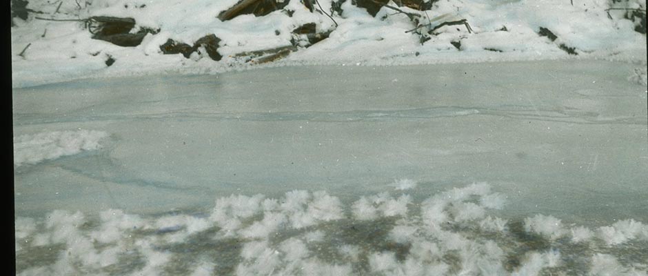
Fig 1 and 2 of the permafrost sheet. Figures 1 and 2 illustrate the results of such an
investigation. Both the frozen and the unfrozen ground consisted of sand and
gravel. The numerals that appear next to the small circles in Figure 1
indicate the depth at which permafrost was encountered. Figure 2 shows the
penetration diagrams for two of the rails which were driven entirely into
unfrozen ground. Experience has led to the following tentative conclusions
regarding the resistance of frozen ground against the penetration of test
rails. If the number of blows per foot of penetration of a test rail
rail with a weight of about 70 lb. per yard, hammer with a weight of 2,200 to 2,500 lb. and
( 70-lb. rail, 2200-ft. hammer a 10-ft. drop) is smaller than 10, the ground
is probably unfrozen, and if it is greater than 12, it is probably frozen.
If the number of blows per foot of penetration is between 10 and 12, one
cannot know whether or not the ground is frozen. As a rule the increase
006a | Vol_IIA-0219
Fig 1
006b | Vol_IIA-0220
Fig 2
007 | Vol_IIA-0221
EA-I. Terzaghi: Soil Mechanics
of the number of blows at the boundary of the permafrost is so conspicuous,
that there cannot be any doubt regarding the location of this boundary.
Otherwise, a few supplementary borings are required. However, before this
procedure is standardized it will be necessary to collect reliable data
regarding the resistance against the penetration of rails into frozen ground
at temperatures close to the freezing point.SOIL TESTING
The laboratory tests for determining the index properties of cohesionless
soils consist of mechanical analysis, which furnished the grain-size character–
istics, and determination of the moisture content. Cohesive soils required the
determination of the natural water content, the Atterberg limits, and the
unconfined compressive strength of relatively undisturbed samples (see “Physics
of Ground Frost”). The necessary equipment includes a small drying oven with
temperature control, accurate scales, and a few pieces of simple apparatus.To get reliable results, all the samples must be carefully protected
against loss of water by evaporation prior to testing and samples of cohesive
soils must be protected against freezing. In order to prevent the deformation
of samples of cohesive soils prior to testing, the samples are taken with thin–
walled tubes or with samplers containing liner tubes. As soon as the samples
come out of the drill hole both ends are sealed with metal disks and paraffin,
and the samples are kept in the tubes until the tests are started.To avoid long-distance transportation and delays the tests are commonly
made in a small soils laboratory attached to the headquarters of the resident
engineer.
008 | Vol_IIA-0222
EA-I. Terzaghi: Soil Mechanics
GEOPHYSICAL METHODS
Since about 1920 civil engineers have made an increasingly extensive
use of geophysical methods for engineering purposes. Some of these methods,
such as the electric potential method , are based on the fact that the geometry
of every field of force depends on the location of the boundaries between the
substances which occupy the field and on the difference between the physical
properties of these substances. Others, known as seismic methods , are based
on the fact that the rate of propagation of elastic waves is a function of
the elastic properties of the materials through which the waves travel. (1). The —
equipment re a q uired for both electric and seismic surveys is compact enough to —
be accommodated, together with the field personnel, on a single car or jeep.Both methods have been successfully used for determining the boundary
between sediments and rock. The application of geophysical methods to the
determination of the upper boundary of the permafrost zone is still in an
experimental sta t g e. —FOOTING AND RAFT FOUNDATIONS
If the bearing capacity of the top layers of the ground is adequate,
structures can safely be established on spread footings, continuous footings,
or rafts. The design of such foundations is commonly based on semiempirical
rules (2, pp. 413-55). However, all these rules presuppose that the base of
the foundation is located below the base of the active zone and that the
subsoil does not contain permafrost. In temperate zones, such as the United
States, this condition is easily satisfied. However, going north, the depth
of the active layer increases and it become a maximum at the fring s e of the — —
permafrost, which coincides approximately with the 0°C. isotherm of the
009 | Vol_IIA-0223
EA-I. Terzaghi: Soil Mechanics
mean annual temperature (see “Physics of Ground Frost”). At that fringe
it may attain a depth up to 15 feet.If the active layer is occupied by a coarse-grained soil such as clear,
coarse sand and gravel, and if, in addition, the water table is permanently
located beneath the base of the active layer, the base of foundations can
safely be installed within the active layer. If the active layer is occupied
by coarse-grained sediments with part of it located below the water table,
alternate freezing and thawing may be associated with a slight heave and
settlement of the surface and of the base of foundations located above the
base of the active layer; but these movements are not necessarily objectionable.
On the other hand, if the soil conditions within the active layer are conducive
to the formation of ice layer (see “Physics of Ground Frost”) the ground move–
ments associated with freezing and thawing can be very important and make it
necessary to establish the base of foundations below the bottom of the active
layer. In the estimate of the depth of the active layer, adequate allowance
must be made for the effect of the future structure on this depth. On the
north side of a large building the thickness of the active layer is likely
to increase and on the south side it will decrease.If an important structure with provisions for heating is constructed
on footings or a raft above a permafrost layer, the thickness of this layer
will be decrease or the layer may completely disappear on account of the increase
of the mean annual temperature over the area covered by the building
(see “Physics of Ground Frost”). The ground movements associated with the
local degradation of the permafrost depend on the thickness of the layer
and the soil conditions within it. If the results of the subsoil exploration
indicate the possibility of important movements, the engineer faces the problem
either of preventing the movements, for instance, by thawing the frozen ground,
010 | Vol_IIA-0224
EA-I. Terzaghi: Soil Mechanics
or else of eliminating the harmful effects of the movements by adequate
design of the superstructure (see “Excavations and Foundations”).PILE FOUNDATIONS
A structure is founded on piles if the bearing capacity of the soil
located immediately beneath the structure is inadequate or if an estimate
of costs indicates that a pile foundation may be cheaper than a shallow one.
Piles may transfer the load either by side friction onto the surrounding
ground or else through their point onto a firm stratum such as a layer of
dense sand and gravel.South of the southern boundary of the permafrost region the depth to
which piles can be driven is limited only by the subsoil conditions. However,
in wintertime and within the active layer, the soil surrounding the piles may
freeze and the frozen soil adheres to the piles. If the soil conditions are
such that the freezing is associated with the formation of ice layers, and if,
in addition, the permanent load on the piles such as those supporting a trestle
is light, the frost may lift the piles many inches and the first application
of the live load after the thaw would cause a settlement by an equal amount.
In a region with a temperate climate, where the depth of the active layer did
not exceed about 4 feet, timber piles were driver late in the fall through a
stratum of saturated silt to refusal in dense sand. The construction of the
foundations was postponed until next spring. After the frost went out of the
ground it was found that the heads of the piles were located from 1 to 4 inches
above their original elevation and it was necessary to redrive them.
011 | Vol_IIA-0225
EA-I. Terzaghi: Soil Mechanics
If the point of a pile strikes permafrost, the pile cannot be driven
any further. Yet after the building is constructed and heated, the perma–
frost inevitably starts to degrade, whereupon the points of the piles lose
their firm support and settlement ensues. If the degradation of the perma–
frost involves the melting of pockets or layers of clear ice located below
the level of the points of the piles, the settlement may even be catastrophic,
though, at the outset, the bearing capacity of the piles was perfectly
adequate.RETAINING WALLS
Retaining walls are designed to withstand the active earth pressure of
backfills in an unfrozen state. If the backfill and ground-water conditions —
are such that winter temperatures may lead to the formation of ice layers,
layers develop not only parallel to the top surface of the backfill, but also
parallel to the back of the wall. During the growth of the vertical layers
the wall is acted upon by a horizontal pressure far in excess of the active
earth pressure and, as a consequence, the wall moves out. To prevent an
excessive outward movement due to the freezing of the backfill, it is necessary
to intercept the free communication between the backfill and the adjoining
aquifers by adequate drainage provisions (2, p. 320). The drains convert the
backfill from an open into a closed system (see “Physics of Ground Frost”).STABILITY OF SIDE SLOPES OF OPENCUTS
In the theories of the stability of slopes, it is assumed that the soil
beneath the slope is acted upon by no forces other than those that are produced
by the force of gravity. During the formation of ice layers the soil is also
acted upon by the forces produced by the freezing of the water contained in
012 | Vol_IIA-0226
EA-I. Terzaghi: Soil Mechanics
the soil. If the freezing is associated with the formation of ice layers,
the process of freezing causes the body of soil to split open along the
seats of layer formation and the growth of the layers is associated with an
increase of the average water content of the soil next to the slope, which
could not possibly be produced by the force of gravity. Furthermore, while
the ice layers melt, the structure of the soil between the layers disintegrates.
Therefore, the stability conditions that prevail on slopes during the thawing
period are entirely beyond the scope of the conventional theories of the
stability of slopes, and the soil movements that occur during the period of
thawing have little resemblance to slope movements caused by gravity alone.SLOPE OF FILLS
The slopes of fills cannot be expected to be stable throughout the year
unless the fills were made out of unfrozen ground. If a fill of fine-grained
material such as silt or silty sand is located above an aquifer, ice layers
may form parallel to its slopes during the winter season, whereby the water
that enters the layers is drawn by capillarity out of the aquifer. Subsequent
melting would cause a failure of the slopes by solifluction in spite of all
the precautions which may have been observed during the construction of the
fill. This danger can be eliminated or at least greatly reduced by inserting
a well-drained layer of clean gravel between the base of the fill and the
natural ground. This layer intercepts the capillary flow of water from the
ground into the fill and converts the fill into a “closed system” (see “Physics
of Ground Frost”). Further improvements can be achieved by covering the crest
and the slopes of the fill with a relatively impermeable layer of soil.
013 | Vol_IIA-0227
EA-I. Terzaghi: Soil Mechanics
The presence of such a cover reduces the maximum degree of saturation of
the fill material to less than 100 per cent. Hence, this precaution
eliminates entirely the possibility of ice-layer formation within the fill. —Karl Terzaghi
BIBLIOGRAPHY
1. Heiland, C.A. Geophysical Exploration . N.Y., Prentice-Hall, 1940.
2. Terzaghi, Karl, and Peck, R.B. Soil Mechanics in Engineering Practice .
N.Y., Wiley, 1948.