-
Outline of the Economic Geology of Alaska
Encyclopedia Arctica Volume 1: Geology and Allied Subjects
Unpaginated | Vol_I-0133
EA-I. (Robert E. Fellows)
OUTLINE OF THE ECONOMIC GEOLOGY OF ALASKA
CONTENTS
Page Introduction 1 Mentallic Mineral Resources 4 Significant Metals 5 Antimony 5 Chromium 6 Copper 7 Gold 9 Mercury 12 Platinum Group 13 Less Significant Metals 17 Iron 17 Molybdenum 18 Nickel 19 Silver 20 Tin 23 Tungsten 25 Nonmetallic Mineral Resources 25 Principal Nonmetallic Minerals 25 Asbestos 26 Barite and Witherite 27 Fluorite 29 Graphite 30 Gypsum 31 Limestone and Marble 32 Sulfur 33 Minor and Miscellaneous Nonmetallic Minerals 36 Building Stone 36 Clay and Claystone 37 Garnet 37 Jade 38 Pumice and Pumicite 38 Sand and Gravel 38 Shale 39 Quartz Crystals 39 Resources of Mineral Fuels 40 Petroleum 41
Unpaginated | Vol_I-0134
EA-I. Fellows: Economic Geology
LIST OF FIGURES
Page Fig.1 Map of Alaska showing regions and districts 2 -a
001 | Vol_I-0135
EA-I. (Robert E. Fellows)
OUTLINE OF THE ECONOMIC GEOLOGY OF ALASKA
INTRODUCTION
The mineral industry has played, and will continue to play, a leading
role in the economic and industrial development of Alaska. Mining has long
ranked second only to fishing as Alaska’s principal industry, although in
the war and postwar years the construction industry has greatly outranked
both. Since the purchase of Alaska from Russia in 1867, the exploration
and exploitation of the mineral resources have shared with the fur industry
in constituting the lure that has led the white man over much of the
Territory, even into most of its remote and inaccessible parts.Alaska is approximately one-fifth the size of the United States, and
it includes a wide variety of geologic environments. As might be expected,
the Territory also includes a wide variety of types and kinds of mineral
deposits but the mineral resources as yet are by no means adequately
appraised. Because of such factors as the undeveloped nature of the Territory,
the long distances, the difficult terrain in many areas, climatic factors to
a certain extent, and the high cost of transportation, the mineral production
thus far has been largely of high-value, low-volume mineral products of the
kind that are relatively easily concentrated into marketable form under
frontier conditions. Chief of these, of course, in gold. One notable
002 | Vol_I-0136
EA-I. Fellows: Economic Geology
exception is copper which has been produced in Alaska largely form the
Fig. 1 Kennecott deposits in the Nizina district, Copper River region (Fig.1),
where phenomenally large and rich deposits were developed at a time when
the price of this metal was high. These deposits justified the building of
transportation facilities, the Copper River and Northwestern Railroad, from
the coast at Cordova. Another exception is coal, which has been produced
in quantity in the Alaska Railroad belt. Coal is one of the few Alaskan
mineral products that has been used virtually entirely in the region in
which it was produced. The value of Alaska’s mineral production from 1880
until the present approximates a billion dollars. The major portion of this
figure can be attributed to the value of gold and copper production. Coal,
silver, and platinum have been produced in important quantities and at least
a dozen other mineral commodities have contributed to the total value of
Alaska’s mineral production.It is expected that the mineral industry will increase not only in size
but also in diversity. Although the mining of gold will probably constitute
the largest part of Alaska’s mineral industry for many years, increases in
the mining of minerals now produced in small quantities only, and the start
of mining of minerals not now produced at all, will assist greatly in the
sound and stable development of the Territory. One field of mining that so
far has been neglected is the production of construction materials for
consumption in the Territory. This appears to be an especially suitable field
for development, for two Salient reasons: Alaska is experiencing a major
constructional boom and relatively large quantities of construction materials
are needed; and the cost of importing construction materials into Alaska is
exceptionally high.
002a | Vol_I-0137
Fig. 1
003 | Vol_I-0138
EA-I. Fellows: Economic Geology
The Geological Survey has been engaged for approximately half a century
in investigating the mineral resources of Alaska and the geologic environ–
ments in which they are found. Except for investigations made during recent
years, since shortly before the start of World War II, most of the studies
have been of a rather general nature. This was necessary in order that a
general understanding be obtained of the character, distribution, interrela–
tionships, and geologic setting of Alaska’s mineral resources.The Geological Survey has published a considerable number of geologic
data bearing on Alaska’s mineral resources. These have been published in
the form of bulletins, professional papers, annual reports, circulars, and
oil and gas sheets. In addition to these reports many unpublished manuscripts
now are being processed for publication. Many of the reports written during
World War II have been released in open file or in mimeographed from for
limited distribution; others contain confidential information, hence have not
been made available to the public. In compiling this article the author has
made free use of the background information accumulated by his colleagues in
the Geographical Survey. For more complete descriptions of individual mining
properties and for information covering production and reserve figures for
Alaska’s mineral resources, the reader is referred to published data available
from the Geological Survey and the Bureau of Mines in Washington, D.C., and
from the Territorial Department of Mines in Juneau.An effort has been made to restrict the use of geographic place names
as much as possible and to tie those names which are used to an index
map (Fig. 1).This article treats the mineral deposits of Alaska under the three major
headings of metals, nonmetals, and fuels. The statements which follow deal
004 | Vol_I-0139
EA-I. Fellows: Economic Geology
with the geographical distribution and geologic occurrence of the minerals
within the three major groups. The descriptions of the minerals are
arranged alphabetically, although a major portion of the space is devoted
to a discussion of those mineral commodities which are considered to have
more than average potentialities in the future of Alaska’s mining industry.METALLIC MINERAL RESOURCES
Deposits of metallic minerals are widely scattered throughout Alaska.
Those which can be considered to have greater than average potentialities
include antimony, chromium, copper, gold, mercury, platinum group, zinc,
and, to a lesser extent, lead.Gold, which has been recognized as the backbone of Alaska’s mining
industry in the past, also holds the spotlight for the future. Estimates
of reserves of placer and lode gold suggest that the amount of gold still
unclaimed is at least as large as that which has been produced.Several metal deposits, which are considered marginal or submarginal
under present economic conditions, can be expected to take their places
as producers as soon as the prices of the metals rise, and as soon as
cheaper labor and transportation facilities are available. The development
of Alaska can be expected to aid in producing incentives to the mining
industry and to spark the opening of new mines or the reopening of old mines.Any well-planned and well-conducted development program for the Territory
will include the further development of the mining industry. Each of the
metals in the group listed above is potentially important as a contributor
to the implementation of the industrial future of Alaska.
005 | Vol_I-0140
EA-I. Fellows: Economic Geology
In addition to these more important metals the Territory can claim small
to moderate amounts of, among others, iron, molybdenum, nickel, silver, tin,
and tungsten. Deposits containing each of these metals are exposed in
natural outcrops or in prospect pits and small workings; or they are produced,
or have been produced, in small to moderate amounts, mostly as by-products
from deposits worked primarily for another metal.Because of the large areas of the Territory still to be explored and
prospected, and because of the continual changes to be expected in mineral
economics during the development of the Territory, it is reasonable to expect
that estimates of metal reserves in Alaska will increase, and that mining
will maintain its importance as a major industry as the Territory develops.Significant Metals
Antimony . Deposits of antimony, most of which are small, are widely
distributed in Alaska. At least 50 antimony deposits are scattered through
two general areas in the Fairbanks district, Yukon region. These are the
Ester Dome area, about 10 miles northwest of Fairbanks, and the Pedro Dome
area, about 14 miles northeast of Fairbanks. Several antimony deposits
occur along the north slope of the Alaska Range. These include two deposits
in the Kantishna district, about 120 miles w s outwest of Fairbanks: ( 1 ) the ✓
Stampede deposit on Stampede Creek, and ( 2 ) a deposit on Slate Creek.
Another deposit is on Stibnite (or Boulder) Creek, a tributary of the Tok
River, in the Tok district, Yukon region, about 180 miles southeast of
Fairbanks. Antimony is associated with mercury in the Georgetown district,
Kuskokwim region, near Sleetmute on the Kuskokwim River. A small deposit,
occurs in southeastern Alaska, near Caamano Point, at the south tip of the
Cleveland Peninsula in the Ketchikan district, about 16 miles northwest from
006 | Vol_I-0141
EA-I. Fellows: Economic Geology
Ket c hhikan. Antimony is also present in the Juneau district, at Carl s son ✓
Creek, Taku Inlet, a few miles east of Juneau. In addition to the above
places antimony has been reported at numerous other localities in the
Kuskokwim and Yukon regions, and on the Seward and Kenai peninsulas.Stibnite (antimony trisulfide) is the only economically important
mineral of antimony in Alaska. It is commonly disseminated in quartz
veins or concentrated in pockets and lenses within veins. Most of these
veins are auriferous, and many of the stibnite deposits have been discovered
through mining for gold. In some deposits stibnite is associated with
cinnabar. The veins commonly occur in schist, quartzite, greywacke, or
shale; a few are in limestone. These rocks range widely in age. Most of
the know deposits are near acidic intrusive bodies and all those known are
within a few hundred feet of the surface.Chromium . Significant reserves of chromite (oxide of chromium and iron)
are known in Alaska only in the Seldovia district on the south end of the
Kenai Peninsula in the Cook Inlet region. Though small in comparison with
deposits of similar grade in other parts of the world, the deposits on the
Kenai Peninsula contain the largest known reserves of high-grade chromite
in the United States or its territories. These deposits are known in two
localities: ( 1 ) an area of about one square mile at Claim Point; and ( 2 )
an area of about 14 square miles at Red Mountain. Occurrences of chromite
also are known in the Anchorage district in the Chugach Mountains near the
head of Cook Inlet, near Livengood, in the Tolov a na district of the Yukon
region, and in southeastern Alaska, in the Baranof district on Baranof
Island, and on the Cleveland Peninsula, northwest of Ketchikan.
007 | Vol_I-0142
EA-I. Fellows: Economic Geology
The deposits constitute parts of dunite and serpentine bodies in which
chromite has been concentrated. In general, the higher-grade deposits are
tabular bodies of banded ore. Chromite concentration within the bands is
not constant, and the ore contains chromic oxide (Cr 2 O 3 ) in amounts ranging
from a few per cent to more than 50 per cent.Copper . The principal known Alaskan copper deposits are grouped in
three general areas: southeastern Alaska, Gulf of Alaska, and overlapping
the boundary between the Copper River and Yuknon regions. In southeastern
Alaska the deposits are in the Wales district on Kassan Peninsula, at Copper
Mountain, and other places on Prince of Wales Island and adjacent islands;
and in the Chichagof, Admiralty, and Baranof districts on Yakobi, Chichagof,
Admiralty, and Baranof Islands. The deposits in the Gulf of Alaska region
are grouped in the northeastern part of the Prince William Sound area in the
Valdez district in the vicinity of Ellamar and Valdez, and in the southeawestern ✓
part of the Prince William Sound area in the vicinity of Latouche. The copper
deposits of the Copper River and Yukon region are grouped in the drainage
basin of the upper part of the Chitina River in the Kuskulana and Nizina
districts, and near the heads of the Nabesna River and the White River in
the Chisana and White districts.Three other general areas which are little known but of possible
importance include the Il l iamna Lake district in southwestern Alaska and ✓
the Kobuk and Noatak districts in northern Alaska.The deposits of the Wales district in the southeastern Alaska occur in ✓
metamorphosed sedimentary rocks, which commonly contain interbedded
greenstone and limestone beds. A magnetite ore with which copper minerals
are associated is the most abundant material in many of the deposits on the
008 | Vol_I-0143
EA-I. Fellow: Economic Geology
Prince of Wales Island. The magnetite replaces beds of limestone, and, to
a lesser extent, greenstone. Magnetite also occurs on as fissure fillings ✓
and replacement bodies in fault and shear zones. Chalcopyrite (copper-iron
sulfide) and pyrite (iron disulfide) constitute as much as 5 per cent of
the magnetite ore. Gold and silver are present locally in recoverable
quantities. At the Salt Chuck mine at the north end of Kas s a san Bay on Kasaan
Prince of Wales Island, however, bornite (a c e o pper and iron sulfide) and ✓
chalcopyrite occur in an intrusive complex of gabbro and pyroxenite. In
some parts of the ore bodies at the Salt Chuck mine as much as one-fourth
of an ounce of palladium per ton of ore is associated with the copper
minerals.The deposits in the northern part of southeastern Alaska are principally
ores containing pyrrhotite, pentlandite and chalcopyrite. These minerals are
disseminated in, or closely associated with, intrusive bodies of norite,
amphibolites, pyroxenite, and olivine gabbro.The deposits in the vicinity of Prince William Sound occur in or near
areas in which basic lava flows are interbedded with alate and graywack s e ✓ .
Chalcopyrite is the principal copper mineral in these deposits. It commonly
occurs, associated with pyrrhotite, pyrite, and other sulfide minerals, in
shear zones. The copper-iron sulfide chalmersite is present in some deposits.
Locally, recoverable amounts of gold and silver are present in the c opper u o res. ✓The copper ores in the drainage basin of the upper part of the Chitina
River occur in two formations, a thick series of basaltic greenstone flows and
an overlying sequence of limestone beds. Minor amounts of copper are abundant
in the greenstone, but the major deposits of copper are in the basal part of
the limestone. Chalcocite (a copper sulfide) is the most abundant copper
009 | Vol_I-0144
EA-I. Fellow: Economic Geology
mineral in the limestone beds; bornite and chalcopyrite are most abundant
in the greenstone. In both greenstone and limestone, the copper minerals
are disseminated through the host rock or occur as replacement bodies and
cavity fillings. The deposits at Kennecott, which have been worked out,
were largely replacement bodies along fracture planes in limestone.The copper deposit at Orange Hill, Yukon region, is on the northeast
side of the Wrangell Mountains near the foot of the Nabesna Glacier , . ✓
Metamorphosed sedimentary rocks, including thick limestone beds with inter–
bedded lava flows, have been intruded by a mass of quartz diorite. Copper
occurs in the quartz diorite as disseminated grains of chalcopyrite and as
veinlets containing chalcopyrite, pyrite and molybdenite, together with gold
silver and some nonmetallic minerals. The deposit is of large size but has
a low copper content so that its value depends also on the tenor of the associated
metals — molybdenum, gold, and silver.Gold . The principal deposits of placer gold in Alaska include both beach
and stream types. The chief productive beach placers are those in the Nome
district on the Seward Peninsula, both others occur on Kodiak Island and at
Lituya Bay, Gulf of Alaska region. Most of the rest of the placers are stream
deposits, although residual and glacial placers that have been modified by
streams are recognized in several district. Deposits of present streams and
buried or elevated deposits of ancient streams are represented in practically
all of the larger, more productive districts. Most of the bonanzas are
probably results of reconcentrations effected through more than one period
of sorting by stream or wave action. Placers commonly are found near the
margins of areas of intrusive rocks, mainly of granitic composition, which
are widely distributed throughout Alaska.
009a | Vol_I-0145
EA-I. Fellows: Economic Geology
Many of the lode-gold deposits are in areas of intrusive igneous rocks,
mainly of granitic composition. In the Juneau district the most productive
deposits are in wide, low-grade, stringer lodes that largely follow the
foliation of schistose or slaty country rocks. Elsewhere in Alaska, lode
deposits have been found in shear zones, fissure veins, contact metamorphic
deposits, and stringer lodes in foliated or shattered rocks. The gold of the
lodes that have been mined is generally free and commonly is associated with
only small amounts of f s ulfide minerals. Alaskan gold is associated, in general, ✓
with only small amounts of silver.Southeastern Alaska outranks all other regions in the production of gold from
lode deposits and most of the production of that region has come from the
Juneau and the Chichagof districts. The wide distribution of gold placers in
Alaska suggests that gold lodes are probably much more widespread than is
indicated by their known distribution and development. Important placer
production has come from many widely distributed districts of which the
Nome and Fairbanks districts are sufficiently outstanding to merit specific
mention.Quantitative data regarding most known Alaskan placer deposits are so
inadequate that estimates of reserves can be little better than surmises.
In 1930, the placer-gold reserves were estimated to be at least twice the total
production up to that time, which was approximately 12½ million ounces. Since
1929, production of placer gold has amounted to more than 4½ million ounces
and the estimates of reserves have likewise been stepped up as a result of new
discoveries.The more productive areas are listed in Table I with a qualitative
estimate of reserves. It should be realized that many of the now less productive
010 | Vol_I-0146
EA-I. Fellows: Economic Geology
areas hold promise of containing significant placer reserves that in time may
eclipse the production of some of those specifically mentioned.Table I. Estimated Reserves in the More Productive Alaskan Placer-Gold Areas.
(Breakdown only in part according to Fig. 1)Placer-gold areas Reserves Copper River region: Nizina Moderate Chisna-Slate Creek Moderate Susitna Basin: Scattered areas Moderate Yukon Basin: Fortymile Large Circle Large Fairbanks Large Tolovana-Livengood Moderate Hot Springs-Rampart Large Koyukuk Large Ruby-Poorman Large Innoko-Tolstoi-Takotna Large Iditarod Large Marshall Moderate Kuskokwim region: Scattered areas Large Seward Peninsula: Nome Bluff Large Candle-Inmachuk Large Kougarok Large Northern Alaska: Kobuk River Moderate Chandalar Moderate Wiseman Moderate
Estimates of lode-gold reserves are even more speculative than those of
placer reserves. About three-fifths of the lode-gold production of the
Territory immediately before the war came from the operations of one company,
the Alaska Juneau Gold Mining Company, at Juneau, in southeastern Alaska.
011 | Vol_I-0147
EA-I. Fellows: Economic Geology
That company, through large-scale and extremely economical operations, made
possible in part by favorable geologic conditions, was mining a low-grade
deposit of great vertical and surface extent.Next in importance among recently productive lode mines in southeastern
Alaska are the Hirst-Chichagof and Chichagof properties on the west coast of
Chichagof Island. Reserves in that district are estimated to be large but the
difficulty and cost of tracing ore may limit full exploitation of the reserves.The principal lode-gold mining areas elsewhere in Alaska are the Willow
Creek district (Wasilla district of Fig. 1) near the head of Cook Inlet, and
the Fairbanks district. In the past, cost of operations generally has limited
mining to ores averaging $30.00 or more per ton. Many of the known deposits
contain large reserves of lower-grade ore which might be profitable if handled
by improved mining and milling practices. Reserves in both of these districts
are probably considerably larger than their past production.The total production from all other lode-gold mines has been considerably
less than the production from any one of the districts mentioned, yet the wide
distribution of placer gold indicates the existence of extensive bedrock
mineralization. In the past the prospector has focused his attention on more
easily and cheaply won placer gold. Lode mining in undeveloped areas under
severe climatic conditions is difficult and generally is restricted to high–
grade deposits of free-milling ore. Development of the Territory would
undoubtedly bring many known lode deposits within the range of economic operation
and might result also in the discovery of other deposits. In the past the
lode-gold production has been predominantly from free-milling ores. If the
mining of base-mental ores in Alaska develops on a larger scale, substantial
amounts of gold would be produced from them either as the principal mineral
012 | Vol_I-0148
EA-I. Fellows: Economic Geology
of value or as an important by-product. Potential lode-gold reserves have
been little developed but are known to be large. Lode production has been
only a little more than half of placer production; but lode reserves actually
may be even larger than potential placer reserves.The increase in the price of gold from $20.67 to $35.00 an ounce, together
with the decline in the relative prices of other commodities during the de–
pression, was a powerful stimulus to Alaskan gold production, carrying the
value of both placer and lode production to an all-time high in 1940. The
government’s order declaring most gold mining nonessential during World War II
caused a sharp decline in Alaskan gold production from 1940 to 1944. The output
of Alaskan gold in 1944 was 49,296 fine ounces as compared with the 1940
peak of 755,970 ounces. Some increased activity was noted in 1945, and a
marked increase took place in 1946, although production still remained con–
siderably below the pre-war level. Gold production continued to increase
during 1947 but not in 1948.Further increase in gold output can be expected, although the fixed
price of gold in relation to mounting labor and other production coats may
continue to force marginal producers to close down or prevent them from
opening or reopening mines.Mercury . Practically all of the known mercury deposits are south of
the Yukon River and west of the Alaska Range. The principal deposits are
in the Georgetown district, six to nine miles northwest of Sleetmute, near
the Kuskokwim River. Sleetmute is a settlement on the Kuskokwim River about
30 miles southeast from Georgetown. Another deposit is near DeCour e c t Mountain, ✓
southwest of Flat, in the Iditarod district. A third deposit is also in the
Georgetown district in the vicinity of Cinnabar Creek, about 85 miles southwest
013 | Vol_I-0149
EA-I. Fellows: Economic Geology
of Sleetmute. A fourth is in the Tikchik district, southwestern Alaska,
near Aleknagik, on March Mountain, about three miles from the Wood River.The geologic setting of all the mercury deposits mentioned is remarkably
similar. The mercury is in the form of cinnabar (mercuric sulfide) and
occurs in close association with basaltic sills and dikes that intrude
interbedded shales, argillites, and graywackes. The dikes and sills, and
locally the intruded country rock, have been largely altered. Cinnabar is
localized principally in breccia zones at the borders of the sills and in
bedding-plane joints in the shale. Placer cinnabar is found in streams near
the lodes. The placer cinnabar and the yellow color of the altered rock are
valuable aids in prospecting.Platinum Group . Platinum metals have been found at a number of localities
in Alaska, the more significant of which are listed below.- Goodnews district in the Kuskokwim region.
- Kasaan Peninsula in the Wales district in southeastern Alaska.
- Koyuk and Fairhaven districts in eastern Seward Peninsula
- Gulkana district in the Copper River region.
- Lituya district in the Gulf of Alaska region.
- Kodiak Island in southwestern Alaska.
- Kehiltna River and some of its tributaries in the Yentna districts,
Cook Inlet region. - Circle and Eagle districts, in east-central Alaska, in the Yukon region.
The platinum placers of the Goodnews district are the most important source
of platinum metals, not merely in Alaska, but also in the United States and its
possessions. These deposits occur in the valley of the Salmon River, and in the
valleys of several of its western tributaries, which, named from north to south,
014 | Vol_I-0150
EA-I. Fellows: Economic Geology
Clara, Dowry, Boulder, and Platinum creeks. Deposits a i l so are known in the ✓
northern tributaries of Platinum Creek.Ultrabasic intrusive rock in the form of dunite occurs in the northern
half of the valley of the Salmon River. All the streams that head in the
dunite and flow eastward to the Salmon River, contain platinum-bearing
gravels. The dunite, therefor e , appears to be the source of these metals, ✓
even though they were not shown by a chemical analysis of a composite sample
of the rock. Similarly, nuggets of placer platinum intergrown with chromite
have been found, and a great amount of chromite is present in the placers;
yet no chromite has been found in place in the dunite. It is therefore
believed, either that the platinum-bearing horizons in the dunite have been
completely eroded, or that the placers have accumulated very slowly from
exceedingly low-grade bedrock sources.The metals of the platinum group from the Goodnews district include
platinum, iridium, osmium, ruthenium, rhodium, and palladium, together with
a little free gold.All of the other platinum-bearing localities mentioned above, except the
Kasaan Peninsula, are known to contain only placer deposits, and these include
beach, bench, and stream placers. The production from all of them has been
minor and far less in value than the gold produced. At the Salt Chuck mine
at the north end of Kasaan Bay, as has already been stated in the section on
copper, an intrusive complex of gabbre and pyroxenite contains as much as
one-fourth of an ounce of palladium per ton of ore associated with bornite
and chalcopyrite. The palladium is recovered in the smelting of the copper ore.Zinc and Lead . Both zinc and lead deposits have been reported from widely
scattered localities throughout Alaska. Almost all of the deposits for which
reserves can be estimated, with information now available, are on or near the
015 | Vol_I-0151
EA-I. Fellows: Economic Geology
mainland of southeastern Alaska. These include deposits at Groundhog Basin,
Glacier Basin, Berg Basin, and the Lake Claims, all of which lie in the
Wrangell district on the mainland ea ch st of Wrangell; Tracy Arm in the ✓
Petersburg district, about 60 miles south of Juneau; Moth Bay on Revillagigedc
Island in the Ketchikan district; Dora Lake in the Wales district on Prince
of Wales Island; and Mahoney Creek in the Ketchikan district, south of
Ketchikan. Argentiferous lead deposits are known in the Hyder district, and
lead was recovered from the gold ore of the Juneau district.Measureable reserves also are contained in the zinc deposits at Mount
Eielson in Mount McKinley National Park in the Kantishna district. In addition
to these, zinc is present apparently in substantial amounts on Unga Island
in the Shumagin district in southwestern Alaska, south of the Alaska Peninsula,
and on Sedanka Island near the east end of the Aleutian chain, southeast of
Dutch Harbor. Both zinc and lead deposite are known in the Iliamna Lake
district in southwestern Alaska, on Omilak Creek, north of Golofnin Bay, in
the Council district on Seward Peninsula, and near Kantishna and south of
Ruby in the districts of the same names in the Yukon region.The zinc and lead deposits may be divided roughly into three categories:
( 1 ) those of value primarily for their sphalerite (zinc sulfide) content;
( 2 ) those important for their silver-bearing galena (lead sulfide) content;
( 3 ) and those in which sphalerite and galena are minor constituents in
precious-metal ores.The deposits of value, chiefly for their sphalerite content, generally
are relatively low-grade, and contain small amounts of lead and silver. Copper
minerals are abundant in some of these deposits. The ore bodies at Groundhog
and Glacier basins east of Wrangell, Moth Bay on Revillagigedo Island, Tracy Arm,
016 | Vol_I-0152
EA-I. Fellows: Economic Geology
and Mount Eielson belong in this category. A small fissure vein, important
for its sphalerite content, occurs at Mahoney Creek, south of Ketchikan.The principal metallic minerals of the Groundhog Basin and Glacier Basin
deposits are pyrrhotite, sphalerite, and galena. These minerals partly
replace beds of pyro z x ene granulite in a sequence of gneisses and schists ✓
that forms part of the Wrangell-Revillagigedo belt of metamorphic rocks
lying adjacent to the Coast Range batholith. The deposits are low grade but
are known to have a considerable vertical and lateral extent. The deposits
at Tracy Arm and Moth Bay also are sphalerite and chalcopyrite replacement bodies ✓
in gneiss.A contact metamorphic deposit at Mount Eielson contains sphalerite,
galena, and chalcopyrite replacing limestone.The silver-bearing galena deposits are small, but some are high grade.
They commonly occur in limestones and metamorphic rocks near granitic
instrusions. Sphalerite is a minor constituent. Many ore bodies are veins
or fissure fillings and some are limestone replacement bodies. Deposits of
this type at Hyder consist of silver-bearing galena with pyrite, sphalerite,
tetrahedrite, and other sulfide minerals in veins which transect granitic
and metamorphic rocks. The little-developed deposit at Berg Basin, east of
Wrangell, appears to be geologically similar.Galena and sphalerite are minor constituents in the precious-metal lodes
of the Juneau gold belt in southeastern Alaska. These large, low-grade,
quartz-stringer lodes contain small percentages of galena and insignificant
amounts of other sulfide mineral. Large-scale, low-cost mining for gold
permits the recovery of galena.
017 | Vol_I-0153
EA-I. Fellows: Economic Geology
Less Significant Metals
It is emphasized that the knowledge of Alaskan mineral deposits is
decidedly inadequate and it is entirely possible that some of the metals
described in this section eventually may prove to be of equal or even greater
importance than those already describe [?] d . The lead deposits of Alaska really ✓
belong in this secondary group but they have been described together with
the zinc deposits because the two metals are commonly associated in the
deposits, either one or the other being the principal metal, and, therefore,
to separate them would be difficult. From the standpoint of past and probably
also future production, silver possibly should have been included in the more
significant group. This has not been done because most of the production has
been as a by-product of the mining of gold and a short statement in this
section describing the silver-bearing deposits appears justified.Iron . Iron deposits are known at widely separated localities in Alaska.
Among these are the deposits in the Wales district on the Prince of Wales
Island, particularly Kasaan Peninsula, in southeastern Alaska; in the Haines
area of the Skagway district, also in southeastern Alaska; near Iliamna in
the Iliamna Lake district, southeastern Alaska; north of Eagle in the Yukon
region; and in the Kobuk district in the vicinity of the Shungnak Hills,
northern Alaska. The known ore bodies probably do not represent the total
iron reserves of the Territory.Most of the known deposits of iron ore in Alaska can be classified as
either magmatic or contact metamorphic. Magnetite (ferrous-ferric oxide)
is the principal ore mineral in each type of deposit s . The magmatic deposits ✓
are titaniferous and contain appreciable amounts of phosphorus, whereas the
contact metamorphic deposits are higher in sulfur content, practically free
018 | Vol_I-0154
EA-I. Fellows: Economic Geology
of titanium and phoshorus and may contain recoverable amounts of gold,
silver, and copper. The latter type appears to be the more abundant and
comprises copper-bearing magnetite deposits which have been found in the
search for copper and gold ores.Molybdenum . Although molybdenum minerals are known at more than
40 localities in Alaska, only a few deposits have been prospected in any
detail, and none have been worked commercially. No shipments of molybdenum
ore have been made other than for experimental tests. Four of the deposits
have been sufficiently prospected to afford some figures of tonnage and grade.
Three of these localities — Shakan in the Wales district on Kosciusko Island,
which lies off the northwest shore of Prince of Wales Island; Muir Inlet in
the Glacier Bay district; and Baker Island also in the Wales district, west
of Prince of Wales Island — are in southeastern Alaska near tidewater; the
other, Orange Hill, is in the Chisana district, Yukon region, near the head
of the Nabesna River.The molybdenum deposit near Shakan on Kosciusko Island is about half a
mile from tidewater. Molybdenite (molybdenum sulfide) occurs in a narrow
brecciated fault zone in hornblende diorite. The associated minerals are
quartz, albite, orthoclase, calcite, epidote, biotite, chlorite, sericite,
zeolite, pyrrhotite, pyrite, chalcopytie, and sphalerite.The molybdenite deposite at Glacier Bay is near the head and on the east
side of Muir Inlet. A small body of quartz manzonite intrudes Paleozoic
sendimentary rocks. The molybdenite occurs principally in silicified fault
zones and in a stockwork deposit in a silicified contact aureole surrounding
the quartz monzonite. The associated minerals are chiefly quartz, [?] a mphibola, ✓
epidote, and pyrite.
019 | Vol_I-0155
EA-I. Fellows: Economic Geology
Molybdenite occurs at tidewater on the east side of Baker Island, west
of Prince of Wales Island. It is present chiefly in a body of quart s z diorite ✓
that intrudes argillite and greywacke. A roughly circular area of the in–
trusive body includes rocks that are highly silicified and locally albitized.
The molybdenite is disseminated in this altered quartz diorite and in the
quartz veinlets that out it. A large tonnage of this low-grade material is
present.Orange Hill is on the east side of the Nabesna River, about 12 miles south
of the terminus of the Nabesna Road, a branch road from the Richardson Highway.
A body of quartz diorite intrudes Permian limestone, greywacke, and greenstone.
The quartz diorite and locally the adjacent limestone have been mineralized
with copper, molybdenum, gold, and silver. Molybdenite occurs principally
in innumerable quartz veins and as disseminated grains in the quartz diorite.
The associated minerals are quartz, calcite, gypsum, pyrite, and chalcopyrite.Nickel . Large-low-grade nickel deposits in Alaska constitute a substan–
tial proportion of the reserves within the United States and its territories.
Virtually all the known reserves are in southeastern Alaska, principally in
and near Bohemia Basin on Yakobi Island in the Chichagof district about 75
miles airline, west of Juneau. Other significant deposits include those near
Funter Bay in the Admiralty district on Admiralty Island, those at Mirror
Harbor in the Chicagof district on the west coast of Chichagof Island, and
those at Snipe Bay in the Baranof district on Baranof Island about 45 miles
south of Sitka. Near Spirit Mountain in the Breamner district, Copper
River region, are small, low-grade deposits.The nickel deposits of Alaska are sulfide-bearing parts of bodies of
norite or related basic rocks. Those in southeastern Alaska are in the
020 | Vol_I-0156
EA-I. Fellows: Economic Geology
noritic parts of composite stocks or in sills of basic rocks. The deposits
at Spirit Mountain are in a discontinuous sill of altered basic rock.Most of the individual deposits are large; some contain several million
tons of low-grade material. In addition to the large, low-grade deposits
are a few, much smaller, higher-grade deposits. The metallic minerals in
the deposits are principally pyrrhotite, pentlandite, chalcopyrite, and
magnetite. These minerals are generally disseminated throughout the parts
of the basic-rock bodies that constitute the deposits. The principal nickel
mineral is pentlandite (iron-nickel sulfide). In general the deposits con–
tain only a little less chalcopyrite. The deposits apparently contain
virtually no gold, silver, or metal of the platinum group.Silver . Although silver has been found in numerous widely separated
deposits in Alaska, it cannot be considered an abundant metal. Many deposits
in southeastern Alaska, valuable principally for gold, copper or zinc, contain
appreciable amounts of silver. These include a number of prospects in the
Hyder, Warngell, and Juneau districts. Silver occurs in significant amounts
in scattered gold and galena deposits in the central and northern portions
of the Kenai Peninsula in the Hope and Tustumena districts, Cook Inlet region,
Silver minerals are reported from deposits in the Chulitna district of the
Cook Inlet region, the Kantischna district in the Alaska Railroad belt of the
Yukon region, and from Orange Hill in the Chisana district, Yukon region.The better-known silver-bearing deposits in southeastern Alaska are in
the Juneau and Hyder districts, on the Kasaan Peninsula in the Wales district,
and at a number of other places in the belt of metamorphic rocks west of the
Coast Range instrusives on the mainland.
021 | Vol_I-0157
EA-I. Fellows: Economic Geology
Silver is not abundantly associated with gold in Alaskan deposits.
In large-scale mining operations, however, such as at the Alaska Juneau mine at ✓
Juneau, the tonnage is large enough to contribute an appreciable quantity
of silver as a by-product of gold mining. In the Juneau district, the
silver-bearing gold ore occurs in low-grade stringer lodes which follow the
foliation of schistose or slaty country rock.In the Hyder district, in numerous deposits along the Salmon River,
there are exposed abundant metallized quartz fissure veins which cut a
granodiorite intrusive. The metallic minerals in these veins are galena
and pyrite with less abundant sphalerite and silver-bearing tetrahedrite.
The commercial ore forms shoots in quartz veins. In the Fish Creek deposit
near Hyder, the ore is exceptionally rich in silver-bearing tetrahedrite.
Freibergite (silver-copper and iron-zinc sulfanti-monide) and electrum
(gold-silver alloy) occur in some of the deposits nearby.At Kasaan Peninsula, on Prince of Wales Island, the copper and iron
ores yield small amounts of silver. The copper ores contain more silver
than the iron ores, but the grade is low in silver in all deposits.Silver deposits within a belt of schist, gneiss, and crystalline
limestone are found at the Lake Claims, in the Glacier Basin, and in the
Groundhog Basin which are all in the Wrangell district east of Wrangell and
west of the Coast Range batholith on the mainland. At the Groundhog and
Glacier besins the deposits are tabular replacement bodies in gneiss. The
ore minerals are pyrrhotite, silver-bearing galena, and sphalerite, with less
abundant chalcopyrite and pyrite.In the d c entral and northern portions of the Kenai Peninsula silver ✓
occurs in both lode and placer deposits. The lode deposits are of two types:
022 | Vol_I-0158
EA-I. Fellows: Economic Geology
one, silver-bearing gold-quartz veins; the other, silver-rich galena deposits.
The Mayflower lode on Eagle River and prospects on Bear Creek contain
silver-rich galena. The deposits on Bear Creek are localized in a sheeted
zone within a series of graywackes and slates. Nuggets of native silver
have been found in the gravel of Crow Creek, Bear Creek, and Palmer Creek.In the Chulitna district is the Golden Zone which is a large body of
biotite-quartz diorite porphyry intruded into argillite and breccias.
Locally, the porphyry is altered and fractured, and such places include
abundant quartz stringers and disseminated sulfide minerals. The fractured
and mineralized rock contains a few ounces of silver per ton, presumably in
galena. The ore at the Mint mine on Portage Creek is a mixture of sulfide
minerals associated with pyrargyrite and miargyrite. Much of the ore occurs
in vugs along the borders and joints of acidic dikes that cut the brecciated,
black-slate country rock.All the lode prospects and mines of the Kantishna district are on veins
that cut Birch Creek schist. All lodes now known are along the northwest
front of the Alaska Range from Muldrow Glacier southwest to the basin of the
Tonzona River. They lie near the margins of granitic intrusive masses. These
include the deposits on Friday Creek and at Mount Eielson, where galena ore
contains appreciable amounts of silver.Deposits of silver are present at many localities in the Yukon region,
although most of them are too low grade to be considered important. At
Orange Hill in the Chisana district the mineralized rock containing gold,
molybdenum, and copper has silver as a persistent constituent. These metals
are disseminated through quartz diorite and in pockets within the adjacent
limestone.
023 | Vol_I-0159
EA-I. Fellows: Economic Geology.
Tin . Although the known Alaskan tin resources are not large, they
constitute the only significant tin reserves within the United States and
its territories. The deficiency of deposits and the large consumption of
tin in the United States support a continuing interest in domestic sources
of supply.The larger known tin-bearing deposits of Alaska are in two distinct
areas: one, in the York district of the Seward Peninsula; the other, in the
central part of the Yukon Valley from approximately 30 miles east to about
110 miles west of the confluence of the Yukon and Tanana rivers. The Tozi
and Hot Springs districts contain significant placer deposits. The minor
occurrences of cassiterite show that tin mineralization is present in the
part of Alaska extending westward from the vicinity of the international
boundary near the Yukon River, to Cape Prince of Wales at the extremity of
the Seward Peninsula, and southwestward from somewhat north of Fairbanks
nearly to Bristol Bay.Cassiterite (tin dioxide), one of the abundant mineral constituents in
stream gravels, occurs in sufficient natural concentration in parts of the
Seward Peninsula and Yukon regions to form minable deposits. The gravels
formerly mined for cassiterite on Seward Peninsula contained only negligible
amounts of gold, and the value of tin alone had to defray all mining costs.
Cassiterite placers in the Yukon region, however, contain appreciable amounts
of gold. The ratio of the value of gold to tin in the Yukon region placers
for which information is available ranges between 1:1 and 30:1.All the known lode deposits of a c assiterite in Alaska are in the York ✓
district of Seward Peninsula. Some of these deposits contain no valuable
metals except tin; others, such as some deposits in the Lost River area,
024 | Vol_I-0160
EA-I. aFellows: Economic Geology
contain both tin and tungsten. The principal tungsten mineral is wolframite
although scheelite is also recognized. The modes of occurrence of the tin
deposits are best represented by the lodes of the Lost River and Cape Mountain
areas, although additional types of deposits include the association of cassi–
terite with axinite in the contact zone of the Ear Mountain granite, and of
cassiterite with arsenopyrite at Potato Mountain.At Lost River, cassiterite and wolframite are present in ( 1 ) hydrothermally
altered parts of dikes and other bodies of rhyolite porphyry that crop out at
the surface; ( 2 ) the upper part of an unexposed granitic intrusive that was
found by diamond drilling at a depth of several hundreds of feet below the
surface; ( 3 ) quartz, mica, and calcite veinlets that intersect both the
porphyry bodies and the adjacent limestone wall rock and are traceable for
a few scores of feet; and ( 4 ) irregular veinlike zones of silicate alternation
in the limestone.Lode deposits in which cassiterite is the only valuable mineral occur in
the Cape Mountain area. They are, so far as is known, small and irregular,
but a few rich pockets have been found. A number of sites where cassiterite
occurs loose in the disintegrated surface rock have not been prospected, but the
(line missing cf. orig p. 26 bottom line
modes of occurrence are believed to be similar to the known bedrock deposits
in the area. The Cape Mountain deposits include the following types: ( 1 ) lime–
stone partly replaced along granite contacts chiefly by quartz, tourmaline,
cassiterite, and calcite, with or without pyrite; ( 2 ) granite partly replaced
by cassiterite and quartz along shear zones, fractures, dike contacts, and
wall-rock contacts; and ( 3 ) quartz-cassiterite and quartz-mica-cassiterite
veins, with or without tourmaline or greisenized margins, cutting either
limestone or granite.
025 | Vol_I-0161
EA-I. Fellows: Economic Geology
In both lode areas, tin mineralization appears to be a late phase of
igneous activity, and the tin-bearing minerals were deposited in, or adjacent
to, any accessible structures either in parts of the in s trusive masses that ✓
were already solidified or in the surrounding country rock.Tungsten . Occurrences of tungsten minerals are fairly widespread in
Alaska but important tungsten deposits are few. A large but low-grade tungsten
deposit occurs at the Lost River tin mine in the York district in the western
part of the Seward Peninsula. The Fairbanks district in the Yukon region and
the Hyder district in southeastern Alaska each contain two tungsten deposits
in the form of bodies of scheelite (calcium tungstate) that may be economically
significant.Some other gold-quartz veins in the Yukon region, the Seward Peninsula,
southeastern Alaska, and the Cook Inlet region contain minor quantities of
scheelite which might be recovered with gold. Locally, tungsten minerals are
present in gold placer deposits.Tungsten in Alaska occurs in replacement bodies in contact metamorphic
zones and in metallized quartz veins. The g t unsten-bearing ore bodies known ✓
to occur as replacement deposits are some of those at the Lost River mine on
Seward Peninsula and at two localities in the Fairbanks district. Some
tungsten-bearing veins are of value primarily for their gold content. Among
the more important vein deposits are the two tungsten-bearing lodes in the
Hyder district of southeastern Alaska.NONMETALLIC MINERAL RESOURCES
Principal Nonmetallic Minerals
In general, information about Alaskan deposits of nonmetallic minerals is
even more incomplete than about the metallic mineral deposits. Also the
actual commercial value of the nonmetallic mineral deposits will depend, even
026 | Vol_I-0162
EA-I. Fellows: Economic Geology
more than in the case of the metallic deposits, not only on the size and
grade of the deposits, but also on their location in relation to development
areas and to the extent to which they are necessary or useful in the develop–
ment of various areas. In this section are described briefly the Alaska
resources of a group of nonmetallic minerals that are believed likely to
become of special significance.A wide variety of nonmetallic minerals are present in the Territory.
Asbestos, barite, building stone, clay, garnet, gy n p sum, limestone, marble, ✓
and pumice have been produced in commercial quantities in the past; and
these, along with graphite , fluorite, and sulfur, probably could be produced ✓
in substantial quantities if justified by economic conditions. Increased
local demand and cheaper transportation rates will help to provide the
economic incentive to develop these resources. Production of nonmetallic
minerals in Alaska has been negligible because the undeveloped state of
industry in the Territory has resulted in continued high cost of mining
development and continued reliance on the United States as a source of
supply for these materials.Asbestos . The only asbestos deposits of known importance in Alaska
are in the Dahl Creek area near Shungnak in the Kobuk district, northern
Alaska. Asbestos minerals have been found at other widely separated
localities in the Territory but information regarding the deposits is
very meager.Both chrysotile (serpentine asbestos) and tremolite asbestos occur in
the Dahl Creek area. The country rock of the area consists of mica schist,
limestone, and ultrabasic rock. The ultrabasic rock is generally massive and
altered to serpentine which includes the deposits of chrysotile. A separate
027 | Vol_I-0163
EA-I. Fellows: Economic Geology
phase of the ultrabasic rock resembles nephrite and consist of interlaced
fibers and veins of tremolite.Two types of chrysotile are present: slip fiber and cross fiber.
Slip fiber chrysotile is formed in irregular faults which cut the serpentine.
The chrysotile locally forms layers as much as three inches thick, composed
of fibers as much as 10 inches long. Cross-fiber chrysotile fills joints in
serpentine. The fibers are normal to the walls of the vein and extend from
one wall to the other. The longest fibers are about three-quarters of an inch
long. Veins of either type of chrysotile are present only locally in the
serpentine and nowhere comprise more than a small fraction of the rock.
Several thin seams of slip-fiber chrysotile are exposed in a prominent serpen–
tine outcrop on Stockley Creek, east of Dahl Creek. Locally, the fibers are
intergrown with magnesite which cements the otherwise easily separated fibers
of chrysotile. Some of the chrysotile, although weathered, is tenacious.Tremolite asbestos in place was first exposed in 1943 in the most
northeasterly of the four trenches that have been dug on the northeast slope
of Asbestos Mountain. The vein, 2-6 inches thick, was composed of subparallel
fibers of pale-green tremolite asbestos. The longest unbroken fibers that
could be dug from the vein were 1.8 feet long. The walls of the vein were
composed of hardy, gray-green nephrite, which has a pronounced platy structure
parallel to the vein; the edges of the plates show some tendency to shred
into fine fibers of tremolite, somewhat resembling the material of the vein.Barite and Witherite . Deposits of barite and witherite are known only
in southeastern Alaska. Two deposits of barite, one at Castle Island, in
Duncan Canal, Kupreanof district, and the other in the Wales district at
028 | Vol_I-0164
EA-I. Fellows: Economic Geology
Lime Point, at the northern end of Cordova Bay, prince of Wales Island,
have been examined in some detail by the Geological Survey. A third group
of deposits, containing both barite and witherite, has been examined by the
Geological Survey in the Kupreanof district in the vicinity of Cornwallis
Peninsula, Kuiu Island.The Castle Island and Lim d e Point deposits are considered to be limestone- ✓
replacement deposits. The barite deposit at Castle Island is in contact with
pillow lavas which overlie schistose chert. At high tide the barite deposit
is isolated from the main island. At Lime Point the country rock is a dense,
blue-gray, crystalline limestone which is readily distinguished from the
fine-grained, snowy-white barite. Bedding in the limestone can be traced
into the barite deposit. This field relation suggests that the barite body
was formed by selective replacement of part of the original limestone. In
some places barren blocks of limestone occur in the barite deposit; in other
places partially replaced limestone blocks are present.Short, widely separated veinlets of witherite are associated with veinlets
of barite in volcanic rocks along the northeast shore of Cornwallis Peninsula
on Kuiu Island, and in limestone on one of the nearby Keku Islands. The
barite and witherite-bearing volcanic rocks on Cornwallis Peninsula are
exposed for about 1 mile and are bounded on the northwest and southeast by
limestone. The volcanic rocks dip gently and are broken by irregular and
nearly vertical fractures that can be grouped roughly into two sets. Some
fractures of both sets are filled with either witherite or barite but rarely
are the two minerals associated in the same veinlet. Most of the veins are
only a few inches wide and a few feet long. One barite vein, however, ranges
from 1 foot to 2½ feet in width and can be traced for 200 feet along the strike.
029 | Vol_I-0165
EA-I. Fellows: Economic Geology
On the easternmost of the two long islands of the Keku group nearest the
northeast shore of Cornwallis Peninsula, veinlets of witherite and barite
are exposed. Witherite is localized at the northeast and northwest sides
of the island, but barite veinlets are found along the entire shore. Most
of these veinlets are in a fine-grained, gray limestone, although a few are
in ba l salt dikes. Most of the veinlets are less than two inches wide and ✓
only a few feet in length.Fluorite . The largest known fluorite deposit in Alaska is in the York
district at the Lost River tin mine on Seward Peninsula. The other occurrences
are in the Wrangell district, southeastern Alaska, and include those on the
southwest coast of Zarembo Island and in the Groundhog and Glacier basins
east of Wrangell.Fluorite has several modes of occurrence in rocks at the Lost River
mine. Small amounts of massive, coarse-grained, nearly pure fluorite occur in
irregular replacement veins in limestone. Deposits of this type generally are
too small to be considered important sources of fluorite. Fluorite also
occurs as irregularly banded replacement bodies commonly developed along
complex systems of intersecting fractures in limestone. The fluorite in the
individual bands is intimately intergrown with other minerals, principally
fine-grained mica. Between the veinlike bands of fluorite rock are blocks
of unreplaced limestone. The third, and most important, mode of occurrence
is represented by selvages of fluoritized limestone that border the major
intrusive body, the cassiterite dike. This dike has been extensively
altered by metasomatism. Fluorite, topaz, mica, and clay minerals, as well
as several ore minerals, have been introduced.
030 | Vol_I-0166
EA-I. Fellows: Economic Geology
Minor occurrences of fluorite are known in brecciated volcanic rocks
along the southwest coast of Zarembo Island from McNamara Point to Point
Nesbitt, and in mineralized fault zones in the Groundhog and Glacier basins
about 13 miles east of Wrangell. Quartz crystals and less abundant fluorite
crystals partly or completely fill the cavities and seams in the brecciated
rock. The fluoritized breccia zones range from one inch to several feet in
thickness. Coatings of clear, pale-green crystalline fluorite a quarter of
an inch thick commonly incrust the breccia fragments or occur as fillings
in narrow fractures.Graphite deposits are not widespread in Alaska. The only known deposits
of possible economic importance are on Seward Peninsula and in southeastern
Alaska. Those on Seward Peninsula are in the Nome district in the Kigluaik
(Sawtooth) Range, on Windy Creek, near Grand Central River, and south of
Imuruk Basin. Those in southeastern Alaska are in the Petersburg district,
north of Petersburg, on Thomas Bay; in the Wrangell district at the head of
Knyga Lake on the Stikine River; in the schist belt crossed by Andrews Creek
on the Stikine River; and near Duck Island Cove in Bradford Canal a few
miles south of Wrangell.Graphite lenses are found in a series of schists and gneisses that make
up a large part of the Kigluaik Mountains. The lenses are associated with
quartz-biotite-sillimanite schists which are in part garnetiferous. Locally
there appear to be two or three series of graphite lenses which are parallel
in strike and dip. Some of the graphite is segregated in beds or much-flattened
lenticular masses that conform in direction with the schist cleavage and have a
maximum thickness of 18 inches. Some schistose zones contain appreciable
quantities of disseminated graphite. The sills and dikes of pegmatite cutting
031 | Vol_I-0167
EA-I. Fellows: Economic Geology
the schist also contain graphite. At one place about 8 inches of pure
graphite is included between a pegmatite sill and the overlying schist.
The size of the bodies is not apparent, but surface exposures indicate
that some graphite lenses are at least 20 feet long, 30 feet deep, and a
foot or more in thickness.On the mainland of southeastern Alaska, the intensity of metamorphism
and recrystall iz ation increases eastward toward the Coast Range batholith. ✓
In approaching the batholith from the southwest, the carbonaceous material
appears first in phyllite as disseminated dust; at a more advanced stage in
the phyllite and crystalline schist, the dust has collected into microscopic
spherules or into clotlike aggregates of spherules; and, finally, in the
injection gneiss and thoroughly recrystallized schists, it is present in
individual crystalline flakes of graphite. Specimens from the deposit at
Thomas Bay carry disseminated flakes with diameters ranging from 0.2 to 0.7
millimeters. Carbonaceous material also is present locally in sparse amounts,
disseminated through gold-quartz veins and crystalline limestone.Gypsum has been reported from only two localities in Alaska: ( 1 ) at
Iyoukeen Cove on Chichagof Island in the Chichagof district, in southeastern
Alaska, where active mining was carried on with occasional interruptions from
1906 to 1923, and ( 2 ) near the Glenn Highway at Sheep Mountain near the head
of the Matanuska Valley in the Matanuska district, Cook Inlet region, where a
gypsum deposit was reported in 1946.The Iyoukeen Cove gypsum deposit consists of at least two deposits about
one and a half miles apart. Outcrops are scarce and thus little information
is available on the relations of the deposits to each other and to adjacent
formations. The lower contact of the gypsum is not visible, but the field
032 | Vol_I-0168
EA-I. Fellows: Economic Geology
relations suggest that the gypsum overlies a limestone breccia composed of
angular and subangular fragments of limestone in a calcereous matrix. Below
this breccia is a predominantly gray, coarsely crystalline limestone con–
taining some black chert. Wherever observed, the local structure is very
complex. Several andesitic and basaltic dikes, mostly less than 15 feet
thick, have intruded the limestone and the gypsum. Apparently the gypsum is
overlain only by Quaternary marine, fluviatile, and glacial deposits. Old
drainage channels and sink holes occur in the deposit. The deposit consists
of translucent, fine-grained, white rock gypsum marked by irregular narrow
gray bands. Much of this gypsum approaches alabaster in grade.The Sheep Mountain deposits are numerous scattered bodies of partially
to completely replaced masses of greenstone. Gypsum and other replacement
minerals such as alunite are present.Limestone and Marble . Alaska contains many and large deposits of both
limestone and marble. Unfortunately, much of the limestone and marble is in
areas far removed from development where quarrying or mining and transportation
cost prohibit the development of the resources except perhaps on a very small
scale for local use. The limestone and marble resources of southeastern
Alaska are an exception to the preceding statement. The deposits there are
large, relatively pure, and, in view of the general scarcity of limestone
near the Pacific coast of North America, constitute a real resource. Limestone
has been quarried intermittently for many years from Dall Island in the Wales
district for use in cement manufacture in the Puget Sound area. The use of
limestone for other industrial purposes both in the Puget Sound area and in
southeastern Alaska is contemplated. Formerly a substantial amount of marble
was quarried at several places for building stone; the marble was used both
033 | Vol_I-0169
EA-I. Fellows: Economic Geology
in Alaska and in the States. It is reported that the reopening of some of
the marble quarries is anticipated.Limestone is especially deficient in the vicinity of the Alaska Railroad
where, because of the development going on there, it would be particularly
valuable as a constituent of cement and for other purposes. The most attractive
deposits near the Railroad are near Windy in the Nenana district of the Yukon
region, southeast of McKinley Park. The large limestone lenses there have
recently been investigated with the possibility in mind of the establishment
of a cement plant at Windy using, in addition to the limestone, shale from the
vicinity, or claystone from near Healy, and coal from the Nenana field.Another locality that appears to be favorable for cement manufacture from
the raw-materials standpoint is the Seldovia district on the Kenai Peninsula,
Cook Inlet region. The resources in alumina-bearing material are not known but
there is a substantial deposit of limestone near Seldovia, and coal and
probably claystone are available across Kachemak Bay. Cement manufacture in
the Seldovia area would require the solution of a much more difficult problem
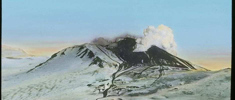
of transportation, especially of the finished product.Sulfur . This section includes an outline of Alaska’s principal known
resources of pyrite and pyrrhotite as well as native sulfur. Even though
pyrite and phyrrhotite are metallic minerals, they are included here for
consideration as sources of various oxides of sulfur or of sulfuric acid.
In general, the resources in these sulfide minerals are more advantageously
located and larger than are the deposits of native sulfur.Pyrite is a common mineral in numerous and widely distributed deposits in
Alaska. It is sufficiently abundant locally to be considered a potential
by-product of ores valuable primarily for copper. Among the deposits that
034 | Vol_I-0170
EA-I. Fellows: Economic Geology
show promise as pyrite producers are those in the Wales district at the
Omar Khayyam and Niblack copper properties on Prince of Wales Island, and
at St. Johns Harbor on Zarembo Island, in southeastern Alaska; the Moose
Creek copper lodes a few miles north of Seward u i n the Alaska Railroad ✓
region; and scattered copper properties in the Prince William Sound region.Pyrrhotite is an abundant associate of pyrite in many deposits and
occurs, like pyrite, as disseminated grains or as massive lenses within the
mineralized zones. The mode of occurrence of these minerals appears to be
similar in nearly all the more promising deposits. The disseminated
pyrite and pyrrhotite, such as are present on Prince of Wales Island in the
contact metamorphic deposits of chalcopyrite and magnetite, are not regarded
as important sources of iron sulfide. Two types of shear-zone deposits,
however, may be important. In deposits of the concentrated type, the metallic
minerals are localized along zones determined by the intensity of the shearing.
The deposits are lenticular or tabular with well-defined walls. In deposits
of the disseminated type, the mineralizing solutions penetrated the country
rock, and the boundaries, though gradational, are essentially parallel to the
shear zone. Massive pyrite or pyrrhotite lenses, or a combination of the two,
are commonly developed along shear zones in cupriferous lodes. In some
localities, however, such as on Zarembo Island, a concentrated massive
pyrite lens is devoid of copper minerals.A massive pyrite-pyrrhotite lens of the Beatson mine on Prince William
Sound has been traced for 800 feet and ranges from 2 to 40 feet in width.
A lens of comparable size exists at the Ellamar mine, where solid pyrite
forms the extensive hanging wall of a copper lode. At Rue Cove on Knight
Island, also on Prince William Sound, the chalcopyrite ore is localized in two
035 | Vol_I-0171
EA-I. Fellows: Economic Geology
lenslike bodies of nearly pure pyrrhotite, the combined volume of which is
estimated at about 7,000,000 cubic feet.Native sulfur deposits in Alaska are situated in the belt of active and
quiescent volcanoes that extends along the Alaska Peninsula and the Aleutian
Islands. Three relatively large deposits have been discovered along this
belt: one in the crater of Makushin Volcano on Unalaska Island, one on Akun
Island, and one near Stepovak Bay in the Stepovak district on the Alaska
Peninsula.The sulfur deposit on Unalaska Island is exposed over an area of 20 to 30
acres in the crater of the Makushin Volcano. The crater floor is covered with
loose, porous, disintegrated lava. Numerous cracks and pits are present from
which volcanic vapors rise and invade the residual mantle. A crust has been
formed on the surface, 1 to 2 feet thick, as a result of the sulfur deposition.
another zone beneath this crust consists largely of moist, hot, porous,
decomposed material in which a small quantity of sulfur is disseminated as
grains and blebs. This extends in some places to a depth of at least 16 feet.
The sulfur content decreases rapidly with depth. In general, the lower half
of the thin crust and most of the subcrustal zone contain enough earthy
material to lower the sulfur content below economic grade.The sulfur deposit on Akun Island occupies 15 to 20 acres along the flanks
of a rugged volcanic ridge. The sulfur occurs chiefly as very thin crystalline
incrustations on the walls of small cavities in the porous, earthy, su r face zone. ✓
Some sulfur is also disseminated through the decomposed material; there are
practically no bodies of pure sulfur in the deposit. Most of the sulfur is
in the porous mantle within 4 feet of the surface. Two samples, one taken
at the surface and the other at a depth of 4 feet, contained 55.5% and 22.8%
sulfur, respectively.
036 | Vol_I-0172
EA-I. Fellows: Economic Geology
Little is known of the deposit near Stepovak Bay because extensive
glaciers and rugged terrain make exploratory work difficult. The character
of the deposit is inferred from properties noted in the sulfur-rich rock
fragments found in glacial moraine. The sulfur-bearing rock in the moraine is
a porous volcanic breccia containing compact crystalline sulfur in its
interstices and in the vesicles of its constituent fragments. Some specimens
of the breccia probably contain as much as 20% of sulfur. Parts of the moraine
may contain 10% of sulfur, but it is assumed that the sulfur beds are richer
at their source. Some of the sulfur-bearing boulders are 30 to 40 feet thick,
and thus indicate the minimum thickness of the bed or beds from which they
were derived. The abundance of the sulfur-bearing material in the moraine
also indicates that the deposit in its original environment i n s large. ✓Minor and Miscellaneous Nonmet [?] a llic Minerals ✓
In this section is briefly summarized information about deposits of a
number of other nonmetallic minerals in Alaska that are believed to be of minor
significance, of such character that they can be appraised with difficulty
and in general terms only, or about which information is so scanty that no
real appreciation of their potential significance is now possible. The actual
economic value of some of the materials included herein, or their importance
to the development of Alaska, is likely to be greater than some included
under “Principal Nonmetallic Minerals.” Engineering geologic studies would
be especially valuable in obtaining more specific information on many such
materials and in indicating their possible use.Building Stone . Brief mention has already been made of the marble formerly
quarried in southeastern Alaska. Alaska contains a wide variety of rocks
that differ in their chemical and physical properties. Some of these, of course,
037 | Vol_I-0173
EA-I. Fellows: Economic Geology
would make excellent stone for various kinds of construction. Building
stone, however, has been little used in Alaska largely because the expense
of quarrying and transportation has made the cost prohibitive. Substantial
quantities of local stone have been used for riprap, various fills, and moles
and dikes for such purposes as enclosing small-boat harbors.In spite of the abundance and variety of Alaskan rocks, local supplies
of suitable rough building stone are very scarce in places. The Alaska
Railroad, for example, has difficulty in obtaining cheaply, suitable riprap
in some places where it is badly needed.Clay and Claystone . The clay and claystone resources of Alaska apparently
are large and some of the deposits are in areas where their use in substantial
quantities is a distinct possibility in the not too distant future. Very little
systematic study has been made of these resources. At least three types of
these materials are known to be present: ( 1 ) deposits of clay in early glacial
lakes, ( 2 ) claystone interbedded with other sediments in the Tertiary coal basins
in the Railroad belt and elsewhere, and ( 3 ) clay developed by hydrothermal
alteration. In favorable localities the use of some, or all, of these materials
may be developed for brick, tile, other ceramic products; alumina-bearing
material for cement; and other purposes. Brick has been made to a limited
extent near Anchorage from an extensive layer of glacial clay. A substantial
deposit of clay formed by hydrothermal alteration is believed to be present
in the same area as the gypsum deposits in the Matanuska district. A clay deposit
near the Richardson Highway, said to be beidellite, was used a few years ago
as a filter to make a usable product from used crank-case oil.Garnet deposits are known at a number of places in Alaska. Probably the
best known is the deposit in the Wrangell district near the mouth of the Stikine
038 | Vol_I-0174
EA-I. Fellows: Economic Geology
River. The garnets, up to an inch or more in diameter, are thickly set in
a dark, micaceous schist. The garnets are dark red with well-developed
crystal faces and specimens are in many mineral collections. The use of
the garnets for abrasive purposes has often been contemplated and the
deposits may have a limited value. Massive garnet is abundant in some
places in the Wales district in the vicinity of Sulzer.Ja [?] d e , both nephrite and jadeite, has been found as pebbles and boulders ✓
near Shungnak in the Kobuk district of northern Alaska. The jade formerly
was used to a limited extent by the natives for various tools. Some of the
jade is apparently of good color and quality, and attempts are being made to
use it in a small ornament industry. Articles made of Alaskan jade are
valuable for purchase at a few places in Alaska now.Pumice and pumicite are widespread near the volcanoes of the Alaska
Peninsula and Aleutian Islands. The deposits have not been studied to
appraise their potentialities. Material from the Katmai National Monument
has been tested as a lightweight aggregate for use with a small amount of
cement to make construction forms such as blocks and panels. Pumice from
Augustine Island on the west side of the entrance to Cook Inlet has been
used to a small extent in Anchorage for this purpose. The greater use of
such material should be investigated because of its abundance, cheapness,
durable nature, and insulating qualities.Sand and gravel are abundant and widespread in Alaska. In many places
any desired quantity of quality material can be obtained. In some large
areas, however, especially nonglaciated areas, it is a difficult problem to
obtain close at hand suitable sand and gravel for building purposes, road metal,
and other uses. In the extensive flat areas, such materials, if present at all,
039 | Vol_I-0175
EA-I. Fellows: Economic Geology
are likely to be deeply buried below fine-grained s li il t or soil, to be below ✓
ground-water level, or to be perpetually frozen. To obtain good gravel
nearby is diffi d c ult at many places along the Alaska Railroad and impossible ✓
at some. This situation adds to the high maintenance cost of the roadbed.
Most, but not all, of the sand and gravel deposits are of glacial origin.Shale . The shale and argillite resources of Alaska have not been
studied to any appreciable degree although these rocks are known to be present
at many places. It is expected that these materials can be found in suffi–
cient quantities for any anticipated uses in, or reasonably close to, areas
of development.Quartz Crystals . Deposits of quartz crystals are known or reported in
a number of places in Alaska, including Port Snettisham in the Juneau
district and Thorne Arm on Revillagigedo Island in the Ket c hikan district, ✓
southeastern Alaska; the Yakataga district, Gulf of Alaska region; Wild Lake
in the Wiseman district, northeast of Bettles, Yukon region; Bettles River
near Big Lake, in the Wiseman and Chandalar district; Chandalar gold-placer
area in the Chandalar district; Dahl Creek area in the Kobuk district,
northern Alaska; Popof Island near the western extremity of the Alaska
Peninsula; and on the Pribilof Islands in the Bering Sea.Samples of selected crystals from Port Snettisham, Wild Lake, and Bettles
River have been examined to determine their value for the manufacture of
oscillating plates used in radio-frequency control. None of the samples tested
met the required minimum specifications.Little is known about most of the reported deposits, and examination of
more crystals, both from the tested and the untested deposits, might reveal
a reserve of material of acceptable quality.
040 | Vol_I-0176
EA-I. Fellows: Economic Geology
RESOURCES OF MINERAL FUELS
Next to gold and copper, coal is the most important mineral product in
terms of production value. A few coal mines have continued to operate for
many years and the industrial future of Alaska will be bolstered greatly by
further exploitation of its large coal reserves.Petroleum was produced commercially in a small way in Alaska prior to
1933 when the small refinery near Katalla was destroyed by fire; but no large
reserves have been proved thus far to justify large-scale operations. Several
possible petroliferous areas are being investigated and it is not unlikely
that data for one or more areas will justify further drilling.Coal is widely distributed in Alaska, in rocks of Carboniferous, Cretaceous,
and Tertiary age. The Carboniferous deposits are known in the vicinity , of ✓
Cape Lisburne, in the Lisburne district on the arctic coast of northern
Alaska, and at the mouth of the Nation River in the Kandik district in the
Yukon region. The Cretaceous coals are chiefly in northern Alaska, in the
western part of the Yukon region north of the Yukon River, and in small deposits
along the Alaska Peninsula. Coal is present in many of the scattered areas of
Tertiary sediments in Alaska. The largest deposits of Tertiary coal are on
the north flank of the Alaska Range, both east and west of the Nenana River;
in the Matanuska district; on the west side of the Kenai Peninsula, especially
in the Seldovia and Tustemena districts; and in the Bering River area near the
coast of the Gulf of Alaska in the Katalla district.The deposit of Carboniferous coal at Caps Lisburne, although of higher
rank than the younger coals of northern Alaska, is small and the structure is
very complex. The coal, much of which is crushed, occurs in beds that have a
maximum thickness of 4 feet. The Carboniferous coal at the mouth of the Nation
River in eastern Alaska lies in pockets and kidneys along a fault zone.
041 | Vol_I-0177
EA-I. Fellows: Economic Ge lo ol ogy
Upper Cretaceous coal has been seen at several localities north of the
Brooks Range, in a broad belt 300 miles long and about 120 miles wide. In
the northern part of the area the beds are horizontal or only gently warped;
farther south they are more strongly folded. In general, the Cretaceous
coal of the Arctic is subbituminous or higher in rank.The t ertiary coal of Alaska is interbedded with poorly to moderately ✓
indurated claystone, siltstone, sandstone, and conglomerate, which generally
are in downfolded and downfaulted areas surrounded by older rocks. The coal
beds are as much as 40 feet thick and range in rank from woody lignite to
anthracite. In the coal fields of the Kenai Peninsula, the Susitna Basin,
and the Yukon Basin, the beds have been only moderately deformed, and the
coal is lignite and subbituminous. In the Matanuska and Bering River coal
fields, the Tertiary formations are in part complexly folded and faulted,
and the coal ranges from bituminous to anthracite. In places the structure
is so complex as to introduce serious problems in mining. Igneous rocks have
intruded the strata of these two fields, especially in the upper Matanuska
field, where they have rendered worthless large quantities of coal.Petroleum is present in Alaska in rocks of Mesozoic and early Tertiary
age. Older rocks, known to be sources of petroleum elsewhere in North America,
are widespread in Alaska, but are generally believed to be too intensely
deformed or metamorphosed to be expected to contain petroleum.The three principal known petroliferous provinces of Alaska include
areas of Tertiary rocks in the Katalla and Yakataga districts on the Gulf
of Alaska; areas where the surface rocks are principally Jurassic on the
western side of Cook Inlet and on the Alaska Peninsula, including the Iniskin
Peninsula in the Chinitna district and the Kanatuk district in [ ?] southwestern
042 | Vol_I-0178
EA-I. Fellows: Economic Geology
Alaska west of Kodiak Island; and northern Alaska north of the Brooks Range
which is underlain principally by Cretaceous and Tertiary rocks. The last–
mentioned area includes Naval Petroleum Reserve No. 4. A fourth potential
province embraces large parts of the basins of the Yukon and Kuskokwim
rivers, where oil shales are known in a few places and geologic conditions
locally appear favorable for the accumulation of petroleum.The Katalla district is on the Gulf of Alaska, east of Cordovs. The
district extends inland 20 to 30 miles to the Chugach Mountains. The bedrocks
include pre-Tertiary metamorphic and igneous rocks, Eocene and Oligocene
sedimentary and extrusive igneous rocks having a total thickness of at least
17,000 feet, and Tertiary or later intrusive rocks. About half of the
district is covered by unconsolidated marine, glacial, stream, and lake
deposits of Quaternary age.The principal petroleum seepages are in the Katalla and Nichawak areas,
in the south-central and eastern part of the district. These seepages issue
from the Oligocene Katalla formation, that consists principally of shale and
sandstone and includes a shale unit which is believed to be the source of at
least part of the petroleum. A few seepages near the coast in the southwestern part
of the district issue partly from a sedimentary sequence that may be Eocene in
age, and partly from pre-Tertiary metamorphic rocks.The Tertiary rocks exposed in the Katalla district are tightly folded
and are cut by thrust and normal faults. The major trend of the folds and the
principal thrust faults, in general, is either northeast, parallel to the thrust
fault contact of the Tertiary rocks with the pre-Tertiary rocks in the northern
part of the district; or north to northwest, parallel to the fault contact of
the Tertiary rocks with the pre-Tertiary rocks in the western part of the district.
043 | Vol_I-0179
EA-I. Fellows: Economic Geology
The Yakataga district is just east of the Katalla district on the Gulf
of Alaska. The district extends eastward about 70 miles to Icy Bay, and
25 to 35 miles inland. All the known bedrocks in the district are sedimentary,
probably ranging in age from early Eocene to late Oligocene or Miocene.
Unconsolidated stream, glacial, and marine deposits cover much of the south–
western part of the district and extend in a narrow belt along the coast in
the eastern part of the district.Most of the known petroleum seepages are ½ to 2 miles from the coast in
a belt extending about 18 miles parallel to the coast. A few seepages are
farther inland. All of the known seepages are associated with an upper
Oligocene sequence consisting principally of shale, siltstone, and sandstone.The rocks are folded into anticlines that are tightly compressed near
the coast but broader and less closely spaced to the north, and into synclines
that are broad and flat-bottomed near the coast but narrower and more closely
spaced to the north. The axes of the folds trend eastward, nearly parallel
to the coast. Successively older rocks are exposed to the north in a series
of fault blocks that are thrust southward along eastward-trending faults. ✓ (word missing)The Iniskin Peninsula in the Chinitna district is on the west side of
Cook Inlet between Iniskin and Chinitna bays, about 150 miles southwest of
Anchorage. The bedrocks consist of a Jurassic marine sedimentary sequence
on the downthrown side of a major northward-trending fault which forms the
western boundary of the petroliferous province. The exposed sedimentary
formations include the upper part of the Lower Jurassic Kialagvik formation,
the Middle and Upper Jurassic Tuxedni formation, and the Upper Jurassic
Chinitna siltstone and Naknmek formation. This sequence, consisting prin–
✓cipally of shale, siltstone, sandstone, and conglomerate, has a total thickness
of about 13,500 feet.
044 | Vol_I-0180
EA-I. Fellows: Economic Geology
The principal structures are two northeastward-trending anticlines
complicated by at least one northeastward-trending major fault and by
numerous minor folds and faults.Several oil seepages are known on the peninsula, and some of the test holes
that have been drilled there showed indications of oil and gas.The Kanatak district is on the southeast side of the Alaska Peninsula,
about 375 miles southwest of Anchorage. Jurassic marine sedimentary rocks
are the principal bedrocks exposed in the district. The underlying conform–
able Triassic beds, which consist principally of limestone, are exposed in a
small area at Cape Kekurnoi. The exposed Jurassic sequence is 10,000 to
14,000 feet thick and is composed of shale, siltstone, sandstone and conglome–
rate. This sequence includes the Lower Jurassic Kialagvik formation and the
Upper Jurassic Shelikof and Naknek formations. Both extrusive and intrusive
igneous rocks occur in the district.The structural trend in the Kanatak district is northeast, parallel to
the coast. The dominant structural features are two parallel belts of anti–
clinal folds. Along the southeastern belt are two structural highs, the Wide
Bay anticline and the Bear Creek anticline, which are separated by a saddle
and an intrusive mass, west of Portage Bay. The northwestern belt, about
10 miles from the southeastern belt, also has two structural highs, the
Hubbal dome and the Pearl Creek dome, that the separated by a saddle.Petroleum seepages, surface deposits of petroleum residue, and rocks
impregnated with petroliferous material are known in the district. Test drill–
ing thus far done in the district was unsuccessful in finding petroleum in
commercial quantities.
045 | Vol_I-0181
EA-I. Fellows: Economic Geology
Between the Brooks Range and the arctic coast, rocks of Mississippian,
Triassic, locally Jurassic, Lower Cretaceous, Upper Cretaceous, and Tertiary
age, in order northward, crop out in eastward-trending belts. The Tertiary
rocks are largely covered by a Quaternary blanket.Physiographically and structurally the region may be subdivided, from
south to north, as follows: ( 1 ) a foothills province, bounded on the south
by the front of the Brooks Range, characterized by intense thrusting and
complex folding, involving Mississippian, Triassic, and Lower Cretaceous
rocks; ( 2 ) a plateau province of open eastward-trending folds and some faults
in Upper Cretaceous rocks, with variations in plunge of the folds producing an
anastomosing structural pattern; and ( 3 ) a plains province, of very gentle
dips and little-known structural pattern, in which the bedrocks are Upper
Cretaceous, Tertiary, and younger beds.Mississippian and Triassic rocks comprise a few thousand feet of highly
fossiliferous marine limestone, shale, and chert. Some of the limestone and
shale beds are bituminous, and a little oil shale is included in the Triassic
rocks.Lower Cretaceous rocks, consisting of very sparsely fossiliferous shale
and greywacke, are possibly more than 20,000 feet thick. It is believed that
the trough in which they were deposited in such great thickness was largely
limited to the foothills province.Upper Cretaceous rocks, in part fossiliferous and comprising beds of
sandstone, shale, conglomerate, coal, bentonite, and tuff, are in part deltaic
and show, in general, oscillating facies changes northward from terrestrial
through littoral and brackish to offshore marine sediments. The Upper
Cretaceous geosyncline, containing about 18,000 feet of these sediments, is
046 | Vol_I-0182
EA-I. Fellows: Economic Geology
believed to coincide approximately with the plateau province; the axis of
this geosyncline lies north of the trough of maximum Lower Cretaceous sedi–
mentation.Upper Cretaceous rocks rest with probable angular unconformity on the
Lower Cretaceous rocks. The unconformities between Lower Cretaceous and
Triassic rocks and between Triassic and Mississippian rocks are believed to
be essentially parallel and not of the orogenic type.Known oil and gas seepages are limited largely to the plains province and
the northern edge of the plateau province.No petroleum seepages are definitely known in the Kuskokwim or Yukon
regions, although rumors of seepages are received from time to time. The
presence of oil shale in the eastern Yukon region and the possibility that
petroleum-bearing rocks may be present in both regions in part beneath a
cover of younger, unconsolidated material justify the consideration of large
parts of these regions as possibly petroliferous.Robert E. Fellows
- Goodnews district in the Kuskokwim region.